Wednesday Evening Update
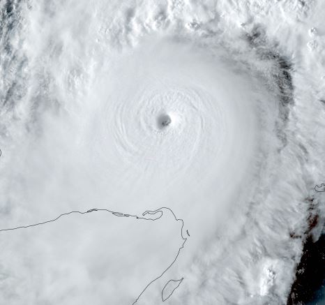
Milton making landfall soon
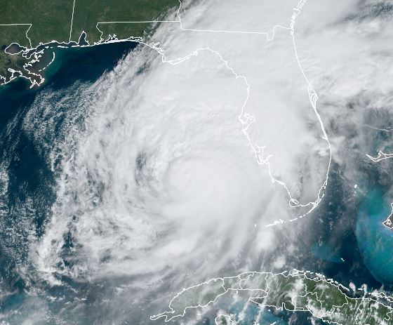
Milton has shifted farther east and will make landfall a bit farther south than projected to near Sarasota. This small shift brings landfall south of Florida's Sun coast. This means Tampa Bay will escape the worst of the surge and that higher surge is projected farther south. Sarasota to Ft Myers will see the highest water increases.
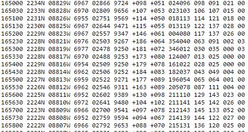
So far highest sustained winds / gusts:
Albert Witted airport 64 / 90 mph
Sarasota / Bradenton intl 58 / 93 mph
Northport 42 / 80 mph
Macdill AFB 46 / 58 mph
Tampa 36 / 64 mph
Punta Gorda 51 / 79 mph
Bay Point Middle School 32 / 72 mph
Clearwater Beach 65 / * mph
St. Pete / Clearwater apt 45 / 81 mph
Brooksville 37 / 64 mph
* = missing
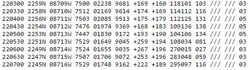
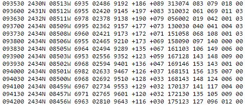
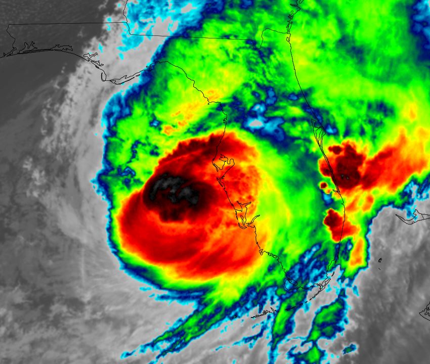
From NHC: A sustained wind of 78 mph (126 km/h) and a gust of 97 mph (156 km/h) was recently reported at a NOAA C-MAN station in Venice. A
sustained wind of 77 mph (124 km/h) and a gust of 100 mph (161 km/h) was recently reported at a WeatherFlow station at Egmont Channel. A
sustained wind of 67 mph (107 km/h) and a gust of 83 mph (133 km/h) was recently reported at a WeatherFlow station at Skyway Fishing
Pier. A sustained wind of 40 mph (64 km/h) and a gust of 73 mph (117 km/h) was recently reported at the Sarasota-Bradenton International
Airport.
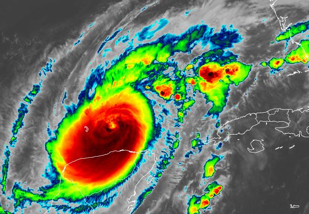
The Weather Situation
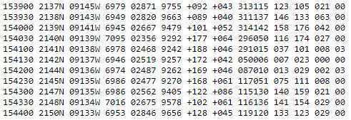
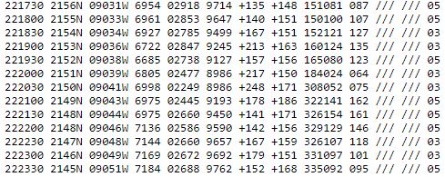
SUMMARY OF 800 PM EDT...0000 UTC...INFORMATION
----------------------------------------------
LOCATION...27.2N 82.8W
ABOUT 20 MI...30 KM WSW OF SARASOTA FLORIDA
ABOUT 130 MI...205 KM SW OF ORLANDO FLORIDA
MAXIMUM SUSTAINED WINDS...120 MPH...195 KM/H
PRESENT MOVEMENT...ENE OR 60 DEGREES AT 15 MPH...24 KM/H
MINIMUM CENTRAL PRESSURE...954 MB...28.17 INCHES
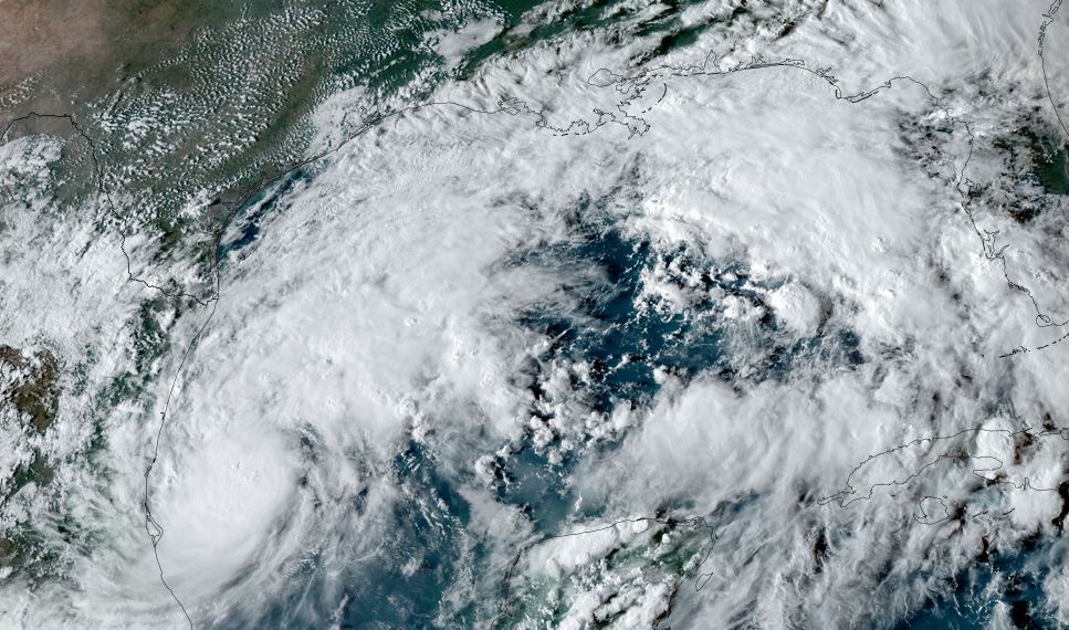
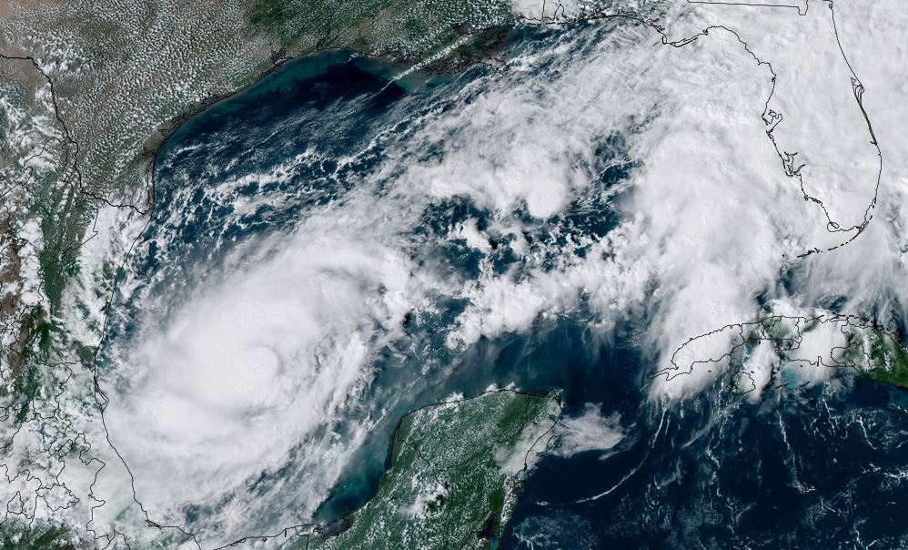
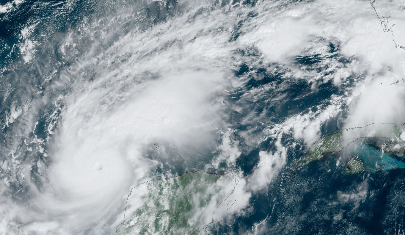
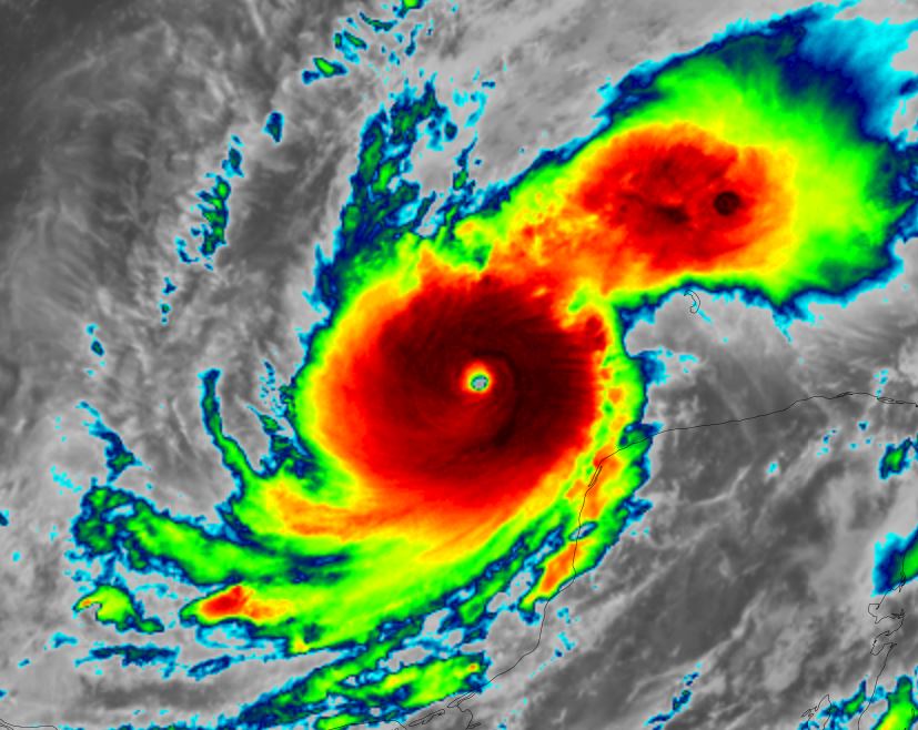
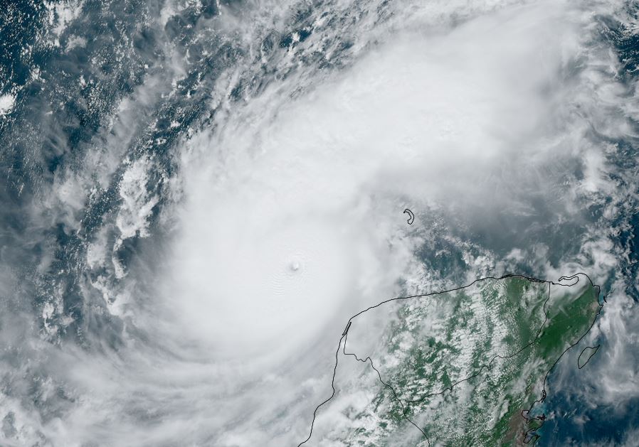
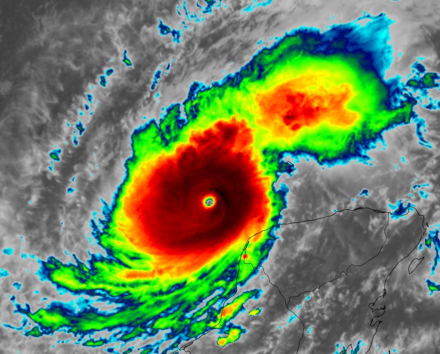
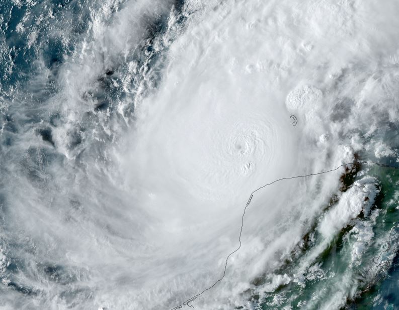
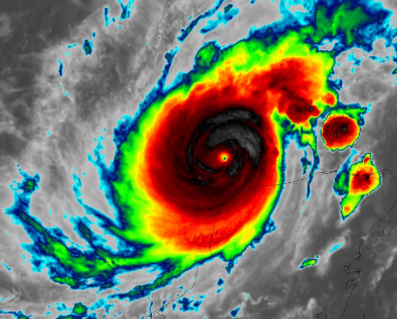
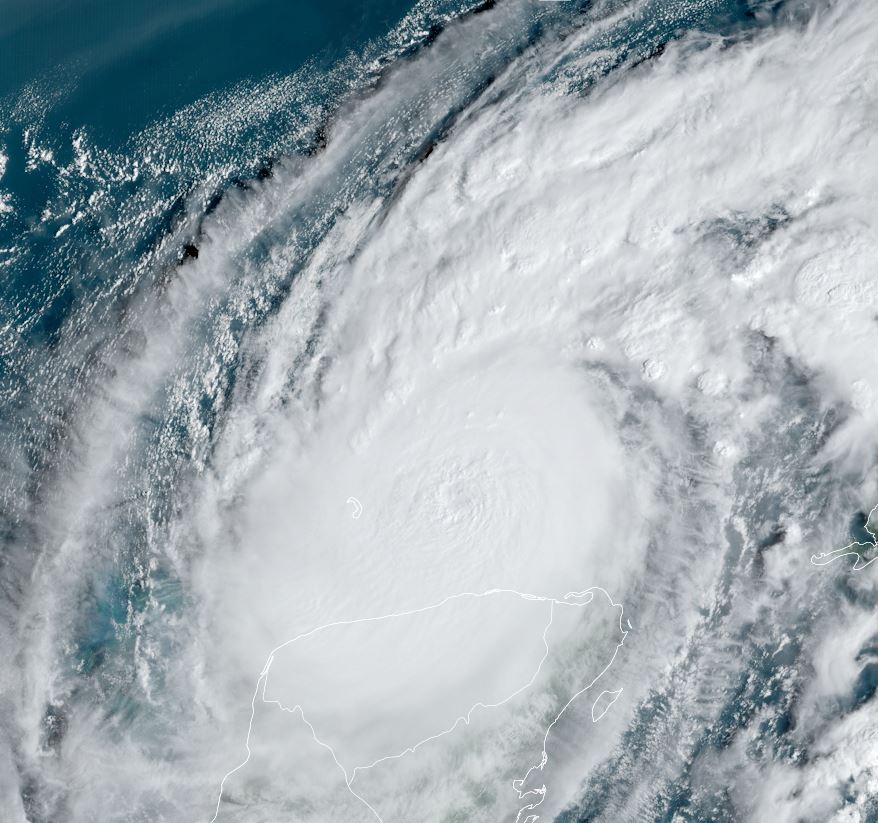
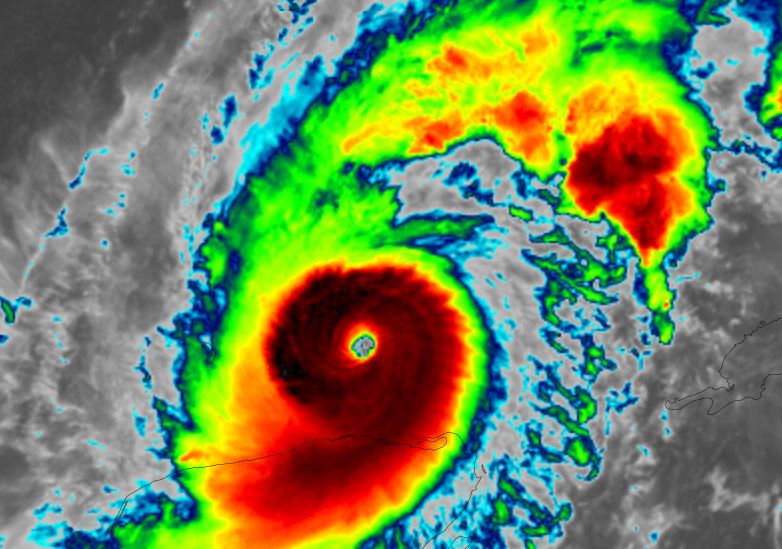
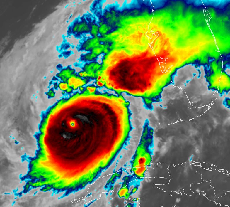
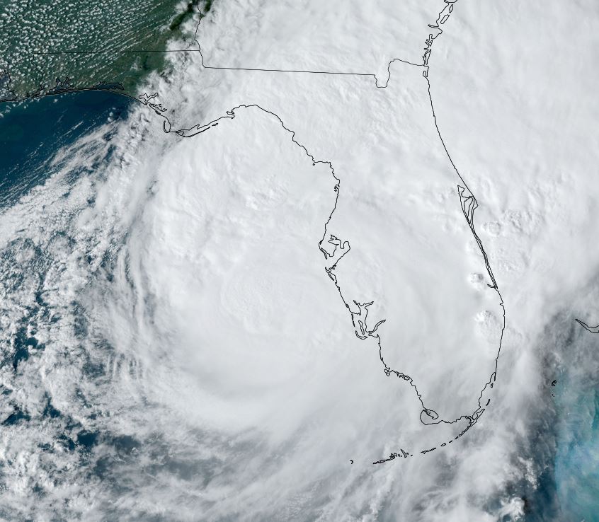
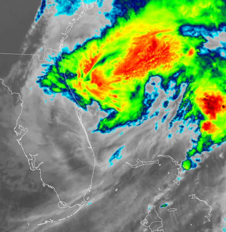
Tropicast: IR Satellite RAMMB / CIRA Slider Wednesday Evening
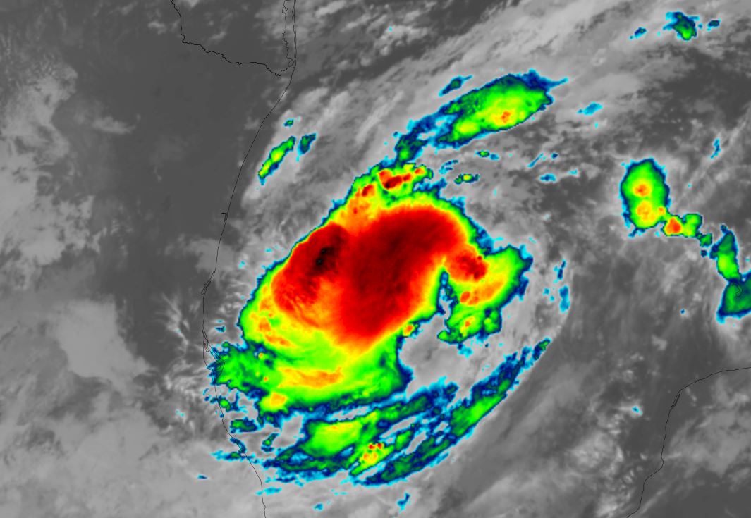
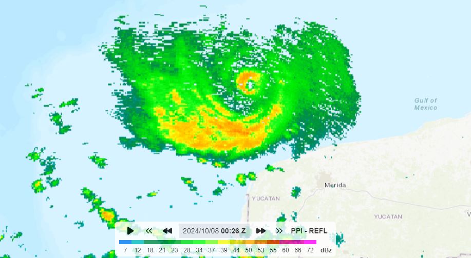
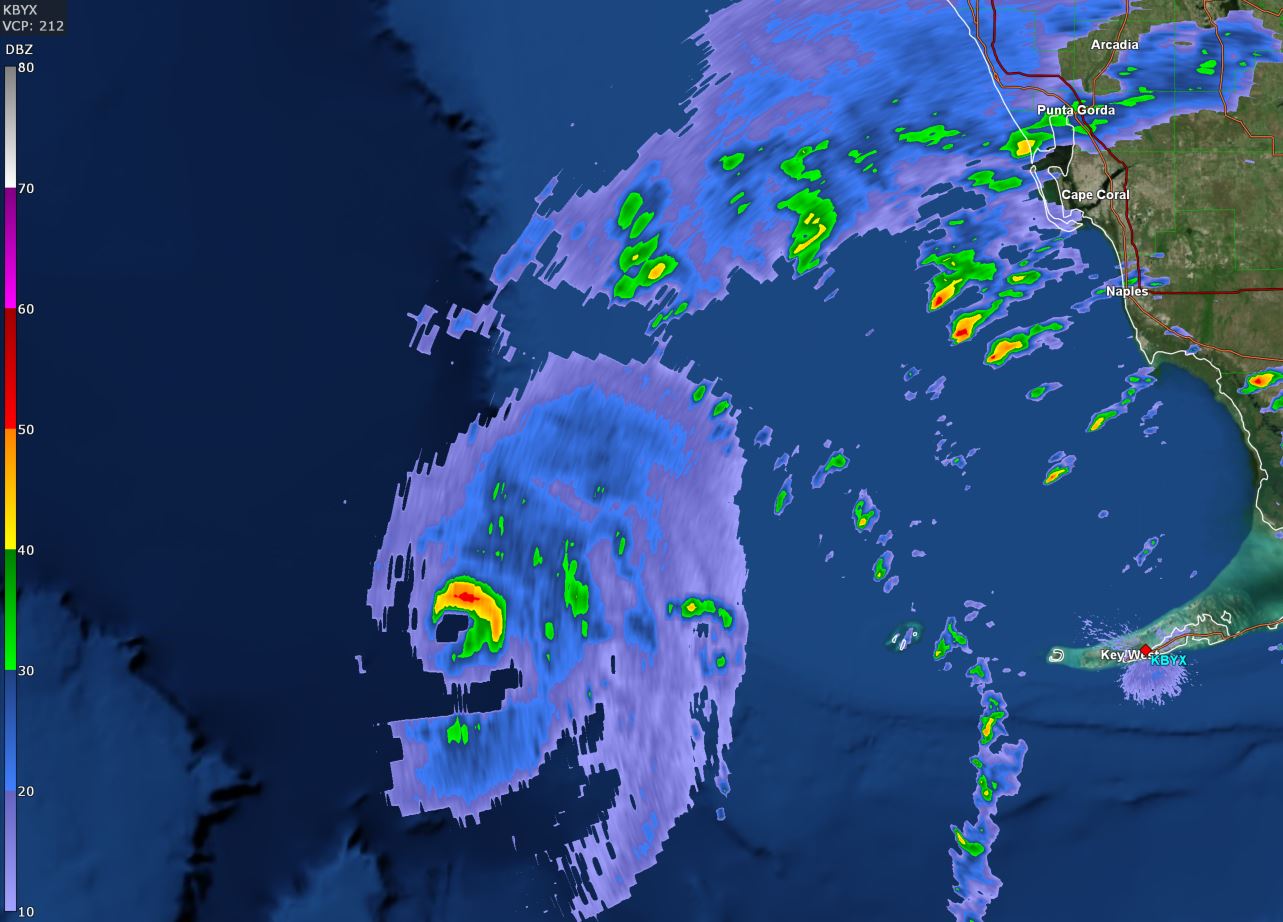
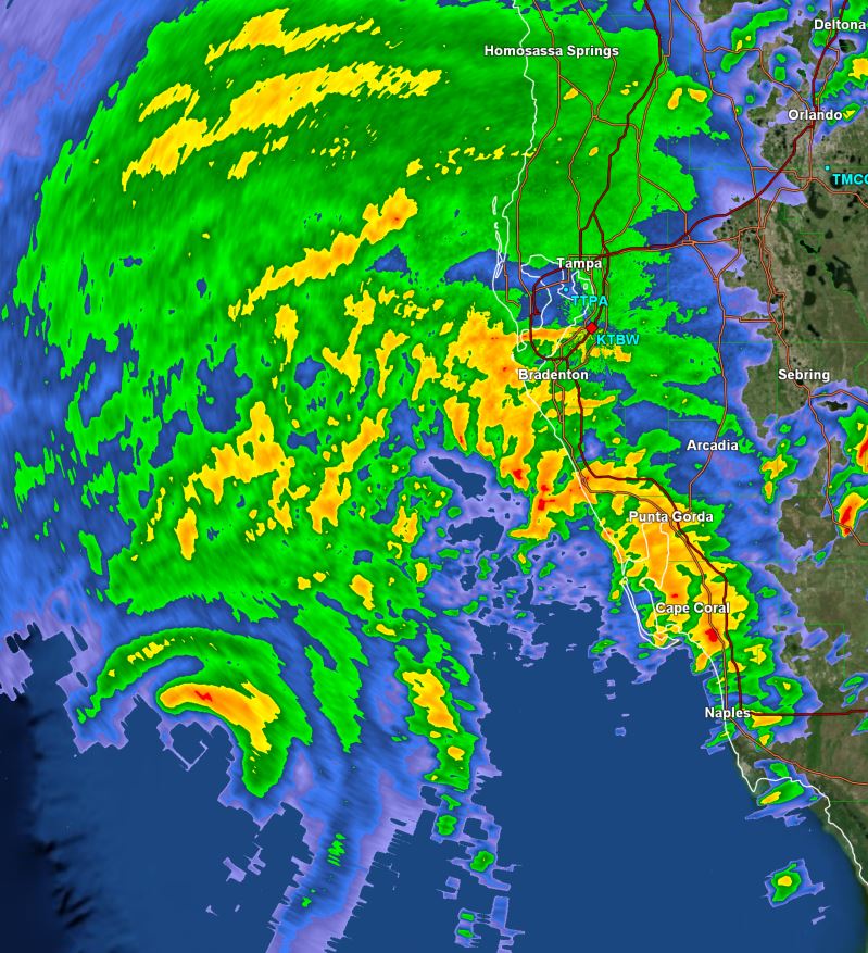
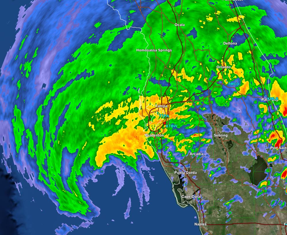
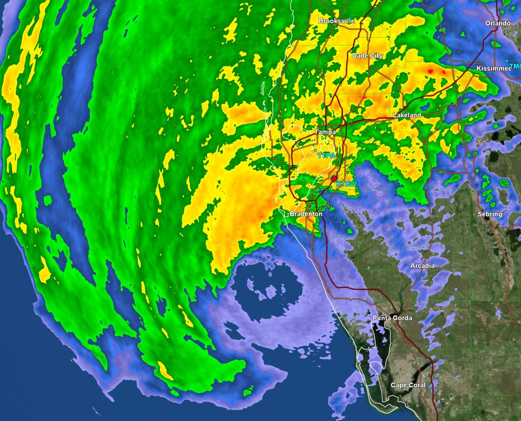
 Tropicast: GR Level 3 Radar Tampa 6:30 pm Wednesday Evening
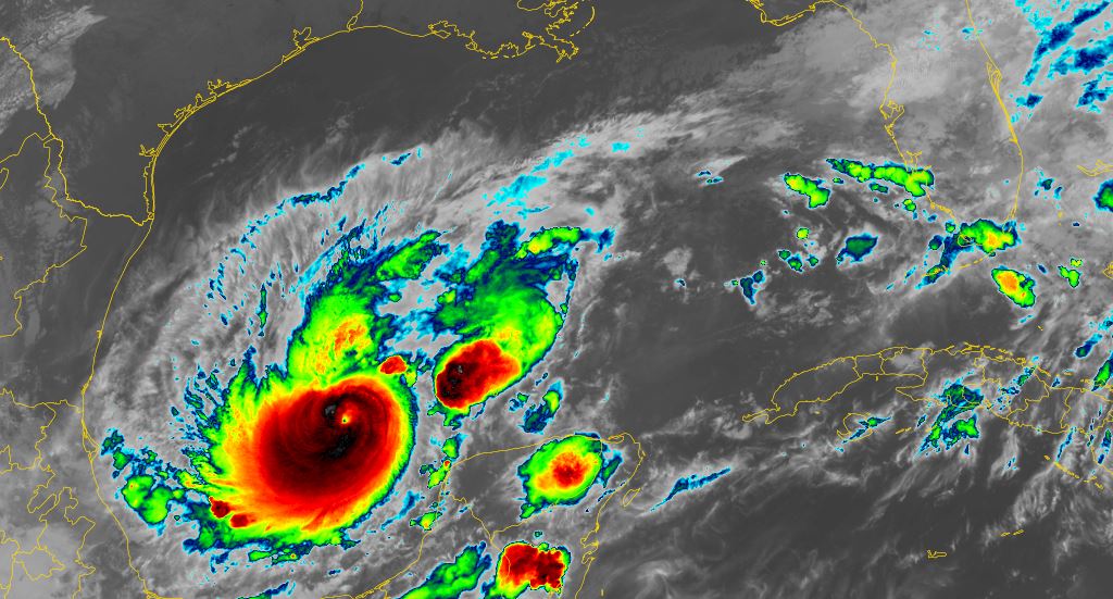
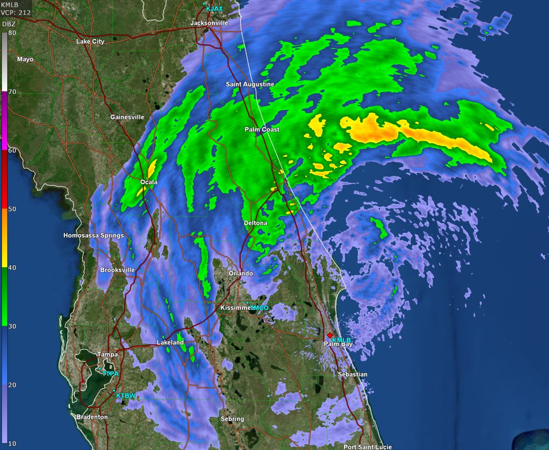
 Tropicast: GR Level 3 Radar Tampa 7:30 pm Wednesday Evening
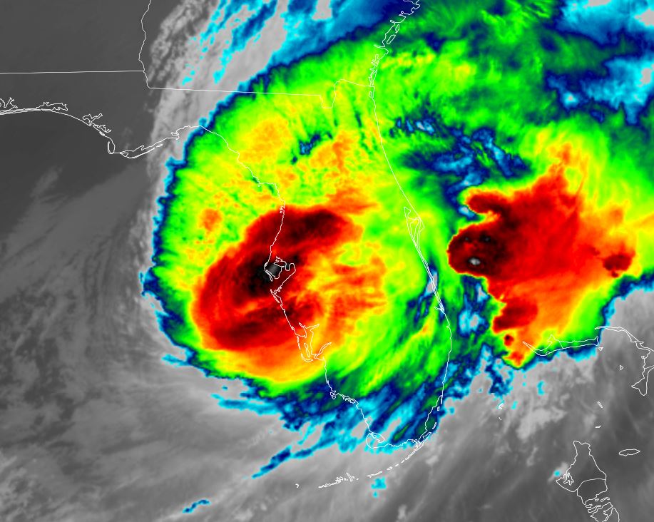
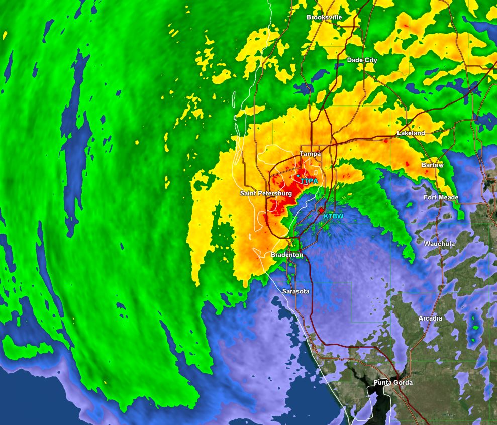
 Tropicast: GR Level 3 Radar Tampa 8:30 pm Wednesday Evening
 Tropical Weather Forecast:
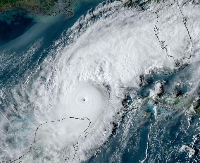
Milton is making landfall near Sarasota soon and will be just south of Orlando later tonight and near Cape Canaveral tomorrow morning. It will be transforming into an extratropical cyclone shortly after moving off of the Florida east coast tomorrow. Keep in mind that surge will also be experienced on the east coast of Florida and northward into the SE US coast.