Fred in sorry shape
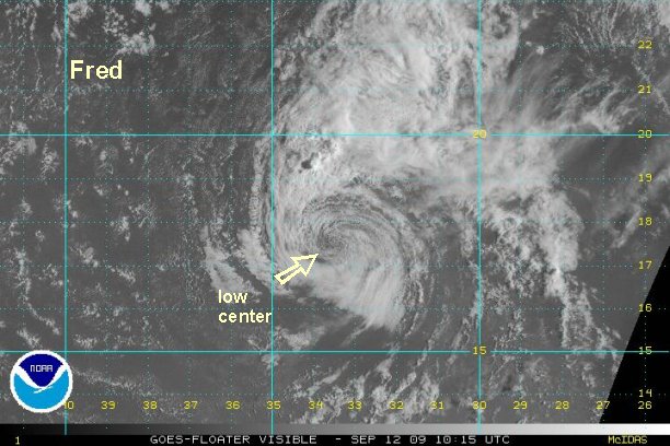
Fred is almost nothing more than a low level swirl of clouds now, except for some deep convection on banding well north of the center. A satellite estimate came in at 41 knots a few hours ago. With no convection near the center and the wekaening trend, we will now estimate 35 mph or just below tropical storm force.
At 8 am edt / ast Hurricane Fred was centered at 17.5° N / 33.5° W or about 695 miles west northwest Sal, Cape Verde Islands. Top sustained winds are estimated at 35 mph (NHC 45 mph). Fred is drifting barely north.
Fred should start moving west northwest as a very weak low in the next day or two.
Tropicast: Visible Floater Satellite (6:15 am edt/ast)