

Twin tropical cyclones well south of Hawaii
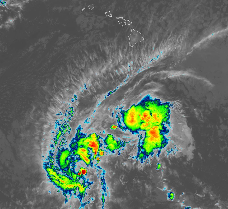
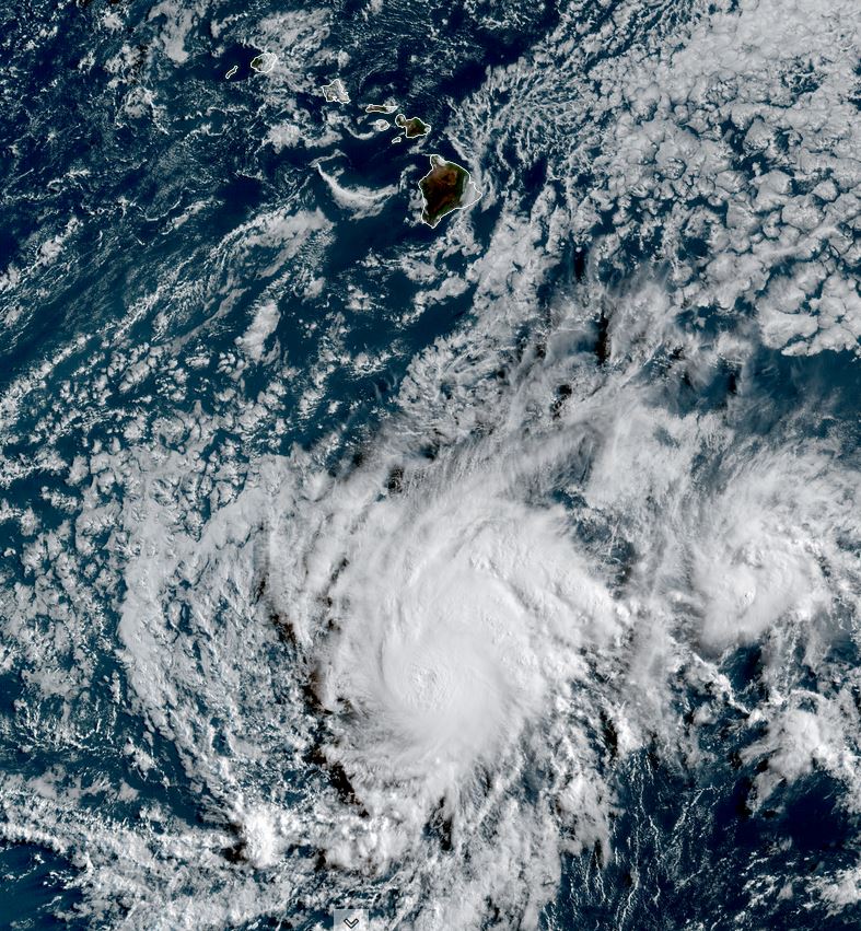
IR satellite imagery shows two tropical cyclones during Hawaii's overnight hours this early Wednesday morning. Iona to the SW does not appear to be close to 105 mph. In fact, the eyewall is very disrupted and this may not be a hurricane any longer. Keli is to the NE of the systems and has more convection, but it isn't as organized.
The Weather Situation - Iona
SUMMARY OF 1100 PM HST...0900 UTC...INFORMATION
-----------------------------------------------
LOCATION...11.3N 158.6W
ABOUT 690 MI...1115 KM S OF HONOLULU HAWAII
MAXIMUM SUSTAINED WINDS...105 MPH...165 KM/H
PRESENT MOVEMENT...W OR 275 DEGREES AT 17 MPH...28 KM/H
MINIMUM CENTRAL PRESSURE...973 MB...28.74 INCHES
The Weather Situation - Keli
SUMMARY OF 1100 PM HST...0900 UTC...INFORMATION
-----------------------------------------------
LOCATION...13.5N 153.7W
ABOUT 605 MI...975 KM SSE OF HONOLULU HAWAII
MAXIMUM SUSTAINED WINDS...40 MPH...65 KM/H
PRESENT MOVEMENT...W OR 280 DEGREES AT 21 MPH...33 KM/H
MINIMUM CENTRAL PRESSURE...1006 MB...29.71 INCHES
Tropicast: IR satellite Early Wednesday Morning
Tropicast: Visible satellite Tuesday afternoon
Tropical Weather Forecast:
Both of these tropical cyclones will pass well south of Hawaii. The only notice will be some clouds and higher than normal surf on the south facing shores.
NHC Advisory - Iona
https://www.nhc.noaa.gov/text/refresh/H ... 841.shtml?
NHC Advisory - Keli
https://www.nhc.noaa.gov/text/refresh/H ... 842.shtml?
NHC Track - Iona
https://www.nhc.noaa.gov/graphics_cp1.s ... t#contents
NHC Track - Keli
https://www.nhc.noaa.gov/graphics_cp1.s ... t#contents