|
|
Hurricane Ike Facts
Hurricane Ike began as a tropical wave off of the coast of Africa around August 29th. A few days later, by September 1 it had developed into the 9th tropical depression of the
hurricane season and was classified tropical storm Ike later in the day. Ike underwent rapid deepening on September 3rd into the morning of the 4th. It had achieved a category 4 strength on the Saffir-Simpson scale at 140 mph. Shortly after this, northerly wind shear started to take its toll and weaken it north of the Leeward Islands.
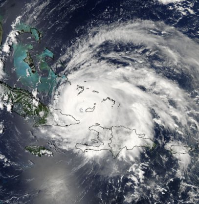
Hurricane Ike underwent another restrengthening phase as it moved west southwest into the Turks and Caicos and southern Bahamas. Grand Turk was in the northern eye wall and Great Inagua, Bahamas received a direct hit. Extensive damage occurred throughout these locations, with preliminary estimates showing 80% of the houses on Grand Turk receiving some damage. Ike continued toward Cuba making landfall on the northeast coast of Cuba. It crossed Cuba and turned more west northwest, barely off of its southern coast. After this, Ike made a second landfall in the western part of the country near where Hurricane Gustav made landfall not long before.
Hurricane Ike began to strengthen immediately after moving into the southern Gulf of Mexico. The Keys received some flooding, had squally weather, and reported an isolated tornado. In a similar fashion to Hurricane Gustav, Hurricane Ike had a very low barometric pressure in the central Gulf of Mexico, but did not strengthen significantly. Dry air on the western side
of the hurricane kept it from strengthening until just before landfall.
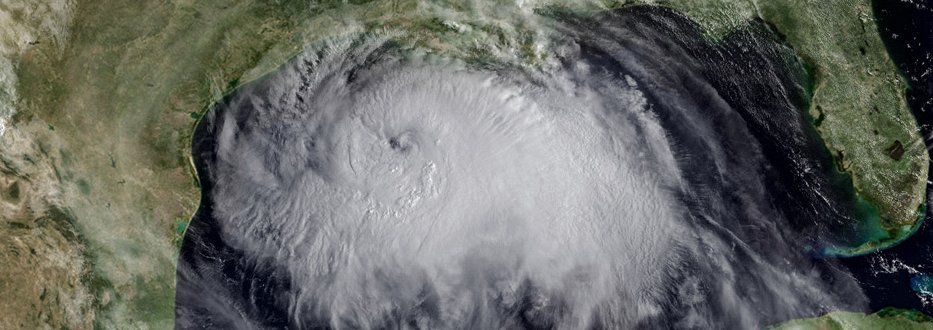
High storm tides flooded the upper Texas and southwest Louisiana coast twenty four hours ahead of landfall. Storm tides of 10-15 were common in these areas. Hurricane Ike made landfall on September 13 at 2:10 am cdt at Galveston, TX. Even though Ike was classified as a category two hurricane with winds of 110 mph, very few gusts over 100 mph were recorded on land. Winds a few hundred feet above the ground were much higher though and caused damage to many windows to the sky scrapers in Houston. Rainfall totals of ten inches were reported in Houston. Heavy rain continued into the mid part of the U.S. as Ike merged with a cold front. Power was lost to approximately four and a half million people at the height of Hurricane Ike.
In summary, Ike was a huge hurricane. Its tropical storm force wind field extended exceeded that of Katrina. In the central Gulf of Mexico, winds of tropical storm force or greater extended out 275 miles from the center. Ike's effects not only were felt on the coast, but extended well inland. Wind damage and/or flooding rains followed the path of Ike into the southern Great Lakes, Ohio Valley and into New England. Rainfall totals of ten inches or more were recorded in the southern Great Lakes. Power Outages were also common from wind damage well northward into the Ohio Valley. Damage estimates are placed at $29.5 billion making hurricane Ike the 2nd costliest hurricane to hit the U.S.
Hurricane Ike Satellite Picture - southern Bahamas
Hurricane Ike Facts Summary
- Lowest pressure: 935 millibars / 27.61 inches
- Pressure and sustained wind at landfall: 953 millibars / 110 mph
- Maximum sustained winds at peak: 145 mph, Atlantic Ocean
- Fatalities: 103 (20 U.S.) with at least 23 still missing
- U.S. Damage: $30 billion - unadjusted dollars
- U.S. Damage: $34.8 billion - adjusted dollars for 2017
- Maximum storm surge height: Approximately 15-20 feet Bolivar Peninsula, TX
Do you want to find out more about Hurricane Ike or other hurricanes? Check out our 2008 hurricane summaries.
Back to more hurricane articles.
|
|
|