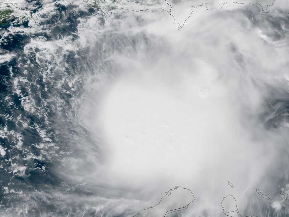
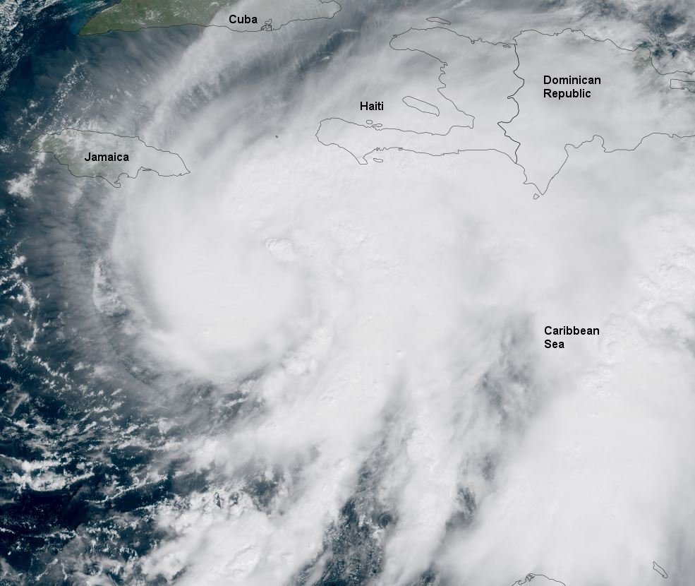
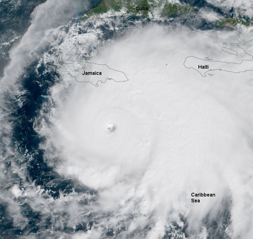
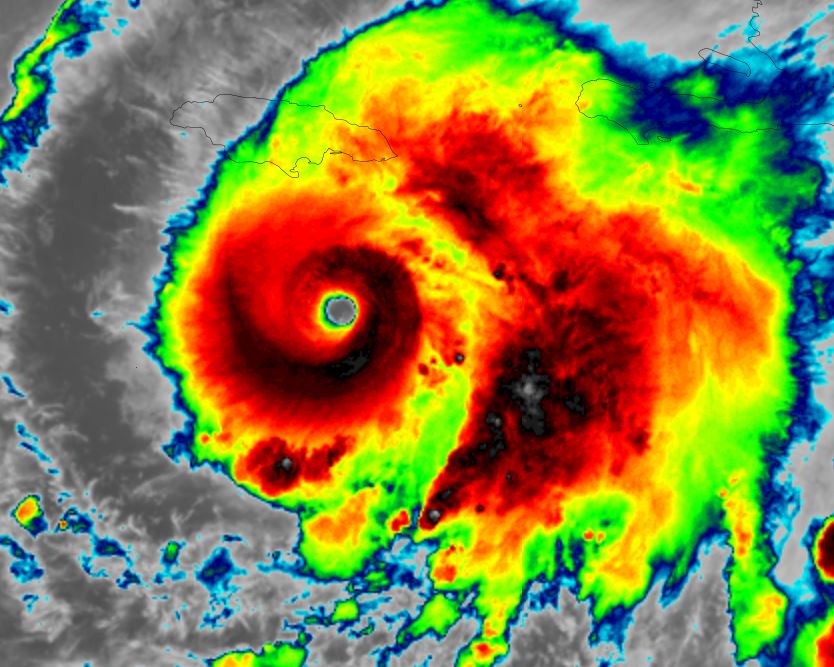
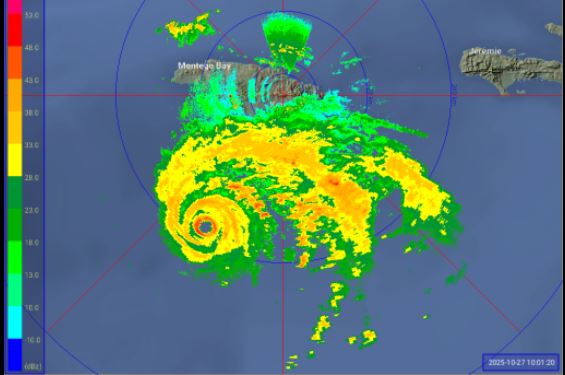
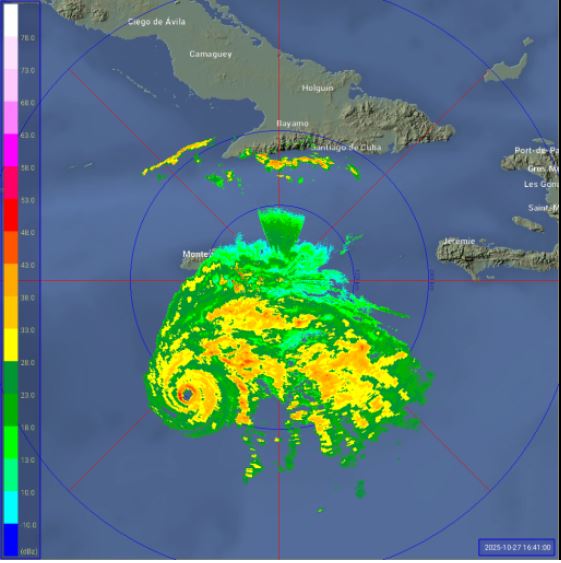
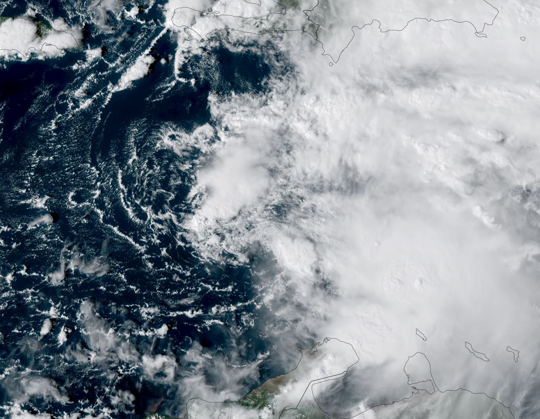
Melissa is heavily sheared
The low center of Melissa is nearly exposed with only some deep convection. It is battling wind shear. The massive burst of deep convection is currently well east of the center of circulation.
The Weather Situation
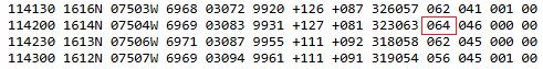
SUMMARY OF 500 PM EDT...2100 UTC...INFORMATION
----------------------------------------------
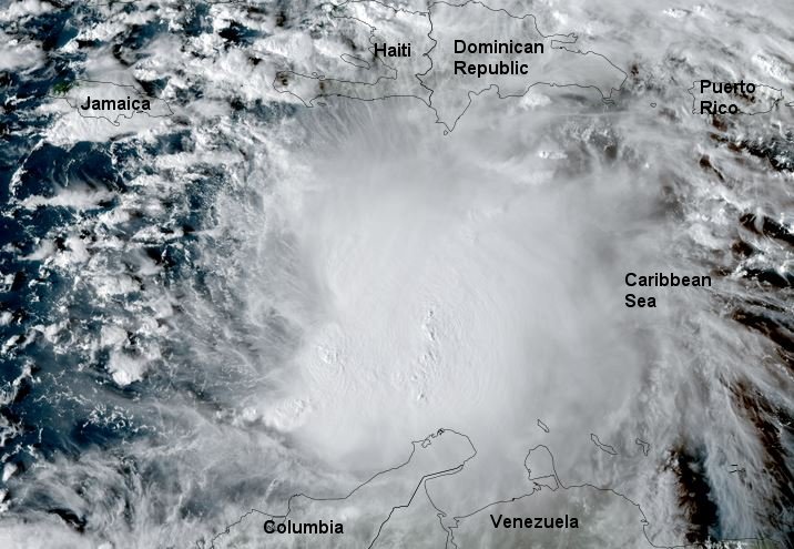
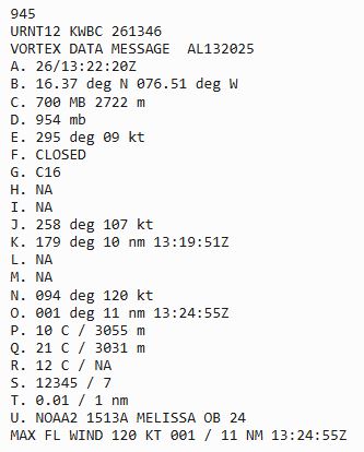
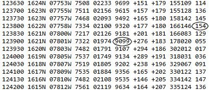
LOCATION...14.2N 73.0W
ABOUT 305 MI...495 KM S OF PORT AU PRINCE HAITI
MAXIMUM SUSTAINED WINDS...50 MPH...85 KM/H
PRESENT MOVEMENT...W OR 275 DEGREES AT 15 MPH...24 KM/H
MINIMUM CENTRAL PRESSURE...1003 MB...29.62 INCHES
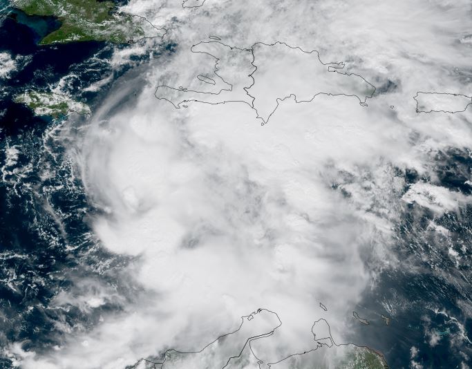
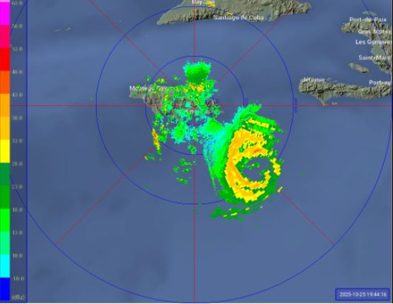
Tropicast: RAMMB/CIRA slider GOES 19 Visible Satellite
Tropical Weather Forecast:
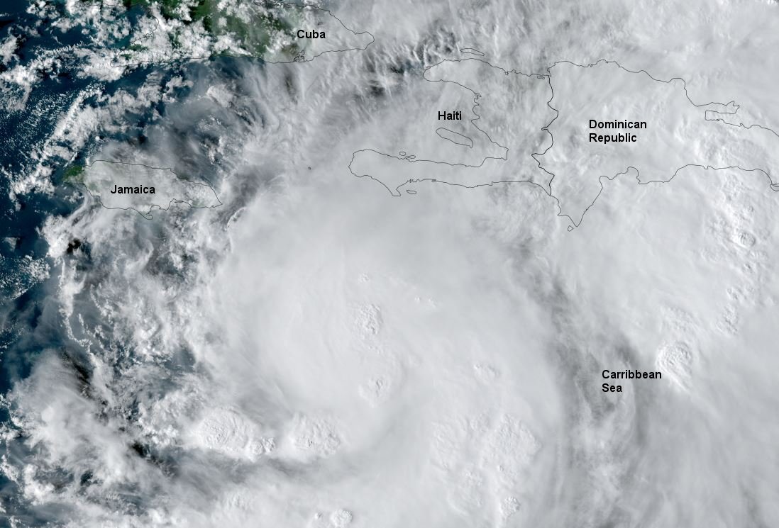
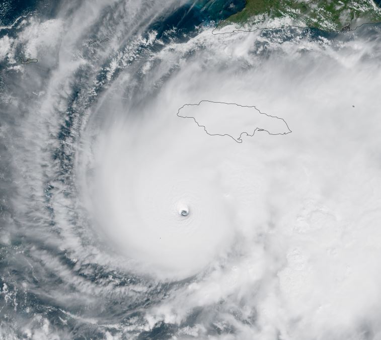
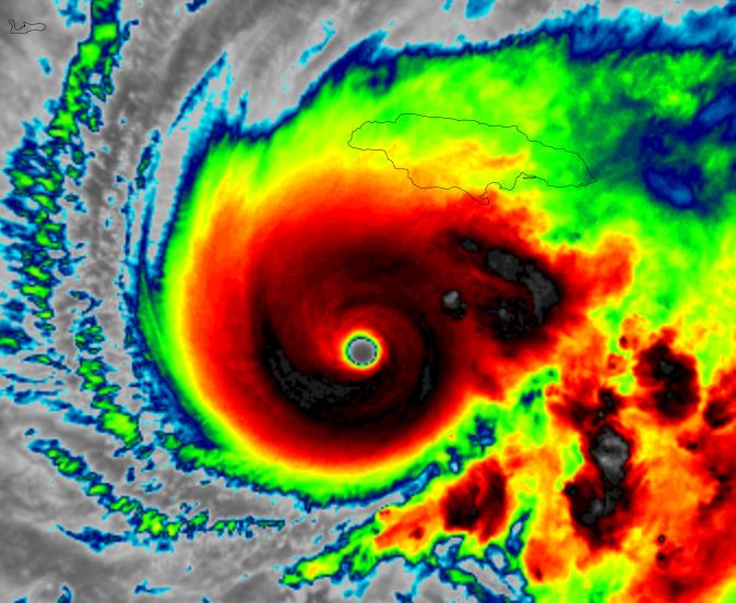
Forecast models make Melissa a hurricane as it slowly moves northward generally between eastern Jamaica and southern Haiti. This track will be impacted by how much wind shear plays a role in its development. Significant changes are possible.
Potential hazards include strong, damaging winds, high surf, very heavy rainfall / flooding.