Tropical storm watches posted
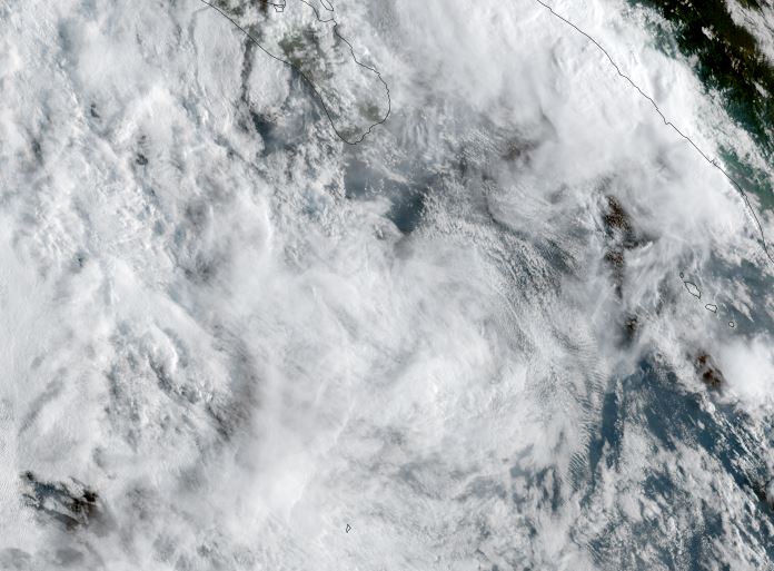
Raymond is currently organizing west of the west central coast of Mexico. Deep convection with very heavy showers remain mostly off of the coast
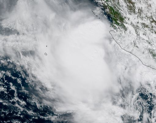
The Weather Situation
SUMMARY OF 200 PM MST...2100 UTC...INFORMATION
----------------------------------------------
LOCATION...19.1N 106.5W
ABOUT 145 MI...230 KM W OF MANZANILLO MEXICO
ABOUT 340 MI...550 KM SE OF THE SOUTHERN TIP OF BAJA CALIFORNIA
MAXIMUM SUSTAINED WINDS...50 MPH...85 KM/H
PRESENT MOVEMENT...NW OR 305 DEGREES AT 17 MPH...28 KM/H
MINIMUM CENTRAL PRESSURE...1000 MB...29.53 INCHES
Tropicast: Visible RAMMB/CIRA slider GOES 18 Friday Afternoon (PDT)
Tropical Weather Forecast:
Raymond is forecast to gain only a little more strength before landfall near the southern Baja Saturday. The greatest threat is very heavy rainfall.