Sunday Morning Update
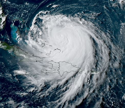
Erin weakens, but still dangerous
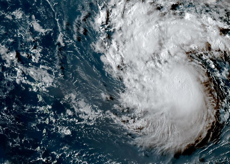
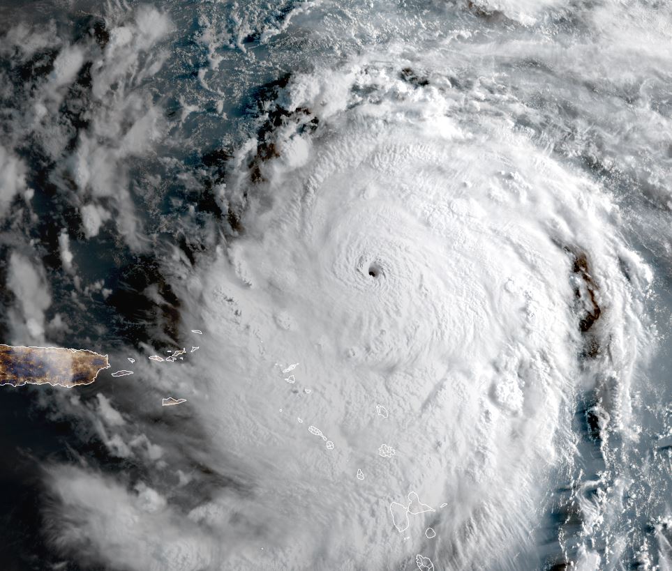
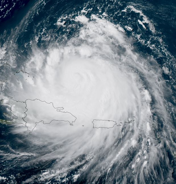
At expected, Erin has gone through an eyewall replacement. Winds have dropped considerably, and pressure has risen. Despite this, this is still a dangerous hurricane. Tropical storm warnings are now posted for the Turks and Caicos and watches for the SE Bahamas. Even tough the hurricane is expected still to turn well east of the Turks and Caicos and Bahamas, heavy squalls with winds to tropical storm force are expected later today.
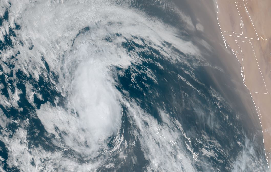
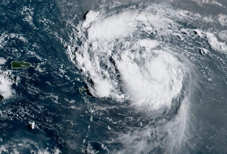
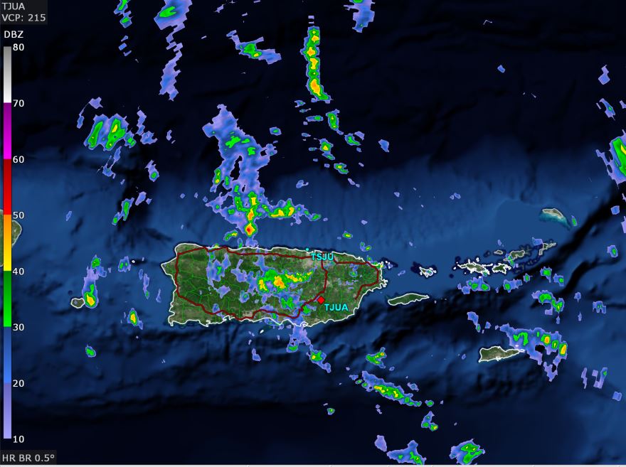
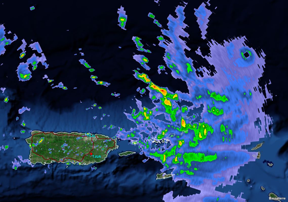
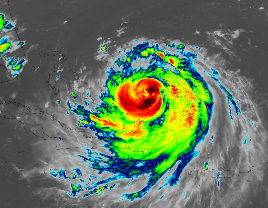
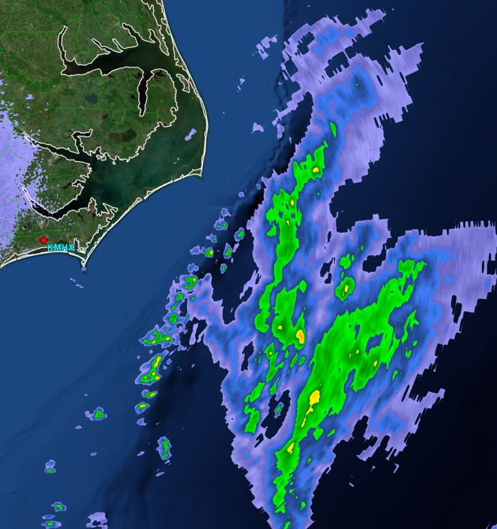
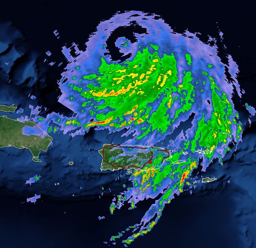
Currently Puerto Rico and Virgin Islands are experiencing some outer bands with heavy rain as the eye is passing well north of Puerto Rico. Some Initials heavy showers are also seen over the Turks and Caicos this morning.
The Weather Situation
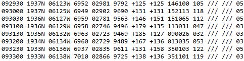
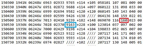
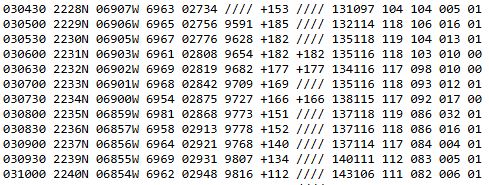
SUMMARY OF 500 AM AST...0900 UTC...INFORMATION
----------------------------------------------
LOCATION...20.6N 66.4W
ABOUT 155 MI...245 KM N OF SAN JUAN PUERTO RICO
ABOUT 310 MI...500 KM E OF GRAND TURK ISLAND
MAXIMUM SUSTAINED WINDS...125 MPH...205 KM/H
PRESENT MOVEMENT...WNW OR 285 DEGREES AT 14 MPH...22 KM/H
MINIMUM CENTRAL PRESSURE...940 MB...27.76 INCHES
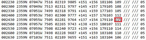
8 am AST Update:
SUMMARY OF 800 AM AST...1200 UTC...INFORMATION
----------------------------------------------
LOCATION...20.7N 67.0W
ABOUT 170 MI...270 KM NNW OF SAN JUAN PUERTO RICO
ABOUT 270 MI...435 KM E OF GRAND TURK ISLAND
MAXIMUM SUSTAINED WINDS...125 MPH...205 KM/H
PRESENT MOVEMENT...WNW OR 285 DEGREES AT 14 MPH...22 KM/H
MINIMUM CENTRAL PRESSURE...940 MB...27.76 INCHES
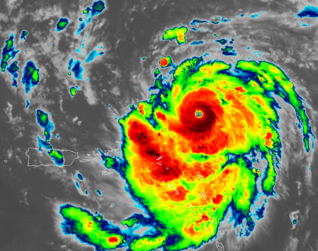
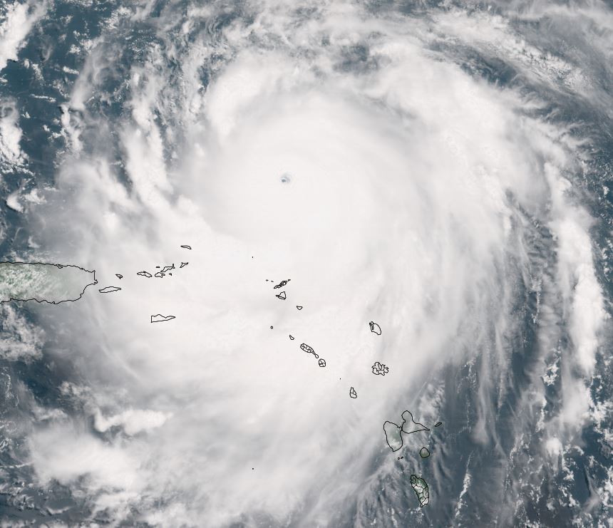
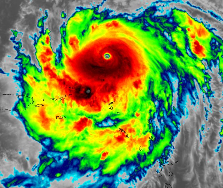
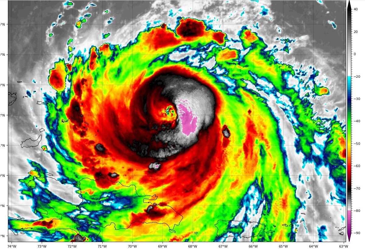
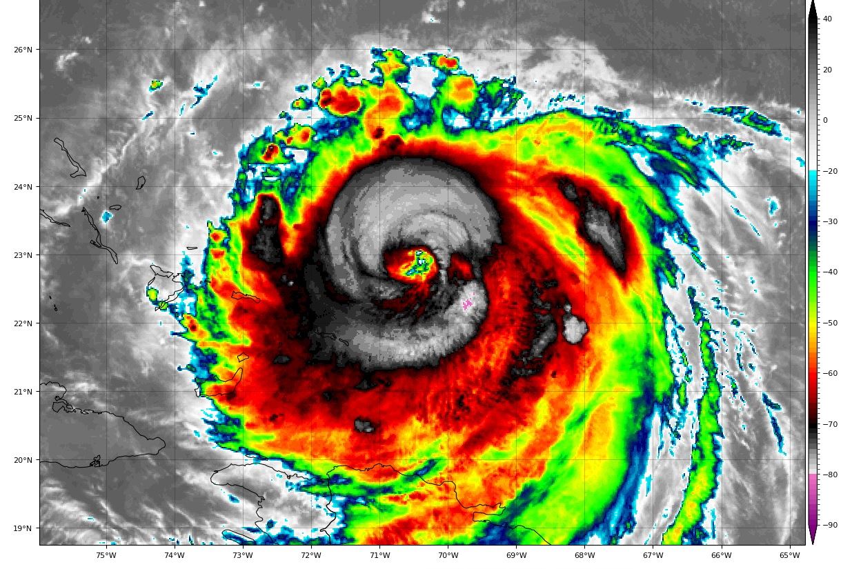
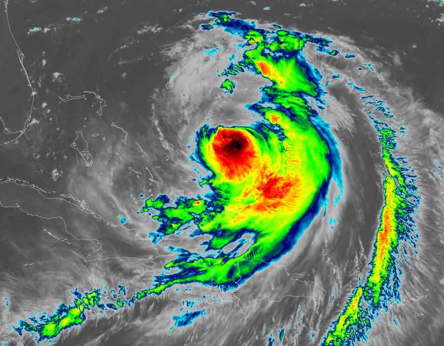
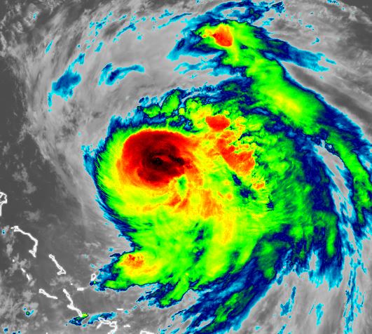
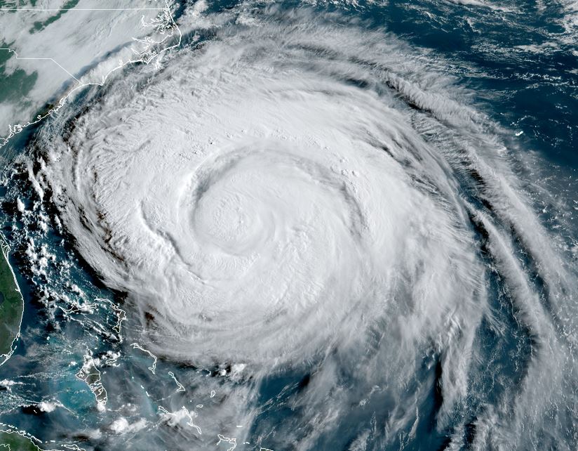
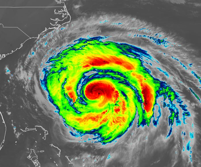
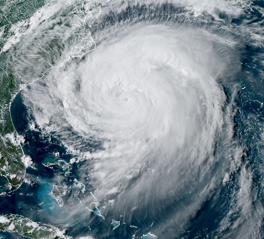
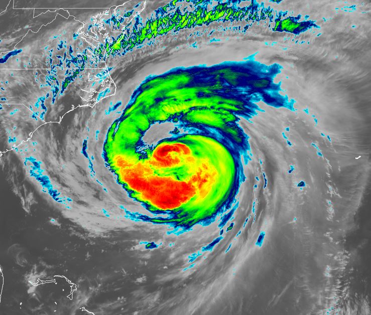
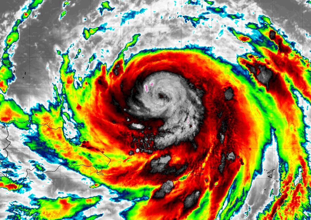
Tropicast: IR satellite NOAA
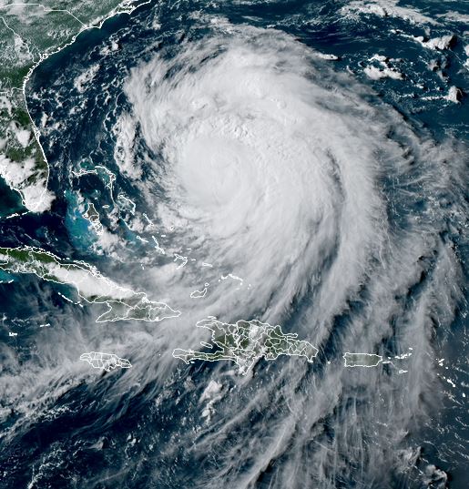
 Tropicast: NWS San Juan Radar ~6:50 am AST Sunday (GR Level 3)
 Tropical Weather Forecast:
Forecast models continue to take Erin east of the Bahamas and eastern US. It is passing north of Puerto Rico this morning with squalls affecting Puerto Rico and Virgin Islands. Erin is expected to turn more northwesterly soon and rain squalls will be approaching the SE Bahamas and Turks and Caicos later today.

Preparations should be finished soon in the Turks and Caicos / eastern Bahamas.