Gordon

Tropical cyclone archives of the 2024 Atlantic hurricane season
Post Reply
User avatar
Tropical Inspector
Site Admin
Site Admin
Posts: 3697
Joined: Tue Feb 20, 2007 2:28 pm
Antispam: no
Location: Under a palm tree
Contact:

Gordon

Post by Tropical Inspector »

Saturday Morning Update
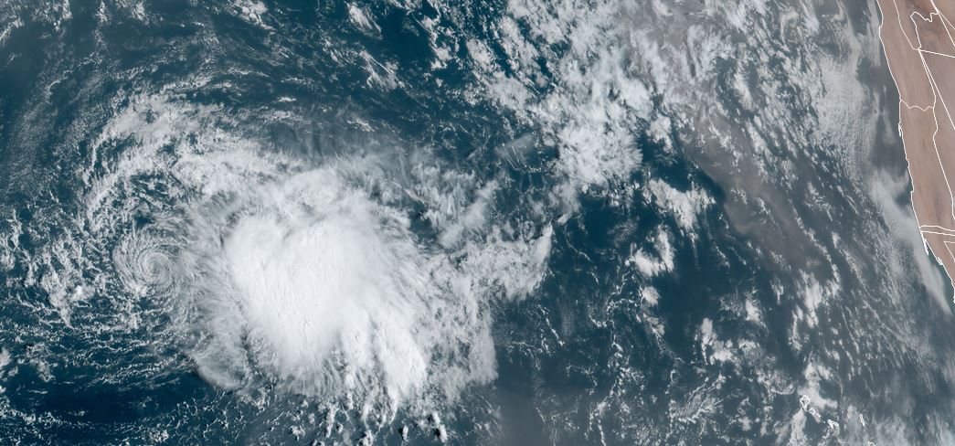
Gordon in open Atlantic

Gordon is being sheared in the open Atlantic waters roughly half way between the Lesser Antilles and the west coast of Africa. The center of the low is one the western side of the burst of deep convection.

The Weather Situation
SUMMARY OF 500 AM AST...0900 UTC...INFORMATION
----------------------------------------------
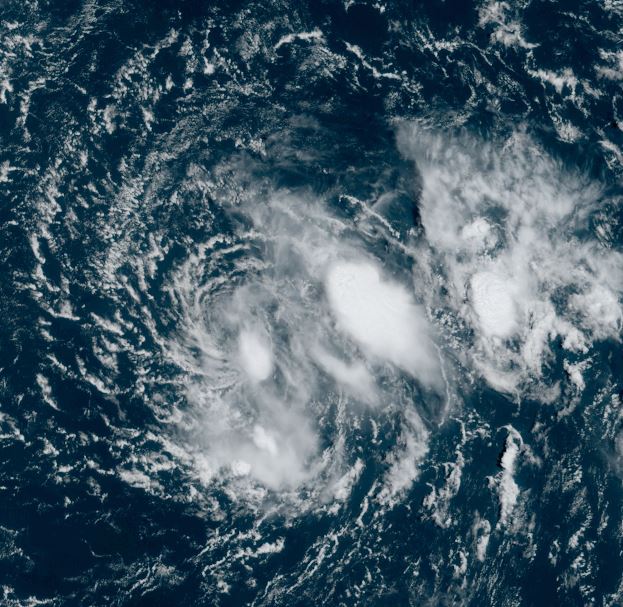
LOCATION...20.1N 40.9W
ABOUT 1145 MI...1840 KM WNW OF THE CABO VERDE ISLANDS
MAXIMUM SUSTAINED WINDS...45 MPH...75 KM/H
PRESENT MOVEMENT...WNW OR 285 DEGREES AT 9 MPH...15 KM/H
MINIMUM CENTRAL PRESSURE...1004 MB...29.65 INCHES

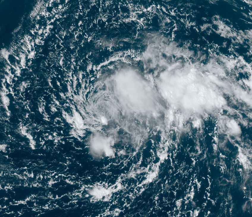
Tropicast: Visible Satellite RAMMB / CIRA Slider Saturday morning
Image

Tropical Weather Forecast:
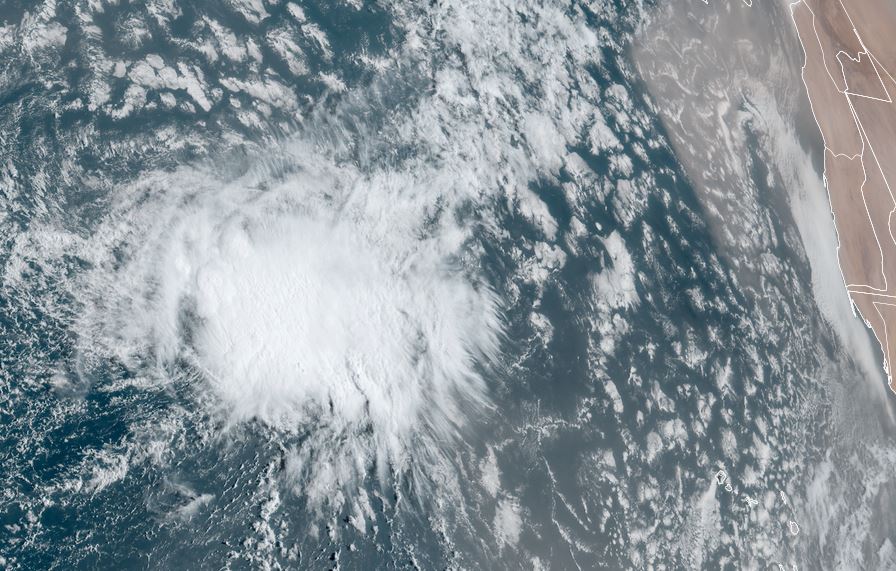
Gordon is expected to stay in the open Atlantic and not post a threat to land as it remains a weak tropical cyclone.
Rich Johnson
Twitter: https://twitter.com/richjohnsonwx
Certified Broadcast Meteorologist - Hurricane Expert
User avatar
Tropical Inspector
Site Admin
Site Admin
Posts: 3697
Joined: Tue Feb 20, 2007 2:28 pm
Antispam: no
Location: Under a palm tree
Contact:

Re: Gordon

Post by Tropical Inspector »

Sunday Morning Update
Gordon sheared

NHC says Gordon is barely a tropical storm, but I believe it is no longer one. Satelite imagery shows deep convection well east of the exposed low center. IMO, surface sustained winds of tropical storm force no longer exist. NHC will likely drop this to a tropical depression during the 11 am edt advisory.

The Weather Situation
SUMMARY OF 500 AM AST...0900 UTC...INFORMATION
----------------------------------------------
LOCATION...19.6N 44.8W
ABOUT 1200 MI...1930 KM E OF THE NORTHERN LEEWARD ISLANDS
MAXIMUM SUSTAINED WINDS...40 MPH...65 KM/H
PRESENT MOVEMENT...WSW OR 255 DEGREES AT 10 MPH...17 KM/H
MINIMUM CENTRAL PRESSURE...1006 MB...29.71 INCHES

Tropicast: Visible Satellite RAMMB / CIRA Slider Sunday morning
Image

Tropical Weather Forecast:
Gordon is expected to stay in the open Atlantic as a depression and not post a threat to land as it remains a weak tropical cyclone. It should dissipate over the next few days.
Rich Johnson
Twitter: https://twitter.com/richjohnsonwx
Certified Broadcast Meteorologist - Hurricane Expert
User avatar
Tropical Inspector
Site Admin
Site Admin
Posts: 3697
Joined: Tue Feb 20, 2007 2:28 pm
Antispam: no
Location: Under a palm tree
Contact:

Re: Gordon

Post by Tropical Inspector »

Monday Afternoon Update
Gordon in bad shape

Gordon is barely hanging on, but a few small bursts of deep convection remain near the center of the low. More substantial convection is to the east of the circulation.

The Weather Situation
SUMMARY OF 1100 AM AST...1500 UTC...INFORMATION
-----------------------------------------------
LOCATION...19.1N 48.1W
ABOUT 985 MI...1580 KM E OF THE NORTHERN LEEWARD ISLANDS
MAXIMUM SUSTAINED WINDS...35 MPH...55 KM/H
PRESENT MOVEMENT...W OR 270 DEGREES AT 7 MPH...11 KM/H
MINIMUM CENTRAL PRESSURE...1006 MB...29.71 INCHES

Tropicast: Visible Satellite RAMMB / CIRA Slider Monday morning
Image

Tropicast: Visible Satellite RAMMB / CIRA Slider Monday afternoon
Image

Tropical Weather Forecast:
Gordon is expected to stay in the open Atlantic as a depression / weak storm and not post a threat to land as it remains a weak tropical cyclone. It is close to dissipating, but some sporadic convection remains. There is the possibility of Gordon regaining a little strength if it can fight shear for a few days.
Rich Johnson
Twitter: https://twitter.com/richjohnsonwx
Certified Broadcast Meteorologist - Hurricane Expert
Post Reply

Return to “2024 Atlantic Hurricane Updates”

Who is online

Users browsing this forum: No registered users and 0 guests