PTC 8

Tropical cyclone archives of the 2024 Atlantic hurricane season
Post Reply
User avatar
Tropical Inspector
Site Admin
Site Admin
Posts: 3697
Joined: Tue Feb 20, 2007 2:28 pm
Antispam: no
Location: Under a palm tree
Contact:

PTC 8

Post by Tropical Inspector »

Sunday Evening Update
PTC 8 will be Helene soon

Potential Tropical Cyclone 8 will acquire enough tropical characteristics to be named a tropical or subtropical storm tonight. Very heavy rainfall is currently out to sea and will move inland over North and South Carolina Monday and Tuesday.

The Weather Situation
SUMMARY OF 500 PM EDT...2100 UTC...INFORMATION
----------------------------------------------
LOCATION...32.0N 78.0W
ABOUT 125 MI...200 KM ESE OF CHARLESTON SOUTH CAROLINA
MAXIMUM SUSTAINED WINDS...45 MPH...75 KM/H
PRESENT MOVEMENT...NW OR 320 DEGREES AT 7 MPH...11 KM/H
MINIMUM CENTRAL PRESSURE...1006 MB...29.71 INCHES

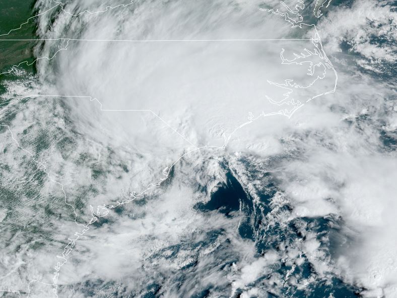
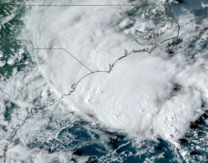
Tropicast: Visible Satellite RAMMB / CIRA Slider Sunday evening
Image

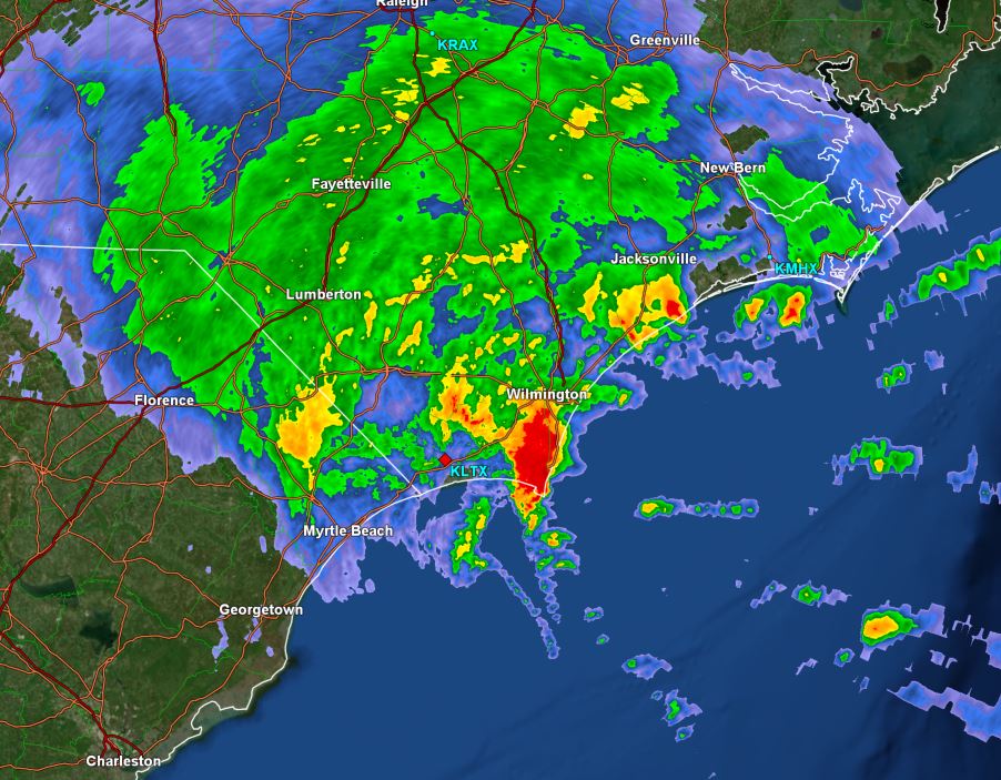
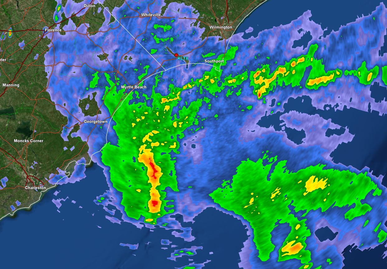
Tropicast: GR Level 3 Wilmington NC radar 7:15pm edt
Image

Tropical Weather Forecast:
PTC 8 will move inland by midday Monday. The main threat from this tropical cyclone will be heavy rainfall over North and South Carolina.
Rich Johnson
Twitter: https://twitter.com/richjohnsonwx
Certified Broadcast Meteorologist - Hurricane Expert
User avatar
Tropical Inspector
Site Admin
Site Admin
Posts: 3697
Joined: Tue Feb 20, 2007 2:28 pm
Antispam: no
Location: Under a palm tree
Contact:

Re: PTC 8

Post by Tropical Inspector »

Monday Late Morning Update
PTC 8 producing strong winds

Potential Tropical Cyclone 8 has not become better organized despite having strong winds of 50 mph or greater. This system is extratropical and will remain so as the low moves inland this afternoon. Last evening it appeared that this system would acquire some tropical characteristics over the Gulf Stream and did not.

The Weather Situation
SUMMARY OF 1100 AM EDT...1500 UTC...INFORMATION
-----------------------------------------------
LOCATION...32.9N 78.3W
ABOUT 70 MI...115 KM SSW OF CAPE FEAR NORTH CAROLINA
ABOUT 95 MI...150 KM E OF CHARLESTON SOUTH CAROLINA
MAXIMUM SUSTAINED WINDS...50 MPH...85 KM/H
PRESENT MOVEMENT...NNW OR 330 DEGREES AT 5 MPH...7 KM/H
MINIMUM CENTRAL PRESSURE...1005 MB...29.68 INCHES

Tropicast: Visible Satellite RAMMB / CIRA Slider Monday morning
Image

Tropicast: GR Level 3 Wilmington NC radar 11:10am edt
Image

Tropical Weather Forecast:
PTC 8 will move inland by later today continuing to bring strong winds and heavy rainfall to the North Carolina coast south of Cape Hatteras.
Rich Johnson
Twitter: https://twitter.com/richjohnsonwx
Certified Broadcast Meteorologist - Hurricane Expert
Post Reply

Return to “2024 Atlantic Hurricane Updates”

Who is online

Users browsing this forum: No registered users and 3 guests