Tuesday Morning Update
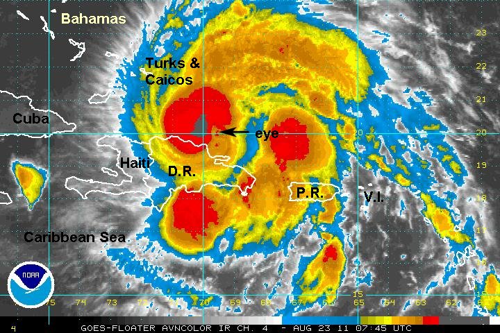
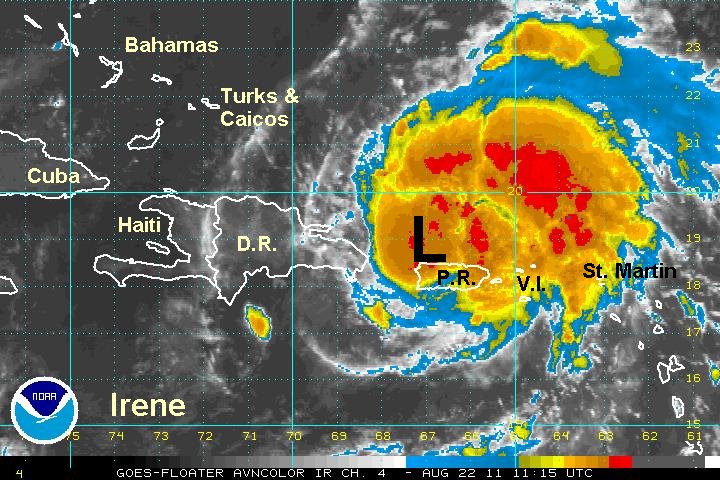
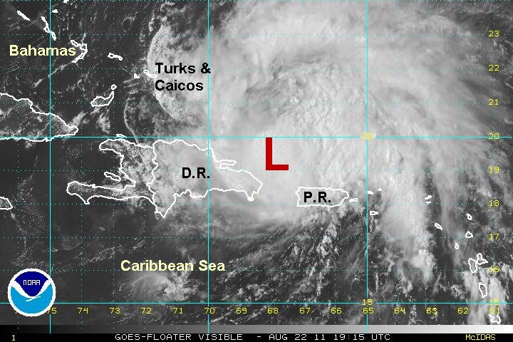
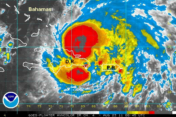
Irene just north of the Dominican Republic
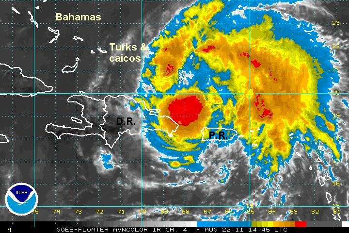
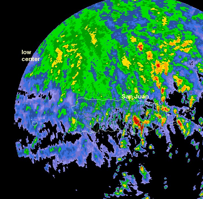
Irene is moving just north of the island of Hispaniola - The Dominican Republic and Haiti. Puerto Plata on the north coast reported a steady wind of 58 mph a few hours ago before stopped reporting. Two distinct zones of convection have set up. The first is over and to the west of the low center, the other remains on the other side of the Dominican Republic to the south. It is apparent that the mountains of Hispaniola are disrupting the intensification of Irene by entraining some dry air into the circulation. As Irene pulls away from Haiti later today additional strengthening is likely.
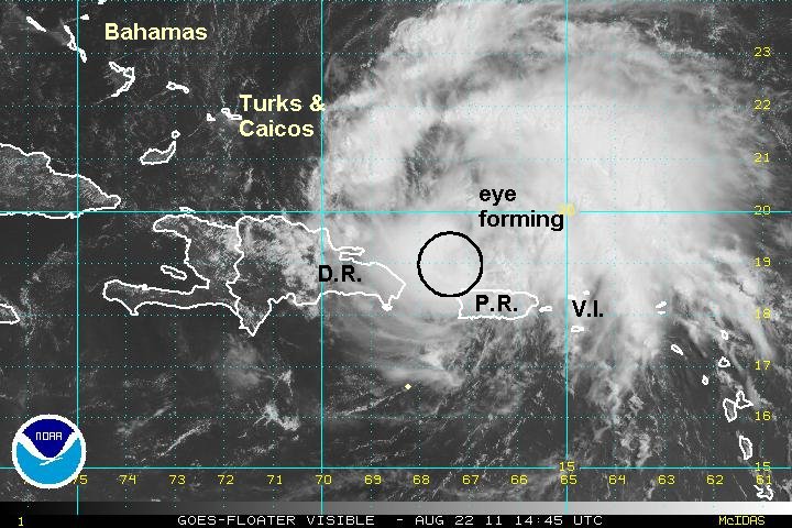
After last evening's burst of intense convection, it doesn't appear that too much strengthening has occured. An eye is now becoming visible as a warm spot on the IR satellite imagery and should be more easily seen on the visible satellite later this morning.
As of 5 am edt / ast Irene was centered near 20.3 N / 70.1 W or about 105 miles se of Grand Turk. It is moving wnw at 12 mph. Top sustained winds are estimated at 95 mph (NHC 100 mph last advisory). Pressure is estimated at 978 mb.
Irene is headed generally west northwest into the southern Bahamas and Turks and Caicos later today. It is projected into the central Bahamas Wednesday where it is expected to make an abrupt north turn late in the day. Thursday the forecasts take it into the northern Bahamas. Friday it is projected north of the Bahamas heading toward the Southeast U.S. Irene is forecast near the central coast of North Carolina Saturday and will either move inland at this location or hug the coast northward. Remember, long range forecasts can have large errors in time and location.

Interests in Cuba, Hispaniola, Bahamas, Turks and Caicos, and U.S. coast Florida to new England should follow this tropical cyclone closely.

Now is the time to make sure you are prepared for a tropical cyclone. Residents of the Turks and Caicos and southern Bahamas should have completed hurricane preparations.
Tropicast: IR Satellite