Tropical depression forming
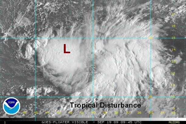
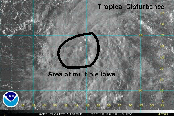
It looks like our newest tropical depression has formed in the central Atlantic east of the Lesser Antilles. We have been following this strong wave for days now. Yesterday there was a weak low level circulation with showers and storms well east of the center. This morning a burst of convection has formed near the circulation center. The exact center has been estimated using the first visible satellite images and microwave. There is a very good chance that this will become the 7th named storm of the Atlantic hurricane season in the next 12-24 hours if development continues.
At 7 am edt / ast the tropical disturbance was centered at 14.0° N / 42.5° W or about or roughly 1250 miles east of the Lesser Antilles. Top sustained winds are estimated at 30 mph. The tropical disturbance is moving west northwest at about 10 mph.
Forecast models are moving this system generally northwest into the open Atlantic the next several days.
Tropicast: Visible Floater Satellite (5:45 am edt/ast)