Danny in sorry shape
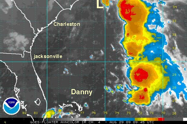
In reality Danny is not a tropical storm any longer. Winds are probably gusting to tropical storm force in the squalls well to the east of the center. The Hurricane Center is not downgrading Danny because they do not want to yo-yo the advisories if Danny were to strengthen some again. This is probably a good move to stay on the conservative side.
Overall, the recent developments bode well for travelers and those living on the Northeast coast. The lack of development and the speed at which Danny will be moving later today and tomorrow will help minimize effects. High surf, a period of gusty winds, and heavy showers is still likely especially on the coast of the Northeast.
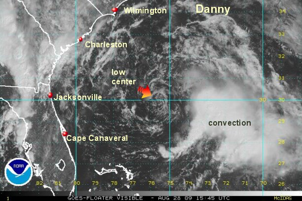
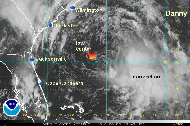
Visible satellite imagery shows that the center of circulation is totally naked. Significant development can not occur if convection can not build over the center.
As of 12:30 pm edt /ast Danny was centered near 30.0° N / 75.7° W or about 370 miles south of Cape Hatteras, North Carolina. Top sustained winds are estimated at 35 mph (NHC estimates 40 mph). Movement is to the west at 5 mph.
Danny will rapidly move up the eastern seaboard tonight and Saturday. Danny will likely remain as a minimal tropical storm then transform into an extratropical cyclone as it approaches Nova Scotia.
Friday Night: near to 100 east of Cape Hatteras
Saturday: Moving rapidly north northeast of the Mid-Atlantic coast by 100-250 miles east
Saturday Late afternoon / Evening: Near Cape Cod to east 50 miles
Saturday Evening / Night: Near or east of the New England coast into Canada (Nova Scotia) as an extratropical cyclone
Tropicast: Atlantic Visible Floater Satellite (11:45 am edt)