|
|
Hurricane pictures / summaries 2024
Satellite images provided by NOAA. Hurricane tracks courtesy of the National Hurricane Center.
 Click pictures for close up view Click pictures for close up view

|
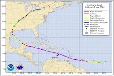
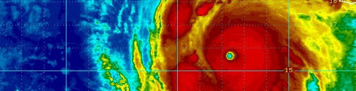
Hurricane Beryl
July 1, 2024
Beryl began taking shape about 1000 miles ese of the Windward islands June 29th. The tropical cyclone strengthened rapidly at a very low latitude that next day with top sustained winds at 130 mph. It weakened briefly as it moved through the Windwards, then exploded to 150 mph in the se Caribbean Sea. Beryl continuted to strengthen into the central Caribbean south of Puerto Rico with winds at 165 mph. The eye passed south of Jamaica on July 3rd with the eyewall affecting the southern coast. Two days later landfall occurred on the Yucatan peninsula with winds at 110 mph after bypassing Cozumel. Beryl continued wnw as a tropical storm then turned north and made landfall on the upper Texas coast as a minimal hurricane.
|
|
|
|
)
)
)
)
)
)
)
)
)
)
)
)
)
)
)
)
)
)
)
)
)
)