|
|
Hurricane pictures / summaries 2013
Satellite images provided by NOAA / NASA / MODIS. Hurricane tracks courtesy of the National Hurricane Center.
 Click pictures for close up view Click pictures for close up view


|
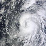
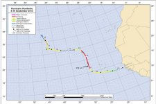
Hurricane Humberto
September 11, 2013
Humberto nearly became the latest first hurricane developing in the Atlantic hurricane season. It was classified as a hurricane at 5 am edt. The previous year hurricane Gustav was classified at 8am on September 11th.
Humberto formed from a strong tropcial wave moving off of the African coast. It was classified as a tropical storm by September 9th south of the Cape Verde Islands. It began a northwest motion west of the islands and strengthened into a category 1 hurricane. Strongest sustained winds were estimated at 85 mph. Wind shear and dry air disrupted the circulation and Humberto looked like a post tropical system by the 14th. Some tropical characteristics reappeared has convection rebuilt a few days later and Humberto was reclassified as a tropical storm on the 16th. Humberto continued north into the cooler north Atlantic water and gradually became extratropical.
|


|
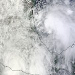
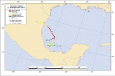
Hurricane Ingrid
September 14, 2013
Unsettled weather drifted from the northwest Caribbean and formed into tropical depression 10 in the southern Bay of Campeche on Septempber 12th. Gradual strengthening continued and Ingrid was classified as a hurricane on the afternoon of the 14th in the western Bay of Campeche. Ingrid's strongest sustained winds were estimated at 85 mph - a category one hurricane. The main threat from Ingid was from flooding rains and mudslides. Ingrid made landfall on the 16th on the northeastern coast of Mexico near La Pesca at 7 am cdt
|
Hurricane pictures and summaries main page.
|
|
|