|
|
Hurricane pictures / summaries 2003
Satellite images provided by NOAA / NASA / MODIS. Hurricane tracks courtesy of the National Hurricane Center.
 Click pictures for close up view Click pictures for close up view
|
Hurricane Claudette
July 15, 2003
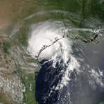
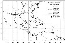
Hurricane Claudette formed east of the Windward Islands and was classified as a tropical depression. Claudette had two brief stints as a hurricane. The first time was in the northwestern Caribbean Sea. It weakened some and made landfall as a tropical storm north of Cozumel. Claudette continued northwest a strengthened again before hitting the cental Texas coast. A storm tide of 5-8 feet was common on the central and upper Texas coast with the highest at Freeport with 9.15 feet. The highest reliable wind gust was reported at Port O'Connor at 90 mph. An oil rig at Eugene Island had a gust to 96 mph. The upper and mid circulation continued west and eventually passed into the Pacific Ocean from California!
|
|
Hurricane Danny
July 19, 2003
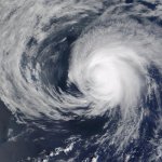
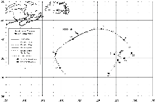
Hurricane Danny was a tropical cyclone that made a large "C" shaped curve through the north Atlantic Ocean. It did not cause any damage and was only a threat to shipping. Danny only reached the bare minimum for a hurricane at 75 mph.
|
|
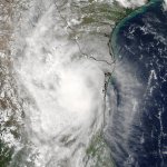
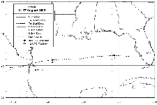
Hurricane Erika
August 16, 2003
Erika formed in the eastern Gulf of Mexico on an old front. It moved westward and made landfall in northeastern Mexico as a minimal hurricane. Originally Erika was not called a hurricane. It was one of the rare times that more research after the hurricane season called for Erika to be upgraded. After studying data from Brownsville, TX doppler radar, it showed winds to be minimal hurricane force. Heavy rain fell in Mexico where 6.71" was seen in Magueyes.
|
|
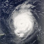
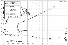
Hurricane Fabian
September 2, 2003
Hurricane Fabian will be remembered as the worst hurricane to hit the Island of Bermuda since 1926. It was a longtrack hurricane that formed off of the coast of Africa. Fabian curved northeast of the Leeward Islands, then hit Bermuda as a category 3 hurricane. Wind gusts of 150 mph were measured at the Bermuda airport and 165 mph at Bermuda Harbour Radio. There was extensive roof and tree damage, especially on exposed locations. Waves of 20-30 feet were estimated on the south shore with a 10 foot storm surge.
|
|
Hurricane Isabel
September 18, 2003
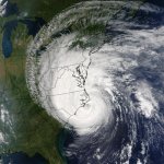
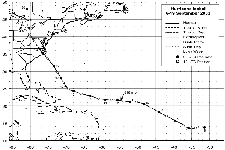
Hurricane Isabel formed in the deep tropics several hundred miles off of the coast of Africa. It strengthened into a powerful category 5 hurricane as it jogged northeast of the Leeward Islands. It continued west, then northwest before weakening and making landfall on the coast of North Carolina near Drum Inlet as a category 2 hurricane. The highest gust was reported on Cape Hatteras at 98 mph. 97 mph was measured at Elizabeth City, NC and an unofficial gust to 117 at Kitty Hawk, NC. The most severely effected region either lost power or had other instrument
failures, so the strongest gusts were probably not captured. As Isabel moved inland, far up the eastern seaboard, La Guardia and JFK airports still had sustained tropical storm force winds. Storm surges of 6-8 feet were measured near landfall. River storm surges also occured from the Chesapeake southward to eastern North Carolina. A surge of 10.5' was measured at the Neuse River, NC and 6-8' at Annapolis and Baltimore, MD.
|
|
Hurricane Juan
September 27, 2003
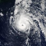
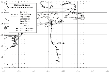
Hurricane Juan formed southeast of Bermuda and moved northward making landfall at Halifax, Nova Scotia as a category two hurricane. The last time Halifax was struck by a hurricane was in 1893. Extensive roof and tree damage occured with Hurricane Juan as well as widespread power outages. The strongest gust was at McNab's Island with a gust to 109 mph. Storm tides of 9-10 feet
were observed on Nova Scotia and Prince Edward Island.
|

|
Hurricane Kate
October 4, 2003
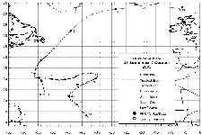
Hurricane Kate followed an extremely unusual course through the north Atlantic Ocean. Kate was born in the deep tropics roughly half way between the Lesser Antillies and the coast of Africa. Kate started north then curved northeast, before reversing its track and moving west. It eventually gained strength over the open Atlantic as a category 3 hurricane. Kate moved north, then mostly eastward losing its tropical characteristics north of the U.K. and merging with an extratropical low near Scandinavia.
|
Hurricane pictures and summaries main page.
|
|
|