Chantal
Posted: Sat Jul 05, 2025 1:41 pm
Saturday Afternoon Update
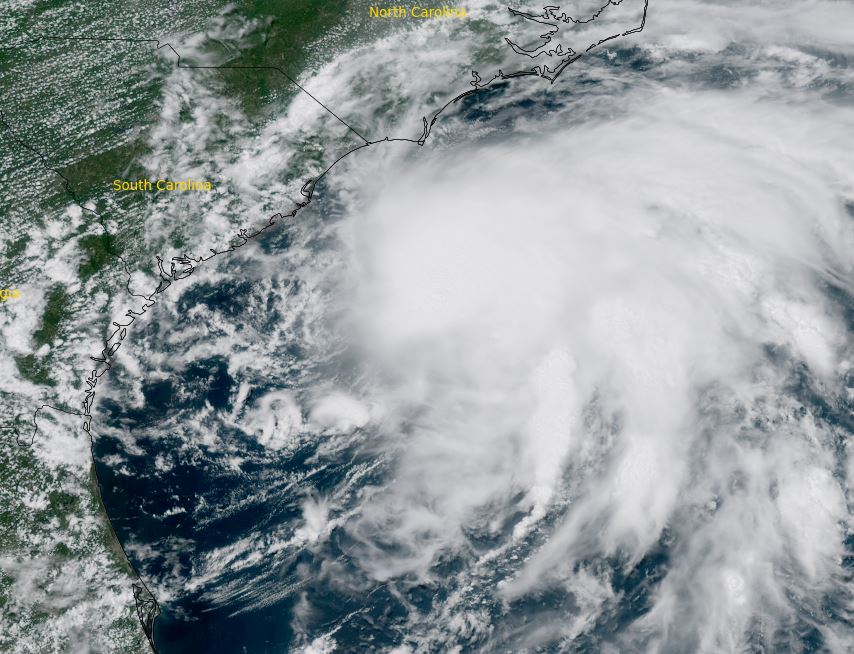
Chantal being sheared
Visibible satellite shows the weak low center moving wsw away from under the convection to the east. Banding is noted to the east where the strongest winds have been found by the recon plane. Despite looking organized, with the low moving away from the convection, Chantal is not expected to strengthen as the rains push onshore of the coast of South and North Carolina.
The Weather Situation
SUMMARY OF 200 PM EDT...1800 UTC...INFORMATION
----------------------------------------------
LOCATION...31.6N 78.7W
ABOUT 105 MI...175 KM SE OF CHARLESTON SOUTH CAROLINA
ABOUT 185 MI...300 KM SSW OF WILMINGTON NORTH CAROLINA
MAXIMUM SUSTAINED WINDS...45 MPH...75 KM/H
PRESENT MOVEMENT...N OR 360 DEGREES AT 3 MPH...6 KM/H
MINIMUM CENTRAL PRESSURE...1006 MB...29.71 INCHES
Tropicast: IR satellite RAAMB Cira-Slider
Tropical Weather Forecast:
NHC mentioned that Chantal is strengthening at 11 am edt, but that trend seems to have ended as the low is moving from the deep convection. The main hazard with be locally heavy rainfall on the North and South Carolina coasts into Sunday.
NHC Advisory
https://www.nhc.noaa.gov/text/refresh/M ... 735.shtml?
NHC Track
https://www.nhc.noaa.gov/refresh/graphi ... e#contents