Page 1 of 1
Philippe
Posted: Mon Sep 25, 2023 7:42 pm
by Tropical Inspector
Monday Evening Update
Philippe remains minimal tropical storm
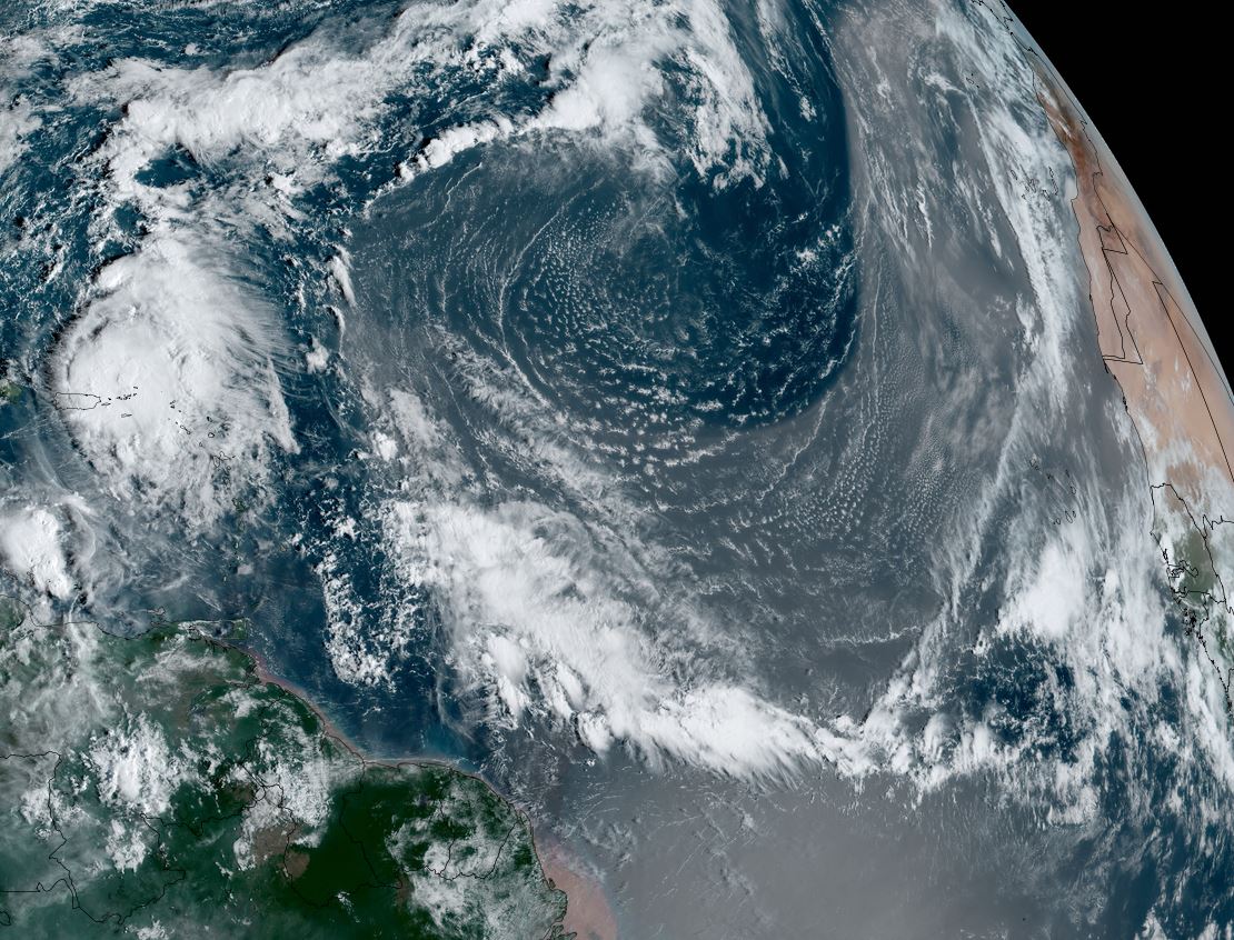
Philippe was name a few days ago. It is in the open north Atlantic far from land at this time. Philippe has been battling westerly wind shear and has weakened a little since earlier today.
The Weather Situation
SUMMARY OF 500 PM AST...2100 UTC...INFORMATION
----------------------------------------------
LOCATION...17.3N 46.7W
ABOUT 1080 MI...1740 KM E OF THE NORTHERN LEEWARD ISLANDS
MAXIMUM SUSTAINED WINDS...45 MPH...75 KM/H
PRESENT MOVEMENT...W OR 275 DEGREES AT 15 MPH...24 KM/H
MINIMUM CENTRAL PRESSURE...1002 MB...29.59 INCHES
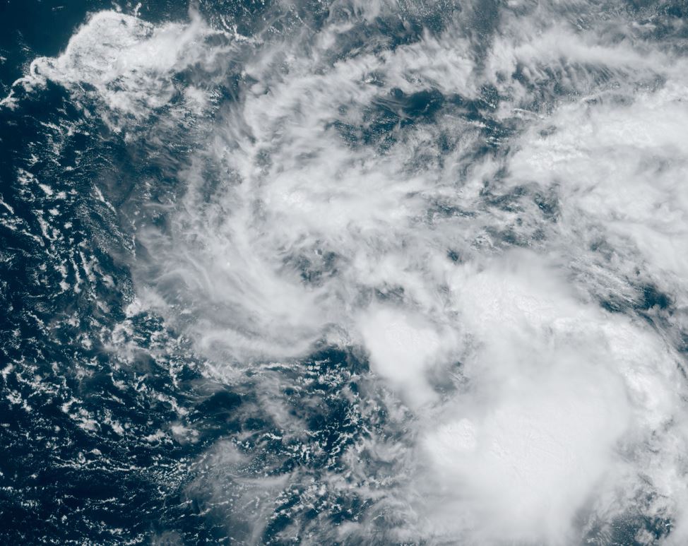
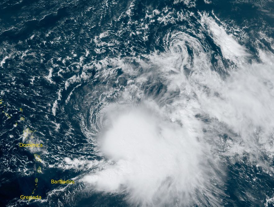
Tropicast: Visible satellite Sunday afternoon
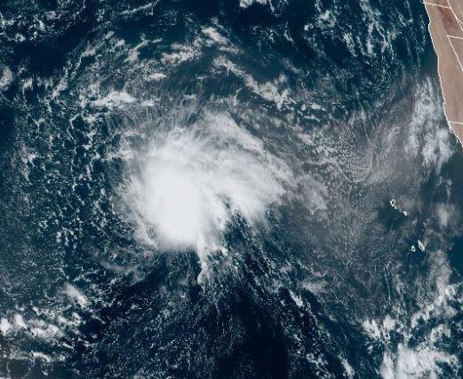 Tropicast: Visible satellite Monday Morning
 Tropical Weather Forecast:
Philippe will continue wnw over the open Atlantic for the next several days as a tropical storm. It is expected to stay well north of the Lesser Antilles.
Re: Philippe
Posted: Tue Sep 26, 2023 7:37 pm
by Tropical Inspector
Tuesday Evening Update
Philippe remains minimal tropical storm
Philippe continues to be facing significant shear with convection well to the east.
The Weather Situation
SUMMARY OF 500 PM AST...2100 UTC...INFORMATION
----------------------------------------------
LOCATION...17.1N 51.3W
ABOUT 780 MI...1255 KM E OF THE NORTHERN LEEWARD ISLANDS
MAXIMUM SUSTAINED WINDS...45 MPH...75 KM/H
PRESENT MOVEMENT...W OR 270 DEGREES AT 13 MPH...20 KM/H
MINIMUM CENTRAL PRESSURE...1003 MB...29.62 INCHES
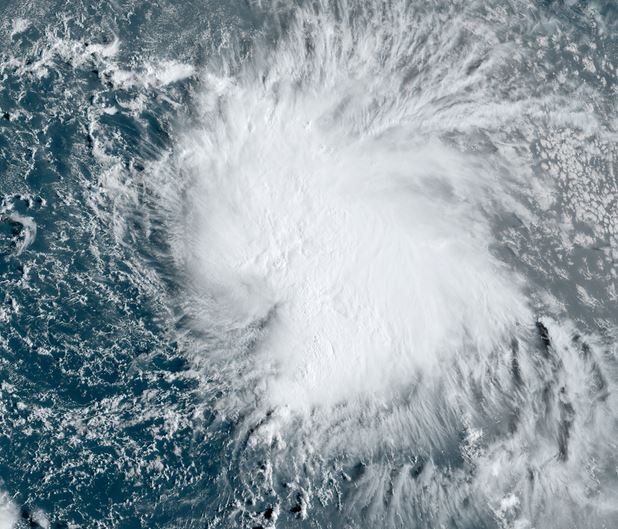
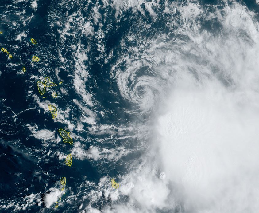
Tropicast: Visible satellite Tuesday Morning
 Tropical Weather Forecast:
Philippe will continue wnw over the open Atlantic for the next several days as a tropical storm. It is expected to stay well north of the Lesser Antilles and weaken in a few more days.
Re: Philippe
Posted: Wed Sep 27, 2023 7:58 pm
by Tropical Inspector
Wednesday Evening Update
Philippe a little stronger today
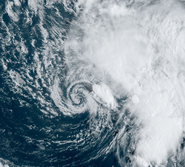
Satellite shows an expanded area of deep convection. As a result, winds have picked up a touch.
The Weather Situation
SUMMARY OF 500 PM AST...2100 UTC...INFORMATION
----------------------------------------------
LOCATION...17.7N 54.0W
ABOUT 600 MI...965 KM E OF THE NORTHERN LEEWARD ISLANDS
MAXIMUM SUSTAINED WINDS...50 MPH...85 KM/H
PRESENT MOVEMENT...WNW OR 295 DEGREES AT 5 MPH...7 KM/H
MINIMUM CENTRAL PRESSURE...998 MB...29.47 INCHES
Tropicast: Visible satellite Wednesday Morning
 Tropical Weather Forecast:
Philippe is now expected to possibly affect the Leewards as a weakening tropical storm by Saturday.
Re: Philippe
Posted: Thu Sep 28, 2023 8:16 pm
by Tropical Inspector
Thursday Evening Update
Philippe wandering
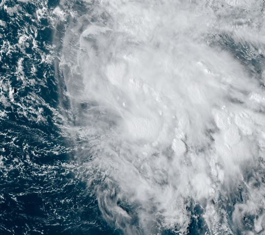
Satellite shows deep convective bursts to the east and south of the low center. It remain a minimal tropical storm.
The Weather Situation
SUMMARY OF 500 PM AST...2100 UTC...INFORMATION
----------------------------------------------
LOCATION...18.9N 55.1W
ABOUT 525 MI...845 KM E OF THE NORTHERN LEEWARD ISLANDS
MAXIMUM SUSTAINED WINDS...45 MPH...75 KM/H
PRESENT MOVEMENT...WNW OR 290 DEGREES AT 2 MPH...4 KM/H
MINIMUM CENTRAL PRESSURE...1003 MB...29.62 INCHES
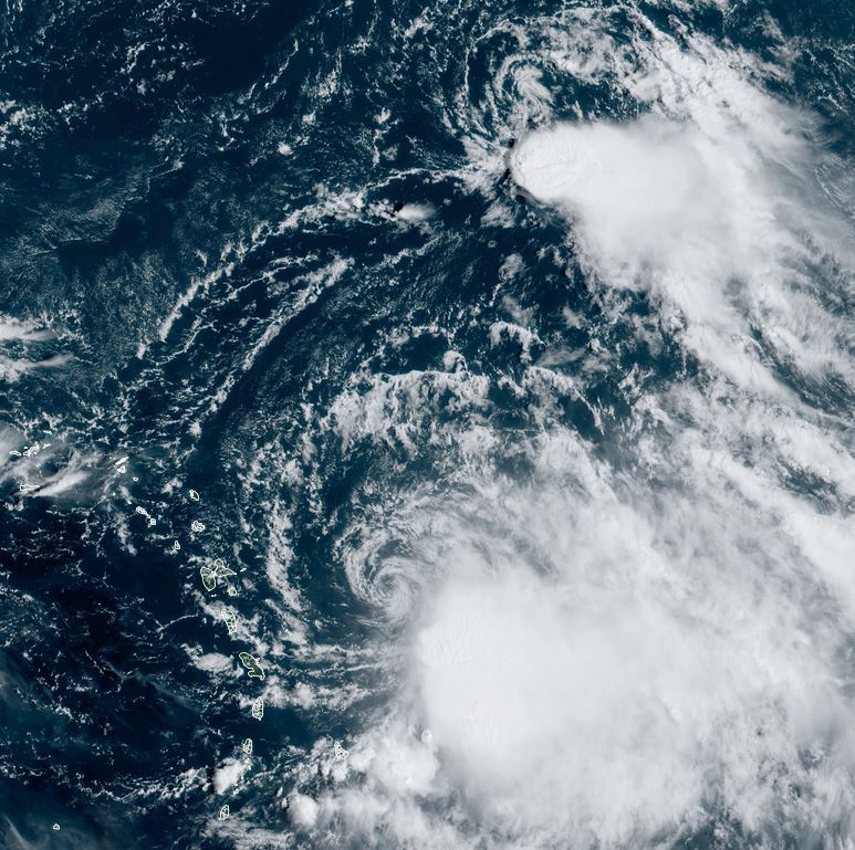
Tropicast: Visible satellite Thursday Morning
 Tropical Weather Forecast:
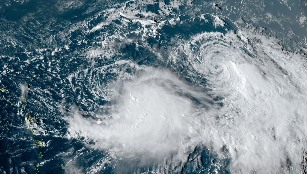
Philippe is expected to interact with tropical storm Rina. This will set up a complex motion which now may keep it northeast of the Lesser Antilles.
Re: Philippe
Posted: Fri Sep 29, 2023 4:39 pm
by Tropical Inspector
Friday Evening Update
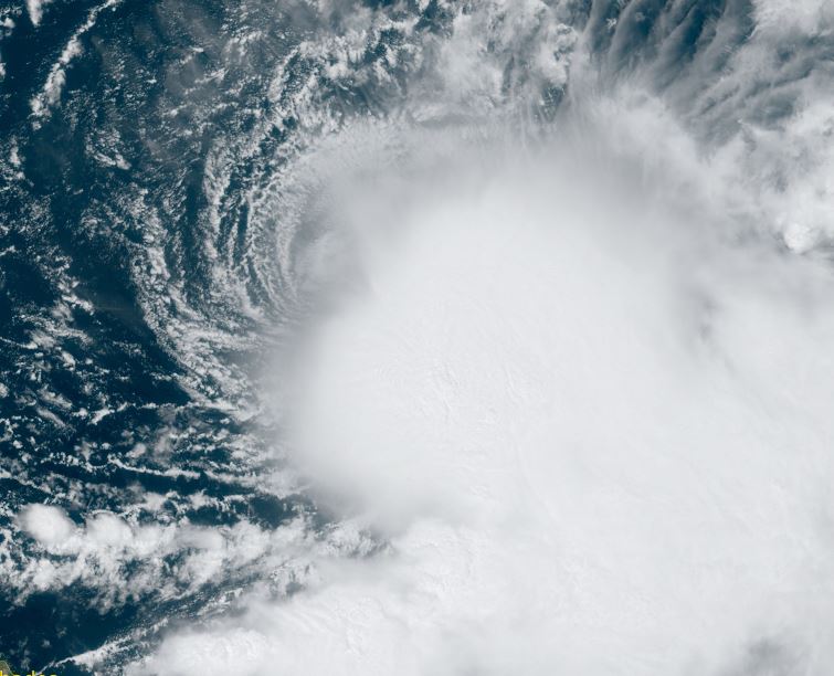
Philippe still sheared
Satellite still shows deep convection to the SE of the low. The low center is plainly visible.
The Weather Situation
SUMMARY OF 500 PM AST...2100 UTC...INFORMATION
----------------------------------------------
LOCATION...18.0N 55.9W
ABOUT 475 MI...760 KM E OF THE NORTHERN LEEWARD ISLANDS
MAXIMUM SUSTAINED WINDS...50 MPH...85 KM/H
PRESENT MOVEMENT...WSW OR 240 DEGREES AT 5 MPH...7 KM/H
MINIMUM CENTRAL PRESSURE...1002 MB...29.59 INCHES
Tropicast: Visible satellite Friday Morning
 Tropicast: Visible satellite Friday Afternoon
 Tropical Weather Forecast:
Philippe is expected to interact with tropical storm Rina. This will set up a complex motion which now may keep it northeast of the Lesser Antilles.
Philippe will move into the central North Atlantic and may strengthen into a hurricane several days from now.
Re: Philippe
Posted: Sat Sep 30, 2023 4:36 pm
by Tropical Inspector
Saturday Evening Update
Philippe strengthening
Deep convection is increasing around Philippe and strengthening has commenced again.
The Weather Situation
SUMMARY OF 500 PM AST...2100 UTC...INFORMATION
----------------------------------------------
LOCATION...16.3N 56.5W
ABOUT 455 MI...730 KM ESE OF THE NORTHERN LEEWARD ISLANDS
MAXIMUM SUSTAINED WINDS...50 MPH...85 KM/H
PRESENT MOVEMENT...SW OR 215 DEGREES AT 5 MPH...7 KM/H
MINIMUM CENTRAL PRESSURE...999 MB...29.50 INCHES
Tropicast: Visible satellite
 Tropicast: Visible satellite
 Tropical Weather Forecast:
Rina is weakening rapidly and any further influence on Philippe's track will be minimal. Philippe will move into the central North Atlantic and will strengthen into a hurricane a few days from now. It will likely stay to the east of the Leewards.
Re: Philippe
Posted: Sun Oct 01, 2023 8:20 am
by Tropical Inspector
Sunday Morning Update
Philippe east of the Lesser Antilles
Deep convection remains well to the southeast of the center of the low. Northwesterly windshear continues to disrupt organized storm development.
The Weather Situation
SUMMARY OF 500 AM AST...0900 UTC...INFORMATION
----------------------------------------------
LOCATION...16.4N 58.2W
ABOUT 210 MI...340 KM E OF GUADELOUPE
ABOUT 250 MI...405 KM ESE OF BARBUDA
MAXIMUM SUSTAINED WINDS...50 MPH...85 KM/H
PRESENT MOVEMENT...W OR 280 DEGREES AT 7 MPH...11 KM/H
MINIMUM CENTRAL PRESSURE...999 MB...29.50 INCHES
Tropicast: Visible satellite
 Tropicast: Visible satellite
 Tropical Weather Forecast:
Philippe will move into the central North Atlantic and will strengthen into a hurricane a few days from now. It will likely stay to the east of the Leewards and also most likely Bermuda also.
Re: Philippe
Posted: Mon Oct 02, 2023 8:37 pm
by Tropical Inspector
Monday Night Update
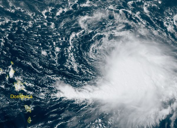
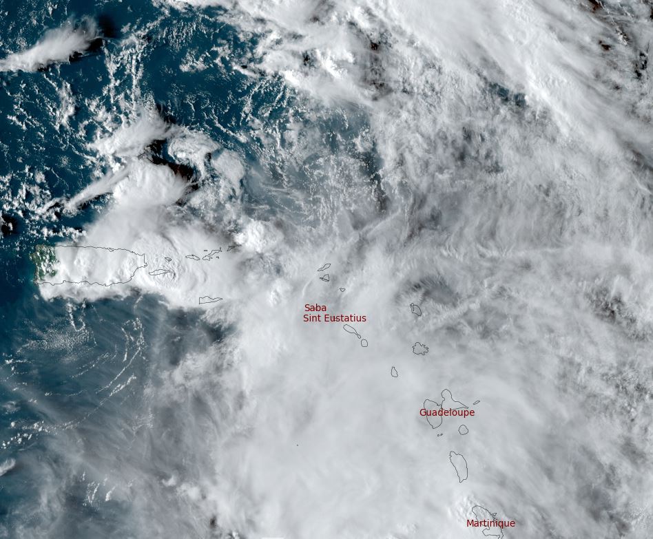
Philippe ESE of St. Martin / St. Maarten
Philippe is still badly sheared with the center clearly visible. A large area of deep convection remains to the south of the low capable of producing very heavy rainfall. Heavy rainfall and flash flooding is possible as Phillipe lifts north tonight into Tuesday.
The Weather Situation
SUMMARY OF 800 PM AST...0000 UTC...INFORMATION
----------------------------------------------
LOCATION...17.6N 62.0W
ABOUT 80 MI...130 KM ESE OF ST. MARTIN
MAXIMUM SUSTAINED WINDS...50 MPH...85 KM/H
PRESENT MOVEMENT...WNW OR 300 DEGREES AT 7 MPH...11 KM/H
MINIMUM CENTRAL PRESSURE...1001 MB...29.56 INCHES
Tropicast: Visible satellite
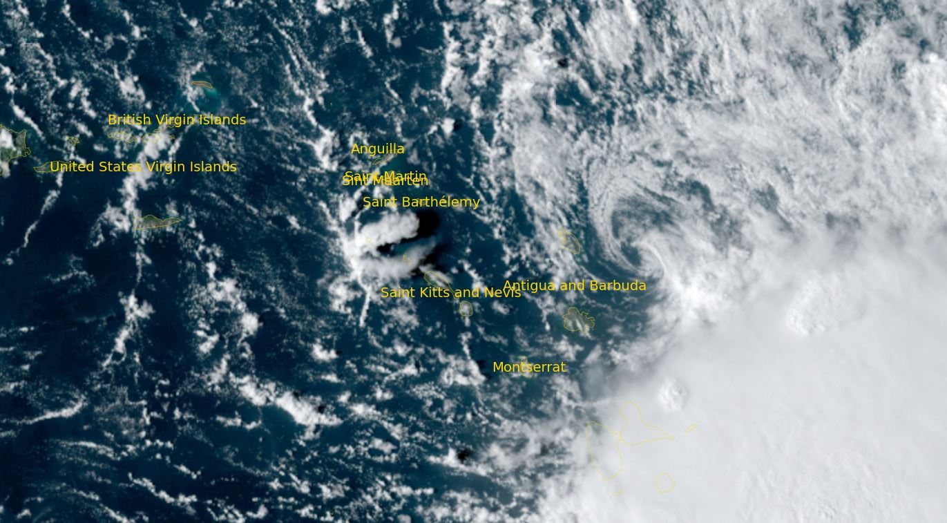 Tropical Weather Forecast:
Philippe will move very close to the NE Lesser Antilles. Very heavy rainfall is possible tonight into Tuesday across the Leewards. Philippe is still on track to move into the open north Atlantic later this week - possibly near or just east of Bermuda and possibly as a hurricane.
Re: Philippe
Posted: Tue Oct 03, 2023 4:52 pm
by Tropical Inspector
Tuesday Evening Update
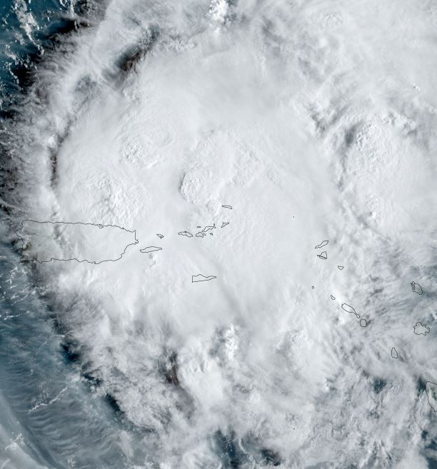
Philippe north of the Virgin Islands
Philippe remains badly sheared. The weak low center is moving north away from the Leewards. Despite this, Heavy scattered showers remain from near Puerto Rico, through the Leewards into the northern Windwards.
The Weather Situation
SUMMARY OF 500 PM AST...2100 UTC...INFORMATION
----------------------------------------------
LOCATION...19.6N 64.9W
ABOUT 85 MI...135 KM N OF ST. THOMAS
ABOUT 875 MI...1410 KM S OF BERMUDA
MAXIMUM SUSTAINED WINDS...45 MPH...75 KM/H
PRESENT MOVEMENT...NW OR 310 DEGREES AT 12 MPH...19 KM/H
MINIMUM CENTRAL PRESSURE...1004 MB...29.65 INCHES
Tropicast: Visible satellite
 Tropical Weather Forecast:
Philippe is now no longer forecast to become a hurricane as it approaches Bermuda by Friday. In fact, IMO the circulation center may fall apart before reaching Bermuda. Interests in Bermuda should continue to follow the progress of Philippe.
Re: Philippe
Posted: Wed Oct 04, 2023 4:24 pm
by Tropical Inspector
Wednesday Evening Update
Philippe eyeing Bermuda
Philippe has reorganized well north of the Virgin Islands today as it continues to fight wind shear. A long line of heavy showers and storms stretches from Philippe and well to the SSW into the Caribbean in groups of clusters. Heavy showers remain a threat into the Leewards to Puerto Rico.
The Weather Situation
SUMMARY OF 500 PM AST...2100 UTC...INFORMATION
----------------------------------------------
LOCATION...22.6N 65.9W
ABOUT 295 MI...475 KM N OF ST. THOMAS
ABOUT 675 MI...1085 KM S OF BERMUDA
MAXIMUM SUSTAINED WINDS...40 MPH...65 KM/H
PRESENT MOVEMENT...N OR 350 DEGREES AT 12 MPH...19 KM/H
MINIMUM CENTRAL PRESSURE...1004 MB...29.65 INCHES
Tropicast: Visible satellite wednesday morning
 Tropicast: Visible satellite wednesday morning
 Tropical Weather Forecast:
Philippe is now no longer forecast to become a hurricane as it approaches Bermuda by Friday morning. Heavy showers and possibly winds gusting to tropical storm strength may be expected. Interests in Bermuda should continue to follow the progress of Philippe.
Re: Philippe
Posted: Thu Oct 05, 2023 1:50 pm
by Tropical Inspector
Thursday afternoon Update
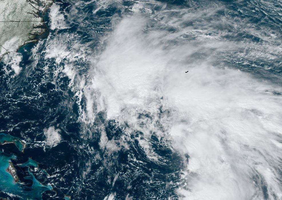
Philippe approaching Bermuda
Philippe still has a good deal of showers and storms but is starting to look more extratropical. Bermuda may see some wind gusts to tropical storm strength and heavy rainfall as it passes by.
The Weather Situation
SUMMARY OF 200 PM AST...1800 UTC...INFORMATION
----------------------------------------------
LOCATION...26.2N 66.3W
ABOUT 430 MI...695 KM SSW OF BERMUDA
MAXIMUM SUSTAINED WINDS...50 MPH...85 KM/H
PRESENT MOVEMENT...N OR 355 DEGREES AT 13 MPH...20 KM/H
MINIMUM CENTRAL PRESSURE...1005 MB...29.68 INCHES
Tropicast: Visible satellite Wednesday morning
 Tropical Weather Forecast:
Philippe will pass by Bermuda tomorrow morning. Heavy showers and possibly winds gusting to tropical storm strength may be expected. Interests in Bermuda should continue to follow the progress of Philippe.