Monday Night Update
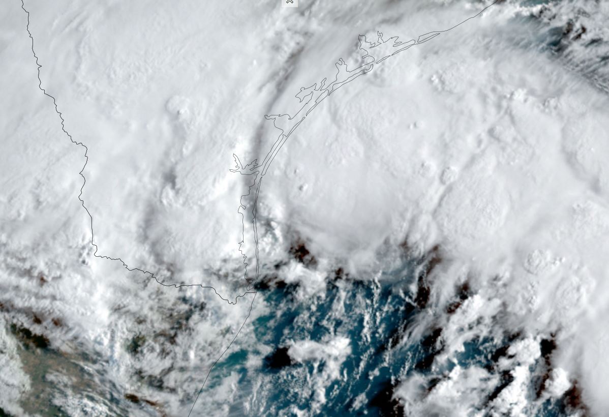
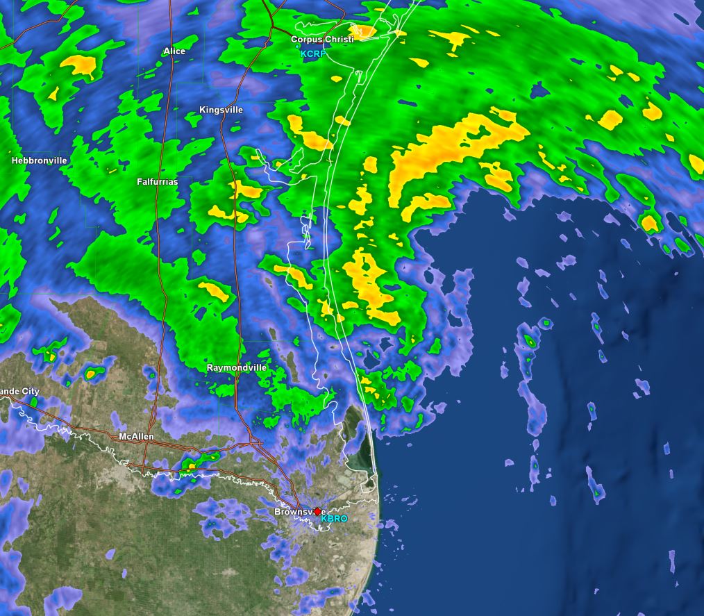
TD 9 headed toward south Texas
Satellite imagery shows a very large area of cloudiness over the western and central Gulf of Mexico. A low pressure are is starting to organize and some strengthening is likely during the next 12 hours.
The Weather Situation
SUMMARY OF 700 PM CDT...0000 UTC...INFORMATION
----------------------------------------------
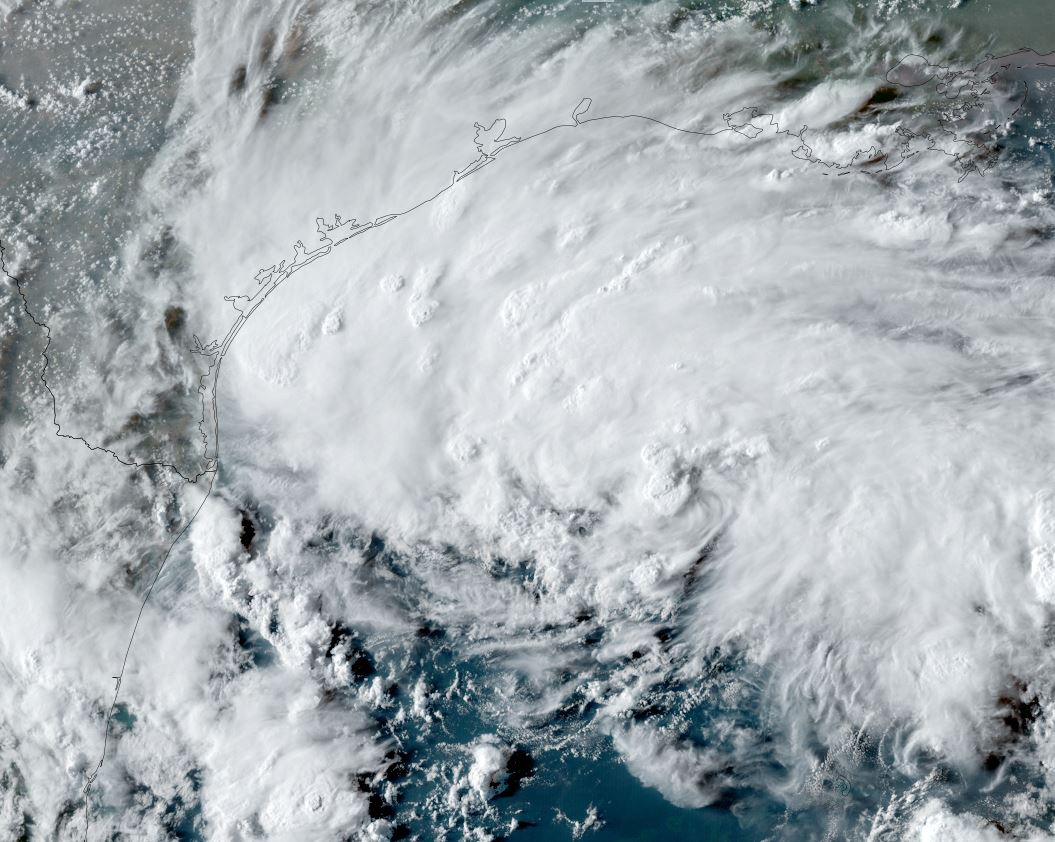
LOCATION...25.4N 92.4W
ABOUT 320 MI...515 KM ESE OF PORT MANSFIELD TEXAS
MAXIMUM SUSTAINED WINDS...35 MPH...55 KM/H
PRESENT MOVEMENT...W OR 275 DEGREES AT 18 MPH...30 KM/H
MINIMUM CENTRAL PRESSURE...1008 MB...29.77 INCHES
Tropicast: Visible satellite
Tropical Weather Forecast:
TD-9 is forecast to become a tropical storm before making landfall on the south Texas coast Tuesday.
Harold
- Tropical Inspector
- Site Admin
- Posts: 3630
- Joined: Tue Feb 20, 2007 2:28 pm
- Antispam: no
- Location: Under a palm tree
- Contact:
Harold
Rich Johnson
Twitter: https://twitter.com/richjohnsonwx
Certified Broadcast Meteorologist - Hurricane Expert
Twitter: https://twitter.com/richjohnsonwx
Certified Broadcast Meteorologist - Hurricane Expert
- Tropical Inspector
- Site Admin
- Posts: 3630
- Joined: Tue Feb 20, 2007 2:28 pm
- Antispam: no
- Location: Under a palm tree
- Contact:
Re: Harold
Tuesday Late Morning Update
Harold makes landfall
Harold is on the Texas coast and is spreading a large area of rainfall in its path.
The Weather Situation
SUMMARY OF 1000 AM CDT...1500 UTC...INFORMATION
-----------------------------------------------
LOCATION...27.1N 97.4W
ABOUT 35 MI...55 KM N OF PORT MANSFIELD TEXAS
ABOUT 50 MI...80 KM S OF CORPUS CHRISTI TEXAS
MAXIMUM SUSTAINED WINDS...50 MPH...85 KM/H
PRESENT MOVEMENT...WNW OR 285 DEGREES AT 21 MPH...33 KM/H
MINIMUM CENTRAL PRESSURE...998 MB...29.47 INCHES
Tropicast: Visible satellite
Tropicast: South Texas Radar
Tropical Weather Forecast:
Harold will weaken back to a depression across south Texas, but still produce heavy rainfall along its track.
Rich Johnson
Twitter: https://twitter.com/richjohnsonwx
Certified Broadcast Meteorologist - Hurricane Expert
Twitter: https://twitter.com/richjohnsonwx
Certified Broadcast Meteorologist - Hurricane Expert
Who is online
Users browsing this forum: No registered users and 0 guests