Thursday Afternoon Update
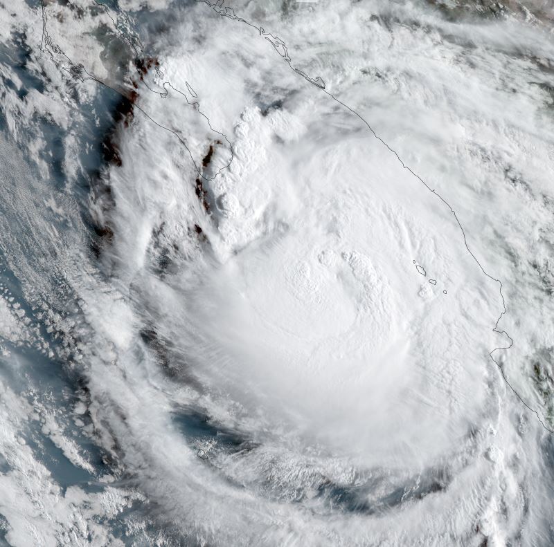
Olaf approaching Los Cabos
The Weather Situation
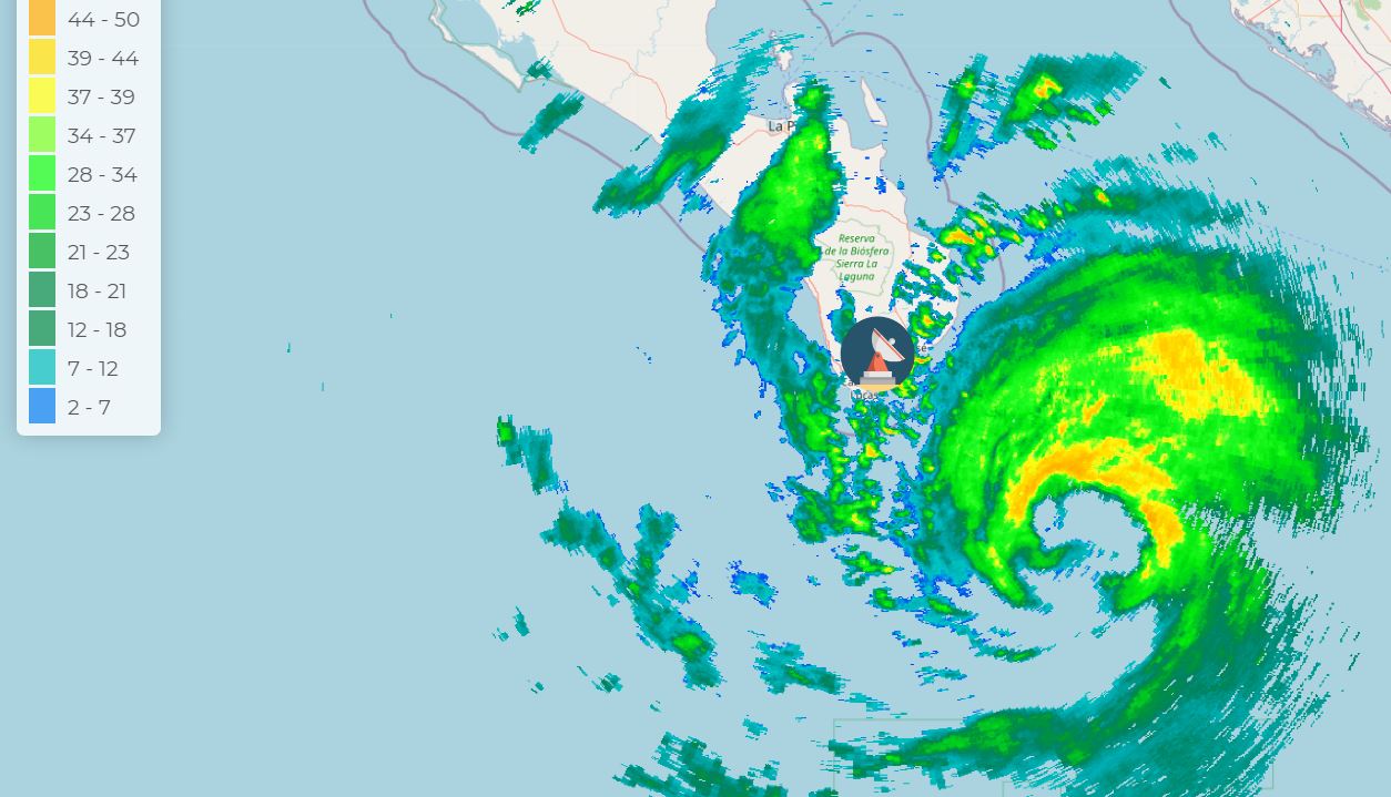
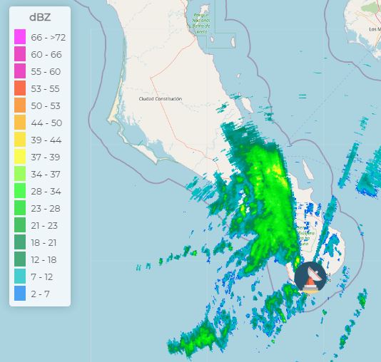
Olaf has strengthened some during the last several hours. Heavy rainfall, gusts to hurricane force winds and high surf can be expected later this afternoon through tonight over the extreme southern Baja.
Current tropical weather
SUMMARY OF 1200 PM MDT...1800 UTC...INFORMATION
-----------------------------------------------
LOCATION...21.8N 108.6W
ABOUT 115 MI...185 KM SE OF CABO SAN LUCAS MEXICO
MAXIMUM SUSTAINED WINDS...80 MPH...130 KM/H
PRESENT MOVEMENT...NNW OR 330 DEGREES AT 9 MPH...15 KM/H
MINIMUM CENTRAL PRESSURE...984 MB...29.06 INCHES
Tropical Weather Forecast:
Olaf will move very close to the southern tip of the Baja this evening before turning WNW and weakening over cooler water.
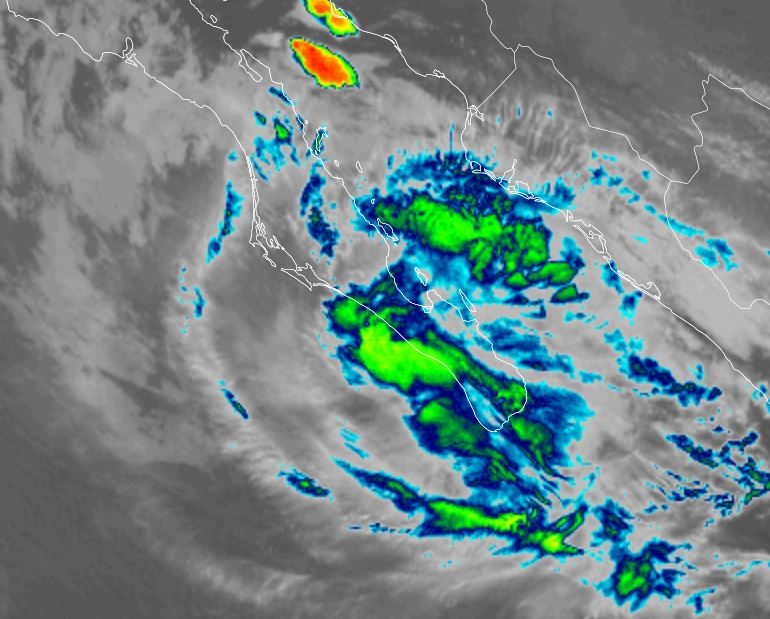
Tropicast: Visible Satellite Wednesday
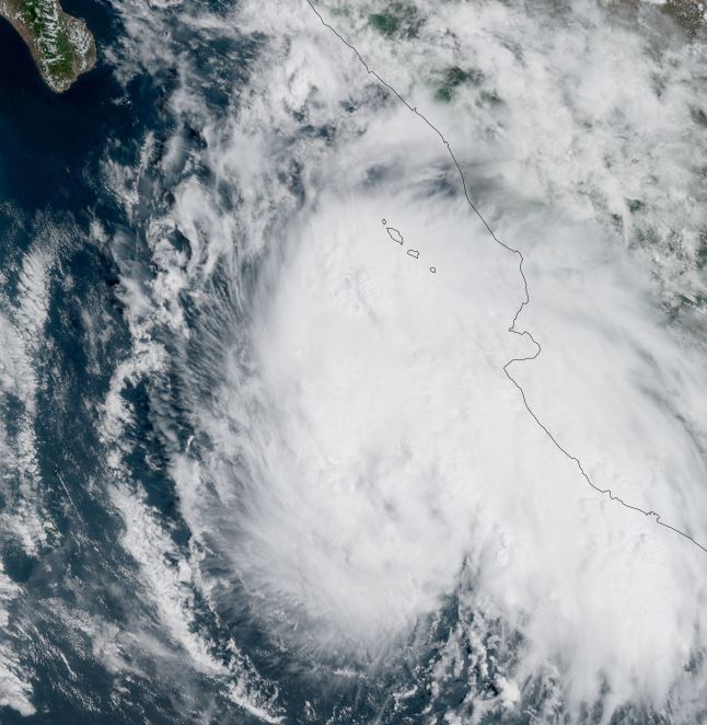
Tropicast: Visible Satellite Thursday
Tropicast: Los Cabos Radar 12:44 PM PDT (19:44Z)
Olaf
- Tropical Inspector
- Site Admin
- Posts: 3581
- Joined: Tue Feb 20, 2007 2:28 pm
- Antispam: no
- Location: Under a palm tree
- Contact:
Olaf
Rich Johnson
Twitter: https://twitter.com/richjohnsonwx
Certified Broadcast Meteorologist - Hurricane Expert
Twitter: https://twitter.com/richjohnsonwx
Certified Broadcast Meteorologist - Hurricane Expert
- Tropical Inspector
- Site Admin
- Posts: 3581
- Joined: Tue Feb 20, 2007 2:28 pm
- Antispam: no
- Location: Under a palm tree
- Contact:
Re: Olaf
Friday Morning Update
Olaf moving up the SW coast of the southern Baja
The Weather Situation
Olaf made landfall around 3Z (8 pm PDT) near San Jose del Cabo. Heavy rainfall and wind gusts to hurricane force can still be expected this morning over portions of the southern Baja. Satellite imagery now shows little deep convection and IMO Olaf is not a hurricane. My estimate is that maximum sustained surface winds are closer to 60 mph.
Current tropical weather
SUMMARY OF 600 AM MDT...1200 UTC...INFORMATION
----------------------------------------------
LOCATION...23.9N 110.8W
ABOUT 35 MI...55 KM WSW OF LA PAZ MEXICO
ABOUT 110 MI...180 KM ESE OF CABO SAN LAZARO MEXICO
MAXIMUM SUSTAINED WINDS...80 MPH...130 KM/H
PRESENT MOVEMENT...NW OR 310 DEGREES AT 10 MPH...17 KM/H
MINIMUM CENTRAL PRESSURE...984 MB...29.06 INCHES
Tropical Weather Forecast:
Olaf will turn NW during the next 24 hours weakening over cooler water.
Tropicast: IR Satellite
Tropicast: Los Cabos Radar 6:40 AM PDT (13:40Z)
Rich Johnson
Twitter: https://twitter.com/richjohnsonwx
Certified Broadcast Meteorologist - Hurricane Expert
Twitter: https://twitter.com/richjohnsonwx
Certified Broadcast Meteorologist - Hurricane Expert
Who is online
Users browsing this forum: No registered users and 5 guests