Sunday Evening Update
Ida over land
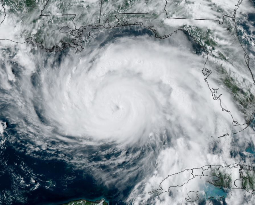
The Weather Situation
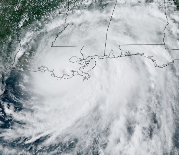
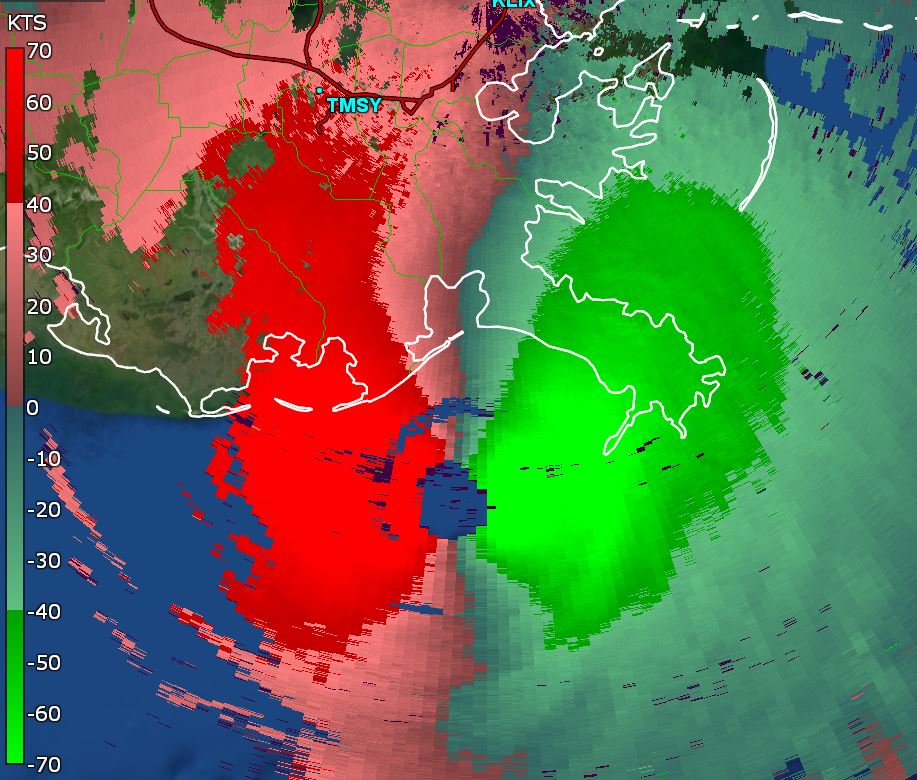
Hurricane Ida is now inland. IMO, Ida was a 135 mph hurricane at landfall, not at 150 mph. My reasoning is that the strongest flight level winds before landfall were about 155 mph measured at 700 mb. With the correction factor this would be closer to 140 mph. The sfmr estimated slightly higher. Over land, the strongest winds aloft never mix to the surface. So IMO Ida may have been 140 - 145 mph over water and a little weaker than that at landfall.
Current Tropical Weather
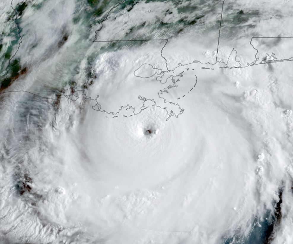
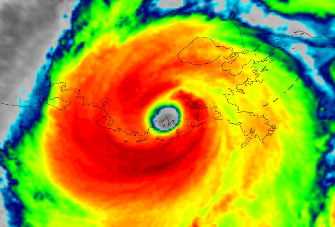
SUMMARY OF 400 PM CDT...2100 UTC...INFORMATION
----------------------------------------------
LOCATION...29.5N 90.6W
ABOUT 45 MI...75 KM SW OF NEW ORLEANS LOUISIANA
ABOUT 70 MI...115 KM SSE OF BATON ROUGE LOUISIANA
MAXIMUM SUSTAINED WINDS...130 MPH...215 KM/H
PRESENT MOVEMENT...NW OR 325 DEGREES AT 10 MPH...17 KM/H
MINIMUM CENTRAL PRESSURE...938 MB...27.70 INCHES
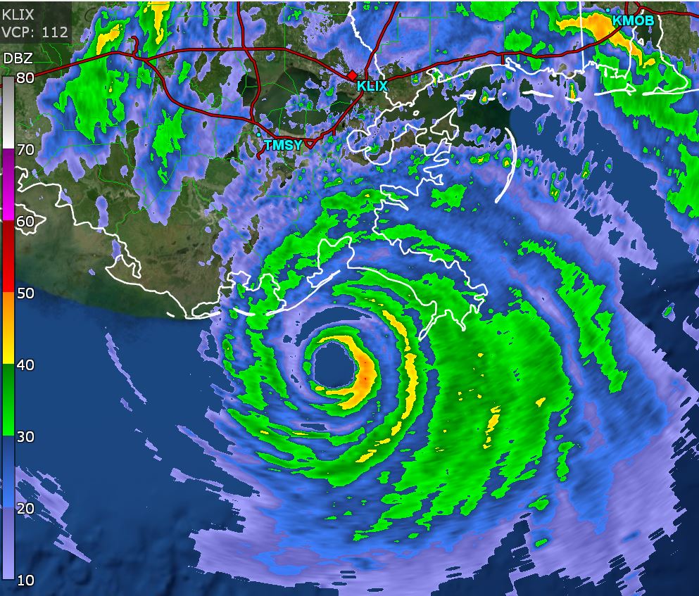
A Weatherflow station near Dulac just reported sustained winds of 93 mph (150 km/h) and a gust to 135 mph (217 km/h). A
Florida Coastal Monitoring Program observing station at the South Lafourche airport recently reported a sustained wind of 91 mph (146
km/h) and wind gust of 122 mph (196 km/h). A sustained wind of 51 mph (81 km/h) and a gust to 82 mph (131 km/h) was recently reported
at Lakefront Airport in New Orleans
Tropical Weather Forecast:
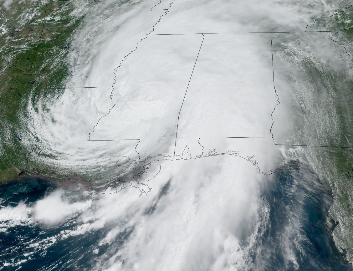
The track will take Ida into northcentral Louisiana and into Mississippi during the next 12-24 hours.
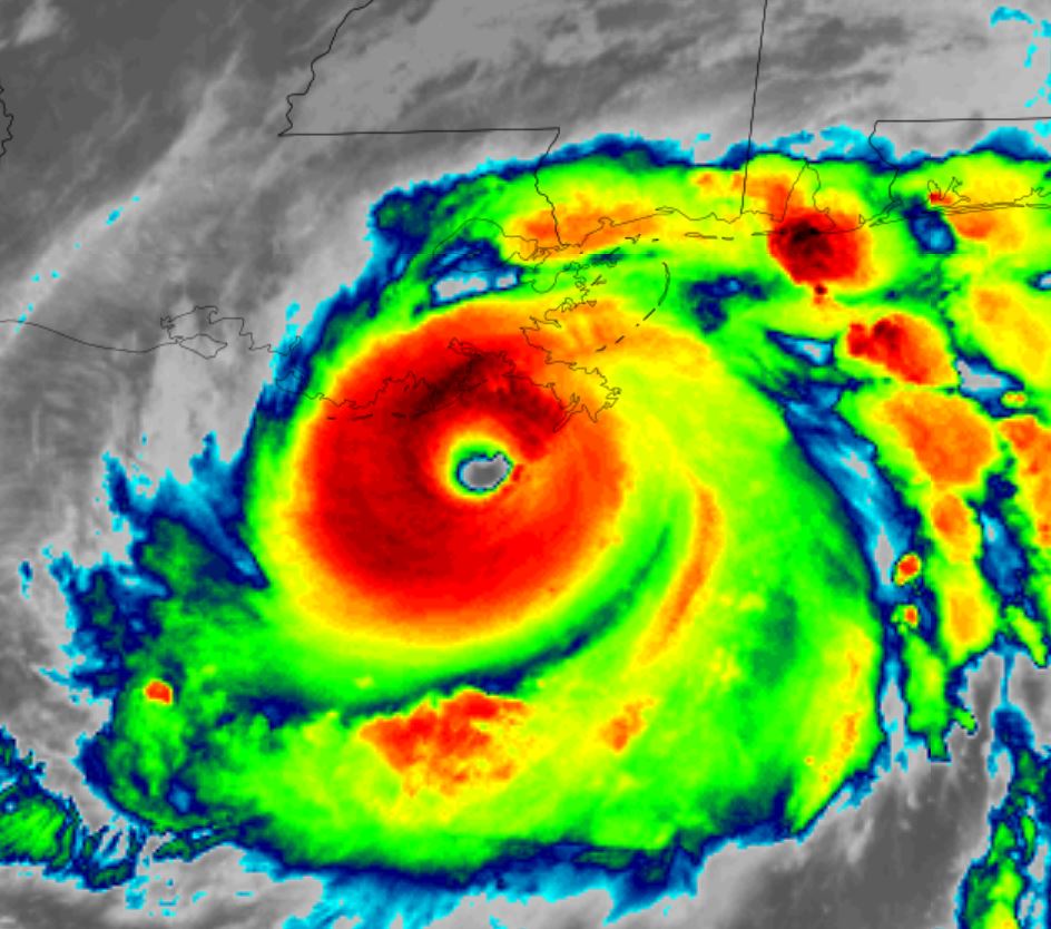
Tropicast: Visible Satellite