Page 1 of 1
Gamma
Posted: Fri Oct 02, 2020 11:34 am
by Tropical Inspector
Friday Afternoon Update
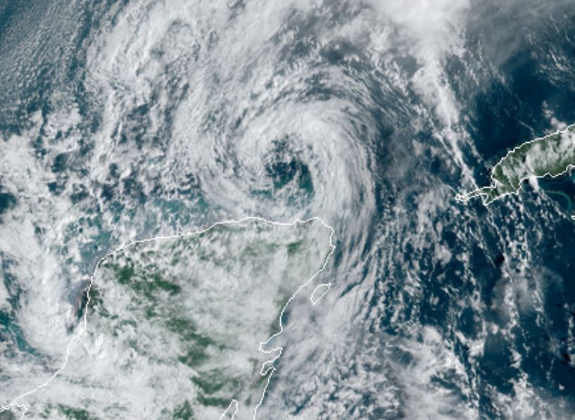
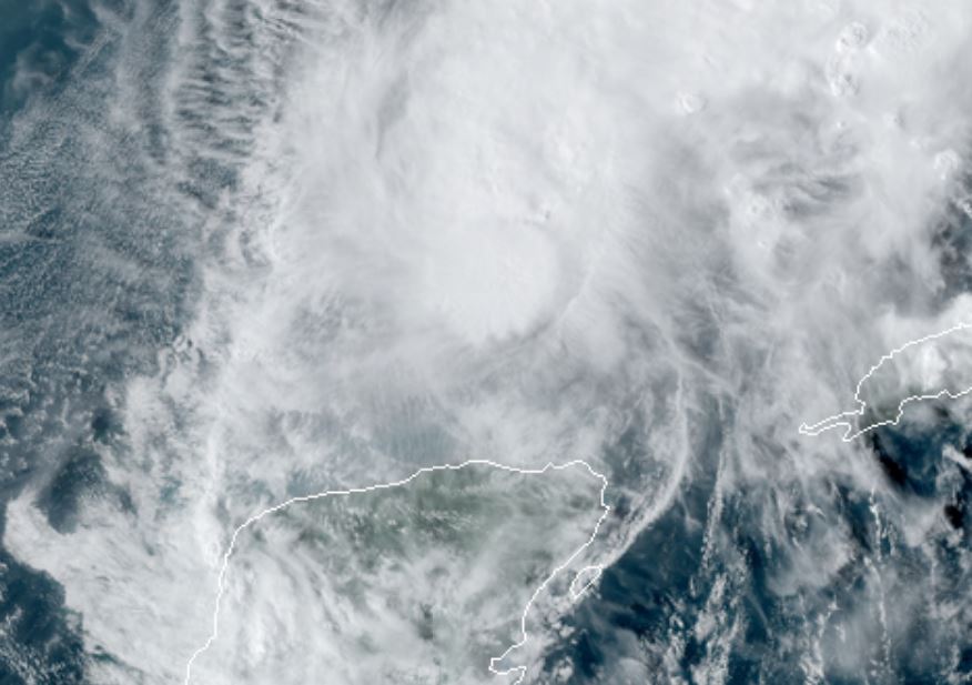
TD 25 classified at 11am edt
The Weather Situation
Disturbed weather in the western Caribbean has organized today. Banding has improved and a low level center is apparent.
For more frequent updates: Twitter:
https://twitter.com/richjohnsonwx
Current tropical weather
As of 11:00 AM EDT TD 25 was centered at 18.1 N / 84.7 W or about 220 miles southeast of Cozumel, Mexico. It was moving northwest at 9 mph. Officially top sustained winds are estimated at 35 mph. Pressure was estimated at 1005 hPa (mb).
Tropical Weather Forecast:
TD 25 is forecast to become a tropical storm and move over the Yucatan peninsula Saturday. It will likely weaken some then reintensify back over the Gulf before it is steered west.
Tropicast: Visible Satellite
Re: Gamma
Posted: Sat Oct 03, 2020 8:58 pm
by Tropical Inspector
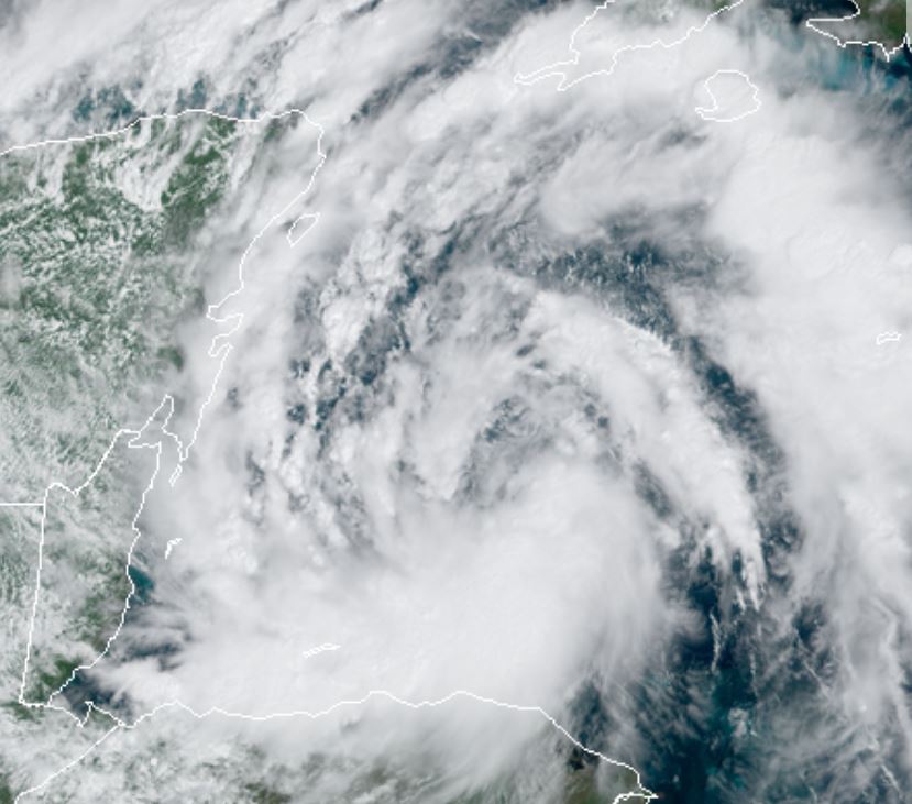
Saturday Night Update
Gamma moving into Gulf of Mexico
The Weather Situation
Over the past 24 hours, Gamma was classified and made landfall on the southeast side of the Yucatan peninsula. It has moved north and is close to the northern coast this evening. Deep convection is concentrated near the circulation center as well as some banding well to the east.
For more frequent updates: Twitter:
https://twitter.com/richjohnsonwx
Current tropical weather
As of 7:00 PM CDT Gamma was centered at 21.0 N / 87.9 W or about 60 miles NNW of Tulum, Mexico. It was moving northwest at 8 mph. Officially top sustained winds are estimated at 60 mph. Pressure was estimated at 990 hPa (mb).
Tropical Weather Forecast:
Gamma is expected to drift west or WSW over the next several days into the Bay of Campeche.
Tropicast: Visible Satellite Saturday Afternoon
 Tropicast: IR Satellite 9:45 PM EDT
Re: Gamma
Posted: Sun Oct 04, 2020 4:35 pm
by Tropical Inspector
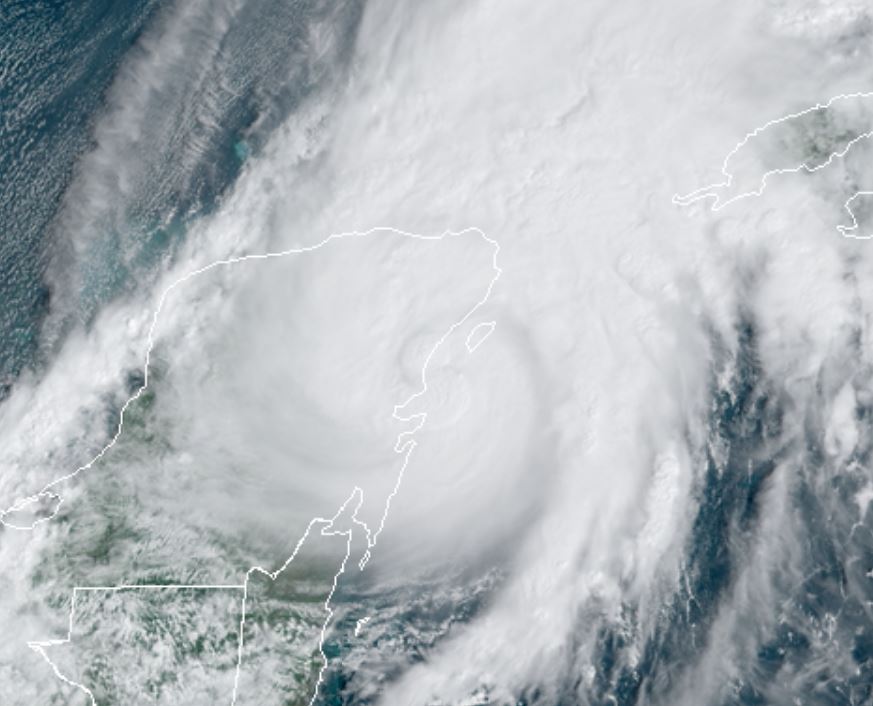
Sunday Evening Update
Gamma sheared
The Weather Situation
Gamma is north of the Yucatan Peninsula of Mexico. Deep convection is on the northwest side of the circulation as the system is quite sheared from southerly winds.
For more frequent updates: Twitter:
https://twitter.com/richjohnsonwx
Current tropical weather
As of 4:00 PM CDT Gamma was centered at 22.4 N / 87.8 W or about 130 miles NE of Progreso, Mexico. It was stationary. Officially top sustained winds are estimated at 60 mph. Pressure was estimated at 997 hPa (mb).
Tropical Weather Forecast:
Gamma is expected to drift west or WSW over the next several days into the Bay of Campeche. It is likely to interact with Potential Tropical Cyclone 26, so the track is more uncertain than average.
Tropicast: Visible Satellite
Re: Gamma
Posted: Mon Oct 05, 2020 9:59 am
by Tropical Inspector
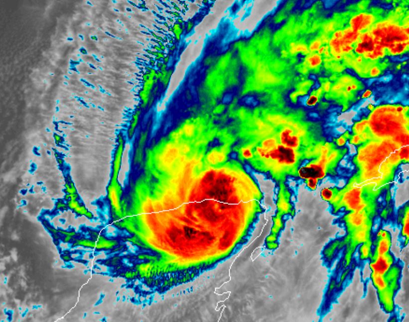
Monday Midday Update
Gamma weakens
The Weather Situation
Gamma remains sheared and has lost most of its convection near the low center. It has a large center of circulation with clear skies at the very center. Deep convection is displaced well to the NE of the low.
For more frequent updates: Twitter:
https://twitter.com/richjohnsonwx
Current tropical weather
As of 10:00 AM CDT Gamma was centered at 22.3 N / 87.6 W or about 160 miles ENE of Progreso, Mexico. It was drifting SSW at 2 mph. Officially top sustained winds are estimated at 45 mph. Pressure was estimated at 1003 hPa (mb).
Tropical Weather Forecast:
Gamma is expected to drift SSW into the Yucatan tomorrow. It will weaken to a tropical depression. It is likely to meander near the NW coast of the Yucatan peninsula for several days.
Tropicast: Visible Satellite