Page 1 of 2
Paulette
Posted: Sun Sep 06, 2020 9:27 pm
by Tropical Inspector
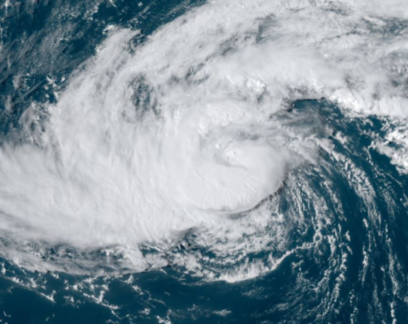
Sunday Night Update
TD 17 forms
The Weather Situation
Updates on TD 17 will be started by NHC at 11 pm AST tonight.
For more frequent updates: Twitter:
https://twitter.com/richjohnsonwx
Tropical Weather Forecast:
Forecast models take TD 17 north of the Leewards then possibly near Bermuda next week.
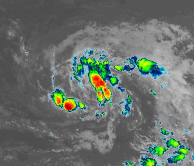
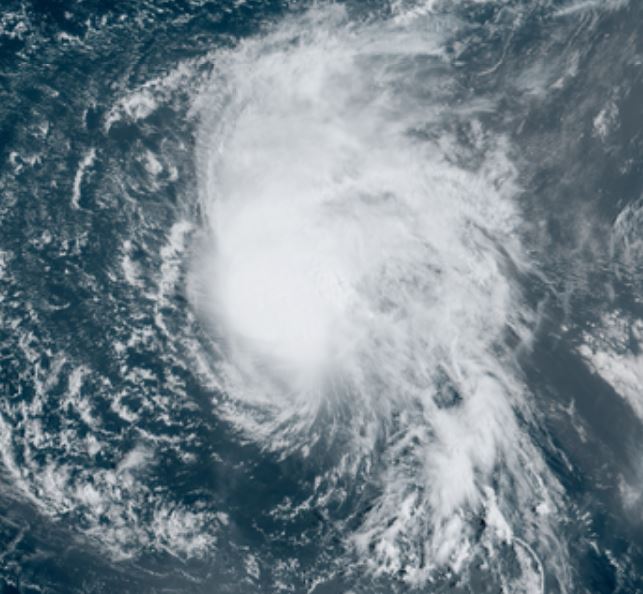
Tropicast: IR Satellite
Re: Paulette
Posted: Mon Sep 07, 2020 1:17 pm
by Tropical Inspector
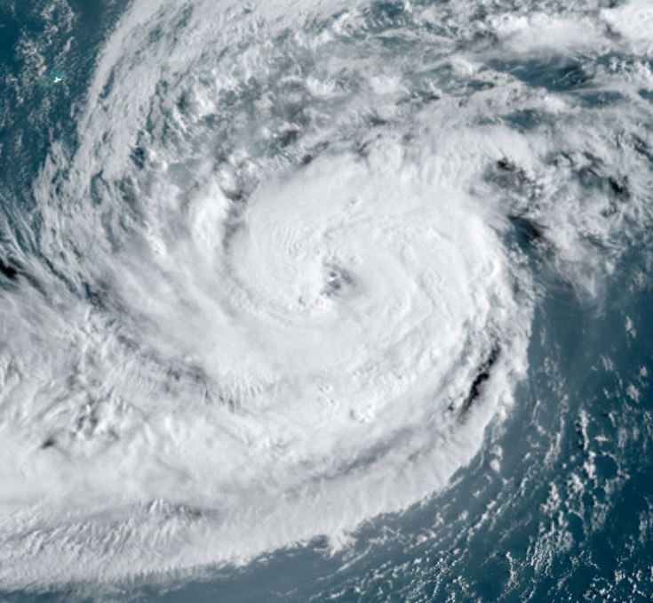
Monday Afternoon Update
Paulette in middle of Atlantic
The Weather Situation
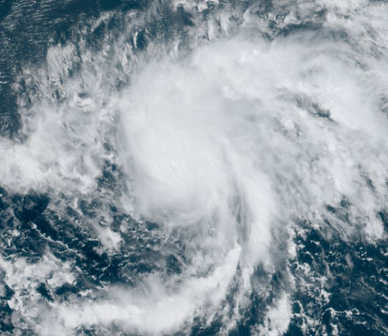
Paulette is showing some banding and deep convection near the center of circulation. It is likely that Paulette will be upgraded in strength during the next advisory.
For more frequent updates: Twitter:
https://twitter.com/richjohnsonwx
Current tropical weather
As of 11:00 AM AST Tropical Storm Paulette was centered at 17.2 N / 42.2 W or about 1375 miles east of the northern Leeward Islands. It was moving WNW 3 mph. Officially top sustained winds are estimated at 40 mph. Pressure was estimated at 1005 hPa (mb).
Tropical Weather Forecast:
Paulette will continue on its path WNW over the next several days staying well north of Leewards. Southwesterly winds will likely keep Paulette under hurricane strength. It is too early to tell if it will impact Bermuda over a week from today.
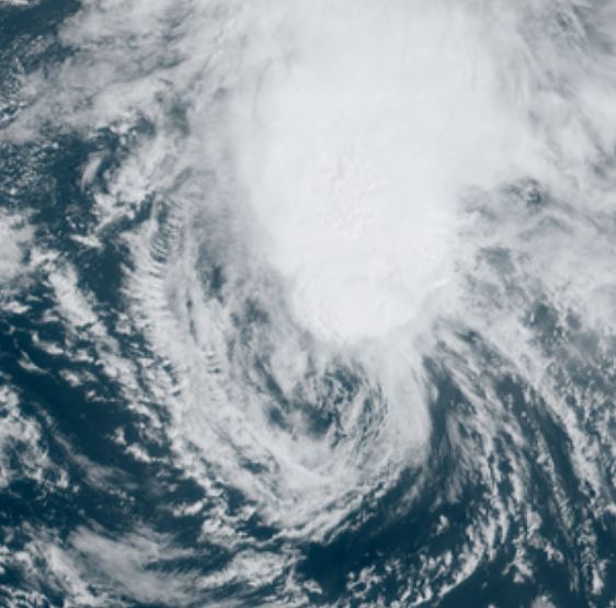
Tropicast: Visible Satellite
Re: Paulette
Posted: Tue Sep 08, 2020 11:14 am
by Tropical Inspector
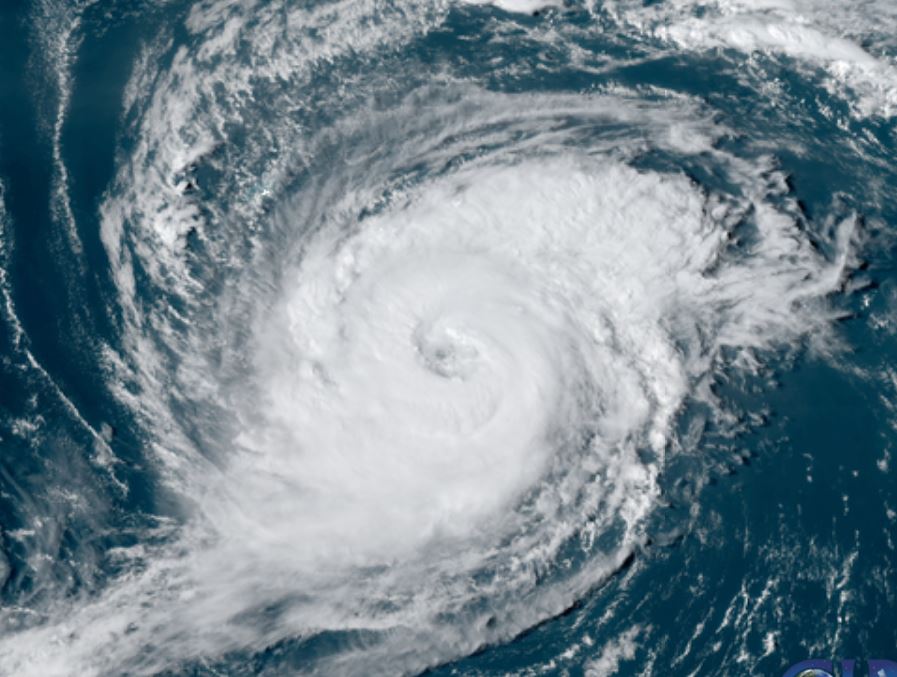
Tuesday Afternoon Update
Paulette in middle of Atlantic still
The Weather Situation
Paulette is showing some banding and deep convection near the center of circulation. It is likely that Paulette will be upgraded in strength during the next advisory.
For more frequent updates: Twitter:
https://twitter.com/richjohnsonwx
Current tropical weather
As of 11:00 AM AST Tropical Storm Paulette was centered at 18.4 N / 43.3 W or about 1295 miles east of the northern Leeward Islands. It was moving NW 6 mph. Officially top sustained winds are estimated at 65 mph. Pressure was estimated at 995 hPa (mb).
Tropical Weather Forecast:
Paulette will continue on its path WNW over the next several days staying well north of Leewards. Southwesterly winds will likely keep Paulette under hurricane strength. It is too early to tell if it will impact Bermuda over a week from today.
Tropicast: Visible Satellite
Re: Paulette
Posted: Wed Sep 09, 2020 12:08 pm
by Tropical Inspector
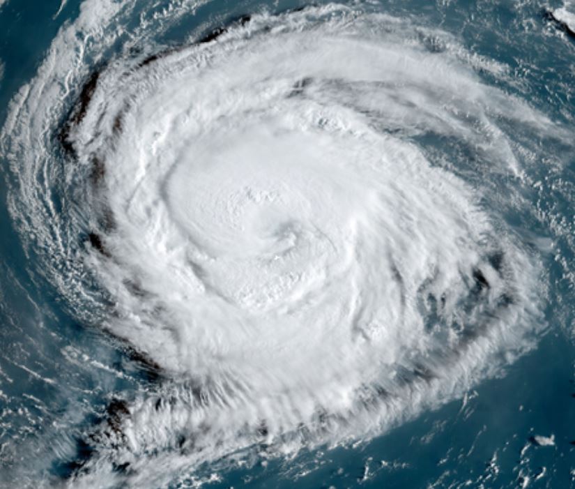
Wedesday Afternoon Update
Paulette changes little
The Weather Situation
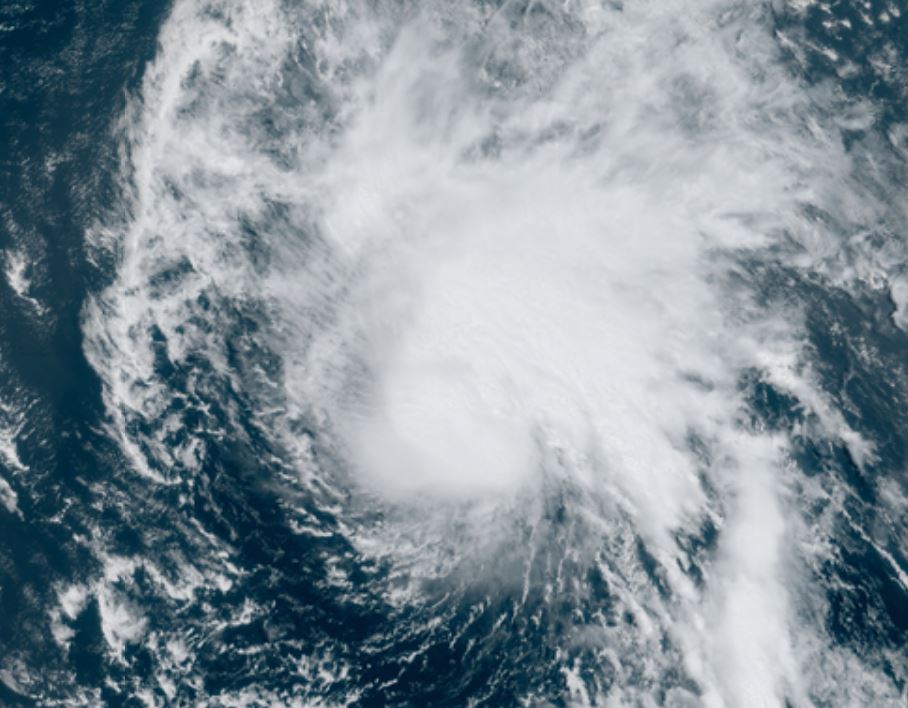
Paulette is fighting some wind shear which is keeping its strength at status quo.
For more frequent updates: Twitter:
https://twitter.com/richjohnsonwx
Current tropical weather
As of 11:00 AM AST Tropical Storm Paulette was centered at 20.0 N / 46.5 W or about 1090 miles east of the northern Leeward Islands. It was moving WNW 9 mph. Officially top sustained winds are estimated at 60 mph. Pressure was estimated at 996 hPa (mb).
Tropical Weather Forecast:
Paulette will continue on its path WNW over the next several days staying well north of Leewards. Southwesterly winds will likely keep Paulette under hurricane strength. It is too early to tell if it will impact Bermuda. It may be in the vicinity by late Monday / Tuesday.
Tropicast: Visible Satellite
Re: Paulette
Posted: Thu Sep 10, 2020 8:52 am
by Tropical Inspector
Thursday Morning Update
Paulette sheared
The Weather Situation
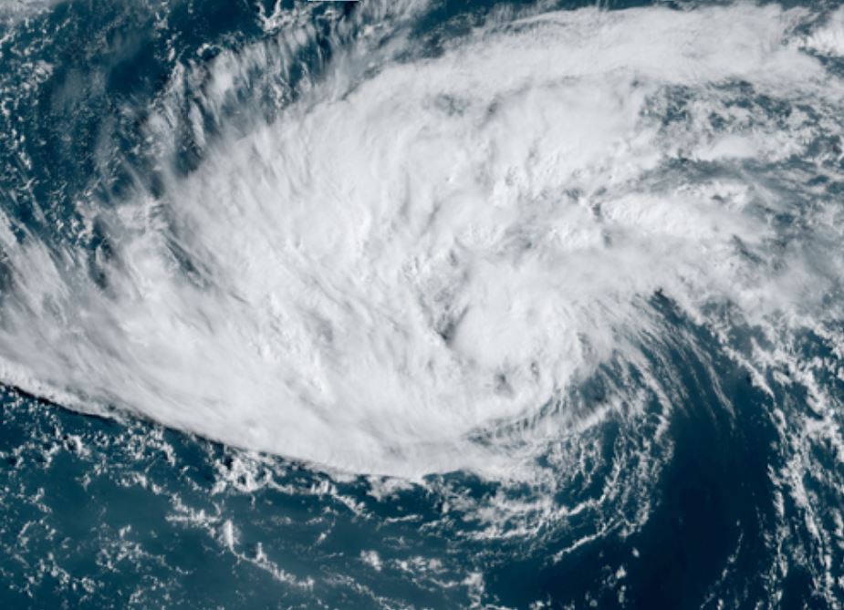
Paulette is being sheared badly by strong SSW winds. This shear is expected to decrease in the next 24-36 hours so restrengthening is likely.
For more frequent updates: Twitter:
https://twitter.com/richjohnsonwx
Current tropical weather
As of 5:00 AM AST Tropical Storm Paulette was centered at 20.9 N / 49.0 W or about 1250 miles SE of Bermuda. It was moving WNW 10 mph. Officially top sustained winds are estimated at 60 mph. Pressure was estimated at 996 hPa (mb).
Tropical Weather Forecast:
Paulette will continue on its path WNW over the next several days staying well north of Leewards. After weakening, Paulette is now expected to strengthen into a cat 1 hurricane as wind shear relaxes. It may be in the vicinity of Bermudaby late Monday / Tuesday.
Tropicast: Visible Satellite
Re: Paulette
Posted: Thu Sep 10, 2020 9:51 am
by Tropical Inspector
As expected NHC decreased strength to 50 mph on the 11 am ast advisory.
Re: Paulette
Posted: Fri Sep 11, 2020 4:27 pm
by Tropical Inspector
Friday Evening Update
Paulette expected to become a hurricane soon
The Weather Situation
Paulette is increasing in strength. Satellite imagery still show some southerly shear, but this is expected to weaken.
For more frequent updates: Twitter:
https://twitter.com/richjohnsonwx
Current tropical weather
As of 5:00 PM AST Tropical Storm Paulette was centered at 24.6 N / 53.7 W or about 855 miles SE of Bermuda. It was moving NW 13 mph. Officially top sustained winds are estimated at 65 mph. Pressure was estimated at 989 hPa (mb).
Tropical Weather Forecast:
Forecast models make Paulette at least a cat 2 hurricane as it approaches Bermuda on Monday. It is expected to turn more north, then northeast after passing Bermuda.
Tropicast: Visible Satellite
Re: Paulette
Posted: Sat Sep 12, 2020 8:08 am
by Tropical Inspector
Saturday Morning Update
Paulette seeing increasing shear
The Weather Situation
IMO Tropical Storm Paulette is not at 70 mph. Satellite imagery shows some, but not impressive convection near the center of Paulette. Southeast shear also seems to be increasing some. I would go with 60 mph.
For more frequent updates: Twitter:
https://twitter.com/richjohnsonwx
Current tropical weather
As of 8:00 AM AST Tropical Storm Paulette was centered at 27.2 N / 56.8 W or about 855 miles SE of Bermuda. It was moving NW 16 mph. Officially top sustained winds are estimated at 70 mph. Pressure was estimated at 987 hPa (mb).
Tropical Weather Forecast:
Forecast models take Paulette very close to Bermuda by early Monday morning. It should rapidly hook northeast afterwards into the open northern North Atlantic Ocean.
Tropicast: Visible Satellite
Re: Paulette
Posted: Sat Sep 12, 2020 2:57 pm
by Tropical Inspector
Saturday Afternoon Update
Paulette convection now increasing
The Weather Situation
Over the past six hours, deep convection has been expanding after being a at lull. Paulette is still battling SE shear, but the convection is winning the battle and I suspect that NHC will upgrade Paulette to hurricane strength at 5 pm.
For more frequent updates: Twitter:
https://twitter.com/richjohnsonwx
Current tropical weather
As of 2:00 PM AST Tropical Storm Paulette was centered at 28.0 N / 57.8 W or about 510 miles SE of Bermuda. It was moving NW 15 mph. Officially top sustained winds are estimated at 70 mph. Pressure was estimated at 987 hPa (mb).
Tropical Weather Forecast:
Forecast models take Paulette very close to Bermuda by early Monday morning. It should rapidly hook northeast afterwards into the open northern North Atlantic Ocean.
Tropicast: Visible Satellite
Re: Paulette
Posted: Sat Sep 12, 2020 3:51 pm
by Tropical Inspector
NHC keeps Paulette at 70 mph for the 5 pm EDT advisory.... waiting for the recon until making the commitment.
Re: Paulette
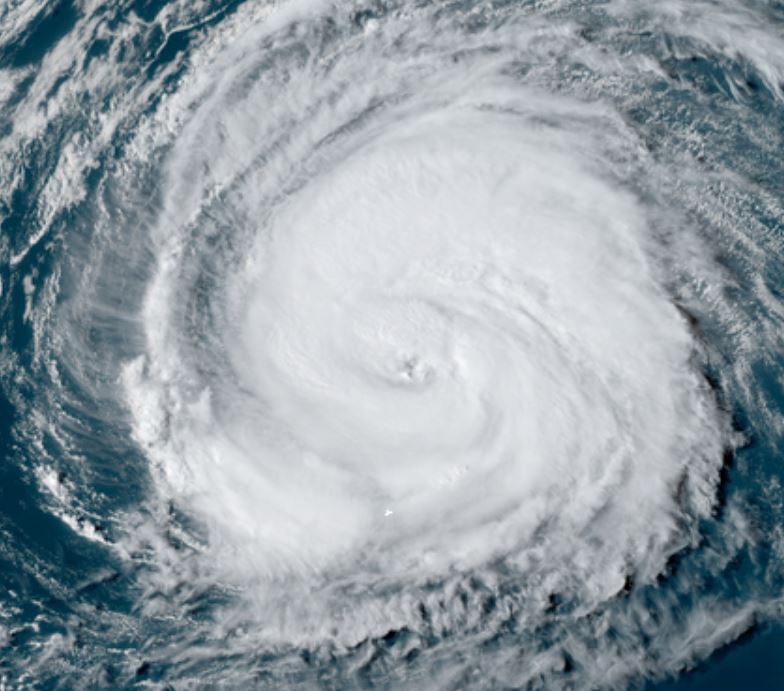
Posted: Sun Sep 13, 2020 8:40 am
by Tropical Inspector
Sunday Morning Update
Paulette strengthens
The Weather Situation
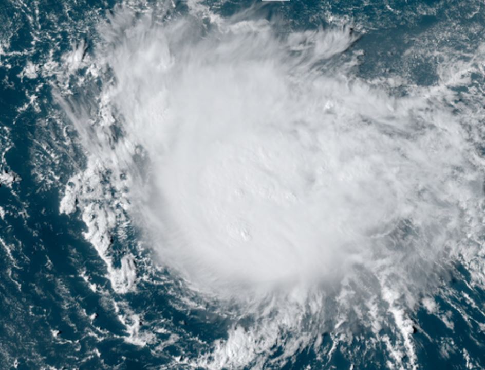
Paulette is slowly strengthening and is a cat 1 hurricane. It looks much more impressive on satellite imagery than its actual strength at this time though. The reason is that deep convection is not a strong as in very strong hurricanes. Hurricane Hunters have verified this with the wind strength. On the satellite imagery below, Bermuda is the white dot in the far top left part of the image.

See the official NHC advisory for surge and rainfall totals expected.
For more frequent updates: Twitter:
https://twitter.com/richjohnsonwx
Current tropical weather
As of 8:00 AM AST Hurricane Paulette was centered at 29.6 N / 61.4 W or about 280 miles SE of Bermuda. It was moving WNW 14 mph. Officially top sustained winds are estimated at 80 mph. Pressure was estimated at 978 hPa (mb).
Tropical Weather Forecast:
Forecast models take Paulette very close to Bermuda by later tonight into Monday morning. It should rapidly hook northeast afterwards into the open northern North Atlantic Ocean after passing Bermuda.
Tropicast: Visible Satellite
Re: Paulette
Posted: Sun Sep 13, 2020 9:53 am
by Tropical Inspector
Paulette still at 80 mph at 11 am AST.
Re: Paulette
Posted: Sun Sep 13, 2020 4:41 pm
by Tropical Inspector
Sunday Evening Update
Paulette nearing Bermuda
The Weather Situation
Paulette continues to slowly strengthen as it approaches Bermuda. It may strengthen to a cat 2 as it passes tonight. Winds, heavy rainfall and surge will steadily increase later this evening.
See the official NHC advisory for surge and rainfall totals expected.
For more frequent updates: Twitter:
https://twitter.com/richjohnsonwx
Current tropical weather
As of 5:00 PM AST Hurricane Paulette was centered at 30.6 N / 63.1 W or about 155 miles SE of Bermuda. It was moving NW 14 mph. Officially top sustained winds are estimated at 85 mph. Pressure was estimated at 974 hPa (mb).
Tropical Weather Forecast:
Forecast models take Paulette very close to Bermuda by later tonight into Monday morning. It should rapidly hook northeast afterwards into the open northern North Atlantic Ocean after passing Bermuda.
Tropicast: Visible Satellite
Re: Paulette
Posted: Mon Sep 14, 2020 7:18 am
by Tropical Inspector
Monday Morning Update
Paulette passing Bermuda
The Weather Situation
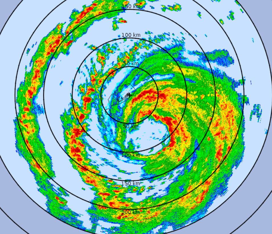
Paulette has passed Bermuda. Conditions should rapidly improve. The radar below is from after midnight. Apparently the radar stopped functioning after that or it was shut down.
For more frequent updates: Twitter:
https://twitter.com/richjohnsonwx
Current tropical weather
As of 8:00 AM AST Hurricane Paulette was centered at 32.9 N / 64.7 W or about 40 miles north of Bermuda. It was moving NNW 12 mph. Officially top sustained winds are estimated at 95 mph. Pressure was estimated at 970 hPa (mb).
Tropical Weather Forecast:
Forecast models take Paulette rapidly northeast into the open north Atlantic.
Tropicast: Visible Satellite
 Tropicast: Radar (1 am)
Re: Paulette
Posted: Mon Sep 14, 2020 3:48 pm
by Tropical Inspector
Monday Evening Update
Paulette stronger
The Weather Situation
Paulette still has strengthened today after passing Bermuda.
For more frequent updates: Twitter:
https://twitter.com/richjohnsonwx
Current tropical weather
As of 5:00 PM AST Hurricane Paulette was centered at 34.5 N / 63.8 W or about 160 miles NNE of Bermuda. It was moving NNE 15 mph. Officially top sustained winds are estimated at 105 mph. Pressure was estimated at 965 hPa (mb).
Tropical Weather Forecast:
Forecast models take Paulette rapidly northeast into the open north Atlantic.
Tropicast: Visible Satellite