Page 1 of 2
Jose
Posted: Tue Sep 05, 2017 5:10 pm
by Tropical Inspector
Tuesday Evening UpdateJose next in lineThe Weather SituationJose is now a tropical storm. It is still in the far eastern tropical Atlantic.
Current Tropical WeatherAs of 5:00 PM AST Jose was centered at 12.5 N / 40.6 W or 1400 miles east of the Lesser Antilles. It was moving west at 12 mph. Top sustained winds are estimated at 45 mph. Pressure was estimated at 1006 MB.
Tropical Weather Forecast:Jose is expected become a hurricane as it follows in the pathway of Irma. It will also approach the Leewards by Saturday but is expected to be pulled northward by a trough. Residents of the Leewards should continue to follow the progress of Jose after Irma passes.
Tropicast: IR Satellite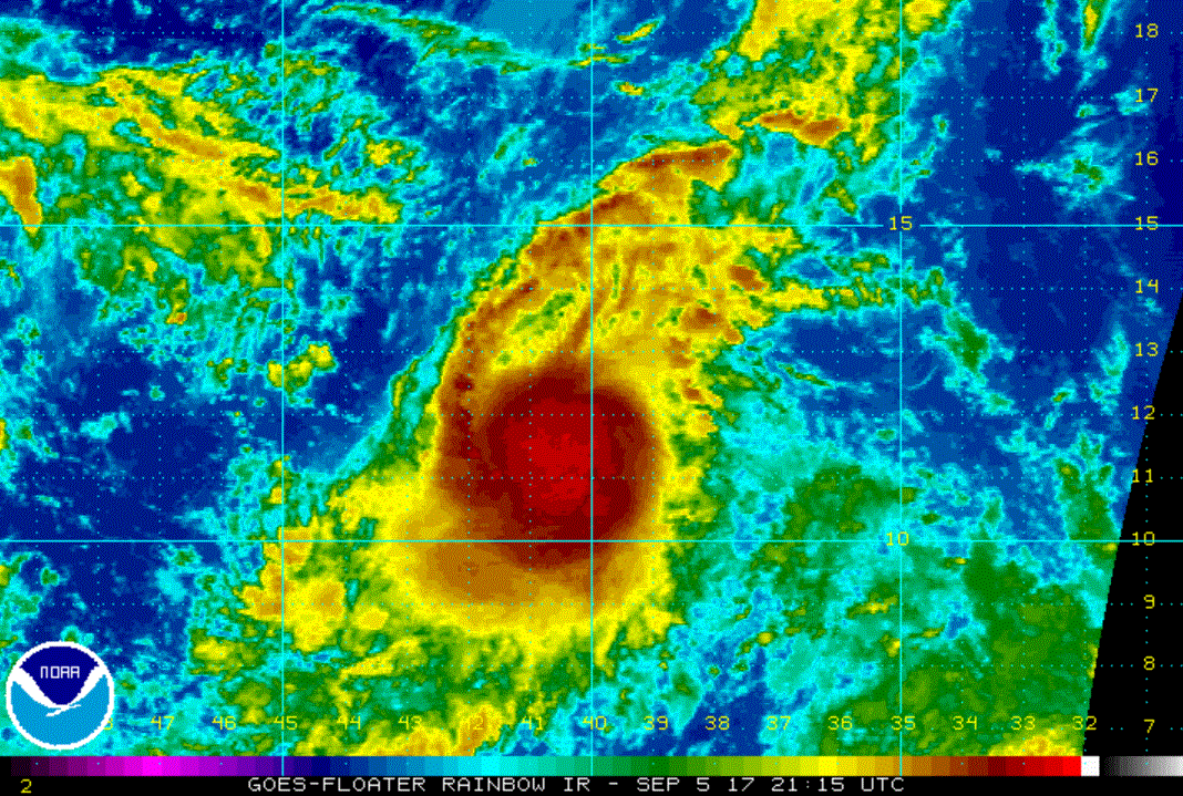
Re: Jose
Posted: Wed Sep 06, 2017 5:05 am
by Tropical Inspector
Wednesday Morning UpdateJose strengtheningThe Weather SituationSatellite imagery shows that deep convection continues to build and outflow aloft is improving. Because of the increased organization, Jose should become a hurricane later today.
Current Tropical WeatherAs of 5:00 AM AST Jose was centered at 12.5 N / 42.8 W or 1255 miles east of the Lesser Antilles. It was moving west at 13 mph. Top sustained winds are estimated at 60 mph. Pressure was estimated at 1002 MB.
Tropical Weather Forecast:Jose is expected become a hurricane as it follows in the pathway of Irma. It will also approach the Leewards by late Saturday, but is expected to be pulled northward by a trough. Residents of the Leewards should continue to follow the progress of Jose after Irma passes.
Tropicast: IR Satellite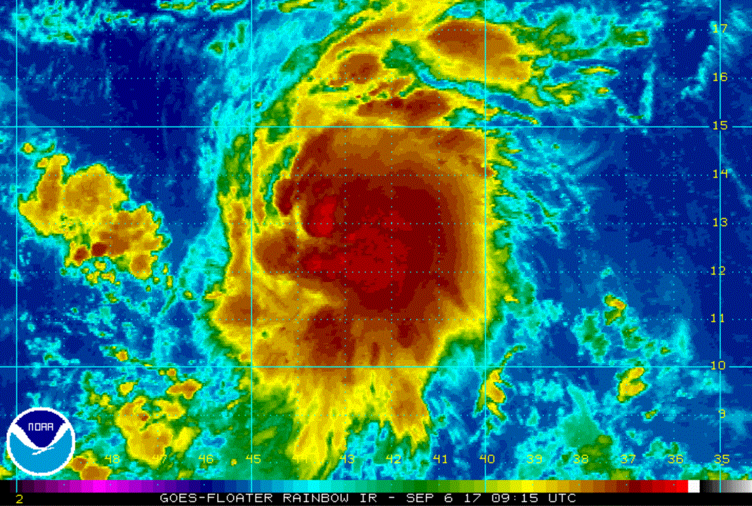
Re: Jose
Posted: Wed Sep 06, 2017 8:46 pm
by Tropical Inspector
Wednesday Night UpdateJose a minimal hurricaneThe Weather SituationJose became a hurricane earlier today. Banding is noted and outflow aloft looks favorable for strengthening, especially on the east side of the circulation.
Current Tropical WeatherAs of 5:00 PM AST Jose was centered at 13.9 N / 45.8 W or 1040 miles east of the Lesser Antilles. It was moving WNW at 16 mph. Top sustained winds are estimated at 75 mph. Pressure was estimated at 994 MB.
Tropical Weather Forecast:Jose may become a major hurricane as it follows in the pathway of Irma. It will also approach the Leewards by late Saturday, but is expected to be pulled northward by a trough. Residents of the Leewards should continue to follow the progress of Jose after Irma passes.
Tropicast: IR Satellite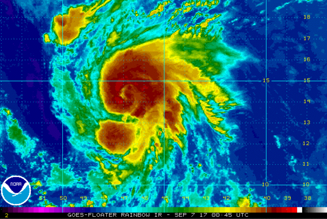
Re: Jose
Posted: Thu Sep 07, 2017 3:50 pm
by Tropical Inspector
Thursday Evening UpdateJose now a cat 3The Weather SituationJose has strengthened steadily today. There is some dry air to the west which may affect the intensity.
Current Tropical WeatherAs of 5:00 PM AST Jose was centered at 15.5 N / 52.4 W or 590 miles east of the Lesser Antilles. It was moving WNW at 18 mph. Top sustained winds are estimated at 120 mph. Pressure was estimated at 966 MB.
Tropical Weather Forecast:Jose is following in the pathway of Irma. It will also approach the Leewards by Saturday. Models are a little slower
which may allow Jose to hit the Leewards.

Residents of the Leewards should continue to follow the progress of Jose.
Tropicast: Visible Satellite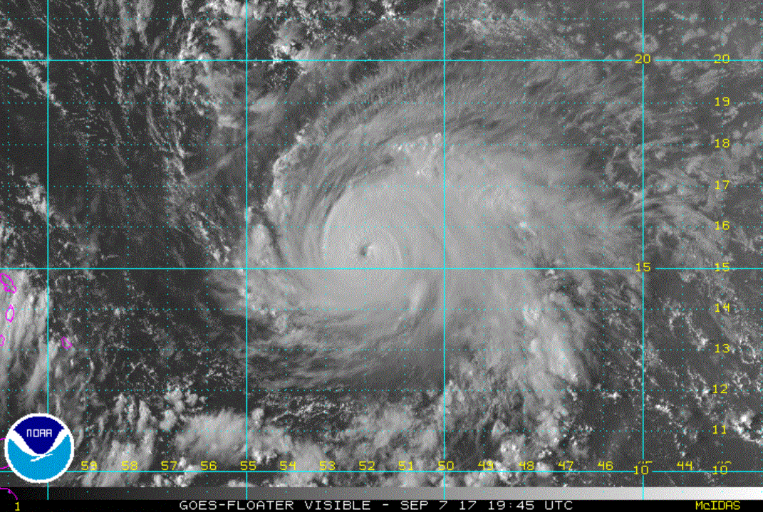 Tropicast: IR Satellite
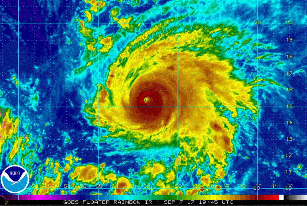 Tropicast: Water Vapor Satellite
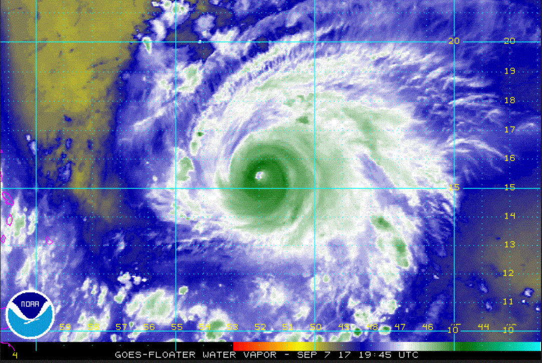
Re: Jose
Posted: Fri Sep 08, 2017 8:33 am
by Tropical Inspector
Friday Morning UpdateJose approaching LeewardsThe Weather SituationJose has continued to strengthen some. It has a symmetrical eye wall, but remains a smaller hurricane than Irma.
Current Tropical WeatherAs of 8:00 AM AST Jose was centered at 16.1 N / 56.2 W or 480 miles ESE of the northern leeward Islands. It was moving WNW at 16 mph. Top sustained winds are estimated at 125 mph. Pressure was estimated at 957 MB.
Tropical Weather Forecast:Jose is following in the pathway of Irma. It will also approach the Leewards late tonight through Saturday. Jose is expected to turn more NW just east or over the Leewards.
Residents of the Leewards should continue to follow the progress of Jose.
Tropicast: Visible Satellite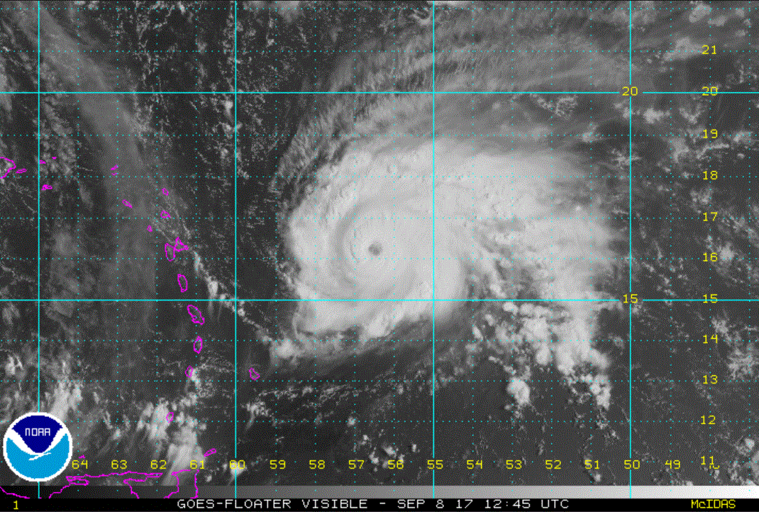
Re: Jose
Posted: Fri Sep 08, 2017 3:09 pm
by Tropical Inspector
Friday Evening UpdateJose very dangerousThe Weather SituationJose has strengthened and is a strong cat 4 hurricane. It is not out of the question that it becomes a cat 5 before reaching Barbuda Saturday AM.
Current Tropical WeatherAs of 5:00 PM AST Jose was centered at 16.6 N / 58.3 W or 335 miles ESE of the northern leeward Islands. It was moving WNW at 17 mph. Top sustained winds are estimated at 150 mph. Pressure was estimated at 940 MB.
Tropical Weather Forecast:Jose is following in the pathway of Irma. It will also approach the Leewards late tonight through Saturday. Jose is expected to turn more NW just east or over the Leewards.
Residents of the Leewards should continue to follow the progress of Jose.
Tropicast: Visible Satellite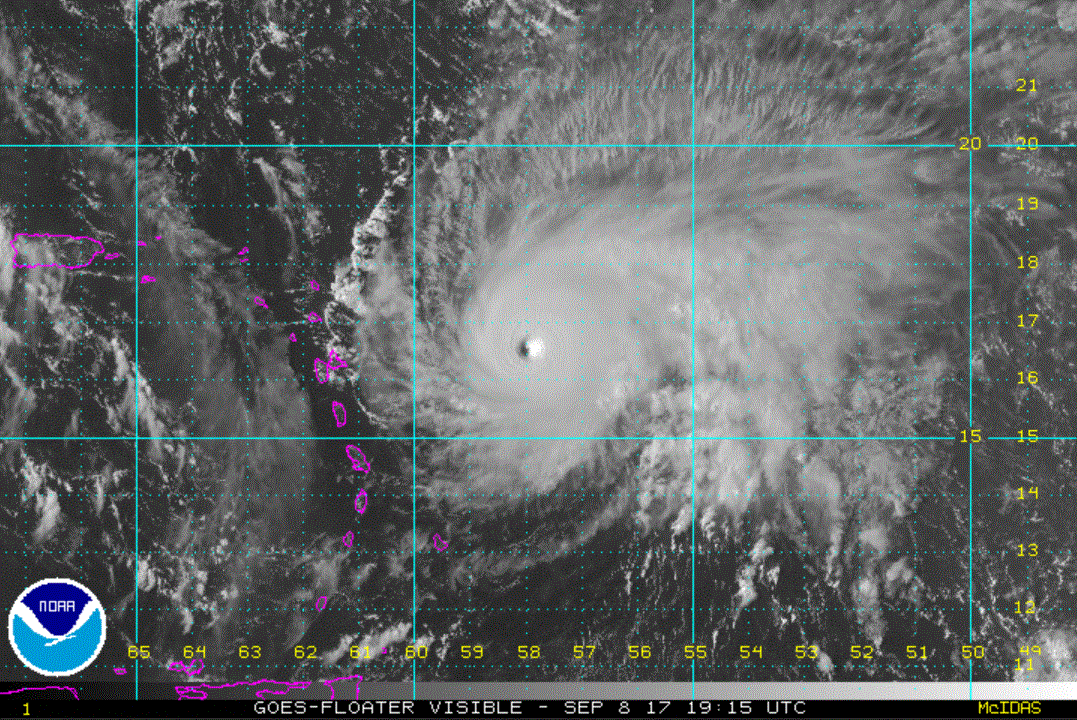 Tropicast: Water Vapor Satellite
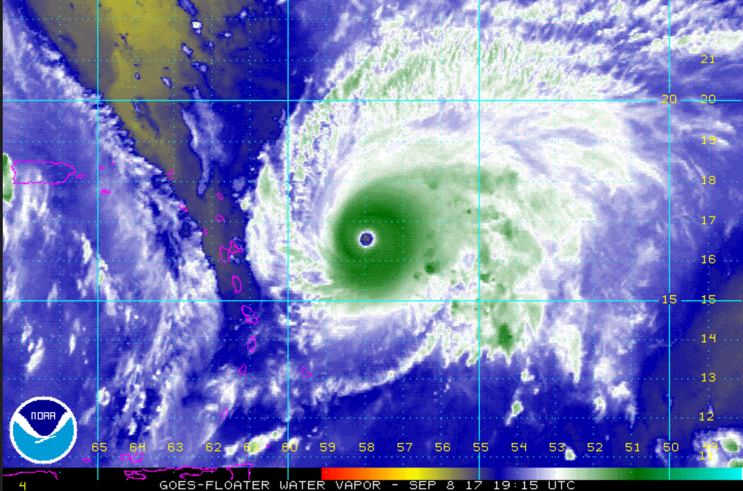
Re: Jose
Posted: Fri Sep 08, 2017 8:50 pm
by Tropical Inspector
Friday Night Mini UpdateThe Weather SituationJose remains a strong cat 4 hurricane and still is heading toward the Leewards Saturday.
Tropicast: IR Satellite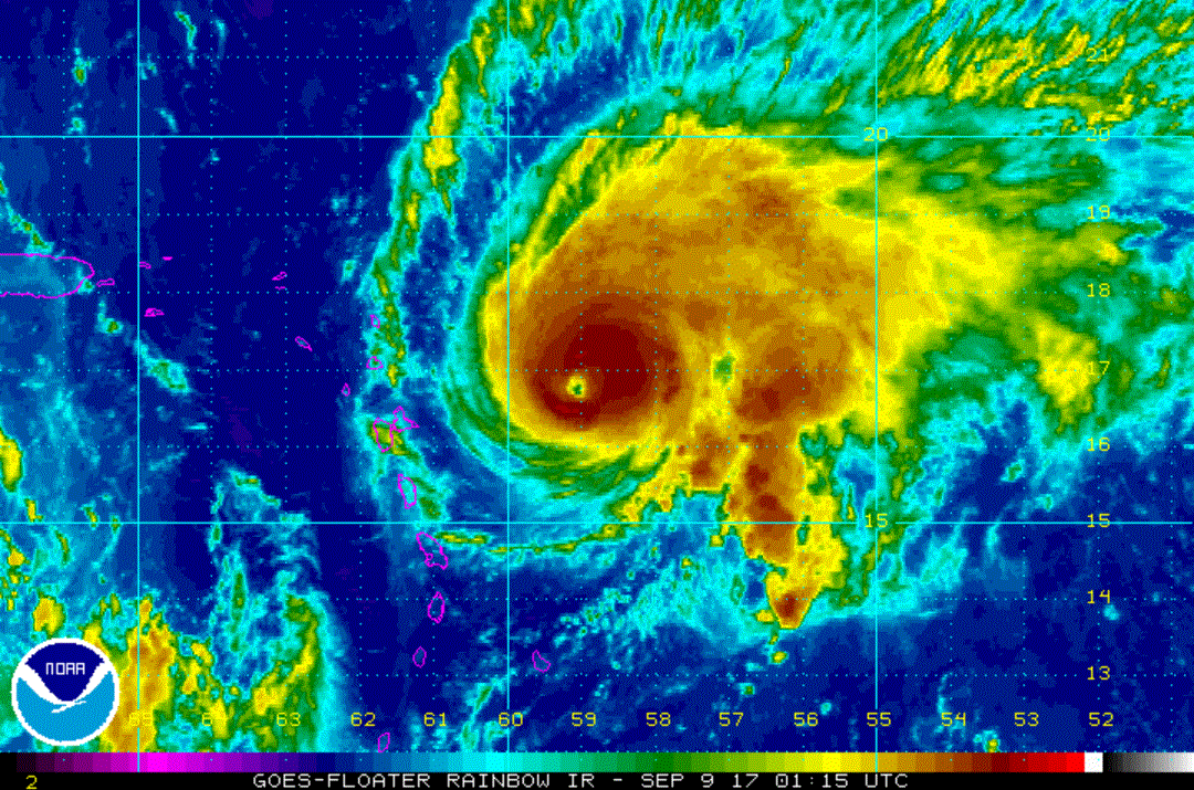
Re: Jose
Posted: Sat Sep 09, 2017 7:11 am
by Tropical Inspector
Saturday Morning UpdateJose turns, just in timeThe Weather SituationJose has turned just before reaching Barbuda. Hurricane warnings have been dropped. Barbuda and the rest of the Leewards can breath a sigh of relief.
Current Tropical WeatherAs of 8:00 AM AST Jose was centered at 17.8 N / 60.7 W or 160 miles east of the northern leeward Islands. It was moving NW at 13 mph. Top sustained winds are estimated at 145 mph. Pressure was estimated at 944 MB.
Tropical Weather Forecast:Jose will continue NW away from the Leewards for the next few day then slow a steering currents weaken. The progress of Jose should continued to be followed by Bermuda and the Mid Atlantic US.
Tropicast: Visible Satellite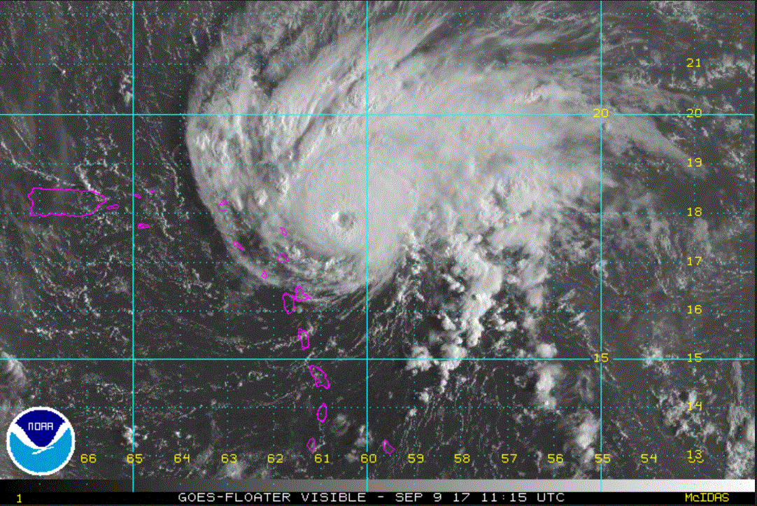
Re: Jose
Posted: Sat Sep 09, 2017 4:23 pm
by Tropical Inspector
Saturday Evening UpdateJose moving away from LeewardsThe Weather SituationJose is moving away from the Leewards. It will pose no threat to land for a few days.
Current Tropical WeatherAs of 5:00 PM AST Jose was centered at 19.2 N / 62.4 W or 85 miles NNE of the northern leeward Islands. It was moving NW at 14 mph. Top sustained winds are estimated at 145 mph. Pressure was estimated at 945 MB.
Tropical Weather Forecast:Jose will continue to the NW, then begin to stall east of the Bahamas by mid week. Interests in the Bahamas and eastern U.S. should monitor the progress of Jose.
Tropicast: Visible Satellite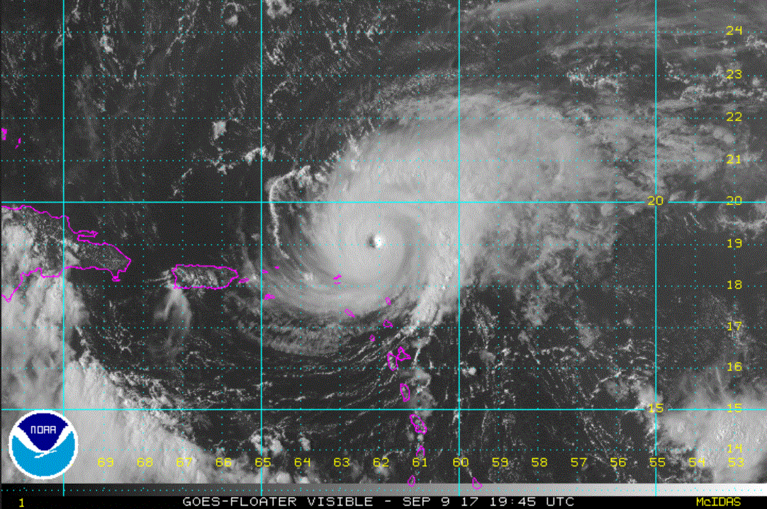 Tropicast: Close-up Visible Satellite
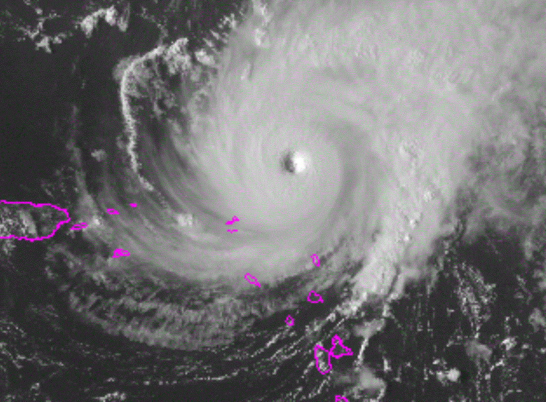
Re: Jose
Posted: Sun Sep 10, 2017 1:36 pm
by Tropical Inspector
Sunday Afternoon UpdateJose not posing a threat....for a few daysThe Weather SituationJose is fighting northerly wind shear. Convection is the most organized on the SE side of the hurricane. It will pose no threat to land for a few days.
Current Tropical WeatherAs of 3:00 PM AST Jose was centered at 22.4 N / 66.5 W or 325 miles east of Grand Turk. It was moving NW at 16 mph. Top sustained winds are estimated at 130 mph. Pressure was estimated at 944 MB.
Tropical Weather Forecast:Jose will continue to the NW, then begin to stall east of the Bahamas by mid week. Interests in the Bahamas and eastern U.S. should monitor the progress of Jose.
Tropicast: Visible Satellite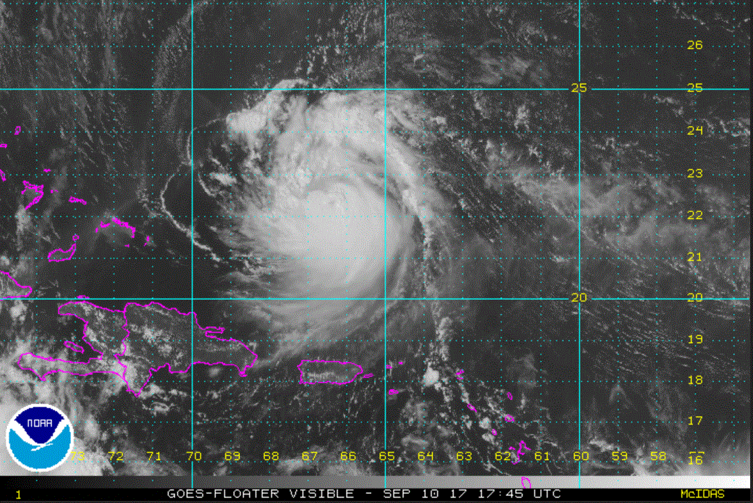
Re: Jose
Posted: Mon Sep 11, 2017 3:47 pm
by Tropical Inspector
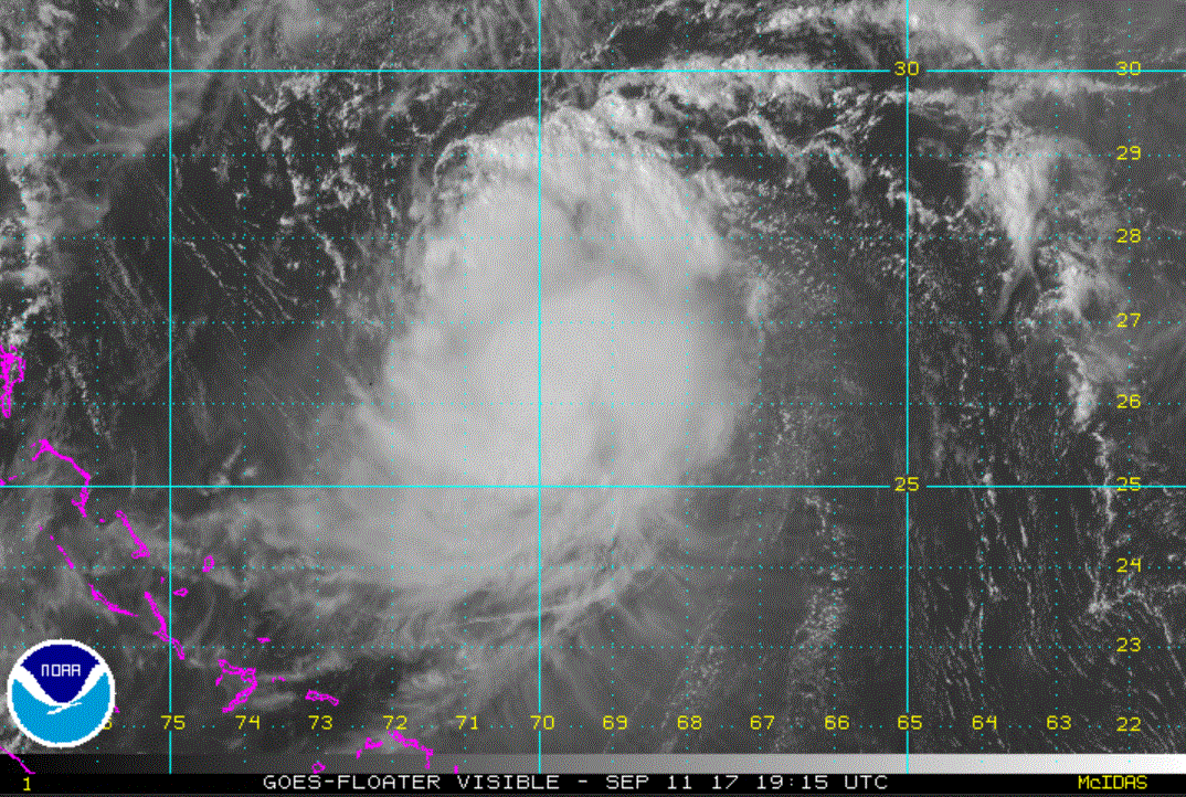
Monday Evening Update
Jose continues to spin east of the Bahamas
The Weather Situation
Jose will continue to fight northerly wind shear. The eye is obscured by clouds. It will pose no threat to land for a few days.
Current Tropical Weather
As of 5:00 PM AST Jose was centered at 26.4 N / 69.2 W or 360 miles NNE of Grand Turk. It was moving north at 12 mph. Top sustained winds are estimated at 100 mph. Pressure was estimated at 973 MB.
Tropical Weather Forecast:
Jose is under weak steering currents. It will be pushed west / NW later this week as a high builds to the north.. Interests in the Bahamas and eastern U.S., especially parts of the Mid-Atlantic should monitor the progress of Jose.
Tropicast: Visible Satellite
Re: Jose
Posted: Tue Sep 12, 2017 2:15 pm
by Tropical Inspector
Tuesday Afternoon UpdateJose fighting shearThe Weather SituationJose continues to fight northerly shear. Last night the eye became distinct as convection exploded for several hours. Despite this NHC downgraded winds from 85 mph at 11 pm EDT to 75 mph at 5 am EDT. It is my belief that that shear relaxed some and Jose strengthened before shear increased again this morning.
Current Tropical WeatherAs of 3:00 PM AST Jose was centered at 27.6 N / 67.0 W or 480 miles NNE of Grand Turk. It was moving east at 5 mph. Top sustained winds are estimated at 75 mph. Pressure was estimated at 987 MB.
Tropical Weather Forecast:Jose is under weak steering currents. It will be pushed west / NW later this week as a high builds to the north.. Interests in the Bahamas and eastern U.S., especially parts of the Mid-Atlantic should monitor the progress of Jose.
Tropicast: Visible Satellite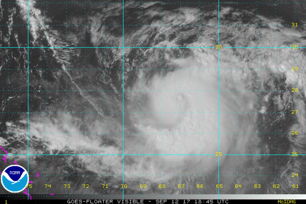
Re: Jose
Posted: Wed Sep 13, 2017 9:47 pm
by Tropical Inspector
Wednesday Night UpdateJose strengthening someThe Weather SituationDeep convection is building over Jose despite still fighting northerly wind shear.
Current Tropical WeatherAs of 11:00 PM AST Jose was centered at 25.2 N / 66.0 W or 475 miles ENE of SE Bahamas / 495 miles south of Bermuda. It was moving west at 3 mph. Top sustained winds are estimated at 80 mph. Pressure was estimated at 985 MB.
Tropical Weather Forecast:Jose is now moving slowly west. It will turn NW later this week as a high builds to the north.. Interests in the Bahamas, Bermuda, and eastern U.S., especially parts of the Mid-Atlantic should monitor the progress of Jose.
Tropicast: Visible Satellite (from afternoon)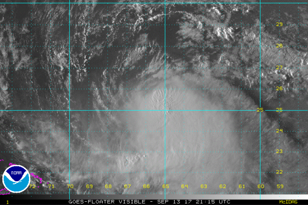 Tropicast: IR Satellite
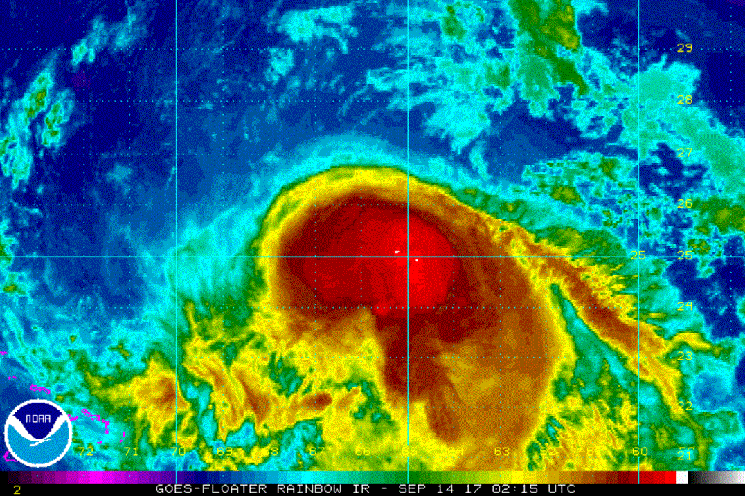
Re: Jose
Posted: Thu Sep 14, 2017 3:55 pm
by Tropical Inspector
Thursday Afternoon UpdateJose weakened some todayThe Weather SituationWind shear has increased today and because of that Jose has lost some strength
Current Tropical WeatherAs of 5:00 PM AST Jose was centered at 25.2 N / 67.3 W or 475 miles ENE of SE Bahamas / 515 miles SSW of Bermuda. It was moving WNW at 8 mph. Top sustained winds are estimated at 70 mph. Pressure was estimated at 989 MB.
Tropical Weather Forecast:Jose is now moving slowly WNW. It will turn NW later this week as a high builds to the north.. Interests in the Bahamas, Bermuda, and eastern U.S., especially parts of the Mid-Atlantic should monitor the progress of Jose.
Tropicast: Visible Satellite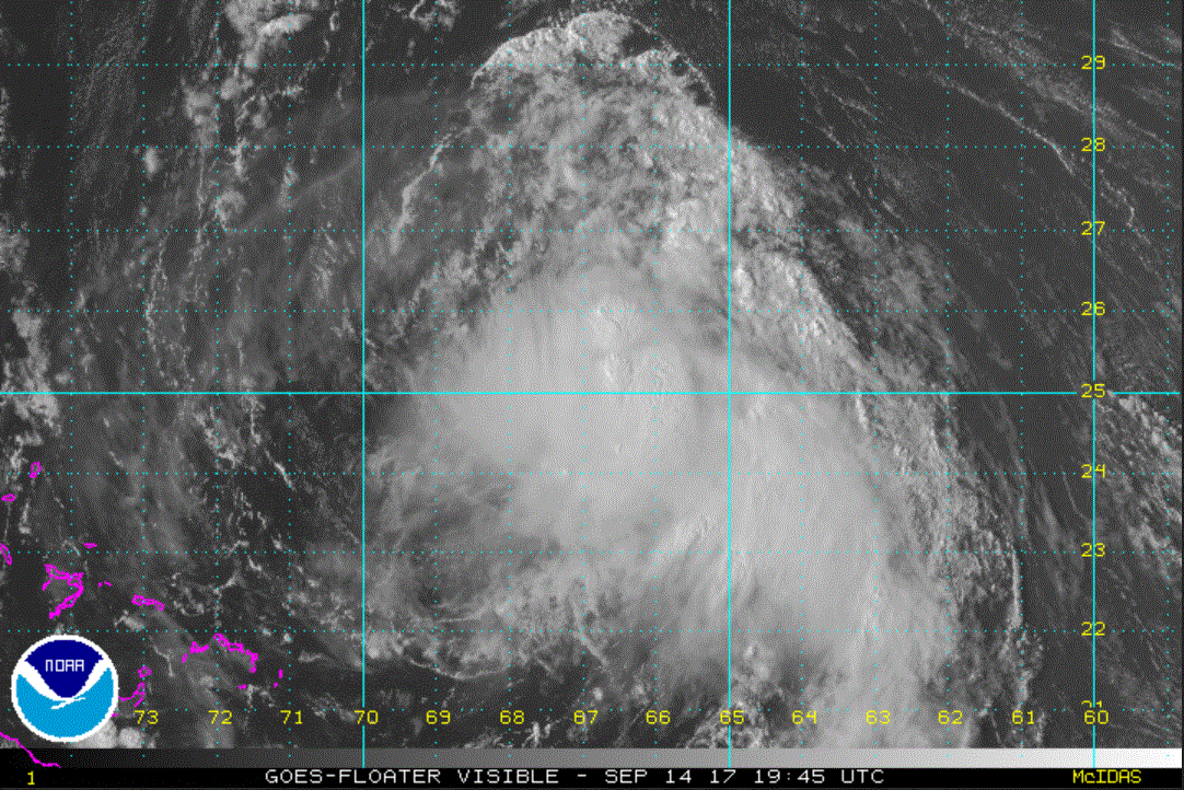
Re: Jose
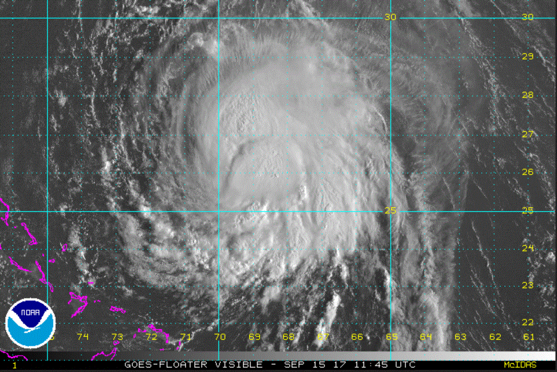
Posted: Fri Sep 15, 2017 7:37 am
by Tropical Inspector
Friday Morning UpdateRip current danger on eastern US coastsThe Weather SituationOnce again wind shear has lessened and Jose will gain some strength. The main threat at this time is increased rip currents and rough surf.
Current Tropical WeatherAs of 5:00 AM AST Jose was centered at 25.9 N / 68.7 W or 360 miles NE of SE Bahamas / 500 miles SSW of Bermuda. It was moving WNW at 8 mph. Top sustained winds are estimated at 70 mph. Pressure was estimated at 989 MB.
Tropical Weather Forecast:Jose is now moving slowly WNW. It will turn NW later this week as a high builds to the north.. Interests in the the Mid Atlantic and Northeast US as well as eastern Canada should monitor the progress of Jose.
Tropicast: Visible Satellite