Irma

Tropical cyclone archives for the 2017 Atlantic hurricane season
User avatar
Tropical Inspector
Site Admin
Site Admin
Posts: 3581
Joined: Tue Feb 20, 2007 2:28 pm
Antispam: no
Location: Under a palm tree
Contact:

Re: Irma

Post by Tropical Inspector »

Friday Evening Update

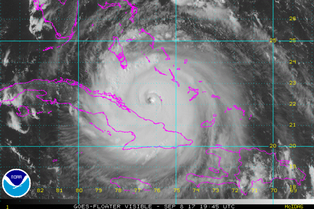
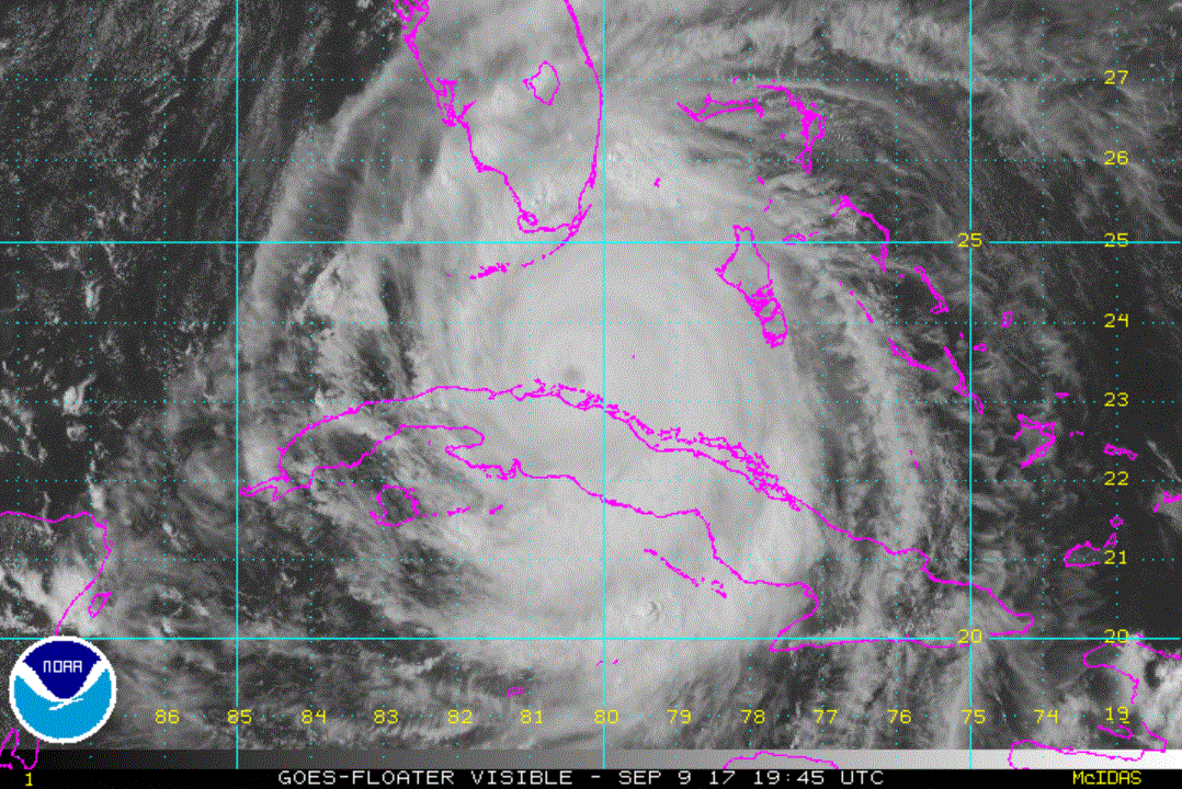
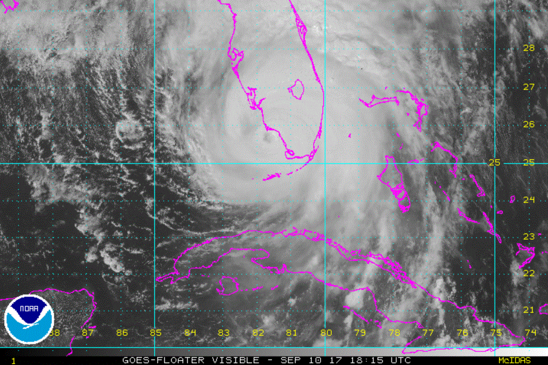
Irma moving toward north Cuba

The Weather Situation
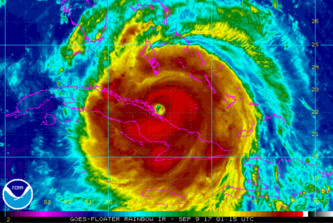
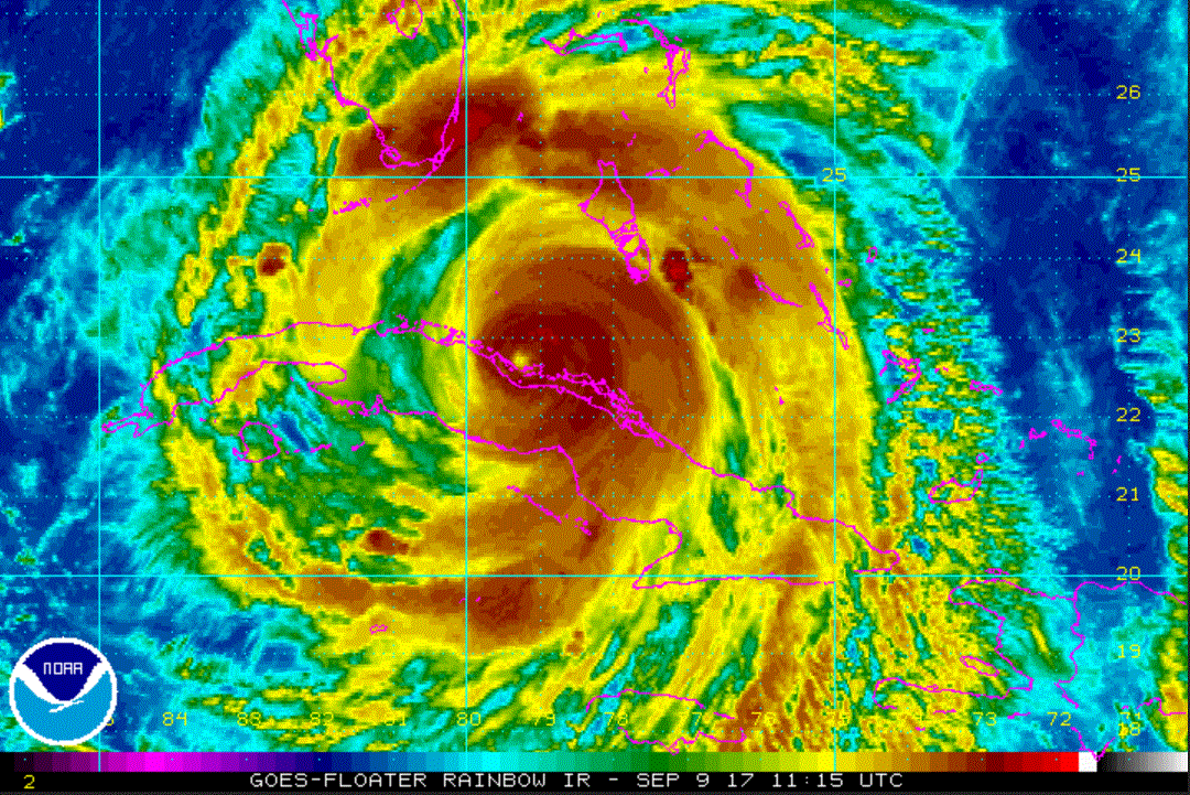
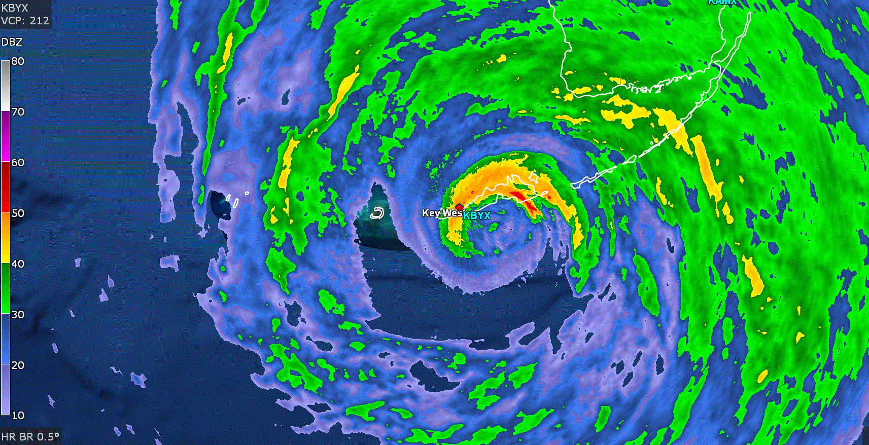
Irma is continuing west between the southern Bahamas and northern Cuba. It will be close to the north central coast of Cuba by Saturday. Heavy rainfall and strong winds are currently affecting the eastern 1/3rd of Cuba at this time.

Current Tropical Weather
As of 5:00 PM EDT Irma was centered at 22.1 N / 76.5 W or 345 miles SE of Miami. It was moving west at 12 mph. Top sustained winds are estimated at 155 mph. Pressure was estimated at 925 MB.

Tropical Weather Forecast:
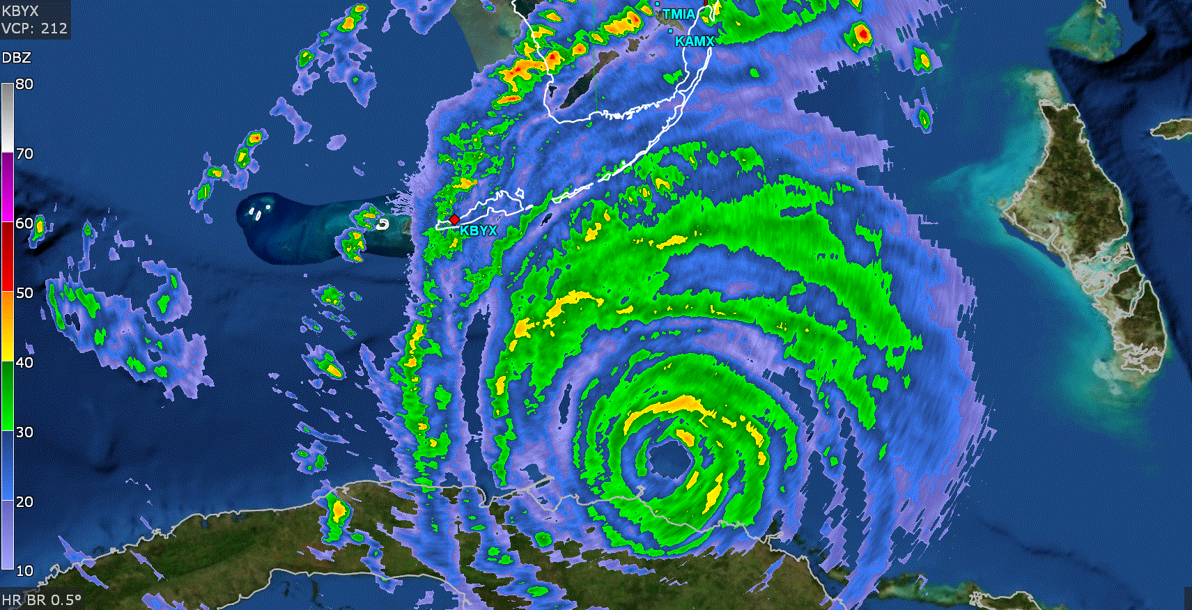
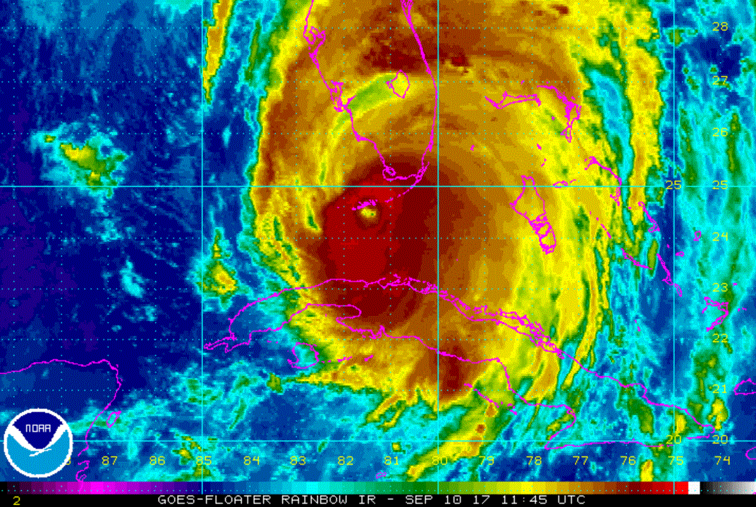
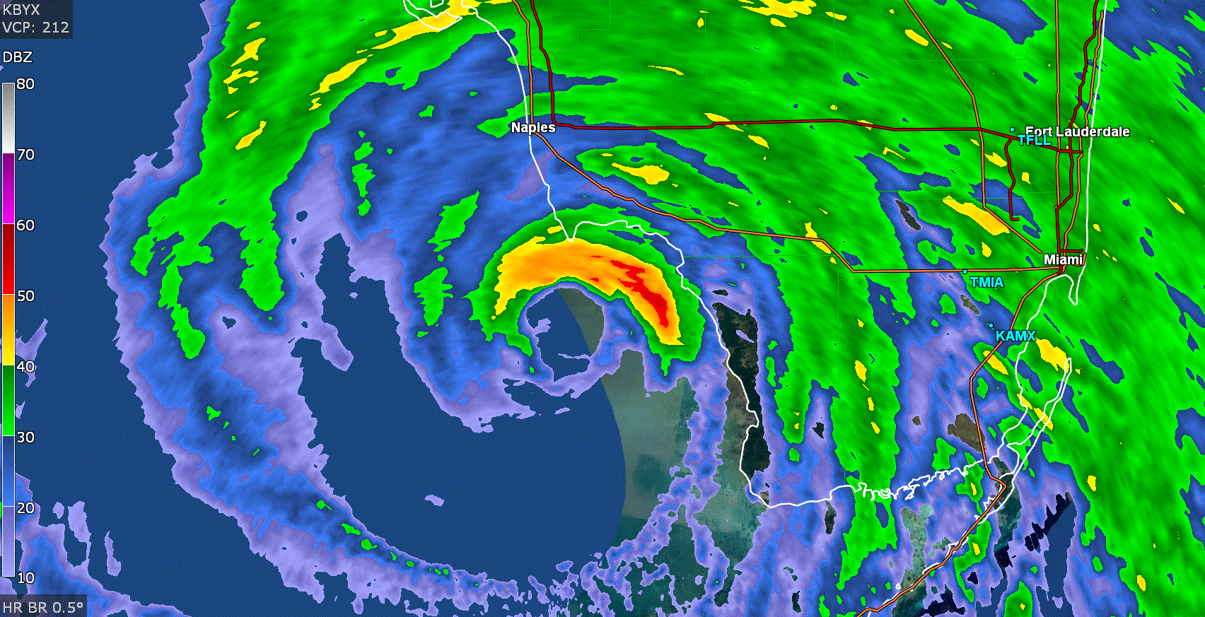
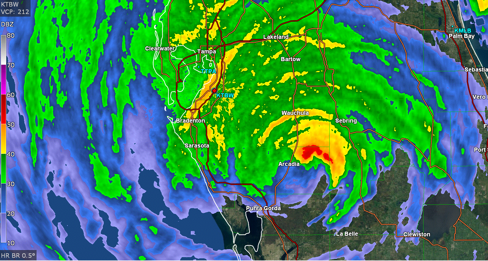
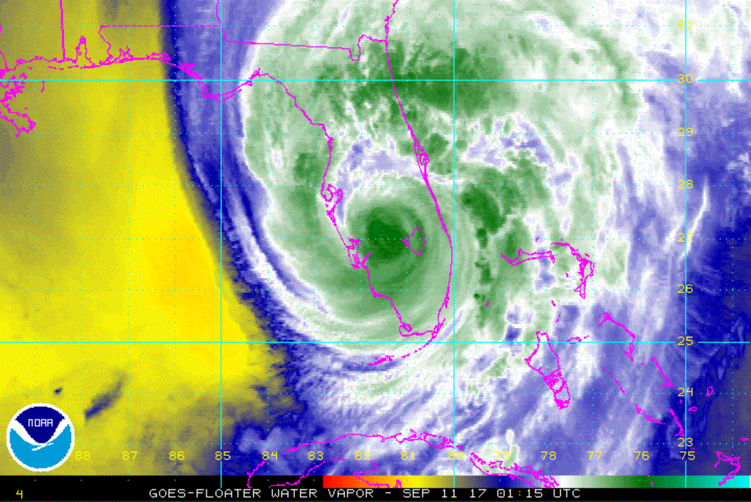
Irma is now expected to move into south Florida through the Keys Saturday night into Sunday morning. It will then move north over the peninsula into Georgia through Tuesday. All interests along the coast and inland over the Florida peninsula need to complete actions to protect life and property now. Residents on the Georgia and South Carolina coast also need to finish preparations.

:!: Pay close attention to the forecasts!

Tropicast: Visible Satellite
Image
Rich Johnson
Twitter: https://twitter.com/richjohnsonwx
Certified Broadcast Meteorologist - Hurricane Expert
User avatar
Tropical Inspector
Site Admin
Site Admin
Posts: 3581
Joined: Tue Feb 20, 2007 2:28 pm
Antispam: no
Location: Under a palm tree
Contact:

Re: Irma

Post by Tropical Inspector »

Friday Night Mini Update

Irma making landfall in north central Cuba

The Weather Situation
Irma appears to be heading a little farther south then forecast. The full force of Irma is being felt in northern Cuba tonight.

Tropicast: IR Satellite
Image
Rich Johnson
Twitter: https://twitter.com/richjohnsonwx
Certified Broadcast Meteorologist - Hurricane Expert
User avatar
Tropical Inspector
Site Admin
Site Admin
Posts: 3581
Joined: Tue Feb 20, 2007 2:28 pm
Antispam: no
Location: Under a palm tree
Contact:

Re: Irma

Post by Tropical Inspector »

Saturday Morning Update

Irma moving along Cuba's north coast

The Weather Situation
Irma made landfall along the islands of north Cuba last night. It continues to parallel the coast this morning bringing surge, high winds and heavy rainfall. Because of the land interaction, Irma has weakened. Even NHC admits that their intensity forecast may be generous. Irma is likely to restrengthen as it moves toward Florida.

Current Tropical Weather
As of 8:00 AM EDT Irma was centered at 22.6 N / 79.6 W or 10 miles north of Caibarian, Cuba / 225 miles SE of Miami. It was moving WNW at 12 mph. Top sustained winds are estimated at 130 mph. Pressure was estimated at 937 MB.

Tropical Weather Forecast:
Irma has slowed over Cuba. It is now expected to move through the Keys into southwest Florida Sunday. It will then move north over the peninsula into Georgia into northern Alabama through Tuesday. The track has shifted some westward. Because of this the worst effects will now shift westward also.

:!: Pay close attention to the forecasts!

Tropicast: IR Satellite
Image
Rich Johnson
Twitter: https://twitter.com/richjohnsonwx
Certified Broadcast Meteorologist - Hurricane Expert
User avatar
Tropical Inspector
Site Admin
Site Admin
Posts: 3581
Joined: Tue Feb 20, 2007 2:28 pm
Antispam: no
Location: Under a palm tree
Contact:

Re: Irma

Post by Tropical Inspector »

Saturday Evening Update

Irma moving toward Keys

The Weather Situation
Irma is moving away from Cuba and reorganizing. It should restrengthen possibly into a cat 4 hurricane before making landfall in the Keys. High winds, storm surge, isolated tornadoes, flooding are all threats as Irma approaches SW Florida.

Current Tropical Weather
As of 5:00 PM EDT Irma was centered at 23.4 N / 80.5 W or 115 miles SE of Key West, FL. It was moving WNW at 9 mph. Top sustained winds are estimated at 125 mph. Pressure was estimated at 933 MB.

Tropical Weather Forecast:
Irma is now moving toward the Keys. It is expected to move through the Keys into southwest Florida Sunday. It will then move north over the western peninsula into Georgia then into northern Alabama through Tuesday.

:!: Pay close attention to the forecasts!

Tropicast: Key West Radar
Image

Tropicast: Visible Satellite
Image
Rich Johnson
Twitter: https://twitter.com/richjohnsonwx
Certified Broadcast Meteorologist - Hurricane Expert
User avatar
Tropical Inspector
Site Admin
Site Admin
Posts: 3581
Joined: Tue Feb 20, 2007 2:28 pm
Antispam: no
Location: Under a palm tree
Contact:

Re: Irma

Post by Tropical Inspector »

Sunday Morning Update

Irma over Keys

The Weather Situation
Irma is near Key West. So far winds are only gusting to 75 mph. Miami is gusted to 63 mph recently. The hurricane is still organizing as it heads north.

Current Tropical Weather
As of 8:00 AM EDT Irma was centered at 24.5 N / 81.5 W or 20 miles ESE of Key West / 110 miles south of Naples. It was moving NNW at 8 mph. Top sustained winds are estimated at 130 mph. Pressure was estimated at 929 MB.

Tropical Weather Forecast:
Irma's track has shifted slightly west again. It will move up the west coast of Florida, into south Georgia then NW into central Alabama.

:!: Pay close attention to the forecasts!

Tropicast: Key West Radar
Image

Tropicast: Visible Satellite
Image
Rich Johnson
Twitter: https://twitter.com/richjohnsonwx
Certified Broadcast Meteorologist - Hurricane Expert
User avatar
Tropical Inspector
Site Admin
Site Admin
Posts: 3581
Joined: Tue Feb 20, 2007 2:28 pm
Antispam: no
Location: Under a palm tree
Contact:

Re: Irma

Post by Tropical Inspector »

Sunday Afternoon Update

Irma near SW Florida

The Weather Situation
From NHC: A 120 mph gust was reported at the National Key Deer Refuge in Big Pine Key. A sustained wind of
62 mph with a gust of 94 mph was reported at the Federal Aviation Administration station at Miami International Airport.

Current Tropical Weather
As of 2:00 PM EDT Irma was centered at 25.6 N / 81.8 W or 35 miles south of Naples. It was moving north at 12 mph. Top sustained winds are estimated at 120 mph. Pressure was estimated at 936 MB.

Tropical Weather Forecast:
Irma will move up the west coast of Florida, into south Georgia then NW into central Alabama. Heavy rainfall, strong winds and isolated tornadoes are a threat.

:!: Pay close attention to the forecasts!

Tropicast: Key West Radar
Image

Tropicast: Visible Satellite
Image
Rich Johnson
Twitter: https://twitter.com/richjohnsonwx
Certified Broadcast Meteorologist - Hurricane Expert
User avatar
Tropical Inspector
Site Admin
Site Admin
Posts: 3581
Joined: Tue Feb 20, 2007 2:28 pm
Antispam: no
Location: Under a palm tree
Contact:

Re: Irma

Post by Tropical Inspector »

Sunday Night Mini Update

Irma near central Florida


Tropical Weather Forecast:
Irma is moving farther east then the models predicted. It will move up through Florida, into south Georgia then NW into central Alabama. Heavy rainfall, strong winds and isolated tornadoes are a threat.

Marco Island 130 mph gust
West Palm Beach 90 mph gust
Miami 100 mph wind gust
Naples 131 mpg wind gust & 142 mph

:!: Pay close attention to the forecasts!

Tropicast: Tampa Radar
Image

Tropicast: Water Vapor Satellite
Image
Rich Johnson
Twitter: https://twitter.com/richjohnsonwx
Certified Broadcast Meteorologist - Hurricane Expert
User avatar
Tropical Inspector
Site Admin
Site Admin
Posts: 3581
Joined: Tue Feb 20, 2007 2:28 pm
Antispam: no
Location: Under a palm tree
Contact:

Re: Irma

Post by Tropical Inspector »

Monday Afternoon Update

Irma weakening

The Weather Situation
The main concern will continue to be coastal flooding on the Southeastern U.S. coast as winds wind down. Isolated tornadoes, and locally heavy rainfall of 5+" are possible in Georgia and South Carolina. It appears that NHC is over estimating winds. No sustained winds of 65 mph are noted. Winds to 50 mph / gusts to 60 mph are being reported.

Current Tropical Weather
As of 11:00 AM EDT Irma was centered at 30.3 N / 83.1 W or 70 miles east of Tallahassee. It was moving NNW at 17 mph. Top sustained winds are estimated at 50 mph (65 mph NHC). Pressure was estimated at 975 MB.

Tropical Weather Forecast:
Irma will weaken to a tropical depression by Tuesday.

Tropicast: Southeast Winds (Temps in black / Wind Gusts in red)
Image

Tropicast: Visible Satellite
Image

Tropicast: Atlanta Radar
Image
Rich Johnson
Twitter: https://twitter.com/richjohnsonwx
Certified Broadcast Meteorologist - Hurricane Expert
User avatar
Tropical Inspector
Site Admin
Site Admin
Posts: 3581
Joined: Tue Feb 20, 2007 2:28 pm
Antispam: no
Location: Under a palm tree
Contact:

Re: Irma

Post by Tropical Inspector »

Winds 9/10/17:

Ft. Myers 89 mph gust
PBI 90 mph gust
Naples 92 / G 122 mpg at airport
Naples 88 / G 131
Marco Island 112 / G 129
Deer Key G 120 mph
Rich Johnson
Twitter: https://twitter.com/richjohnsonwx
Certified Broadcast Meteorologist - Hurricane Expert
Post Reply

Return to “2017 Atlantic Hurricane Season Archives”

Who is online

Users browsing this forum: No registered users and 0 guests