Friday Evening Update
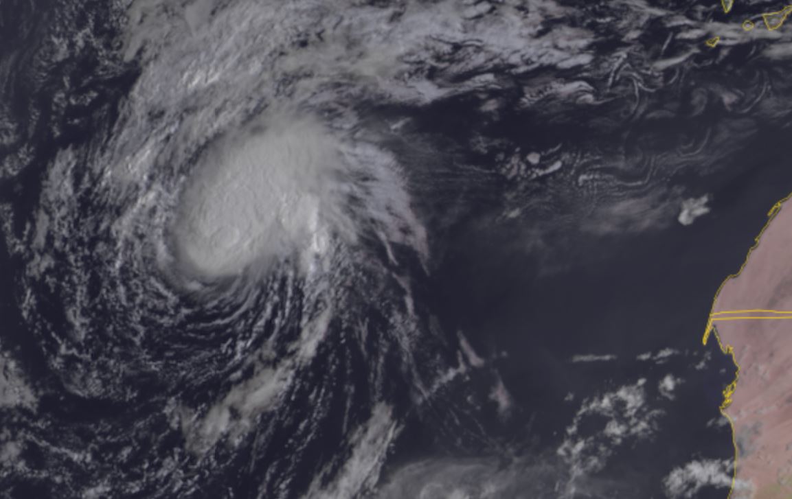
TD 12 expected to have short lifespan
TD 12 has some convection and a small, but loosely organized banding.
The Weather Situation
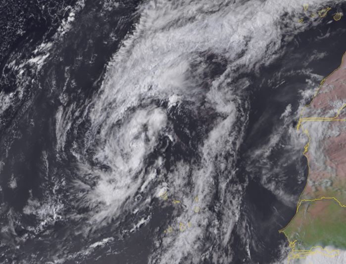
SUMMARY OF 200 AM CVT...0300 UTC...INFORMATION
----------------------------------------------
LOCATION...21.6N 28.7W
ABOUT 495 MI...795 KM NW OF THE CABO VERDE ISLANDS
MAXIMUM SUSTAINED WINDS...35 MPH...55 KM/H
PRESENT MOVEMENT...N OR 355 DEGREES AT 13 MPH...20 KM/H
MINIMUM CENTRAL PRESSURE...1007 MB...29.74 INCHES
Tropicast: Visible satellite Friday afternoon
Tropical Weather Forecast:
TD 12 may briefly become a tropical storm on Saturday.
Katia
- Tropical Inspector
- Site Admin
- Posts: 3581
- Joined: Tue Feb 20, 2007 2:28 pm
- Antispam: no
- Location: Under a palm tree
- Contact:
Katia
Rich Johnson
Twitter: https://twitter.com/richjohnsonwx
Certified Broadcast Meteorologist - Hurricane Expert
Twitter: https://twitter.com/richjohnsonwx
Certified Broadcast Meteorologist - Hurricane Expert
- Tropical Inspector
- Site Admin
- Posts: 3581
- Joined: Tue Feb 20, 2007 2:28 pm
- Antispam: no
- Location: Under a palm tree
- Contact:
Re: Katia
Saturday Morning Update
Katia classified in far eastern Atlantic
Satellite imagery shows that the tropical cyclone is much better organized this morning with convection around the center of circulation. IMO Katia has winds stronger than the official estimate. Possibly 45-50 mph surface sustained.
SUMMARY OF 800 AM CVT...0900 UTC...INFORMATION
----------------------------------------------
LOCATION...22.7N 29.4W
ABOUT 580 MI...935 KM NW OF THE CABO VERDE ISLANDS
MAXIMUM SUSTAINED WINDS...40 MPH...65 KM/H
PRESENT MOVEMENT...NNW OR 330 DEGREES AT 13 MPH...20 KM/H
MINIMUM CENTRAL PRESSURE...1005 MB...29.68 INCHES
Tropicast: Visible satellite - Meteosat view
Tropicast: Visible satellite - GOES 16 view
Tropical Weather Forecast:
Katia is predicted to become extratropical within 24 hours. It would not be surprising to see it hold on longer as it currently has a fairly impressive structure.
NHC Advisory
https://www.nhc.noaa.gov/text/refresh/M ... 839.shtml?
NHC Track
https://www.nhc.noaa.gov/refresh/graphi ... e#contents
Rich Johnson
Twitter: https://twitter.com/richjohnsonwx
Certified Broadcast Meteorologist - Hurricane Expert
Twitter: https://twitter.com/richjohnsonwx
Certified Broadcast Meteorologist - Hurricane Expert
Who is online
Users browsing this forum: No registered users and 6 guests