Page 1 of 1
Claudette
Posted: Thu Jun 17, 2021 6:47 pm
by Tropical Inspector
Thursday Evening Update
PTC 3
The Weather Situation
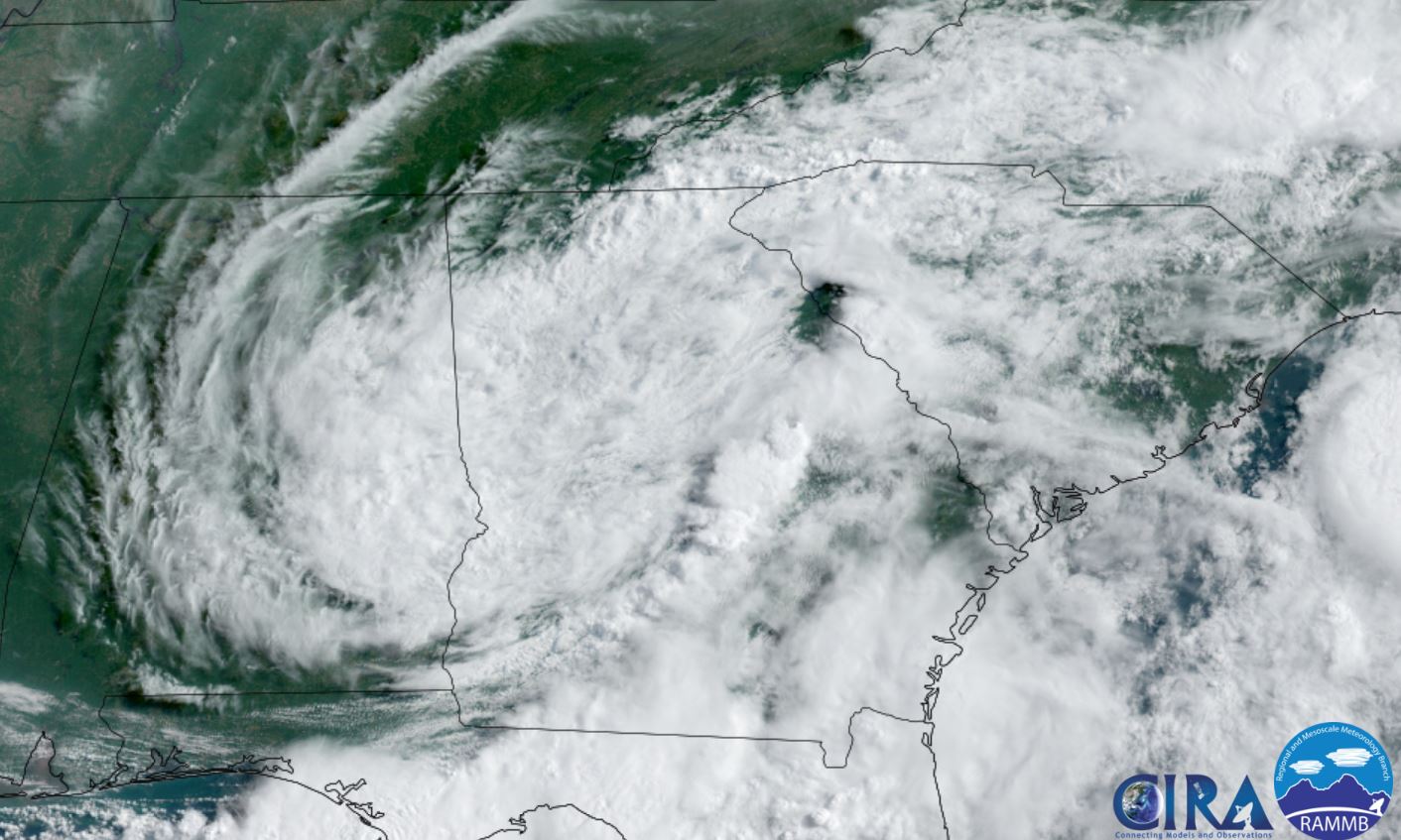
A very disorganized area of low pressure covers the western and central Gulf of Mexico. Deep convection remains to the NE of the broad circulation.
Current tropical weather
As of 4:00 PM CDT PTC 3 was centered at 22.9 N / 92.4 W or about 475 miles south of Morgan City, Louisiana. It was moving N at 9 mph. Officially top sustained winds are estimated at 30 mph. Pressure was estimated at 1008 hPa (mb).
Tropical Weather Forecast:
PT3 or Claudette will bring heavy rainfall to eastern Louisiana, Alabama and into the northern areas of Georgia.
Tropicast: Visible Satellite
Re: Claudette
Posted: Sat Jun 19, 2021 11:19 am
by Tropical Inspector
Saturday Noon Update
Heavy rainfall big story with Claudette
The Weather Situation
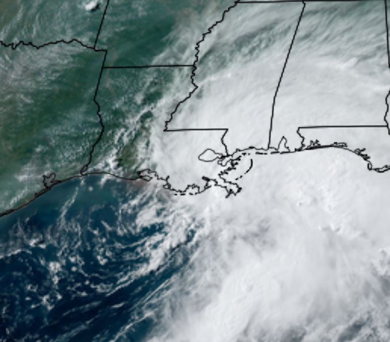
Claudette was named as it made landfall on the Louisiana coast this morning at 4 am CDT. Heavy rainfall was occurring over a large part of Alabama moving into western Georgia.
Current tropical weather
As of 10:00 AM CDT Claudette was centered at 31.0 N / 89.7 W or about 75 miles NNE of New Orleans, Louisiana. It was moving NNE at 14 mph. Officially top sustained winds are estimated at 40 mph. Pressure was estimated at 1007 hPa (mb).
Tropical Weather Forecast:
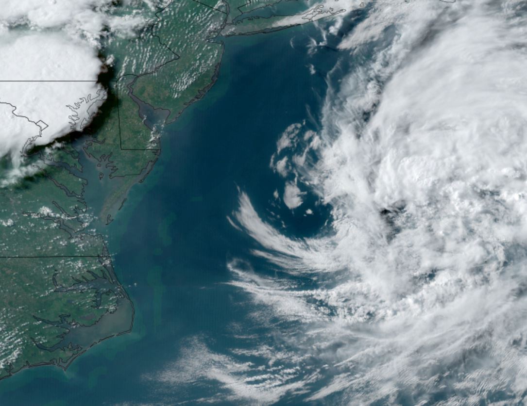
Claudette will move across the southern states as a tropical depression then redevelop near the North Carolina coast. It will become a storm before becoming extratropical over colder waters on its way to Nova Scotia, Canada.
Tropicast: Visible Satellite - Friday Afternoon
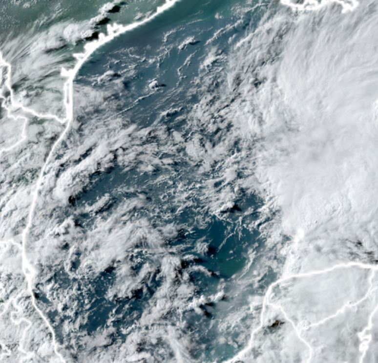
 Tropicast: Visible Satellite - Saturday Midday
Re: Claudette
Posted: Sun Jun 20, 2021 8:29 am
by Tropical Inspector
Sunday Morning Update
Claudette inland - rain continues
The Weather Situation
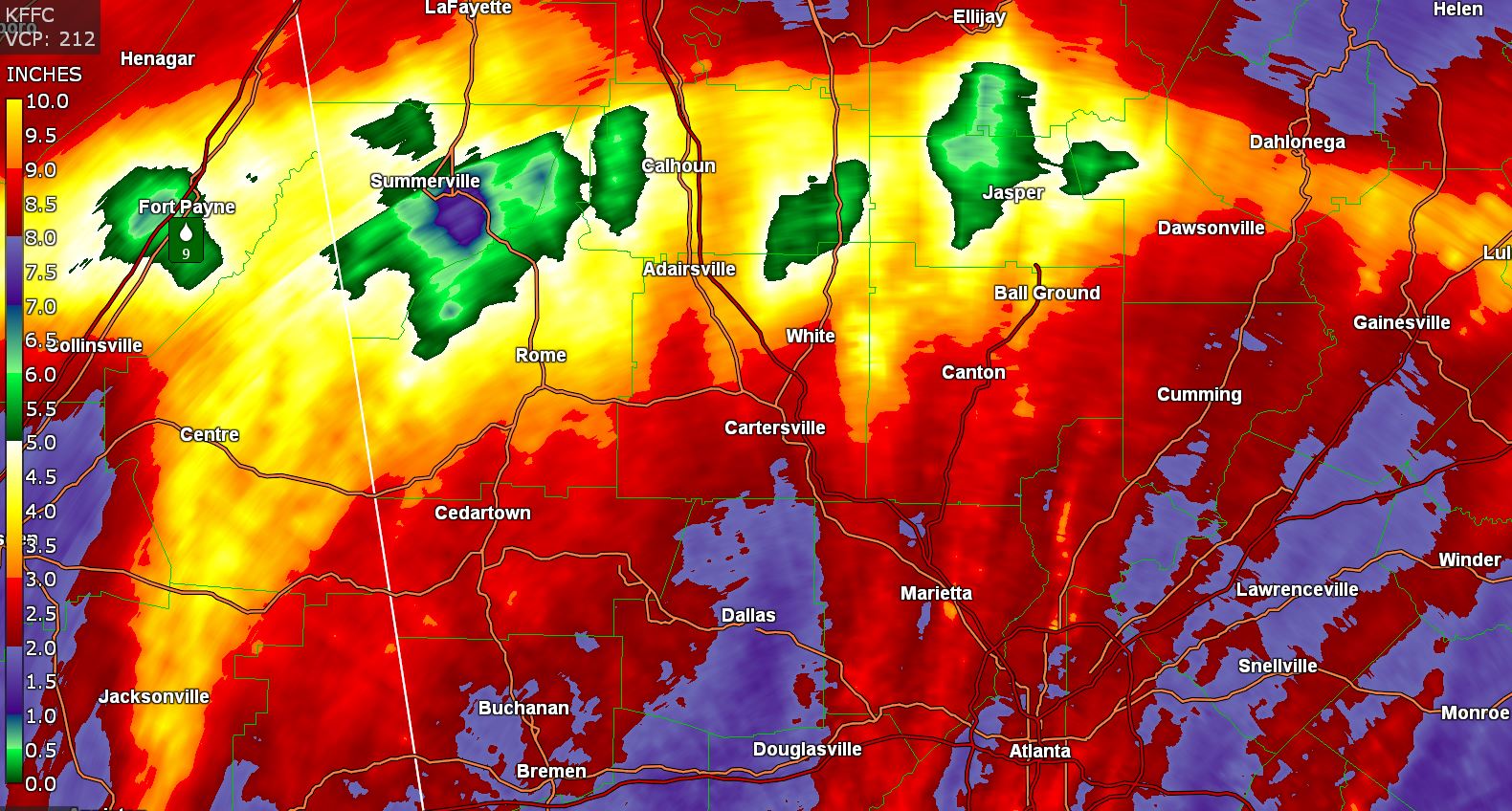
Claudette brought 5-8" of rainfall across the north Georgia mountains into NE Alabama where a maximum of nearly 10" was recorded. Rainfall will progress across the Carolinas today.
Current tropical weather
As of 8:00 AM EDT Claudette was centered at 33.7 N / 84.8 W or about 25 miles west of Atlanta, Georgia. It was moving ENE at 13 mph. Officially top sustained winds are estimated at 30 mph. Pressure was estimated at 1007 hPa (mb).
Tropical Weather Forecast:
Claudette will be over eastern North Carolina as a tropical depression Monday morning. It will become a storm near the coast before becoming extratropical over colder waters on its way to Nova Scotia, Canada.
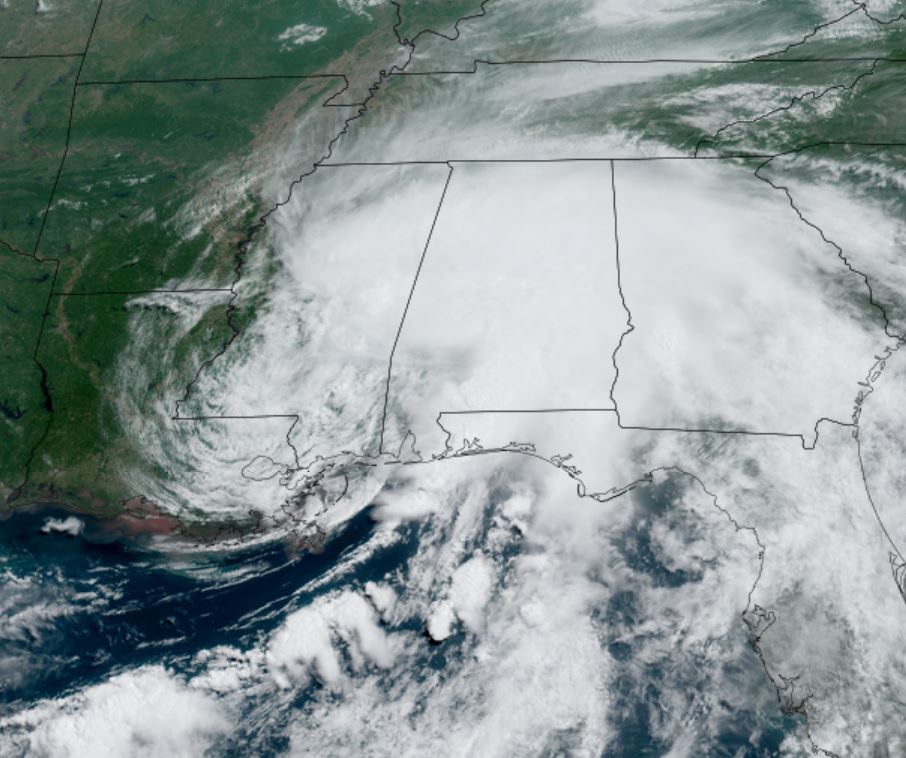
Tropicast: Visible Satellite
 Tropicast: Rainfall Estimate
Re: Claudette
Posted: Mon Jun 21, 2021 5:06 pm
by Tropical Inspector
Monday Afternoon Update
Claudette looks extratropical
The Weather Situation
I'm wondering if Claudette was ever a tropical storm. It was named at landfall and renamed today. It is very questionable if it is not now an extratropical cyclone.
Tropicast: Visible Satellite