Dolly
Posted: Mon Jun 22, 2020 4:14 pm
Monday Evening Update
SubTD4 classified
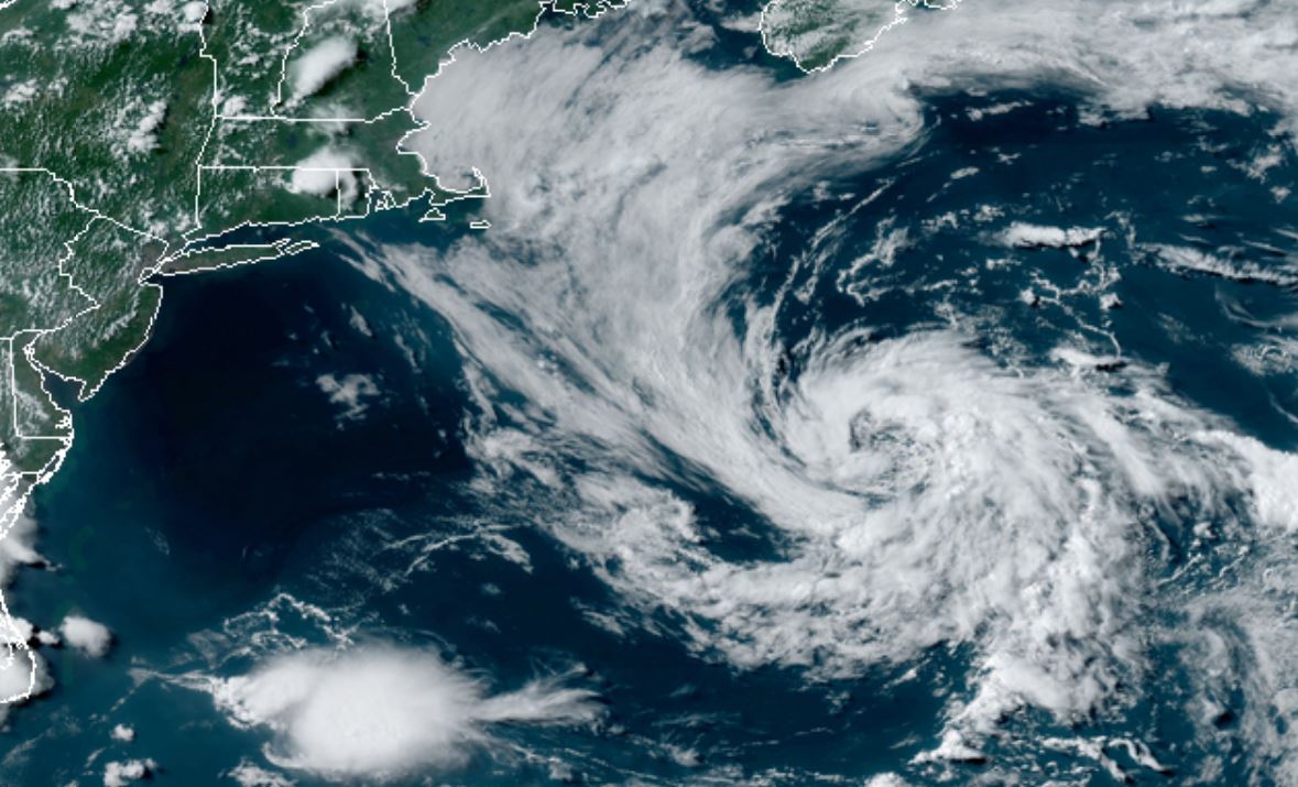
The Weather Situation
A weather system which looks like a Nor'easter has gained convection around the center of circulation today. Because of this, there is now enough characteristics to classify this as a subtropical depression.The system remains well east of the Mid Atlantic coast. The only concerns will be to shipping.
For more frequent updates: Twitter: https://twitter.com/richjohnsonwx
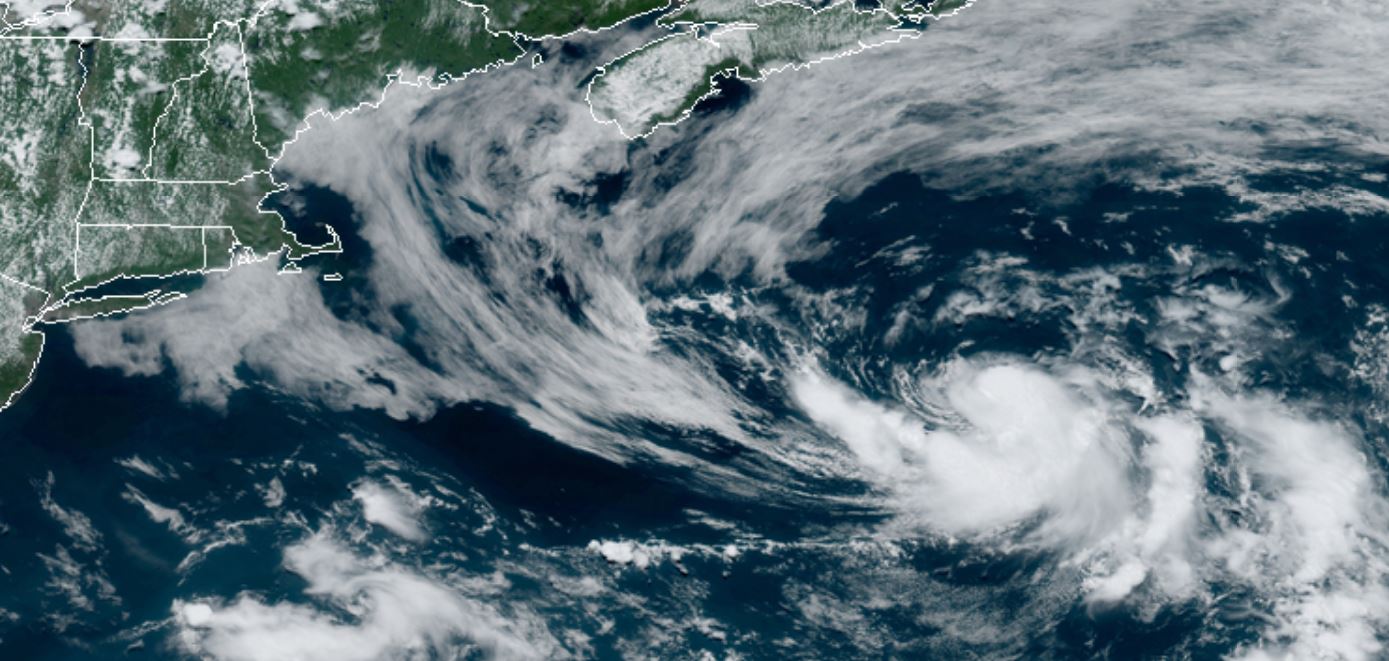
Current tropical weather
As of 5:00 PM EDT Subtropical depression 4 was centered at 38.2 N / 65.7 W or 310 miles SE of Nantucket, MA. It was moving ENE at 9 mph. Officially top sustained winds are estimated at 35 mph. Pressure was estimated at 1009 hPa (mb).
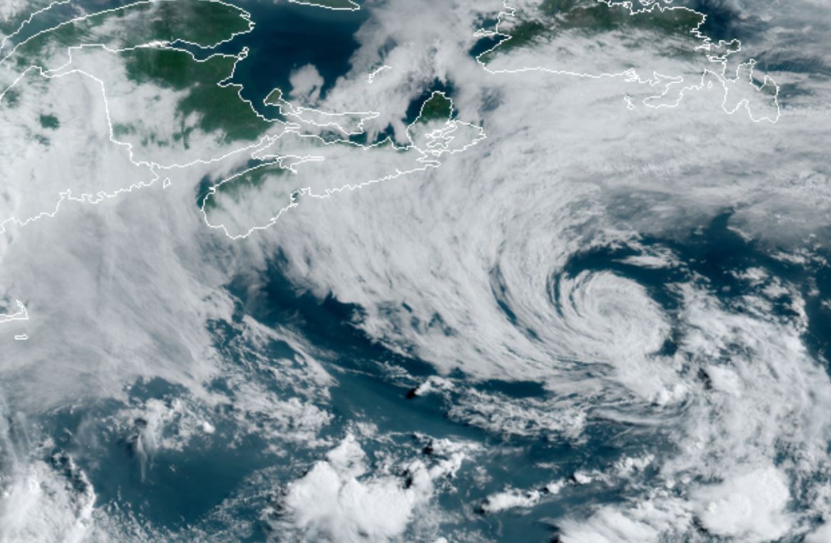
Tropical Weather Forecast:
Forecasts take TD4 near the eastern tip of Newfoundland, Canada by Thursday as an extratropical cyclone. It may briefly strengthen to tropical storm strength.
Tropicast: Visible Satellite
SubTD4 classified
The Weather Situation
A weather system which looks like a Nor'easter has gained convection around the center of circulation today. Because of this, there is now enough characteristics to classify this as a subtropical depression.The system remains well east of the Mid Atlantic coast. The only concerns will be to shipping.
For more frequent updates: Twitter: https://twitter.com/richjohnsonwx
Current tropical weather
As of 5:00 PM EDT Subtropical depression 4 was centered at 38.2 N / 65.7 W or 310 miles SE of Nantucket, MA. It was moving ENE at 9 mph. Officially top sustained winds are estimated at 35 mph. Pressure was estimated at 1009 hPa (mb).
Tropical Weather Forecast:
Forecasts take TD4 near the eastern tip of Newfoundland, Canada by Thursday as an extratropical cyclone. It may briefly strengthen to tropical storm strength.
Tropicast: Visible Satellite