Page 1 of 1
Karen
Posted: Sun Sep 22, 2019 1:55 pm
by Tropical Inspector
Sunday Afternoon Update
Recon investigating karen
The Weather Situation
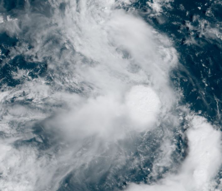
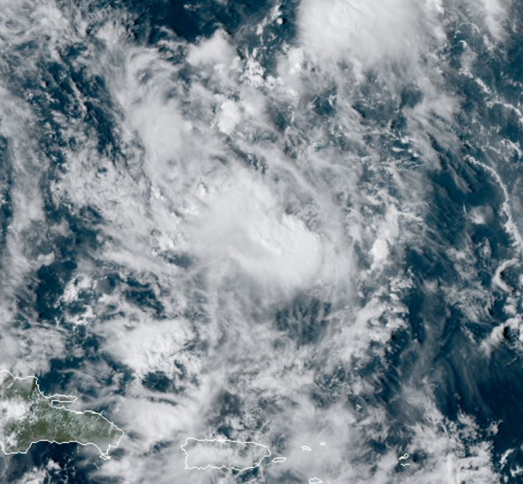
Satellite shows that Karen is poorly defined. It has a broad low level circulation in the SE Caribbean Sea. IMO it is not a storm.
For more frequent updates: Twitter:
https://twitter.com/richjohnsonwx
Current tropical weather
As of 2:00 PM AST Karen was centered at 12.7 N / 62.3 W or 60 miles north of Grenada. It was moving WNW at 10 mph. Top sustained winds are estimated at 40 mph. Pressure was estimated at 1006 hPa.
Tropical Weather Forecast:
Karen is forecast to move north across the eastern Caribbean over the next few days. This is also dependent if the circulation holds together.
Tropicast: Visible Satellite
Re: Karen
Posted: Mon Sep 23, 2019 11:41 am
by Tropical Inspector
Monday Afternoon Update
Recon investigating karen
The Weather Situation
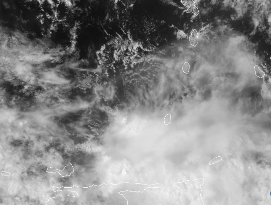
Satellite shows that Karen remains poorly defined. I still do not believe it is at tropical storm strength even though the SFMR data reporting mid 40''s winds.
For more frequent updates: Twitter:
https://twitter.com/richjohnsonwx
Current tropical weather
As of 2:00 PM AST Karen was centered at 14.9 N / 64.8 W or 190 miles south of St. Croix. It was moving NNW at 12 mph. Top sustained winds are estimated at 40 mph. Pressure was estimated at 1007 hPa.
Tropical Weather Forecast:
Karen is forecast to move north across the eastern Caribbean over the next few days. This is also dependent if the circulation holds together.
Tropicast: Visible Satellite
Re: Karen
Posted: Tue Sep 24, 2019 4:03 pm
by Tropical Inspector
Tuesday Evening Update
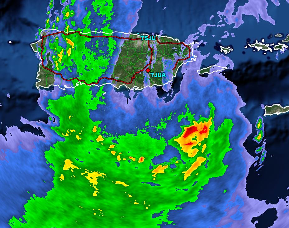
Karen nearing Puerto Rico
The Weather Situation
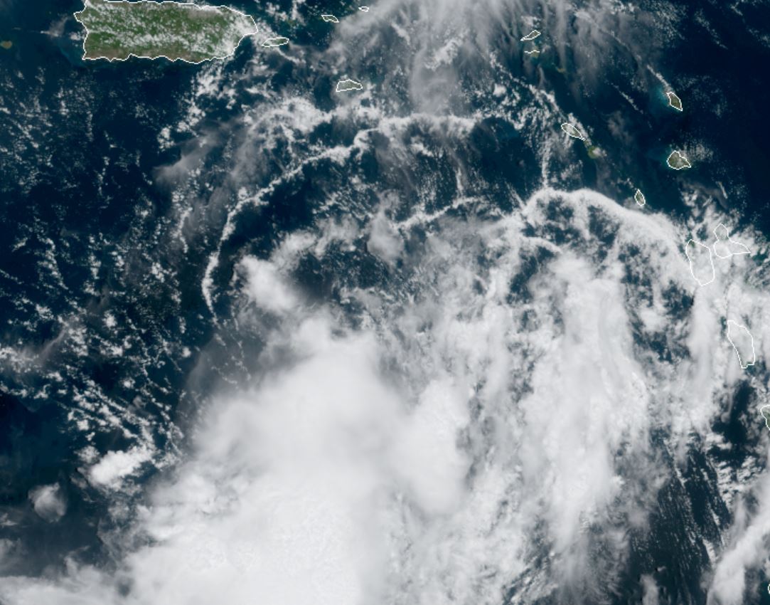
Karen is organizing and approaching the eastern end of Puerto Rico. It is the first time that it actually looks like a tropical storm. The greatest threat will be from flash flooding.
For more frequent updates: Twitter:
https://twitter.com/richjohnsonwx
Current tropical weather
As of 5:00 PM AST Karen was centered at 18.0 N / 65.8 W or 35 miles southeast of San Juan, P.R. It was moving north at 8 mph. Top sustained winds are estimated at 45 mph. Pressure was estimated at 1005 hPa.
Tropical Weather Forecast:
Karen is forecast to move north away from Puerto Rico and stall well east of the Bahamas.
Tropicast: Visible Satellite
 Tropicast: Radar Tuesday late afternoon
Re: Karen
Posted: Wed Sep 25, 2019 9:35 pm
by Tropical Inspector
Wednesday Night Update
Karen weaker
The Weather Situation
Karen has weakened again today after showing some organization yesterday.
For more frequent updates: Twitter:
https://twitter.com/richjohnsonwx
Current tropical weather
As of 5:00 PM AST Karen was centered at 22.9 N / 64.3 W or 330 miles NNE of San Juan, P.R. It was moving NNE at 14 mph. Top sustained winds are estimated at 40 mph. Pressure was estimated at 1004 hPa.
Tropical Weather Forecast:
Karen is forecast to stall well east of the Bahamas for the next several days and may try to move westward after that.
Tropicast: Visible Satellite
Re: Karen
Posted: Thu Sep 26, 2019 8:38 pm
by Tropical Inspector
Thursday Night Update
Karen starting to get sheared
The Weather Situation
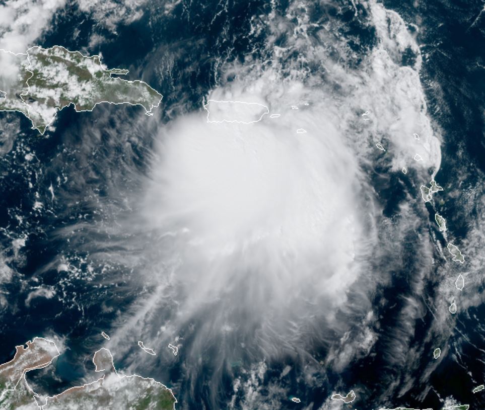
An impressive burst of deep convection is east of the circulation center. It is expected that wind shear will increase and weaken the circulation during the next 48 hours.
For more frequent updates: Twitter:
https://twitter.com/richjohnsonwx
Current tropical weather
As of 5:00 PM AST Karen was centered at 27.2 N / 62.9 W or 370 miles SSE of Bermuda. It was moving NNE at 12 mph. Top sustained winds are estimated at 45 mph. Pressure was estimated at 1005 hPa.
Tropical Weather Forecast:
Karen is forecast weaken well east of the Bahamas for the next several days and may try to move westward after that as an extratropical cyclone.
Tropicast: Visible Satellite

Re: Karen
Posted: Fri Sep 27, 2019 10:23 am
by Tropical Inspector
Friday Midday Update
Karen a depression
The Weather Situation
Karen will dissipate to a remnant low shortly.
For more frequent updates: Twitter:
https://twitter.com/richjohnsonwx
Tropicast: Visible Satellite