Page 1 of 1
Jerry
Posted: Tue Sep 17, 2019 2:17 pm
by Tropical Inspector
Tuesday Afternoon Update
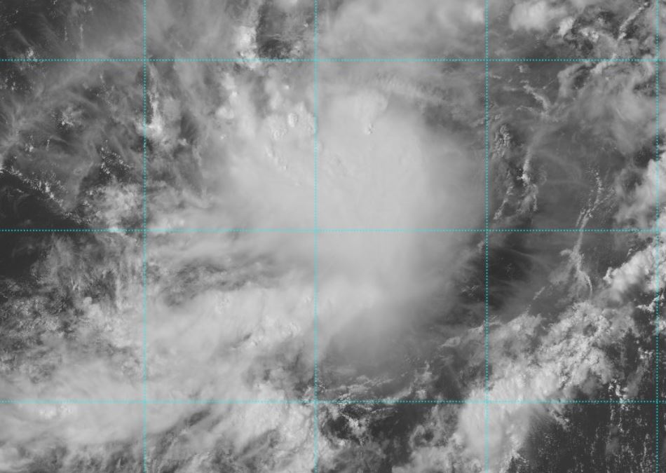
TD 10 forms
The Weather Situation
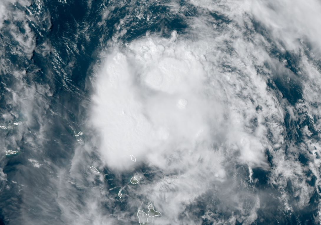
TD 10 has formed in the deep tropics in the central Atlantic. At this point there is little organization of the structure. A burst of deep convection is noted though.
For more frequent updates: Twitter:
https://twitter.com/richjohnsonwx
Current Tropical Weather
As of 11:00 AM AST TD10 was centered at 12.9 N / 44.9 W or 1165 miles ESE of the Leewards. It was moving WNW at 12 mph. Top sustained winds are estimated at 35 mph. Pressure was estimated at 1007 MB.
Tropical Weather Forecast:
TD 10 is forecast to move west then WNW as it approaches the Islands. At this time it is forecast to move just northeast of the Lesser Antilles and east of the Bahamas several days from now.
Tropicast: Visible Satellite
Re: TD10
Posted: Wed Sep 18, 2019 1:49 pm
by Tropical Inspector
Wednesday Afternoon Update
Jerry a little stronger
The Weather Situation
The structure of Jerry is much more impressive today. Outflow is impressive on the south side and banding is now improving.
For more frequent updates: Twitter:
https://twitter.com/richjohnsonwx
Current tropical weather
As of 3:00 PM AST Jerry was centered at 14.7 N / 49.4 W or 800 miles east of the Leeward Islands. It was moving WNW at 14 mph. Top sustained winds are estimated at 50 mph. Pressure was estimated at 1002 hPa.
Tropical Weather Forecast:
Jerry is expected to continue west, then WNW and should be near or just north of the Leewards by Friday. It is currently expected to recurve east of the Bahamas later this weekend. Stay advised of any intensity or track updates.
Tropicast: Visible Satellite
Re: Jerry
Posted: Thu Sep 19, 2019 2:40 pm
by Tropical Inspector
Thursday Afternoon Update
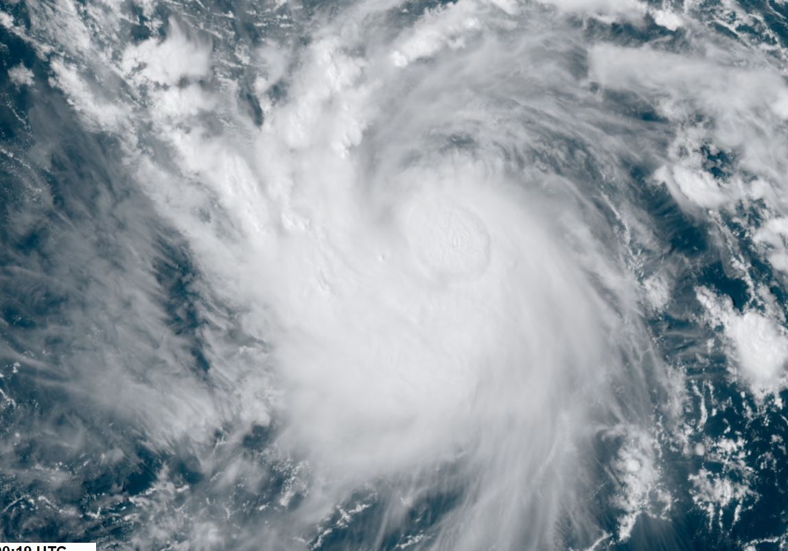
Jerry a hurricane
The Weather Situation
Jerry is steadily strengthening and has become a hurricane. A large plume of dust is closely following the circulation.
For more frequent updates: Twitter:
https://twitter.com/richjohnsonwx
Current tropical weather
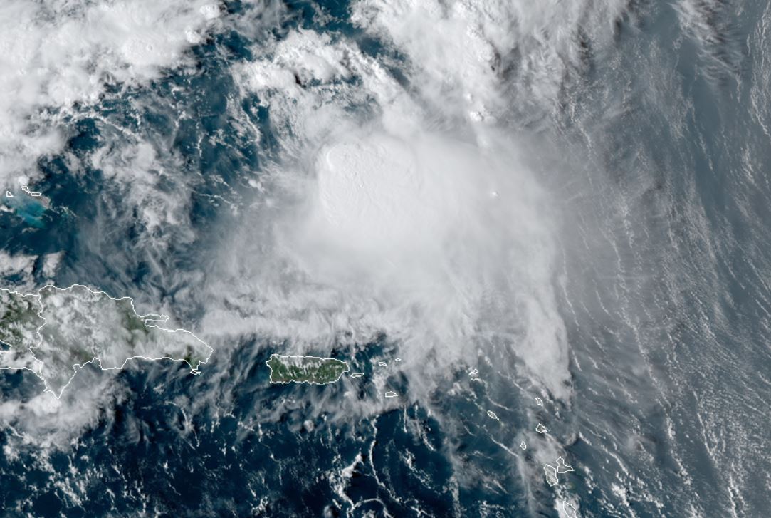
As of 2:00 PM AST Jerry was centered at 17.2 N / 55.2 W or 435 miles east of the Leeward Islands. It was moving WNW at 16 mph. Top sustained winds are estimated at 85 mph. Pressure was estimated at 982 hPa.
Tropical Weather Forecast:
Jerry is expected to continue WNW and should be near or just north of the Leewards by Friday. It is currently expected to recurve east of the Bahamas later this weekend. Stay advised of any intensity or track updates.
Tropicast: Visible Satellite
Re: Jerry
Posted: Fri Sep 20, 2019 8:33 pm
by Tropical Inspector
Friday Night Update
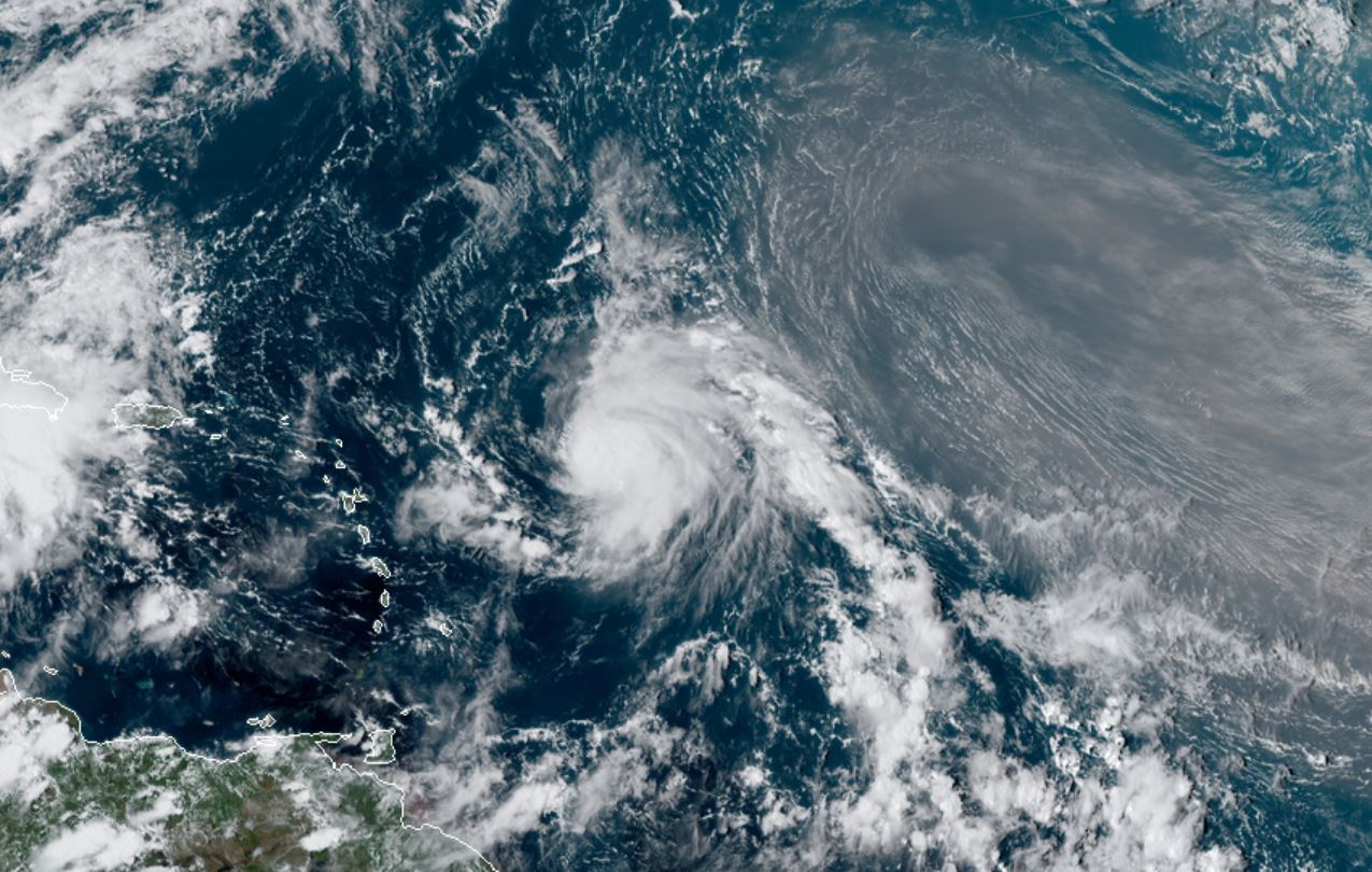
Jerry north of the Leewards
The Weather Situation
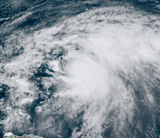
Jerry is still a hurricane. A huge explosion of deep convection has now developed and further strengthening is likely. A few heavy showers are possible over the Leewards tonight, but the heaviest rain will stay north.
For more frequent updates: Twitter:
https://twitter.com/richjohnsonwx
Current tropical weather
As of 8:00 PM AST Jerry was centered at 19.9 N / 62.5 W or 125 miles NNE of Anguilla. It was moving WNW at 17 mph. Top sustained winds are estimated at 80 mph. Pressure was estimated at 991 hPa.
Tropical Weather Forecast:
Jerry is expected to stay well east of the Bahamas. It may pose a threat to Bermuda . Stay advised of any intensity or track updates.
Tropicast: Visible Satellite Friday Afternoon
Re: Jerry
Posted: Sat Sep 21, 2019 3:52 pm
by Tropical Inspector
Saturday Evening Update
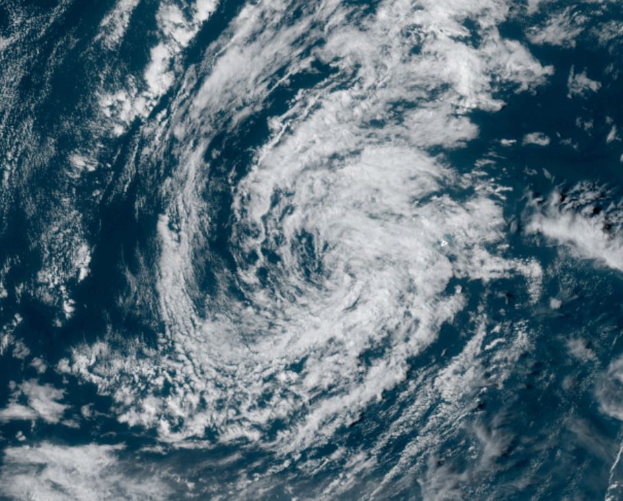
Jerry sheared
The Weather Situation
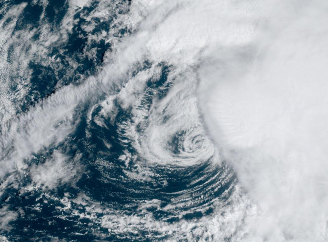
Jerry is badly sheared. Deep convection remains on the southside of the circulation..
For more frequent updates: Twitter:
https://twitter.com/richjohnsonwx
Current tropical weather
As of 5:00 PM AST Jerry was centered at 23.0 N / 65.8 W or 645 miles south of Bermuda. It was moving NW at 14 mph. Top sustained winds are estimated at 65 mph. Pressure was estimated at 1002 hPa.
Tropical Weather Forecast:
Jerry is expected to stay well east of the Bahamas. It may pose a threat to Bermuda Tuesday. Stay advised of any intensity or track updates.
Tropicast: Visible Satellite
Re: Jerry
Posted: Sun Sep 22, 2019 1:50 pm
by Tropical Inspector
Sunday Afternoon Update
Jerry still sheared
The Weather Situation
Satellite still shows that Jerry is fighting shear. Deep convection seems to be more impressive today.
For more frequent updates: Twitter:
https://twitter.com/richjohnsonwx
Current tropical weather
As of 11:00 AM AST Jerry was centered at 25.7 N / 66.6 W or 470 miles SSW of Bermuda. It was moving NNW at 10 mph. Top sustained winds are estimated at 65 mph. Pressure was estimated at 997 hPa.
Tropical Weather Forecast:
Jerry may pose a threat to Bermuda Tuesday. Stay advised of any intensity or track updates.
Tropicast: Visible Satellite
Re: Jerry
Posted: Mon Sep 23, 2019 11:46 am
by Tropical Inspector
Monday Afternoon Update
More shear
The Weather Situation
Satellite still shows that Jerry continues to fight shear. Deep convection seems to be more impressive today.
For more frequent updates: Twitter:
https://twitter.com/richjohnsonwx
Current tropical weather
As of 11:00 AM AST Jerry was centered at 28.1 N / 68.0 W or 345 miles SW of Bermuda. It was moving NNW at 7 mph. Top sustained winds are estimated at 65 mph. Pressure was estimated at 991 hPa.
Tropical Weather Forecast:
Jerry may pose a threat to Bermuda Tuesday. Stay advised of any intensity or track updates.
Tropicast: Visible Satellite
Re: Jerry
Posted: Tue Sep 24, 2019 3:57 pm
by Tropical Inspector
Tuesday Evening Update
Jerry weakens
The Weather Situation
An upper air trough south of Jerry and east of the Bahamas is producing lots of wind shear of the system. 50 mph is generous for Jerry
For more frequent updates: Twitter:
https://twitter.com/richjohnsonwx
Current tropical weather
As of 5:00 PM AST Jerry was centered at 31.1 N / 69.0 W or 260 miles WSW of Bermuda. It was moving north at 6 mph. Top sustained winds are estimated at 50 mph. Pressure was estimated at 992 hPa.
Tropical Weather Forecast:
Jerry may pose a threat to Bermuda Tuesday. Stay advised of any intensity or track updates.
Tropicast: Visible Satellite
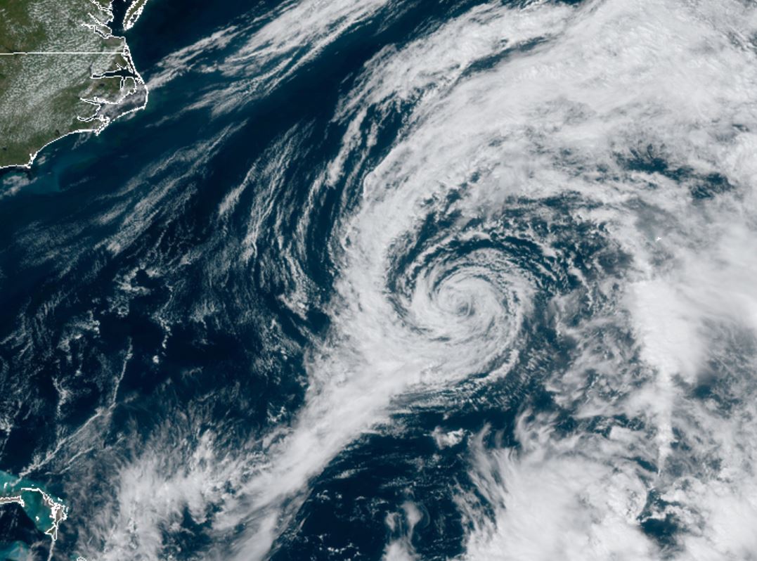
Re: Jerry
Posted: Wed Sep 25, 2019 9:13 pm
by Tropical Inspector
Wednesday Night Update
Jerry is now a remnant low
Tropicast: Visible Satellite