Andrea
Posted: Mon May 20, 2019 7:11 pm
Monday Evening Update
Andrea forms
The Weather Situation
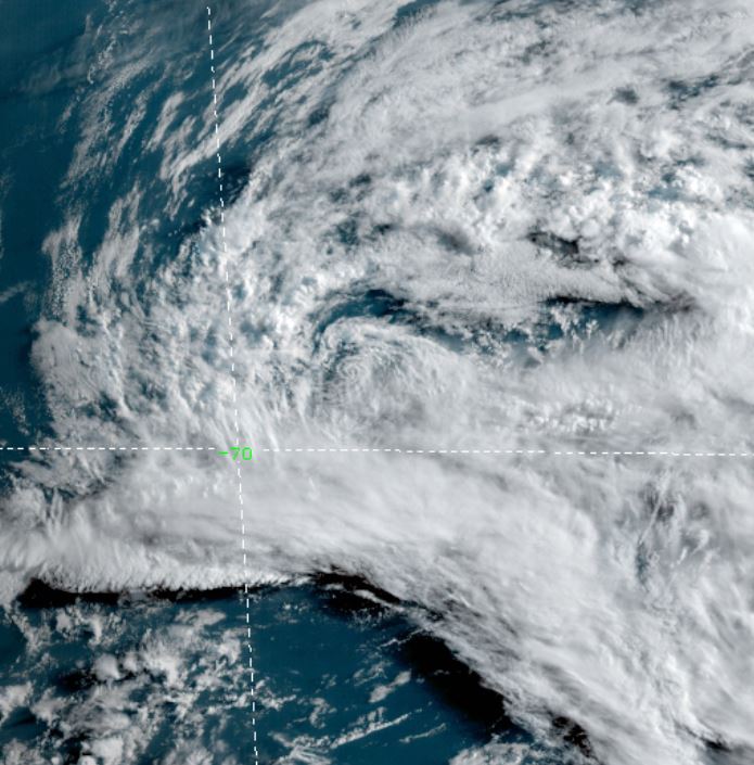
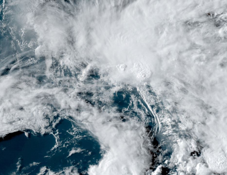
A strong low level circulation is apparent on visible satellite imagery as well as being confirmed by the Hurricane Hunters. The only deep convection is northeast of the center of circulation.
Current Tropical Weather
As of 6:30 PM AST Andrea was centered at 28.8 N / 68.7 W or 335 miles SW of Bermuda. It was moving north at 14 mph. Top sustained winds are estimated at 40 mph. Pressure was estimated at 1006 MB.
Tropical Weather Forecast:
Andrea is forecast to weaken within 24 to 36 hours before reaching Bermuda.
Tropicast: Visible Satellite
Andrea forms
The Weather Situation
A strong low level circulation is apparent on visible satellite imagery as well as being confirmed by the Hurricane Hunters. The only deep convection is northeast of the center of circulation.
Current Tropical Weather
As of 6:30 PM AST Andrea was centered at 28.8 N / 68.7 W or 335 miles SW of Bermuda. It was moving north at 14 mph. Top sustained winds are estimated at 40 mph. Pressure was estimated at 1006 MB.
Tropical Weather Forecast:
Andrea is forecast to weaken within 24 to 36 hours before reaching Bermuda.
Tropicast: Visible Satellite