Franklin

Tropical cyclone archives for the 2017 Atlantic hurricane season
Post Reply
User avatar
Tropical Inspector
Site Admin
Site Admin
Posts: 3581
Joined: Tue Feb 20, 2007 2:28 pm
Antispam: no
Location: Under a palm tree
Contact:

Franklin

Post by Tropical Inspector »

Monday Morning Update

Franklin moving toward Yucatan

The Weather Situation
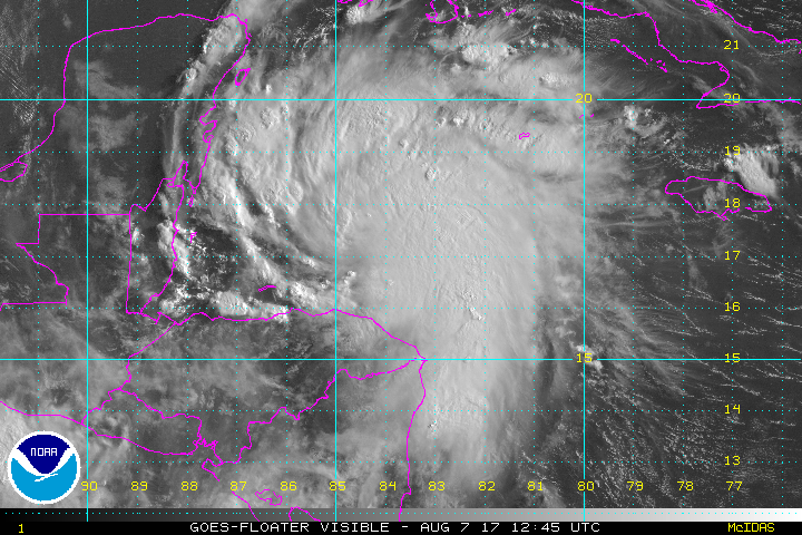
Franklin was named at 11 pm EDT on Sunday night. Convection intensified yesterday afternoon in the western Caribbean. A mid level spin was apparent, but without a low level circulation. Today convection has greatly increased.

Current Tropical Weather
As of 8 AM EDT Tropical Storm Franklin was centered at 17.3 N / 84.7 W or 230 miles east of Belize City. It was moving WNW at 13 mph. Top sustained winds are estimated at 50 mph. Pressure was estimated at 1004 mb.

Tropical Weather Forecast:
Franklin will make landfall overnight tonight on the Yucatan / northern Belize coast. It will weaken over land then reorganize over the Bay of Campeche. It will then make another landfall on the northeast coast of Mexico, well south of southern Texas.

Tropicast: Visible Satellite
Image
Rich Johnson
Twitter: https://twitter.com/richjohnsonwx
Certified Broadcast Meteorologist - Hurricane Expert
User avatar
Tropical Inspector
Site Admin
Site Admin
Posts: 3581
Joined: Tue Feb 20, 2007 2:28 pm
Antispam: no
Location: Under a palm tree
Contact:

Re: Franklin

Post by Tropical Inspector »

Monday Night Update

Franklin nearing Yucatan

The Weather Situation
Franklin will make landfall later tonight. The main threat will be heavy rainfall. There will be some power outages as sustained winds of 60 mph will be seen.

Current Tropical Weather
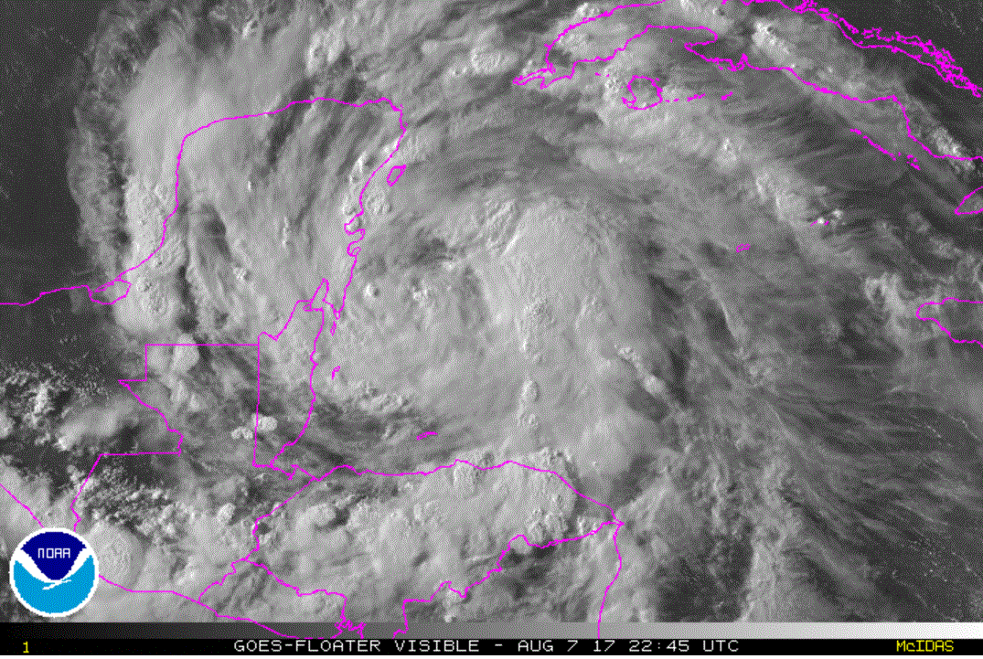
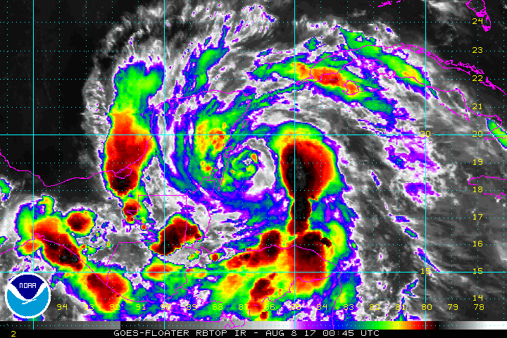
As of 7 PM CDT Tropical Storm Franklin was centered at 18.8 N / 86.5 W or 120 miles east of Chetumal, Mexico. It was moving NW at 13 mph. Top sustained winds are estimated at 60 mph. Pressure was estimated at 995 mb.

Tropical Weather Forecast:
Franklin will make landfall overnight tonight on the Yucatan / northern Belize coast. It will weaken over land then reorganize over the Bay of Campeche. It will then make another landfall on the northeast coast of Mexico, well south of southern Texas.

Tropicast: Visible Satellite - Monday afternoon
Image

Tropicast: IR Satellite
Image
Rich Johnson
Twitter: https://twitter.com/richjohnsonwx
Certified Broadcast Meteorologist - Hurricane Expert
User avatar
Tropical Inspector
Site Admin
Site Admin
Posts: 3581
Joined: Tue Feb 20, 2007 2:28 pm
Antispam: no
Location: Under a palm tree
Contact:

Re: Franklin

Post by Tropical Inspector »

Tuesday Morning Update

Franklin over Yucatan

The Weather Situation
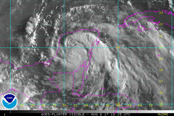
Franklin Is over the Yucatan bringing heavy rainfall across the region. The strongest winds are likely near Cozumel where a strong band continues over the western Caribbean Sea.

Current Tropical Weather
As of 7 AM CDT Tropical Storm Franklin was centered at 19.5 N / 89.1 W or 85 miles NW of Chetumal, Mexico. It was moving WNW at 14 mph. Top sustained winds are estimated at 45 mph. Pressure was estimated at 999 mb.

Tropical Weather Forecast:
Franklin is weakening over land today then will reorganize over the Bay of Campeche late tonight into Wednesday. It will then make another landfall on the northeast coast of Mexico, well south of southern Texas Wednesday night.

Tropicast: Visible Satellite
Image
Rich Johnson
Twitter: https://twitter.com/richjohnsonwx
Certified Broadcast Meteorologist - Hurricane Expert
User avatar
Tropical Inspector
Site Admin
Site Admin
Posts: 3581
Joined: Tue Feb 20, 2007 2:28 pm
Antispam: no
Location: Under a palm tree
Contact:

Re: Franklin

Post by Tropical Inspector »

Tuesday Evening Update

Franklin near west coast

The Weather Situation
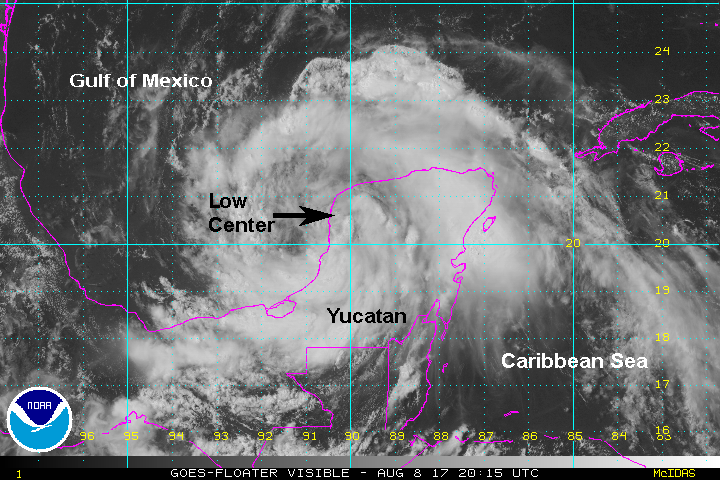
Franklin is about to move into the Bay of Campeche. Restrengthening will begin later tonight.

Current Tropical Weather
As of 4 PM CDT Tropical Storm Franklin was centered at 20.2 N / 90.3 W or 25 miles NNE of Cameche. It was moving WNW at 12 mph. Top sustained winds are estimated at 40 mph. Pressure was estimated at 1001 mb.

Tropical Weather Forecast:
Franklin will reorganize over the Bay of Campeche late tonight into Wednesday. It will then make another landfall on the northeast coast of Mexico, well south of southern Texas Wednesday night.

Tropicast: Visible Satellite
Image
Rich Johnson
Twitter: https://twitter.com/richjohnsonwx
Certified Broadcast Meteorologist - Hurricane Expert
User avatar
Tropical Inspector
Site Admin
Site Admin
Posts: 3581
Joined: Tue Feb 20, 2007 2:28 pm
Antispam: no
Location: Under a palm tree
Contact:

Re: Franklin

Post by Tropical Inspector »

Wednesday Morning Update

Franklin almost a hurricane

The Weather Situation
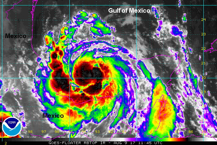
Franklin is over the Bay of Campeche and is strengthening steadily. It will almost certainly be classified as a hurricane on the next advisory. Deep convection is exploding around the center of circulation as well as in the spiral bands.

Current Tropical Weather
As of 7 AM CDT Tropical Storm Franklin was centered at 20.2 N / 93.4 W or 195 miles ENE of Verracruz, Mexico. It was moving west at 13 mph. Top sustained winds are estimated at 70 mph. Pressure was estimated at 987 mb.

Tropical Weather Forecast:
Franklin will make landfall on the northeast coast of Mexico near midnight, well south of southern Texas Wednesday night. The main hazards are flooding from 15"+ of rainfall, strong damaging winds to hurricane force which will disrupt power, and a storm surge of 2-4' near where the center makes landfall and to the north of the center.

Tropicast: Enhanced IR Satellite
Image
Rich Johnson
Twitter: https://twitter.com/richjohnsonwx
Certified Broadcast Meteorologist - Hurricane Expert
User avatar
Tropical Inspector
Site Admin
Site Admin
Posts: 3581
Joined: Tue Feb 20, 2007 2:28 pm
Antispam: no
Location: Under a palm tree
Contact:

Re: Franklin

Post by Tropical Inspector »

Wednesday Night Update

Franklin approaching Mexican coast

The Weather Situation
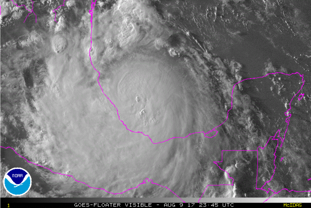
Franklin has strengthened today, but will soon reach peak as landfall is only a few hours away. It was upgraded to hurricane strength at 5 pm EDT.

Current Tropical Weather
As of 7 PM CDT Hurricane Franklin was centered at 20.2 N / 95.4 W or 90 miles NE of Veracruz, Mexico. It was moving west at 12 mph. Top sustained winds are estimated at 85 mph. Pressure was estimated at 983 mb.

Tropical Weather Forecast:
Franklin will make landfall in a few hours. It may restrengthen in the Eastern Pacific in a few days. The main hazards are flooding from 15"+ of rainfall, strong damaging winds to hurricane force which will disrupt power, and a storm tides of 4-6' near where the center makes landfall and to the north of the center.

Tropicast: Visible Satellite
Image
Rich Johnson
Twitter: https://twitter.com/richjohnsonwx
Certified Broadcast Meteorologist - Hurricane Expert
Post Reply

Return to “2017 Atlantic Hurricane Season Archives”

Who is online

Users browsing this forum: No registered users and 1 guest