Page 1 of 1
Colin
Posted: Sat Jun 04, 2016 11:48 am
by Tropical Inspector
Saturday Afternoon Update
Tropical development likely
The Weather Situation
A tropical disturbance is in the western Caribbean Sea. A tropical depression or storm is possible over the eastern Gulf of Mexico on Monday. It will be fighting wind shear so development may be hampered.
Current Tropical Weather
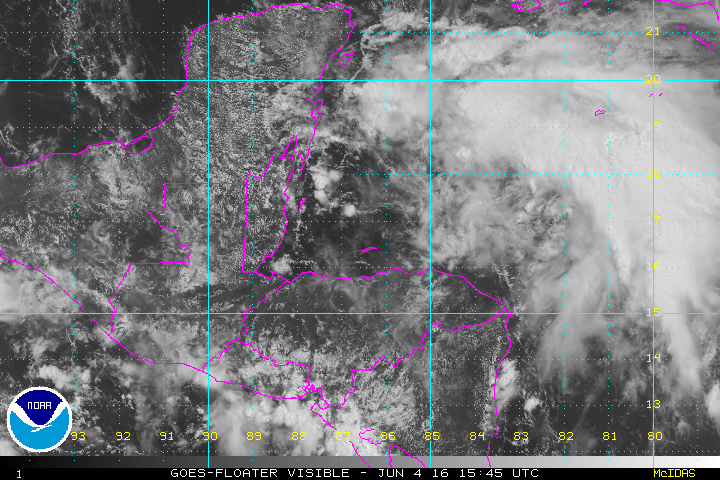
As of 11 AM EDT the tropical disturbance is centered southeast of the Yucatan with a large area of heavy, disorganized convection.
Tropical Weather Forecast:
There is a good chance for tropical development with Monday being the day with greatest potential. A depression is likely to form Sunday night or Monday morning north of the Yucatan. The low has the chance of becoming a tropical storm as it moves northeast toward the west-central coast of Florida. Landfall is expected by Monday night. The low will rapidly move across northeast Florida and off of the Southeast coast on Tuesday.
Tropicast: Visible Satellite
Re: Colin
Posted: Sun Jun 05, 2016 12:01 pm
by Tropical Inspector
Sunday Afternooon Update
TD3 will likely be upgraded by tonight
The Weather Situation
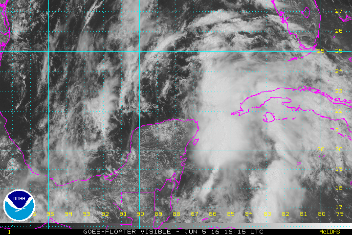
TD 3 has formed just north of the Yucatan peninsula. At this time visible satellite imagery shows a rather weak circulation. Deep convection has built to the southeast of the low over the Yucatan channel.
Current Tropical Weather
As of 11 AM EDT Tropical Depression 3 was centered at 21.9 N /88.1 W or 550 miles SW of Tampa, Florida. It was moving north at about 8 mph. Top sustained winds are estimated at 35 mph (NHC). Pressure was estimated at 1005 mb.
Tropical Weather Forecast:
Tropical depression 3 (Colin) will move northeast to the northeast Gulf and make landfall by Monday evening somewhere near Cedar Key, Florida. Upper air wind shear will inhibit development, so this system will likely stay as a tropical storm. The main effect will be additional heavy rainfall to the east of the circulation over the peninsula of Florida. Colin will rapidly move east of the Carolinas on Tuesday.
Tropicast: Visible Satellite
Re: Colin
Posted: Mon Jun 06, 2016 1:25 pm
by Tropical Inspector
Monday Afternoon Update
Colin heading toward Big Bend of Florida
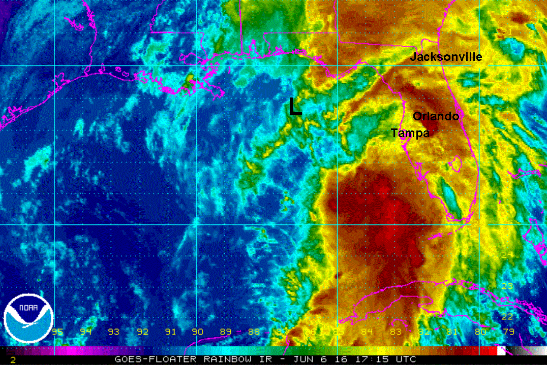
The Weather Situation
Colin was upgraded to a tropical storm as expected last evening. A hurricane hunter found one small area where tropical storm force winds were located.
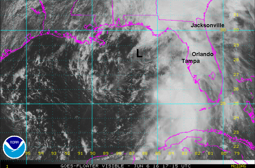
Today Colin remains a very disorganized storm. The low center is very broad south of the Florida Panhandle. The low center resembles more a trough as the low level circulation is difficult to discern. Strong upper air winds will keep Colin from strengthening significantly as it makes landfall this evening. Landfall will not be much a noticeable event as much of the "weather" is well to the east and north.
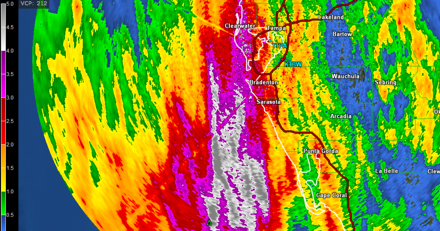
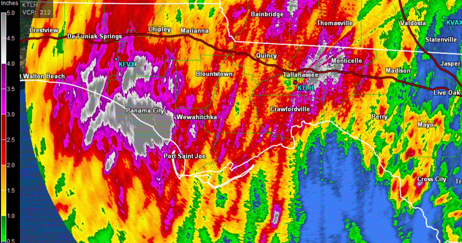
Heavy rainfall has been estimated / reported across the Florida panhandle as a stalled front is interacting with the circulation of Colin. Rainfall amounts are from 1-5" with 5" being reported in Tallahassee. Doppler has indicated heavy rainfall over the peninsula with the heaviest still offshore of Tampa. This heavy rainfall is associated with deep tropical moisture from Colin.
Current Tropical Weather
As of 2 PM EDT Colin was centered at 27.7 N /86.5 W or 165 miles SSW of Apalachicola, FL / 245 miles west of Tampa, FL. It was moving NNE at about 17 mph. Top sustained winds are estimated at 50 mph (NHC). Pressure was estimated at 1004 mb.
Tropical Weather Forecast:
Colin will race across the Big Bend of Florida tonight with the center of circulation near Charleston, SC by Tuesday morning and east of Cape Hatteras later in the day. The rapid speed will limit precipitation amounts despite more than 5" falling in some locations.
Tropicast: Visible Satellite
 Tropicast: IR Satellite
 Tropicast: Rainfall Estimate
 Tropicast: Rainfall Estimate