Carlos

Tropical cyclone archives of the 2015 eastern and central Pacific hurricane season
Post Reply
User avatar
Tropical Inspector
Site Admin
Site Admin
Posts: 3581
Joined: Tue Feb 20, 2007 2:28 pm
Antispam: no
Location: Under a palm tree
Contact:

Carlos

Post by Tropical Inspector »

Thursday Morning Update

3-E not organizing yet

The Weather Situation
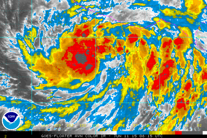
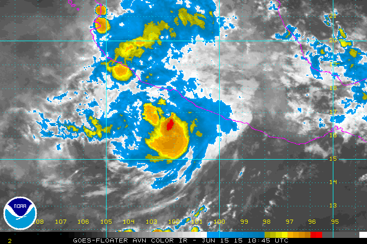
An area of heavy showers and storms is centered south of Mexico associated with tropical depression 3-E. Even though a large area of storms exists, no banding is evident at this time. Heavy thundershowers remain mostly just offshore to the south. Surf will gradually build over the next few days.

Current Tropical Weather
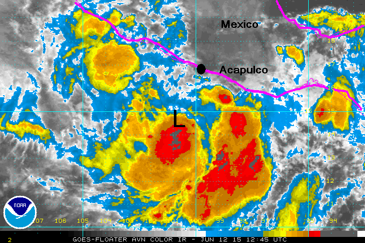
As of 5 AM EDT Tropical Depression 3-E was centered at 13.1.5N / 100.2 W or about 265 miles south of Acapulco, Mexico. It was moving NW at 8 mph. Top sustained winds are estimated at 35 mph. Pressure was estimated at 1002 mb.

Tropical Weather Forecast:
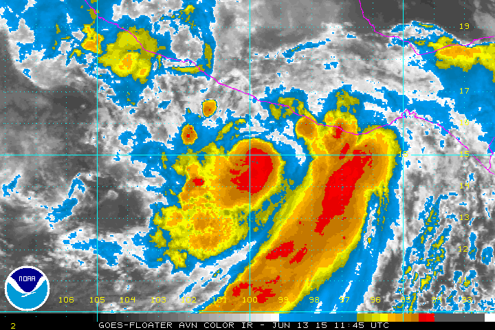
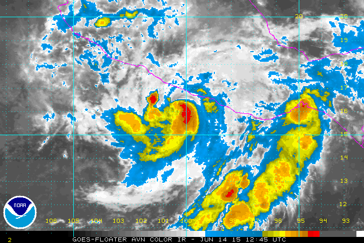
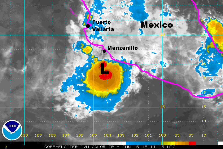
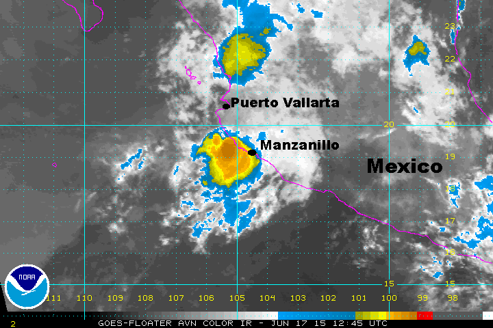
3-E is expected to become a tropical storm (Carlos) during the next 12-24 hour then strengthen into a hurricane. Forecast models take this system parallel to the west coast offshore. It will be close enough for rain bands to effect the coast.

Tropicast: Pacific IR Satellite
Image
Rich Johnson
Twitter: https://twitter.com/richjohnsonwx
Certified Broadcast Meteorologist - Hurricane Expert
User avatar
Tropical Inspector
Site Admin
Site Admin
Posts: 3581
Joined: Tue Feb 20, 2007 2:28 pm
Antispam: no
Location: Under a palm tree
Contact:

Re: Carlos

Post by Tropical Inspector »

Friday Morning Update

Carlos disorganized

The Weather Situation
An area of heavy showers and storms remain relatively disorganized. Some heavy thundershowers will venture onto the southwest coast of Mexico with the heaviest storms remaining offshore.

Current Tropical Weather
As of 8 AM EDT Tropical storm Carlos was centered at 14.7N / 100.8 W or about 165 miles SSW of Acapulco, Mexico. It was stationary. Top sustained winds are estimated at 60 mph. Pressure was estimated at 997 mb.

Tropical Weather Forecast:
Carlos is expected to become a hurricane and parallel the west coast of Mexico over the next several days. The center of circulation should remain between 100-200 to the west of the coast. It will be close enough for rain bands to effect the coast.

Tropicast: Pacific IR Satellite
Image
Rich Johnson
Twitter: https://twitter.com/richjohnsonwx
Certified Broadcast Meteorologist - Hurricane Expert
User avatar
Tropical Inspector
Site Admin
Site Admin
Posts: 3581
Joined: Tue Feb 20, 2007 2:28 pm
Antispam: no
Location: Under a palm tree
Contact:

Re: Carlos

Post by Tropical Inspector »

Saturday Morning Update

Carlos changes little

The Weather Situation
Carlos has a relatively small central dense overcast - where the ball of heavy showers are near the center of the low. An impressive band is east of the center with some heavy showers on the coast. it is being affected by moderate northerly wind shear from a high is pressure area over northwestern Mexico. This shear is keeping Carlos from developing. At this time, I'm thinking the top sustained winds are a little lower than the official 70 mph estimate from NHC

Current Tropical Weather
As of 8 AM EDT Tropical storm Carlos was centered at 14.8N / 100.2 W or about 145 miles south of Acapulco, Mexico. It was stationary. Top sustained winds are estimated at 70 mph. Pressure was estimated at 992 mb.

Tropical Weather Forecast:
Carlos is expected to become a minimal hurricane and parallel the west coast of Mexico over the next several days. The center of circulation should remain between 75-150 miles to the west of the coast. The closest pass to the coast will be near Cabo Corrientes late Monday. It will be close enough for rain bands to affect the coast as well as rough surf.

Tropicast: Pacific IR Satellite
Image
Rich Johnson
Twitter: https://twitter.com/richjohnsonwx
Certified Broadcast Meteorologist - Hurricane Expert
User avatar
Tropical Inspector
Site Admin
Site Admin
Posts: 3581
Joined: Tue Feb 20, 2007 2:28 pm
Antispam: no
Location: Under a palm tree
Contact:

Re: Carlos

Post by Tropical Inspector »

Sunday Morning Update

Carlos officially a minimal hurricane

The Weather Situation
Carlos does not appear to be a hurricane per the official NHC advisory. Satellite imagery shows that the western side the of circulation has weakened. IMO, Carlos is a strong tropical storm with some gusts to hurricane force on the eastern side of the circulation. Heavy rainfall, high surf and strong winds will be seen near where the center of circulation moves onshore.

Current Tropical Weather
As of 8 AM EDT Hurricane Carlos was centered at 15.8N / 100.3 W or about 80 miles SSW of Acapulco, Mexico. It was stationary. Top sustained winds are estimated at 65 mph (75 mph NHC). Pressure was estimated at 983 mb.

Tropical Weather Forecast:
Forecast models have shifted eastward over the past 24 hours. The official NHC forecast takes Carlos inland near Manzanillo by late Monday night. Recent satellite imagery shows that Carlos may move inland before that time as it appears to be closer to land than the models indicate.

Tropicast: Pacific IR Satellite
Image
Rich Johnson
Twitter: https://twitter.com/richjohnsonwx
Certified Broadcast Meteorologist - Hurricane Expert
User avatar
Tropical Inspector
Site Admin
Site Admin
Posts: 3581
Joined: Tue Feb 20, 2007 2:28 pm
Antispam: no
Location: Under a palm tree
Contact:

Re: Carlos

Post by Tropical Inspector »

Monday Morning Update

Carlos officially a minimal hurricane

The Weather Situation
Carlos continues to have a poor appearance on satellite imagery. Northerly wind shear is keeping the heaviest showers and storms offshore on the southern side of the circulation. It does not appear to be a hurricane IMO.

Current Tropical Weather
As of 5 AM EDT Tropical Storm Carlos was centered at 16.7 N / 101.8 W or about 95 miles SSE of Lazaro Cardenas, Mexico. It was moving WNW at 6 mph. Top sustained winds are estimated at 60 mph (70 mph NHC). Pressure was estimated at 988 mb.

Tropical Weather Forecast:
Forecast models have now stabilized. Landfall will still likely occur Tuesday night near Lazaro Cardenas, but Carlos will stay closer to the coast. It is expected to make landfall as a tropical storm and weaken further.

Tropicast: Pacific IR Satellite
Image
Rich Johnson
Twitter: https://twitter.com/richjohnsonwx
Certified Broadcast Meteorologist - Hurricane Expert
User avatar
Tropical Inspector
Site Admin
Site Admin
Posts: 3581
Joined: Tue Feb 20, 2007 2:28 pm
Antispam: no
Location: Under a palm tree
Contact:

Re: Carlos

Post by Tropical Inspector »

Tuesday Morning Update

Carlos remains offshore

The Weather Situation
Carlos is moving parallel to the coast. The heaviest rainfall remains offshore. Even though the satellite impression has improved this morning, it still does not appear to be a hurricane IMO.

Current Tropical Weather
As of 8 AM EDT Tropical Storm Carlos was centered at 17.4 N / 104.0 W or about 115 miles south of Manzanillo, Mexico. It was moving WNW at 6 mph. Top sustained winds are estimated at 70 mph (75 mph NHC). Pressure was estimated at 989 mb.

Tropical Weather Forecast:
Forecast models have reverted to their original solution a few days ago keeping Carlos just offshore. It is now forecast to dissipate northwest of Cabo Corrientes - offshore.

Tropicast: Pacific IR Satellite
Image
Rich Johnson
Twitter: https://twitter.com/richjohnsonwx
Certified Broadcast Meteorologist - Hurricane Expert
User avatar
Tropical Inspector
Site Admin
Site Admin
Posts: 3581
Joined: Tue Feb 20, 2007 2:28 pm
Antispam: no
Location: Under a palm tree
Contact:

Re: Carlos

Post by Tropical Inspector »

Wednesday Morning Update

Carlos making landfall

The Weather Situation
Carlos has veered east toward land in its weakened state. A small ball of heavy showers remains with the low between Manzanillo and Cabo Corrientes. Locally heavy rainfall can still be expected near the low center today as it drifts inland south of Cabo Corrientes.

Current Tropical Weather
As of 8 AM EDT Tropical Storm Carlos was centered at 19.4 N / 105.1 W or about 10 miles south of Playa Perula, Mexico. It was moving NNW at 9 mph. Top sustained winds are estimated at 45 mph. Pressure was estimated at 1000 mb.

Tropical Weather Forecast:
Forecast models have performed very poorly on correctly predicting the path of Carlos. Carlos is is now making landfall and will be only a tropical depression shortly.

Tropicast: Pacific IR Satellite
Image
Rich Johnson
Twitter: https://twitter.com/richjohnsonwx
Certified Broadcast Meteorologist - Hurricane Expert
Post Reply

Return to “2015 Eastern / Central Hurricane Season Archives”

Who is online

Users browsing this forum: No registered users and 1 guest