Raymond

Tropical cyclone archives of the 2013 eastern and central Pacific hurricane season
Post Reply
User avatar
Tropical Inspector
Site Admin
Site Admin
Posts: 3581
Joined: Tue Feb 20, 2007 2:28 pm
Antispam: no
Location: Under a palm tree
Contact:

Raymond

Post by Tropical Inspector »

Tuesday Morning Update

Raymond stalled offshore

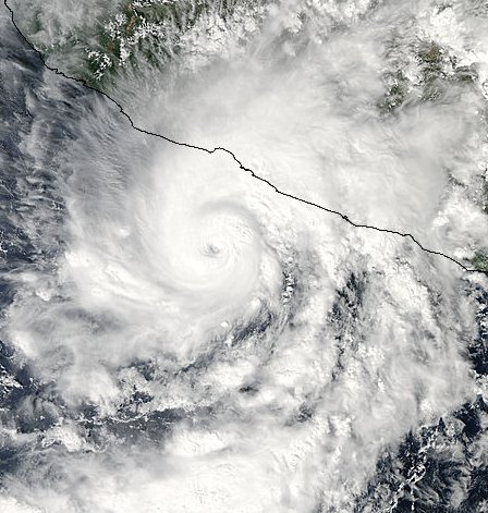
Hurricane Raymond's winds peaked at 125 mph yesterday afternoon. The hurricane center has dropped winds to 115 mph which is still a minimal category 3 hurricane. The IR imagery below shows the drastic change in the eye structure. Because of this, my estimate is considerably lower than the official estimate of sustained winds. A recon is scheduled later today and I suspect that NHC will drop their winds lower with the official confirmation.

Rainfall of over 10-15 inches is possible, especially in the mountains just inland. High swell will continue.

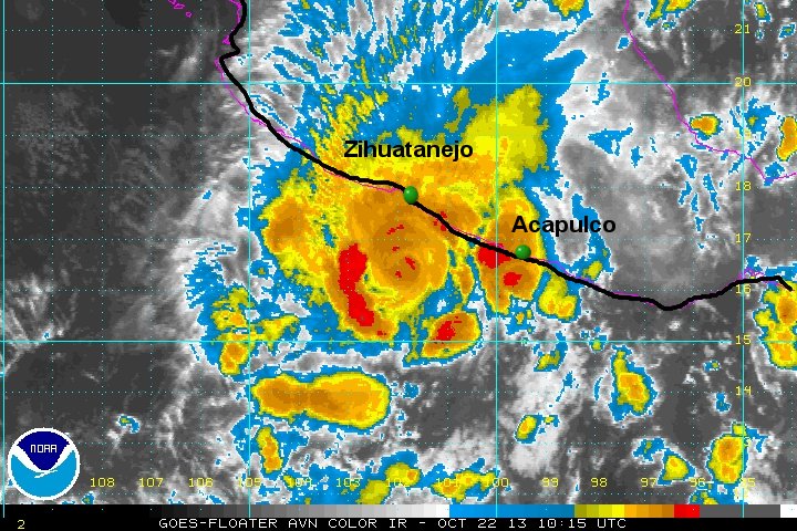
As of 2 am pdt (5 am edt) Raymond was centered near 16.5 N / 102.0 W or about 85 miles SSW of Zihuatanejo, Mexico. Movement is stationary. Top sustained winds are estimated at 100 mph (NHC 115 mph / 2 am pdt advisory). Pressure is estimated at 959 mb.

Forecast:
Raymond should continue to slowly weaken and drift farther to the west out to sea during the next 24-48 hours. :!: Note: conditions on the coast could deteriorate if Raymond jogs only slightly farther to the east.

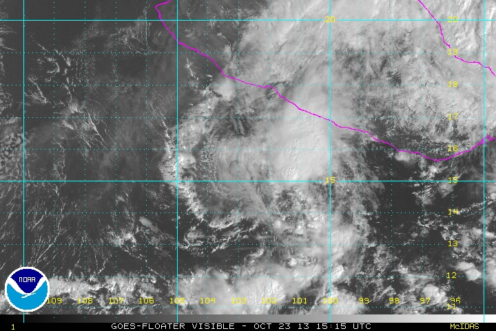
Tropicast: Pacific Visible Satellite Monday Afternoon
Image

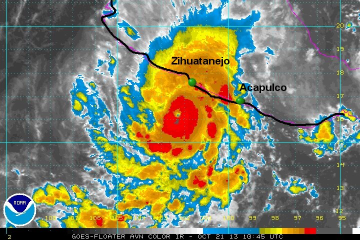
Tropicast: Pacific IR Satellite Monday Afternoon
Image

Tropicast: Pacific IR Satellite Tuesday Morning
Image
Rich Johnson
Twitter: https://twitter.com/richjohnsonwx
Certified Broadcast Meteorologist - Hurricane Expert
User avatar
Tropical Inspector
Site Admin
Site Admin
Posts: 3581
Joined: Tue Feb 20, 2007 2:28 pm
Antispam: no
Location: Under a palm tree
Contact:

Re: Raymond

Post by Tropical Inspector »

NHC dropped winds from 115 mph to 90 mph. They were waiting for the recon to drop the winds. This more closely matches my 100 mph estimate at 5 am edt. The eye is trying to reappear with good banding. The 90 mph estimate looks good now.
Rich Johnson
Twitter: https://twitter.com/richjohnsonwx
Certified Broadcast Meteorologist - Hurricane Expert
User avatar
Tropical Inspector
Site Admin
Site Admin
Posts: 3581
Joined: Tue Feb 20, 2007 2:28 pm
Antispam: no
Location: Under a palm tree
Contact:

Re: Raymond

Post by Tropical Inspector »

Wednesday Afternoon Update

Raymond weakening offshore

Visible satellite imagery shows that the deep convection associated with Raymond has been stripped away from its circulation. Because of this, my estimate is much lower than the official NHC estimate.


As of 8 am pdt (11am edt) Raymond was centered near 15.4 N / 103.0 W or about 185 miles SSW of Zihuatanejo, Mexico. Movement is WSW at 8 mph. Top sustained winds are estimated at 40 mph (NHC 60 mph / 8 am pdt advisory). Pressure is estimated at 996 mb.

Forecast:
Raymond should continue to slowly weaken and drift farther to the west out to sea during the next 24-48 hours.

Tropicast: Pacific Visible Satellite
Image
Rich Johnson
Twitter: https://twitter.com/richjohnsonwx
Certified Broadcast Meteorologist - Hurricane Expert
Post Reply

Return to “2013 Eastern / Central Pacific Hurricane Season Archives”

Who is online

Users browsing this forum: No registered users and 1 guest