|
|
Hurricane Pictures
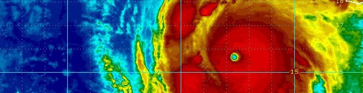
For those interested in hurricane study, browse our collection of pictures of hurricanes from a satellite perspective. Hurricanes are large weather systems. On average, they are approximately 300 to 400 miles wide. It takes a satellite from space to capture the full scope of this magnificent and many times very dangerous tropical cyclone.
The first satellite images that were of any real use for tracking hurricanes were from the late 1960's. You will notice the technological advances in the quality of the images as you compare hurricane pictures from past decades to the present. GOES 16 and 17 now offers high quality imagery of hurricanes. Some of the more notable hurricanes of the past several decades are listed. They include Hurricane Camille, Hurricane Andrew, Hurricane Katrina and many more. Meteorologists study pictures of hurricanes by using the Dvorak technique. Hurricanes follow patterns of development that can be seen from a satellite image. These hurricane pictures can relate the developmental stage that the tropical storm or hurricane is undergoing. Other information such as Hurricane Hunter and radar data are also used to acertain hurricane structure and strength. The hurricane pictures that are shown are generally of hurricanes in a mature stage.
- Hurricane Pictures 2024
Including Hurricane Beryl, Hurricane Helene, Hurricane Milton
- Hurricane Pictures 2023
Including Hurricane Idalia, Hurricane Lee, Hurricane Franklin
- Hurricane Pictures 2022
Including Hurricane Fiona, Hurricane Ian
- Hurricane Pictures 2021
Including Hurricane Ida
- Hurricane Pictures 2020
Including Hurricane Hanna, Hurricane Isaias, Hurricane Laura, Hurricane Paulette, Hurricane Sally, Hurricane Delta, Hurricane Zeta
- Hurricane Pictures 2019
Including Hurricane Dorian, Hurricane Humberto, Hurricane Lorenzo
- Hurricane Pictures 2018
Including Hurricane Florence, Hurricane Michael
- Hurricane Pictures 2017
Including Hurricane Harvey, Hurricane Irma, Hurricane Maria
- Hurricane Pictures 2016
Including Hurricane Matthew
- Hurricane Pictures 2015
- Hurricane Pictures 2014
- Hurricane Pictures 2013
- Hurricane Pictures 2012
Including Hurricane Michael, Hurricane Sandy
- Hurricane Pictures 2011
Including Hurricane Irene, Hurricane Katia, Hurriane Ophelia
- Hurricane Pictures 2010
Including Hurricane Alex, Hurricane Danielle, Hurricane Earl, Hurricane Igor, Hurricane Karl, Hurricane Richard, Hurricane Tomas
- Hurricane Pictures 2009
Including Hurricane Bill, Hurricane Fred, Hurricane Ida
- Hurricane Pictures 2008
Including Hurricane Ike, Hurricane Omar, Hurricane Paloma
- Hurricane Pictures 2007
Including Hurricane Dean, Felix
- Hurricane Pictures 2006
- Hurricane Pictures 2005
Including Hurricane Dennis, Hurricane Katrina, Hurricane Rita, Hurricane Wilma
- Hurricane Pictures 2004
Including Hurricane Charley, Hurricane Frances, Hurricane Ivan, Hurricane Jeanne
- Hurricane Pictures 2003
Including Hurricane Isabel
- Hurricane Pictures 2002
- Hurricane Pictures 2001
- Hurricane Pictures 2000
Including Hurricane Keith
- Hurricane Pictures 1990's
Including Hurricane Andrew, Hurricane Bertha, Hurricane Fran, Hurricane Floyd, Hurricane Georges, Hurricane Mitch
- Hurricane Pictures 1969-1989
Including Hurricane Allen, Hurricane Camille, Hurricane David, Hurricane Frederick, Hurricane Hugo
Return to the Tropicalweather.net Home Page.
|
|
|
|
|