Page 1 of 1
Kay
Posted: Sun Sep 04, 2022 4:54 pm
by Tropical Inspector
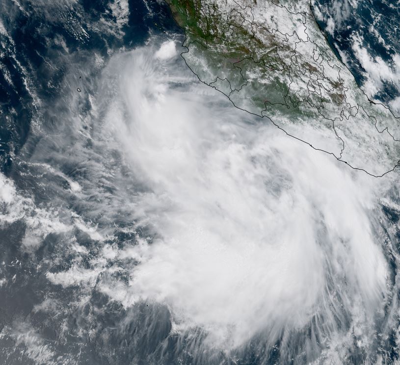
Sunday Late Afternoon Update
Kay has a large circulation
Kay will continue to strengthen west of western Mexico and bring the threat of tropical storm wind gusts to the SW coast of Mexico. In addition, locally heavy rainfall and rough surf will be experienced in the same area.
SUMMARY OF 400 PM CDT...2100 UTC...INFORMATION
----------------------------------------------
LOCATION...14.8N 102.5W
ABOUT 225 MI...365 KM SW OF ACAPULCO MEXICO
MAXIMUM SUSTAINED WINDS...40 MPH...65 KM/H
PRESENT MOVEMENT...WNW OR 290 DEGREES AT 13 MPH...20 KM/H
MINIMUM CENTRAL PRESSURE...1004 MB...29.65 INCHES
Tropicast: Visible Satellite
 Tropical Weather Forecast:
Kay will continue to strengthen as it moves NNW and possibly affect the western Baja as a hurricane several days from now.
Re: Kay
Posted: Mon Sep 05, 2022 5:09 pm
by Tropical Inspector
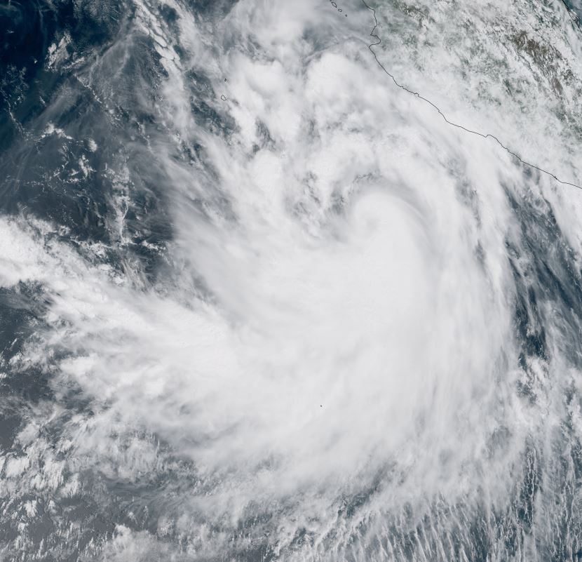
Monday Late Afternoon Update
Kay now a hurricane
Kay has steadily organized over the past 24 hours. The deepest convection is south of the circulation center well offshore of western Mexico. Some outer rain bands are bringing heavy rainfall to the western coast.
SUMMARY OF 300 PM MDT...2100 UTC...INFORMATION
----------------------------------------------
LOCATION...15.6N 107.3W
ABOUT 305 MI...495 KM SW OF MANZANILLO MEXICO
ABOUT 530 MI...855 KM SSE OF THE SOUTHERN TIP OF BAJA CALIFORNIA
MAXIMUM SUSTAINED WINDS...80 MPH...130 KM/H
PRESENT MOVEMENT...WNW OR 295 DEGREES AT 10 MPH...17 KM/H
MINIMUM CENTRAL PRESSURE...981 MB...28.97 INCHES
Tropicast: Visible Satellite
 Tropical Weather Forecast:
Kay will affect the southern Baja with possibly hurricane conditions in a few days and other areas of the Baja later this week.
Re: Kay
Posted: Tue Sep 06, 2022 2:40 pm
by Tropical Inspector
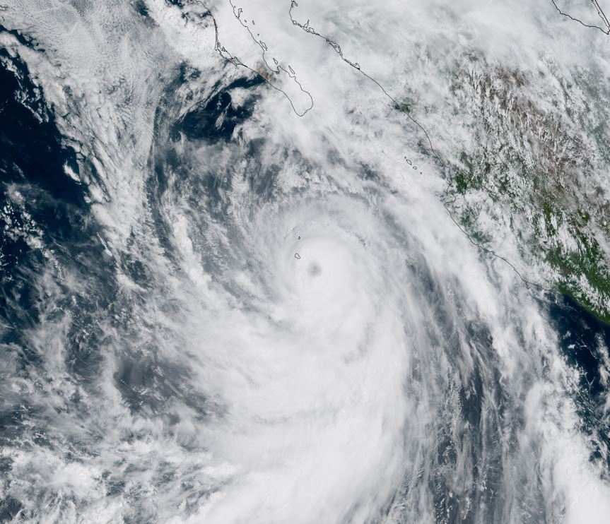
Tuesday Afternoon Update
Kay strengthening
Kay continues to organize this afternoon, with most of the deep convection offshore of western Mexico. Some heavy rainbands will affect the coast. The eye is now clearly visible and rapid deepening is possible.
SUMMARY OF 1200 PM MDT...1800 UTC...INFORMATION
-----------------------------------------------
LOCATION...18.4N 110.5W
ABOUT 320 MI...515 KM SSW OF THE SOUTHERN TIP OF BAJA CALIFORNIA
MAXIMUM SUSTAINED WINDS...85 MPH...140 KM/H
PRESENT MOVEMENT...NW OR 315 DEGREES AT 14 MPH...22 KM/H
MINIMUM CENTRAL PRESSURE...977 MB...28.85 INCHES
Tropicast: Visible Satellite
 Tropical Weather Forecast:
Kay will affect the southwest and west central Baja with heavy rainfall, possible hurricane force winds and rough surf.
Re: Kay
Posted: Wed Sep 07, 2022 3:12 pm
by Tropical Inspector
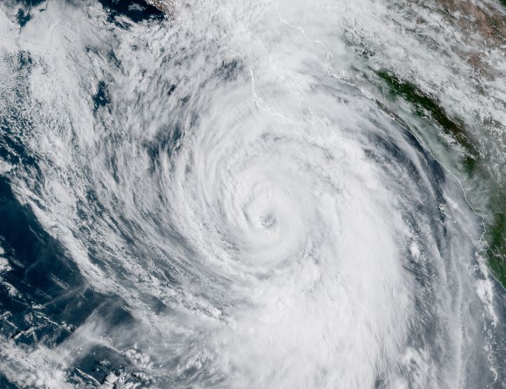
Wednesday Afternoon Update
Kay is WSW of the southern Baja
Rain bands are now affecting the Baja. The core of the hurricane is well offshore at this time. A Hurricane Hunter is in Kay reporting winds of about 90 knots or close to the official 105 mph estimate.
SUMMARY OF 1200 PM MDT...1800 UTC...INFORMATION
-----------------------------------------------
LOCATION...21.4N 112.8W
ABOUT 210 MI...340 KM SW OF THE SOUTHERN TIP OF BAJA CALIFORNIA
MAXIMUM SUSTAINED WINDS...105 MPH...165 KM/H
PRESENT MOVEMENT...NNW OR 330 DEGREES AT 12 MPH...19 KM/H
MINIMUM CENTRAL PRESSURE...971 MB...28.67 INCHES
Tropicast: Visible Satellite
 Tropical Weather Forecast:
Heavy rain will move up the Baja peninsula into possibly southern California over the next few days. The best chance for experiencing hurricane conditions will be on the west central Baja Thursday afternoon and evening.
Re: Kay
Posted: Thu Sep 08, 2022 2:10 pm
by Tropical Inspector
Thursday Afternoon Update
Kay near landfall
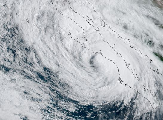
Kay looks disorganized on satellite imagery and may not be a hurricane, but a strong tropical storm.
SUMMARY OF 1200 PM MDT...1800 UTC...INFORMATION
-----------------------------------------------
LOCATION...26.6N 114.1W
ABOUT 110 MI...175 KM SE OF PUNTA EUGENIA MEXICO
ABOUT 175 MI...280 KM NW OF CABO SAN LAZARO MEXICO
MAXIMUM SUSTAINED WINDS...80 MPH...130 KM/H
PRESENT MOVEMENT...NNW OR 345 DEGREES AT 15 MPH...24 KM/H
MINIMUM CENTRAL PRESSURE...979 MB...28.91 INCHES
Tropicast: Visible Satellite
 Tropical Weather Forecast:
Heavy rain will move up the Baja peninsula into possibly southern California over the next few days. The best chance for experiencing hurricane conditions will be on the west central Baja this afternoon and evening.
Re: Kay
Posted: Fri Sep 09, 2022 4:36 pm
by Tropical Inspector
Friday Late Afternoon Update
Heavy rain moving north into Socal
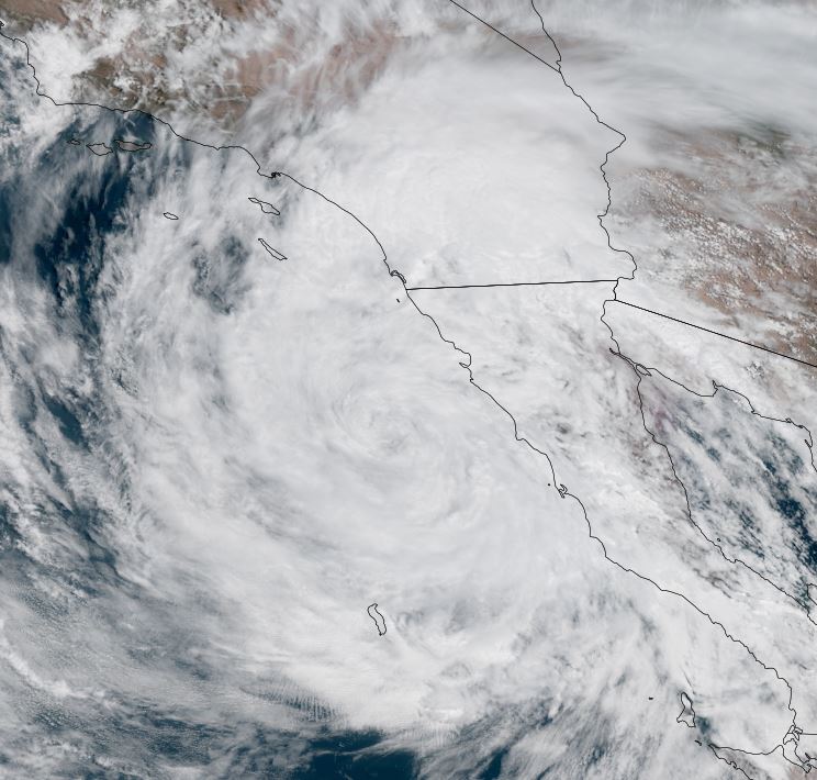
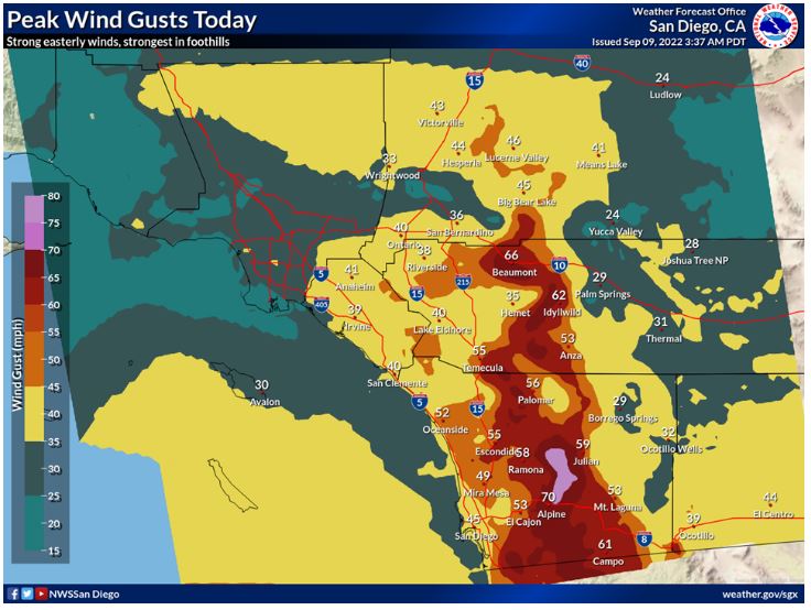
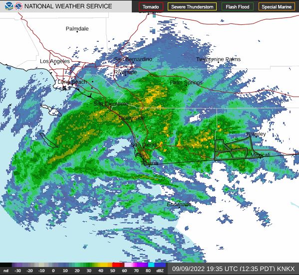
Kay is deteriorating but the heavy rain associated with Kay has moved up the Baja into southern California and SW Arizona. Rain totals in excess of three inches has fallen in extreme southern California. Occasional wind gusts to near hurricane force have been reported in the mountains WNW of San Diego.
SUMMARY OF 200 PM PDT...2100 UTC...INFORMATION
----------------------------------------------
LOCATION...31.0N 118.0W
ABOUT 130 MI...205 KM SSW OF SAN DIEGO CALIFORNIA
ABOUT 150 MI...240 KM WNW OF PUNTA BAJA MEXICO
MAXIMUM SUSTAINED WINDS...40 MPH...65 KM/H
PRESENT MOVEMENT...NW OR 305 DEGREES AT 12 MPH...19 KM/H
MINIMUM CENTRAL PRESSURE...994 MB...29.36 INCHES
Tropicast: Visible Satellite
 Tropicast: Wind Gusts
 Tropicast: Mid Afternoon Radar
 Tropical Weather Forecast:
Heavy rain will continue tonight over southern California as Kay weakens offshore.
Official NHC Public Advisory
https://www.nhc.noaa.gov/text/refresh/M ... 052.shtml?
Official NHC Track
https://www.nhc.noaa.gov/refresh/graphi ... e#contents
