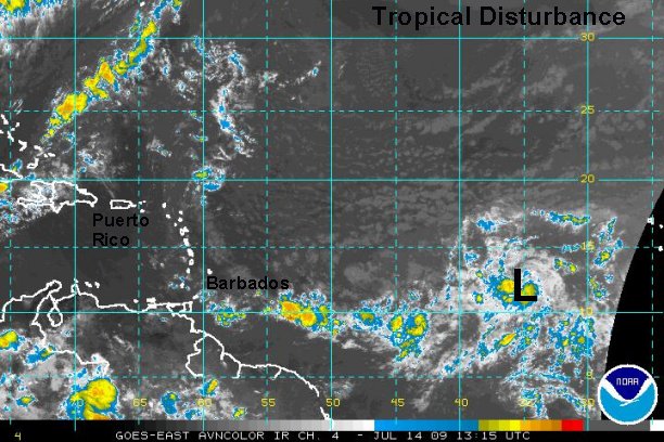
Tropical disturbance slowly organizing well east of the Antillies
Forecast models have been hinting at a low developing in the deep tropics. A spin is now noted on satellite imagery near 12° N / 35° W or about 1700 miles west of the Lesser Antilles. Forecast models take this low northeast of the Lesser Antilles as it recurves northeast around the break in the ridge. A very large unseasonably strong trough on the east coast this weekend should continue the recurving trend well east of the states.
Remember, we are simply in recon mode on this one. This is no time to panic or cancel travel plans. The "L" on the satellite imagery denotes a spin center and not a formed tropical depression.
Tropicast: Western Caribbean I.R. Satellite