Bonnie

Tropical cyclone archives of the 2022 eastern and central Pacific hurricane season
Post Reply
User avatar
Tropical Inspector
Site Admin
Site Admin
Posts: 3686
Joined: Tue Feb 20, 2007 2:28 pm
Antispam: no
Location: Under a palm tree
Contact:

Bonnie

Post by Tropical Inspector »

Saturday Late AM Update

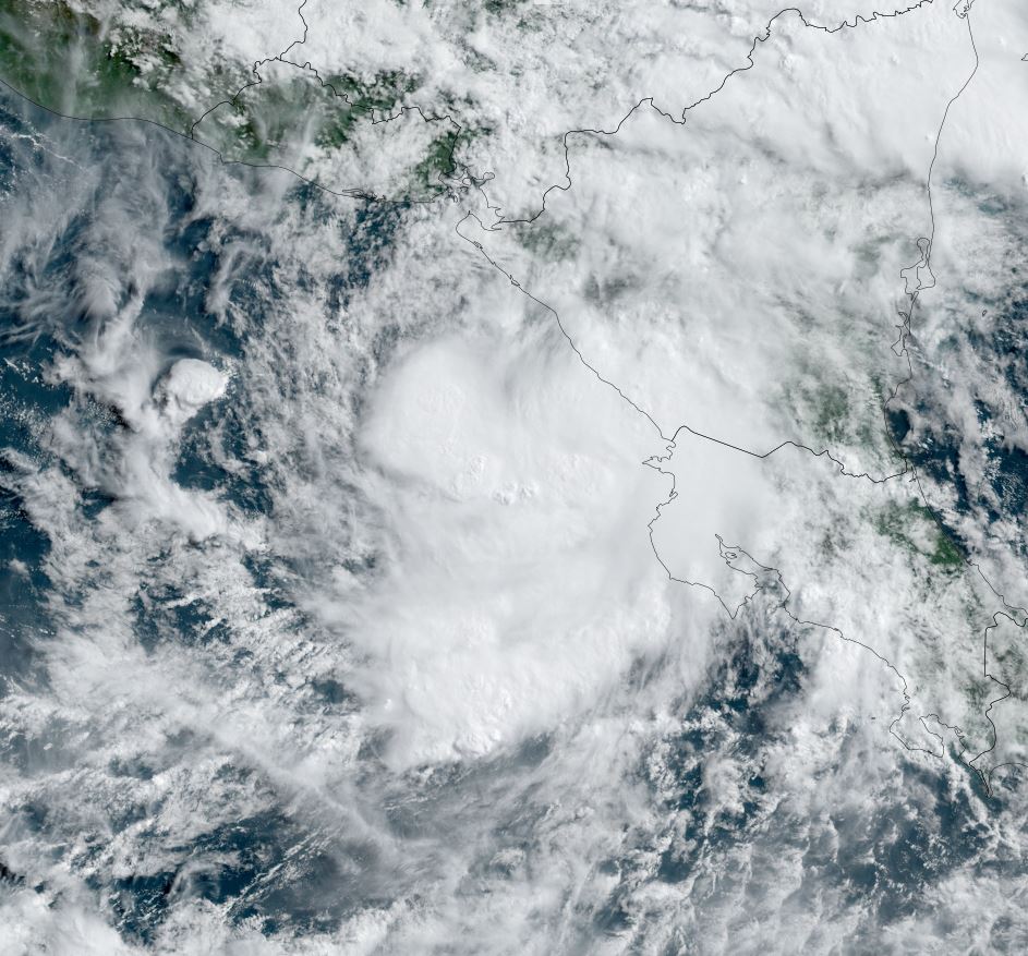
Bonnie is moving into the Pacific
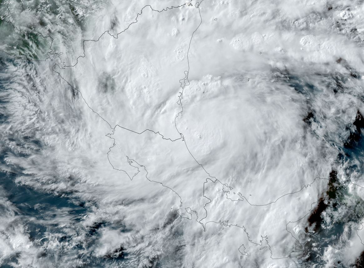
After remaining disorganized for several days across the southern Caribbean, the PTC finally was named as it developed a low level circulation just before landfall in Central America. The main threat continues to be heavy rainfall / mudslides.

The Weather Situation

SUMMARY OF 700 AM CDT...1200 UTC...INFORMATION
----------------------------------------------
LOCATION...11.2N 85.8W
ABOUT 50 MI...80 KM NW OF LIBERIA COSTA RICA
ABOUT 65 MI...105 KM SE OF MANAGUA NICARAGUA
MAXIMUM SUSTAINED WINDS...40 MPH...65 KM/H
PRESENT MOVEMENT...W OR 280 DEGREES AT 14 MPH...22 KM/H
MINIMUM CENTRAL PRESSURE...1002 MB...29.59 INCHES

Tropicast: Visible Satellite Friday Afternoon
Image

Tropicast: Visible Satellite Saturday Morning
Image

Tropical Weather Forecast:
Bonnie is emerging in the eastern Pacific Ocean and further updates with be found in our eastern Pacific update thread.
Rich Johnson
Twitter: https://twitter.com/richjohnsonwx
Certified Broadcast Meteorologist - Hurricane Expert
User avatar
Tropical Inspector
Site Admin
Site Admin
Posts: 3686
Joined: Tue Feb 20, 2007 2:28 pm
Antispam: no
Location: Under a palm tree
Contact:

Re: Bonnie

Post by Tropical Inspector »

Sunday Afternoon Update

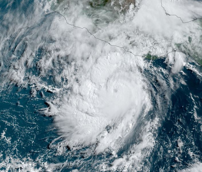
Bonnie is strengthening
Bonnie is organizing as it moves offshore. The beginnings of an eye are seen in the cloud structure. Heavy rainfall is remains a threat for the next day or two.

SUMMARY OF 1000 AM CDT...1500 UTC...INFORMATION
-----------------------------------------------
LOCATION...11.9N 92.4W
ABOUT 205 MI...335 KM S OF TAPACHULA MEXICO
MAXIMUM SUSTAINED WINDS...65 MPH...100 KM/H
PRESENT MOVEMENT...W OR 280 DEGREES AT 16 MPH...26 KM/H
MINIMUM CENTRAL PRESSURE...995 MB...29.39 INCHES

Tropicast: Visible Satellite
Image

Tropical Weather Forecast:
Bonnie is moving out to sea and will stay to the south of Mexico. Rough surf is the main concern to the Mexican coast as rain gradually tampers down the next few days.
Rich Johnson
Twitter: https://twitter.com/richjohnsonwx
Certified Broadcast Meteorologist - Hurricane Expert
User avatar
Tropical Inspector
Site Admin
Site Admin
Posts: 3686
Joined: Tue Feb 20, 2007 2:28 pm
Antispam: no
Location: Under a palm tree
Contact:

Re: Bonnie

Post by Tropical Inspector »

Monday Midday Update

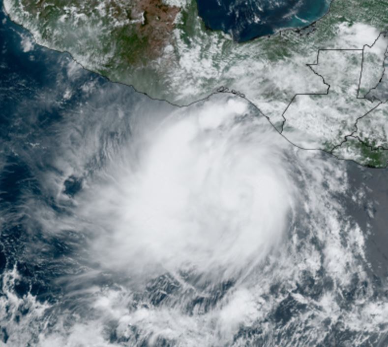
Bonnie has an eye
Bonnie continued to organize last night and formed an eye. This strengthening phase with be slowed in a few days by increasing shear aloft and eventually cooler sea surface water.

SUMMARY OF 1000 AM CDT...1500 UTC...INFORMATION
-----------------------------------------------
LOCATION...13.7N 99.0W
ABOUT 230 MI...370 KM SSE OF ACAPULCO MEXICO
MAXIMUM SUSTAINED WINDS...90 MPH...150 KM/H
PRESENT MOVEMENT...WNW OR 285 DEGREES AT 18 MPH...30 KM/H
MINIMUM CENTRAL PRESSURE...982 MB...29.00 INCHES

Tropicast: Visible Satellite
Image

Tropical Weather Forecast:
Bonnie is moving out to sea and will stay to the south of Mexico. Rough surf is the main concern to the Mexican coast as rain gradually tampers down the next few days.
Rich Johnson
Twitter: https://twitter.com/richjohnsonwx
Certified Broadcast Meteorologist - Hurricane Expert
Post Reply

Return to “2022 Eastern / Central Pacific Hurricane Archives”

Who is online

Users browsing this forum: No registered users and 0 guests