Page 1 of 1
Mario
Posted: Sat Sep 13, 2025 6:24 am
by Tropical Inspector
Saturday Morning Update
Mario gone
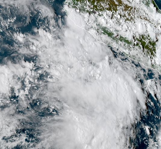
Yesterday Mario was classified with this large mass of disorganized showers and storms, west of the coast of Mexico. By this morning the convection did not show any additional organization and a satellite pass confirmed this. NHC now has classified the area as remnants.
Tropicast: Visible RAMMB/CIRA slider GOES 18 Saturday Late Afternoon
Re: Mario
Posted: Sun Sep 14, 2025 12:36 pm
by Tropical Inspector
Sunday Afternoon Update
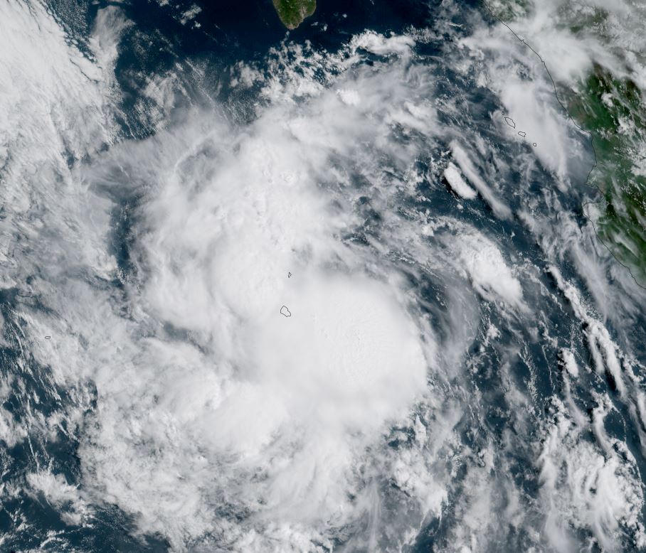
Mario is back
Mario will be back for a short while. A deep convection burst is near the island of Socorro west of the Mexican coast. Most of the outlying showers and storms will avoid the Baja as Mario continues to move generally NW toward cooler water. This cooler water will rob the energy from the tropical storm within about 36 hours.
Current Situation
SUMMARY OF 800 AM MST...1500 UTC...INFORMATION
----------------------------------------------
LOCATION...18.5N 110.2W
ABOUT 55 MI...90 KM ESE OF SOCORRO ISLAND
ABOUT 305 MI...490 KM S OF THE SOUTHERN TIP OF BAJA CALIFORNIA
MAXIMUM SUSTAINED WINDS...40 MPH...65 KM/H
PRESENT MOVEMENT...WNW OR 285 DEGREES AT 8 MPH...13 KM/H
MINIMUM CENTRAL PRESSURE...1004 MB...29.65 INCHES
Tropicast: Visible RAMMB/CIRA slider GOES 18
Re: Mario
Posted: Mon Sep 15, 2025 1:23 pm
by Tropical Inspector
Monday Afternoon Update
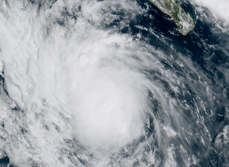
Mario is stronger today
This Monday morning (Pacific time) Mario looks more impressive as a circular area of deep convection is over the core. The heavy showers and storms are offshore, west of the Baja. Strong outflow aloft is also noted east of the storm.
The Weather Situation
SUMMARY OF 800 AM MST...1500 UTC...INFORMATION
----------------------------------------------
LOCATION...20.0N 113.2W
ABOUT 165 MI...265 KM WNW OF SOCORRO ISLAND
ABOUT 290 MI...470 KM SW OF THE SOUTHERN TIP OF BAJA CALIFORNIA
MAXIMUM SUSTAINED WINDS...60 MPH...95 KM/H
PRESENT MOVEMENT...WNW OR 300 DEGREES AT 12 MPH...
Tropicast: Visible RAMMB/CIRA slider GOES 18 Tuesday Late Afternoon
 Tropical Weather Forecast:
Mario is probably maxing out today just before encountering cooler sea water. It will remain well west of the Baja.
NHC Advisory
https://www.nhc.noaa.gov/text/refresh/M ... 434.shtml?
NHC Track
https://www.nhc.noaa.gov/refresh/graphi ... e#contents