Page 1 of 1
Fernand
Posted: Sat Aug 23, 2025 3:23 pm
by Tropical Inspector
Saturday Afternoon Update
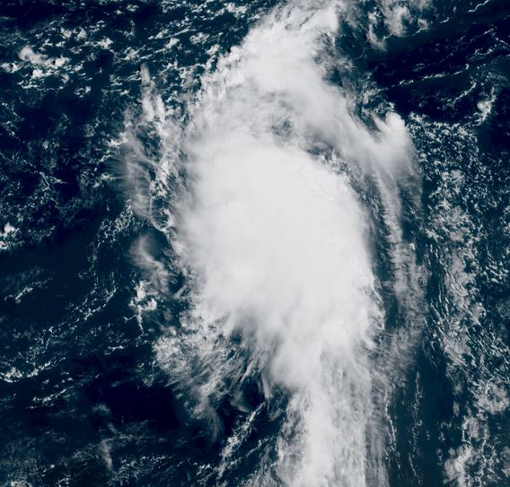
Tropical disturbance organizing
A tropical disturbance in the open Atlantic will likely be classified as a depression or tropical storm Fernand soon. A Hurricane Hunter aircraft is investigating and found a closed low, but not tropical storm level winds yet.
Update: NHC will start updates on tropical storm Fernand at 5pm edt.
Tropicast: Visible GOES 19 satellite RAMMB/CIRA Slider Saturday Morning
Fernand
Posted: Sat Aug 23, 2025 3:43 pm
by Tropical Inspector
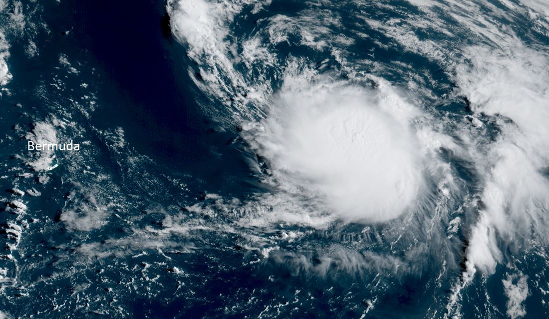
Saturday Late Afternoon Update
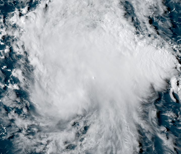
Fernand classified
A reconnaissance aircraft has found winds to minimal tropical storm force and a closed low level circulation recently.
The Weather Situation
SUMMARY OF 500 PM AST...2100 UTC...INFORMATION
----------------------------------------------
LOCATION...27.2N 61.4W
ABOUT 405 MI...655 KM SSE OF BERMUDA
MAXIMUM SUSTAINED WINDS...40 MPH...65 KM/H
PRESENT MOVEMENT...N OR 10 DEGREES AT 15 MPH...24 KM/H
MINIMUM CENTRAL PRESSURE...1010 MB...29.83 INCHES
Tropicast: RAMMB/CIRA slider GOES 19 Visible Satellite
 Tropical Weather Forecast:
Fernand is expected to stay in the open Water of the Atlantic moving generally north. It should pass to the east of Bermuda with possibly some showers affecting the area. Fernand is not expected to become a hurricane as it moves into the northern North Atlantic several days from now.
Re: Fernand
Posted: Sun Aug 24, 2025 5:20 am
by Tropical Inspector
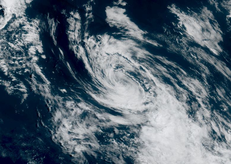
Sunday Morning Update
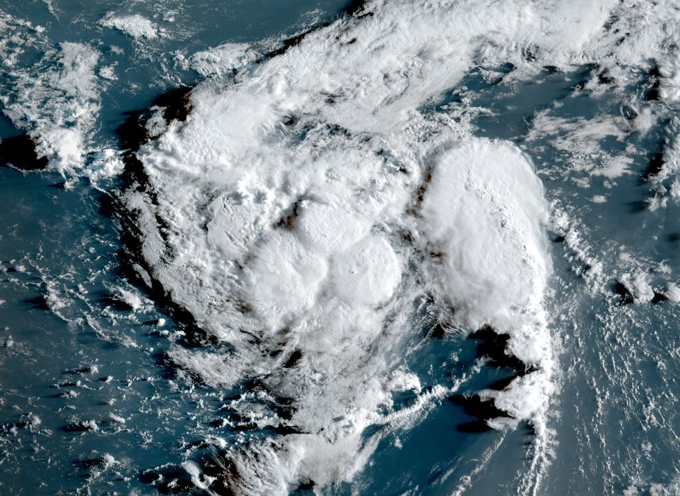
Fernand still disorganized
Satellite imagery shows sporadic deep convection. Easterly wind shear appears to be decreasing allowing for this deep convection to build west of the low center the past few hours. Some strengthening is likely if this trend continues today. Fernand poses no threat to land areas.
The Weather Situation
SUMMARY OF 500 AM AST...0900 UTC...INFORMATION
----------------------------------------------
LOCATION...29.7N 60.7W
ABOUT 300 MI...485 KM SE OF BERMUDA
MAXIMUM SUSTAINED WINDS...40 MPH...65 KM/H
PRESENT MOVEMENT...NNE OR 15 DEGREES AT 15 MPH...24 KM/H
MINIMUM CENTRAL PRESSURE...1010 MB...29.83 INCHES
Tropicast: RAMMB/CIRA slider GOES 19 Visible Satellite
 Tropicast: RAMMB/CIRA slider GOES 19 IR Satellite
 Tropical Weather Forecast:
Fernand is expected to stay in the open Water of the Atlantic moving generally north. It should pass well to the east of Bermuda with possibly some showers affecting the area. Fernand is not expected to become a hurricane as it moves into the northern North Atlantic a few days from now.
Re: Fernand
Posted: Mon Aug 25, 2025 9:33 am
by Tropical Inspector
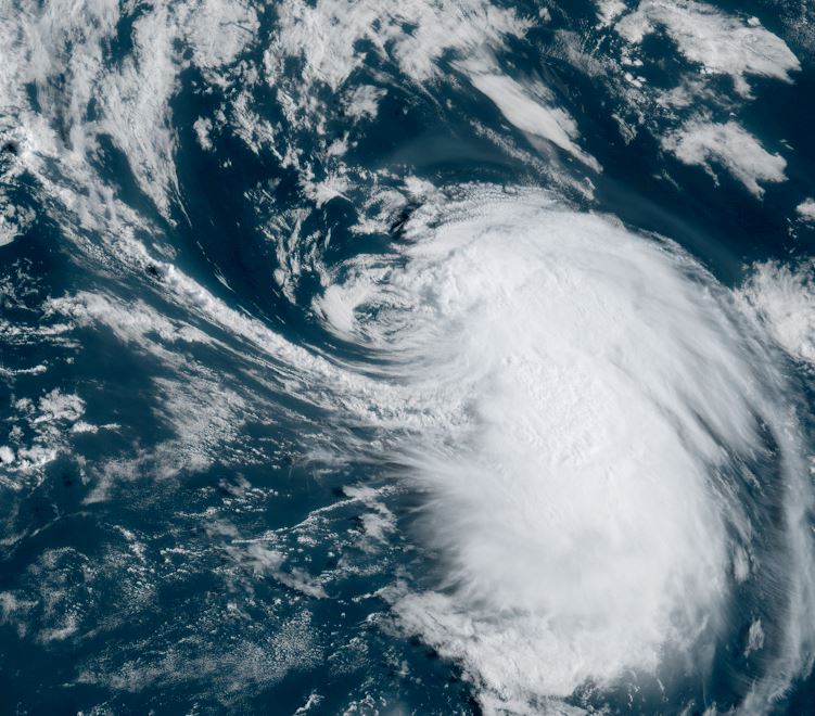
Monday Morning Update
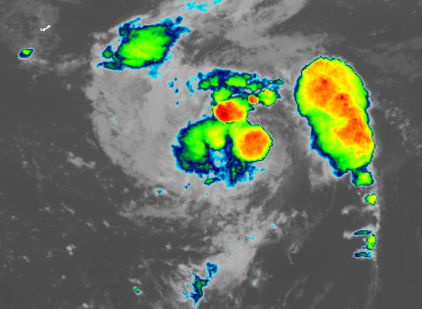
Fernand stronger today
Fernand is much more organized today with a sizeable area of convection over the core.
The Weather Situation
SUMMARY OF 500 AM AST...0900 UTC...INFORMATION
----------------------------------------------
LOCATION...33.7N 58.8W
ABOUT 360 MI...580 KM ENE OF BERMUDA
MAXIMUM SUSTAINED WINDS...50 MPH...85 KM/H
PRESENT MOVEMENT...NNE OR 20 DEGREES AT 12 MPH...19 KM/H
MINIMUM CENTRAL PRESSURE...1007 MB...29.74 INCHES
Tropicast: RAMMB/CIRA slider GOES 19 Visible Satellite
 Tropical Weather Forecast:
Fernand is expected to stay in the open Water of the Atlantic moving generally north. It is well to the east of Bermuda. Fernand is not expected to become a hurricane as it moves into the northern North Atlantic as it becomes extratropical tomorrow.
Re: Fernand
Posted: Tue Aug 26, 2025 12:30 pm
by Tropical Inspector
Tuesday Afternoon Update
Convection waning
Satellite shows that most of the deep convection is removed from the circulation. Fernand is essentially an extratropical system except for the small amount of convection.
The Weather Situation
SUMMARY OF 1100 AM AST...1500 UTC...INFORMATION
-----------------------------------------------
LOCATION...37.6N 54.6W
ABOUT 635 MI...1020 KM S OF CAPE RACE NEWFOUNDLAND
MAXIMUM SUSTAINED WINDS...40 MPH...65 KM/H
PRESENT MOVEMENT...NE OR 40 DEGREES AT 13 MPH...20 KM/H
MINIMUM CENTRAL PRESSURE...1007 MB...29.74 INCHES
Tropicast: RAMMB/CIRA slider GOES 19 Visible Satellite
 Tropical Weather Forecast:
Fernand is predicted to become extratropical tomorrow officially.
Re: Fernand
Posted: Wed Aug 27, 2025 8:26 am
by Tropical Inspector
Wednesday Morning Update
Fernand still holding on
Deep convection remains well south of the low center with the low center lacking any convection. There is actually an increase in convection compared with yesterday. Fernand may try to hold onto tropical status a bit longer until the southern convection dissipates.
The Weather Situation
SUMMARY OF 500 AM AST...0900 UTC...INFORMATION
----------------------------------------------
LOCATION...38.3N 50.8W
ABOUT 590 MI...950 KM SSE OF CAPE RACE NEWFOUNDLAND
MAXIMUM SUSTAINED WINDS...45 MPH...75 KM/H
PRESENT MOVEMENT...E OR 80 DEGREES AT 12 MPH...19 KM/
Tropicast: RAMMB/CIRA slider GOES 19 Visible Satellite
 Tropical Weather Forecast:
Fernand will continue to move generally to the NE into the northern North Atlantic Ocean as it becomes extratropical.
NHC Advisory
https://www.nhc.noaa.gov/text/refresh/M ... 837.shtml?
NHC Track
https://www.nhc.noaa.gov/graphics_at1.s ... t#contents