Henriette
Posted: Thu Aug 07, 2025 5:36 pm
Thursday Evening Update
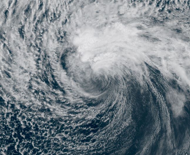
Henriette near cool water
Henriette currently only has minimal convection near its core. The large field of strato-cumulus clouds to the north is indicative of cooler ocean water temperatures limiting its strength.
The Weather Situation
SUMMARY OF 1100 AM HST...2100 UTC...INFORMATION
-----------------------------------------------
LOCATION...18.9N 136.8W
ABOUT 1195 MI...1920 KM E OF HILO HAWAII
MAXIMUM SUSTAINED WINDS...45 MPH...75 KM/H
PRESENT MOVEMENT...W OR 280 DEGREES AT 16 MPH...26 KM/H
MINIMUM CENTRAL PRESSURE...1006 MB...29.71 INCHES
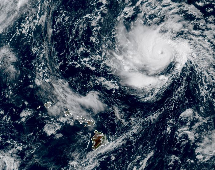
Tropicast: Visible RAMMB Cira-Slider Thursday Afternoon
Tropical Weather Forecast:
Henriette is near chilly water which is limiting intensification. It will also battle some dry air. It eventually will be closer to warmer water as it tracks WNW north of Hawaii. Intensification will be determined if it can survive through those harsh conditions.
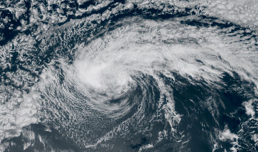
Henriette near cool water
Henriette currently only has minimal convection near its core. The large field of strato-cumulus clouds to the north is indicative of cooler ocean water temperatures limiting its strength.
The Weather Situation
SUMMARY OF 1100 AM HST...2100 UTC...INFORMATION
-----------------------------------------------
LOCATION...18.9N 136.8W
ABOUT 1195 MI...1920 KM E OF HILO HAWAII
MAXIMUM SUSTAINED WINDS...45 MPH...75 KM/H
PRESENT MOVEMENT...W OR 280 DEGREES AT 16 MPH...26 KM/H
MINIMUM CENTRAL PRESSURE...1006 MB...29.71 INCHES
Tropicast: Visible RAMMB Cira-Slider Thursday Afternoon
Tropical Weather Forecast:
Henriette is near chilly water which is limiting intensification. It will also battle some dry air. It eventually will be closer to warmer water as it tracks WNW north of Hawaii. Intensification will be determined if it can survive through those harsh conditions.