Barry
Posted: Sun Jun 29, 2025 6:09 am
Sunday Morning Update
TD Two
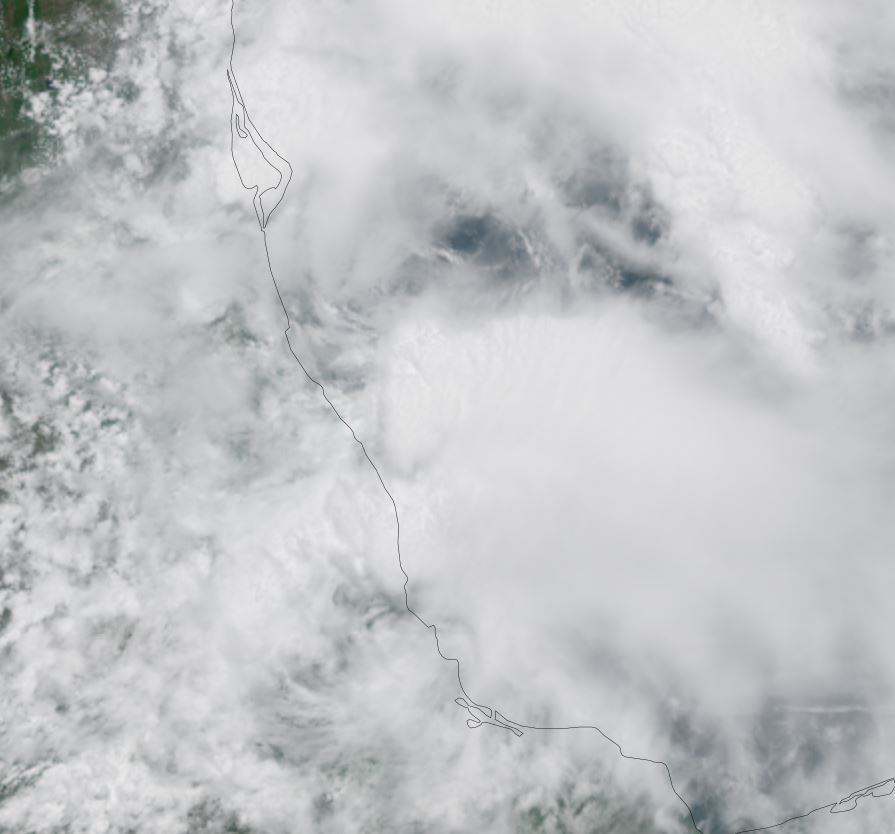
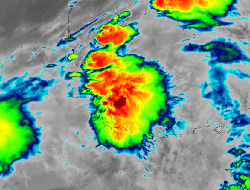
IR satellite this morning shows a mass of clouds which is disorganized over the western Bay of Campeche. It also appears that low level clouds are flowing in a counter clockwise director confirming a circulation.
Hurricane Hunter aircraft show a tiny weak circulation. Winds at flight level have slightly increased to 30-35 knots in a small area at 2500 ft, likely associated with a convection burst. SFMR winds which estimate surface conditions are closer to 20 kts. So this system is definitely below tropical storm strength.
The Weather Situation
SUMMARY OF 400 AM CDT...0900 UTC...INFORMATION
----------------------------------------------
LOCATION...19.9N 95.9W
ABOUT 50 MI...85 KM NNE OF VERACRUZ MEXICO
ABOUT 125 MI...200 KM SE OF TUXPAN MEXICO
MAXIMUM SUSTAINED WINDS...35 MPH...55 KM/H
PRESENT MOVEMENT...WNW OR 290 DEGREES AT 9 MPH...15 KM/H
MINIMUM CENTRAL PRESSURE...1010 MB...29.83 INCHES
Tropicast: IR satellite RAMMB Cira-Slider
Tropical Weather Forecast:
The tropical Depression will move into the eastern Mexico today. It possibly will be named, but the main threat will be heavy rainfall and its effects.
TD Two
IR satellite this morning shows a mass of clouds which is disorganized over the western Bay of Campeche. It also appears that low level clouds are flowing in a counter clockwise director confirming a circulation.
Hurricane Hunter aircraft show a tiny weak circulation. Winds at flight level have slightly increased to 30-35 knots in a small area at 2500 ft, likely associated with a convection burst. SFMR winds which estimate surface conditions are closer to 20 kts. So this system is definitely below tropical storm strength.
The Weather Situation
SUMMARY OF 400 AM CDT...0900 UTC...INFORMATION
----------------------------------------------
LOCATION...19.9N 95.9W
ABOUT 50 MI...85 KM NNE OF VERACRUZ MEXICO
ABOUT 125 MI...200 KM SE OF TUXPAN MEXICO
MAXIMUM SUSTAINED WINDS...35 MPH...55 KM/H
PRESENT MOVEMENT...WNW OR 290 DEGREES AT 9 MPH...15 KM/H
MINIMUM CENTRAL PRESSURE...1010 MB...29.83 INCHES
Tropicast: IR satellite RAMMB Cira-Slider
Tropical Weather Forecast:
The tropical Depression will move into the eastern Mexico today. It possibly will be named, but the main threat will be heavy rainfall and its effects.