Helene
Posted: Mon Sep 23, 2024 7:09 pm
Monday Evening Update
PTC 9 in western Caribbean
An area of disturbed weather is slowly organizing in the western Caribbean Sea. Forecast models have been hinting at a tropical cyclone moving into the eastern Gulf of Mexico for several days now. In fact models have been suggesting a tropical cyclone in the Gulf for well over a week.
The Weather Situation
SUMMARY OF 800 PM EDT...0000 UTC...INFORMATION
----------------------------------------------
LOCATION...18.3N 82.3W
ABOUT 100 MI...160 KM SW OF GRAND CAYMAN
ABOUT 300 MI...485 KM SE OF THE WESTERN TIP OF CUBA
MAXIMUM SUSTAINED WINDS...35 MPH...55 KM/H
PRESENT MOVEMENT...NNW OR 345 DEGREES AT 7 MPH...11 KM/H
MINIMUM CENTRAL PRESSURE...1002 MB...29.59 INCHES
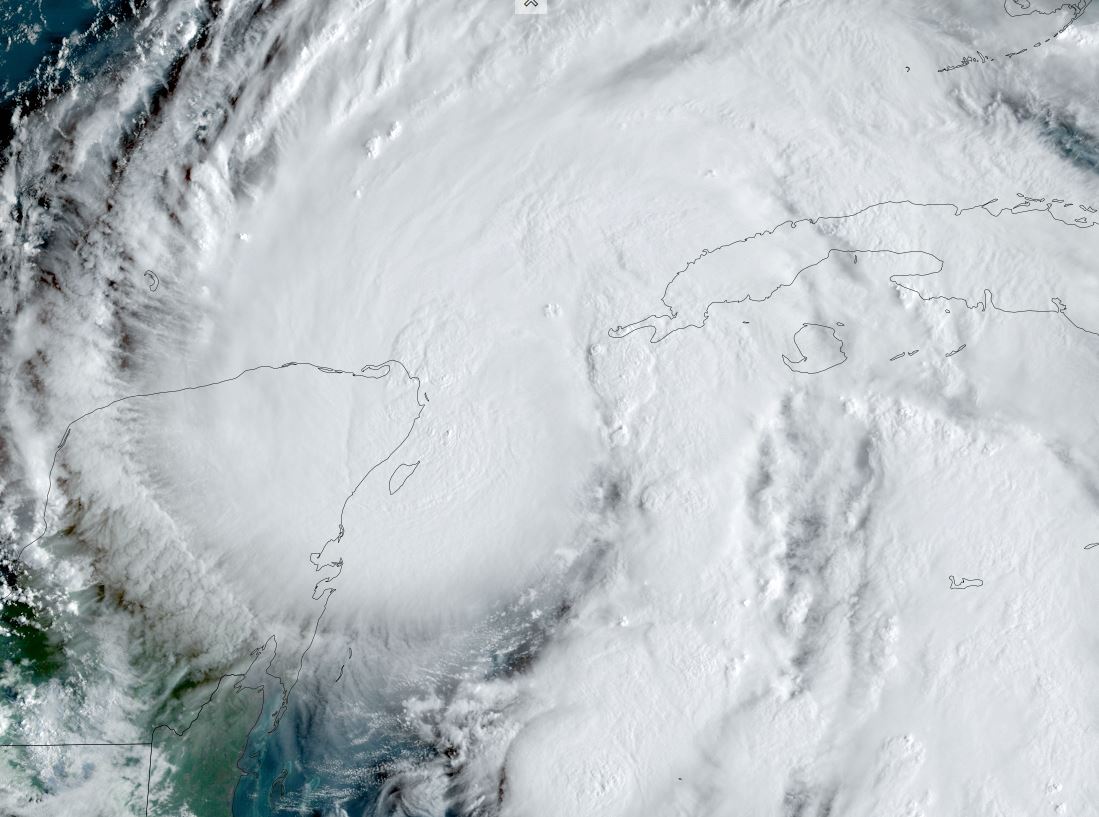
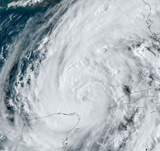
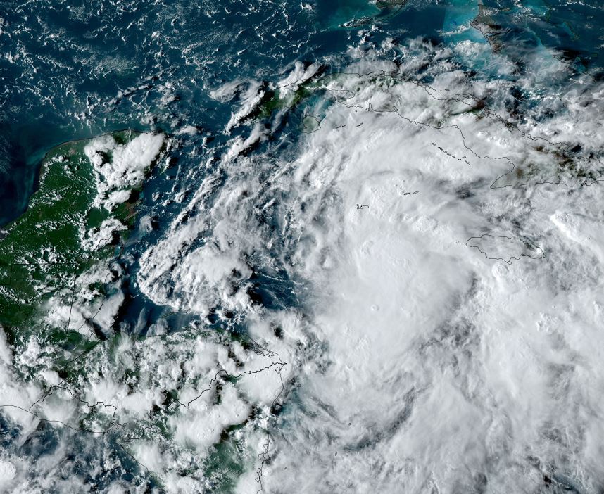
Tropicast: Visible Satellite RAMMB / CIRA Slider Monday evening
Tropical Weather Forecast:
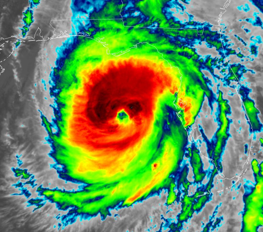
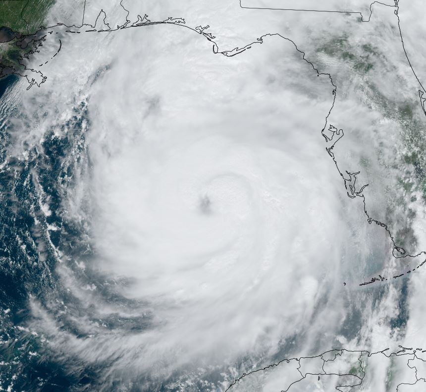
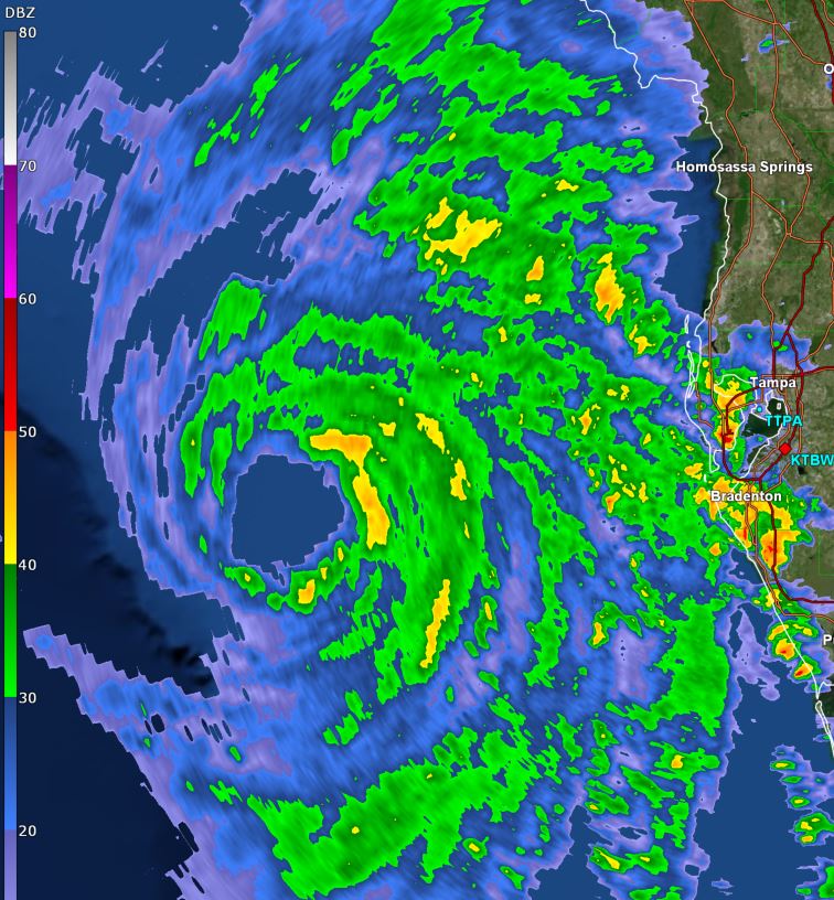
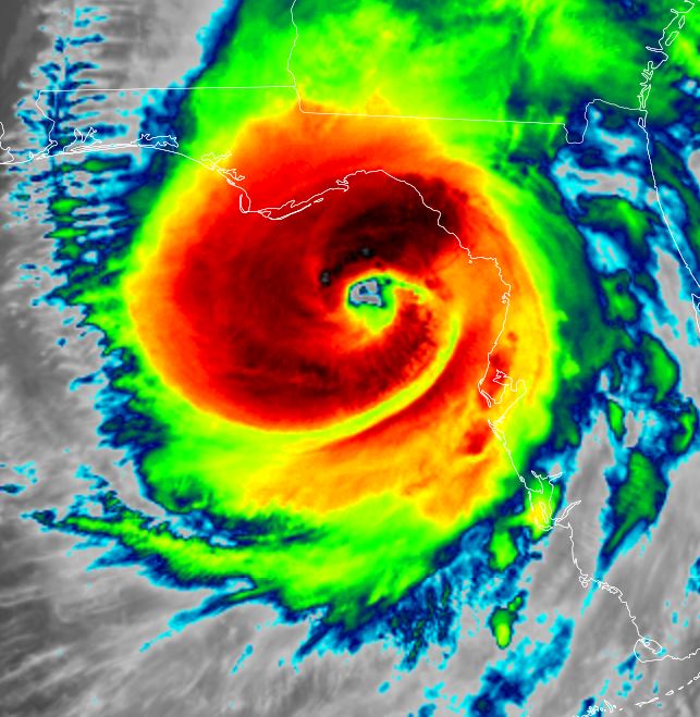
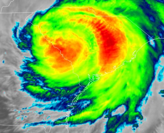
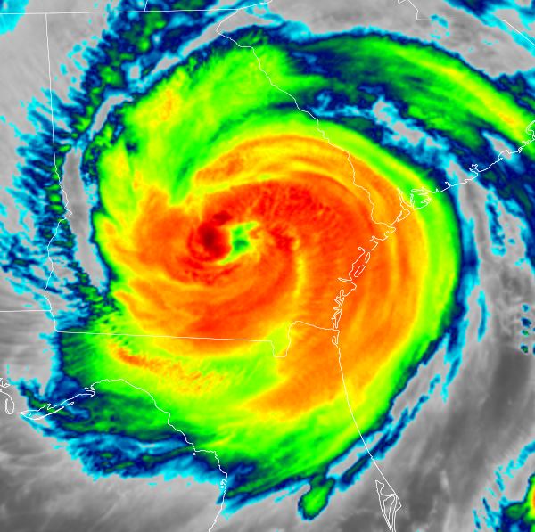
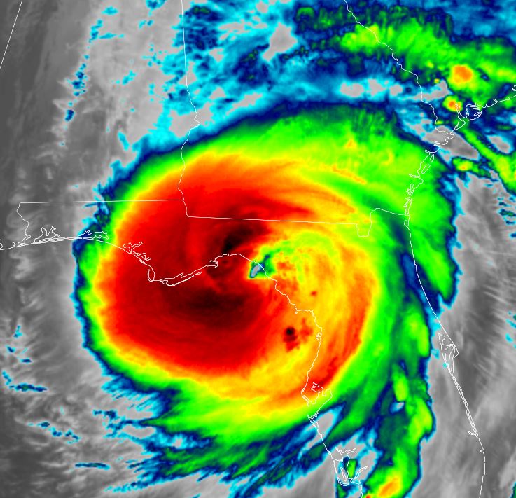
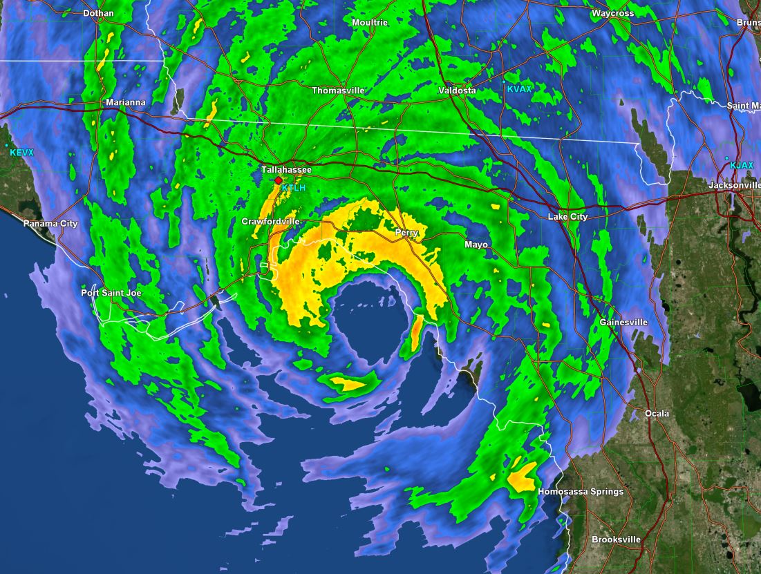
PTC 9 is expected to become tropical storm Helene later tonight and strengthen into a hurricane as it moves through the Yucatan channel by Tuesday night. It will be pulled northward by upper air southwesterly winds as it picks up forward speed into the eastern Gulf of Mexico. It may strengthen into a major hurricane and make landfall later in the day Thursday over the northeastern Gulf coast. The effects of storm surge, damaging winds and flash flooding can be expected.
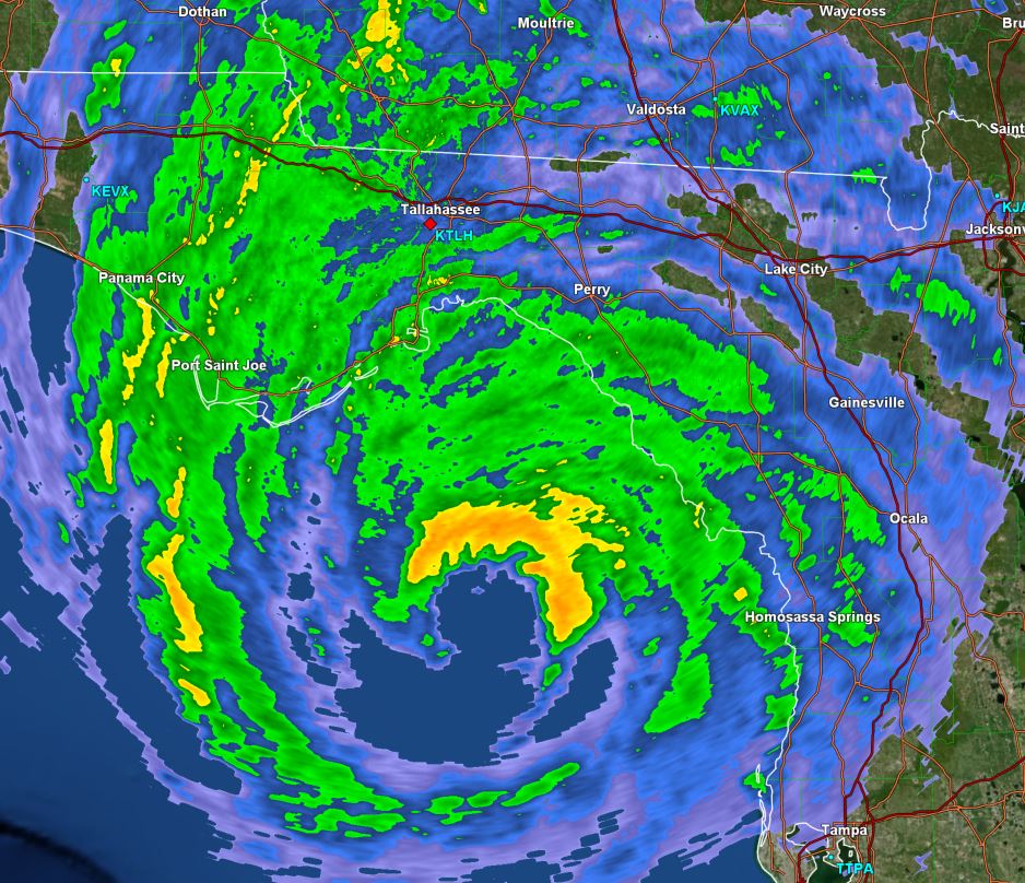
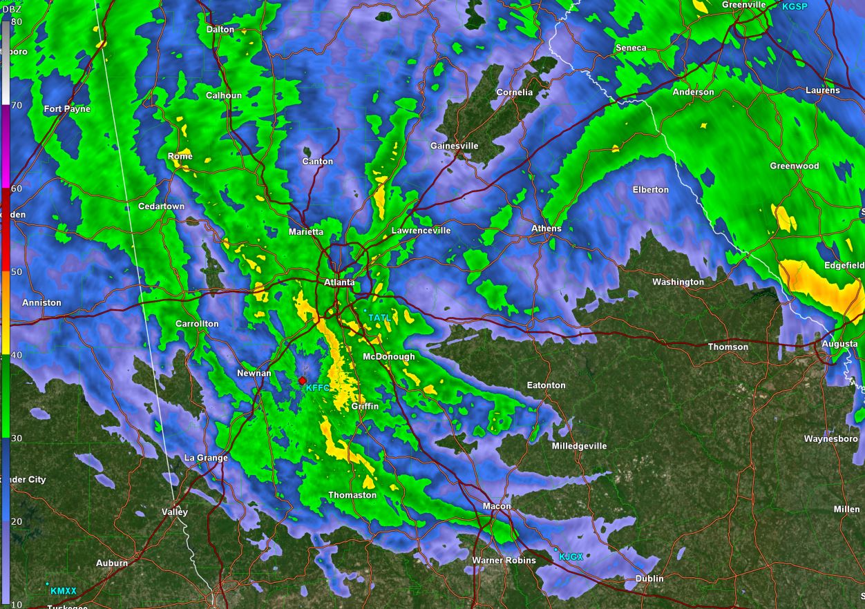
It will then move into Georgia Thursday night and early Friday. Due to its significant forward speed, damaging winds will likely move well inland.
PTC 9 in western Caribbean
An area of disturbed weather is slowly organizing in the western Caribbean Sea. Forecast models have been hinting at a tropical cyclone moving into the eastern Gulf of Mexico for several days now. In fact models have been suggesting a tropical cyclone in the Gulf for well over a week.
The Weather Situation
SUMMARY OF 800 PM EDT...0000 UTC...INFORMATION
----------------------------------------------
LOCATION...18.3N 82.3W
ABOUT 100 MI...160 KM SW OF GRAND CAYMAN
ABOUT 300 MI...485 KM SE OF THE WESTERN TIP OF CUBA
MAXIMUM SUSTAINED WINDS...35 MPH...55 KM/H
PRESENT MOVEMENT...NNW OR 345 DEGREES AT 7 MPH...11 KM/H
MINIMUM CENTRAL PRESSURE...1002 MB...29.59 INCHES
Tropicast: Visible Satellite RAMMB / CIRA Slider Monday evening
Tropical Weather Forecast:
PTC 9 is expected to become tropical storm Helene later tonight and strengthen into a hurricane as it moves through the Yucatan channel by Tuesday night. It will be pulled northward by upper air southwesterly winds as it picks up forward speed into the eastern Gulf of Mexico. It may strengthen into a major hurricane and make landfall later in the day Thursday over the northeastern Gulf coast. The effects of storm surge, damaging winds and flash flooding can be expected.
It will then move into Georgia Thursday night and early Friday. Due to its significant forward speed, damaging winds will likely move well inland.