Page 1 of 1
Margot
Posted: Fri Sep 08, 2023 1:59 pm
by Tropical Inspector
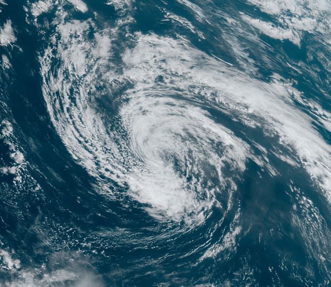
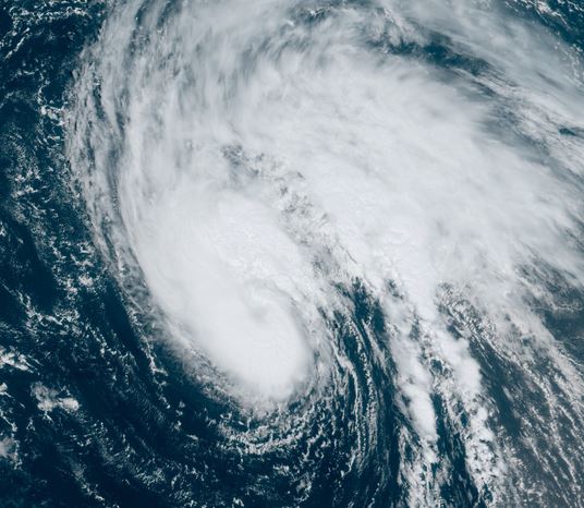
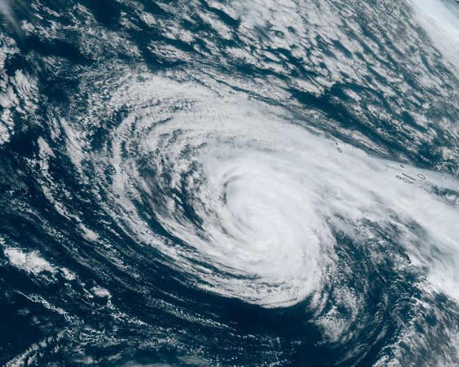
Friday Afternoon Update
Margot in eastern Atlantic
Margot is sheared with the western side of the circulation exposed as seen on satellite imagery.
The Weather Situation
SUMMARY OF 1100 AM AST...1500 UTC...INFORMATION
-----------------------------------------------
LOCATION...18.0N 32.5W
ABOUT 580 MI...930 KM WNW OF THE CABO VERDE ISLANDS
MAXIMUM SUSTAINED WINDS...40 MPH...65 KM/H
PRESENT MOVEMENT...WNW OR 290 DEGREES AT 17 MPH...28 KM/H
MINIMUM CENTRAL PRESSURE...1005 MB...29.68 INCHES
Tropicast: Visible satellite
 Tropical Weather Forecast:
Margot is expected to move into the central north Atlantic and strengthen. It is not expected to impact land at this time.
Re: Margot
Posted: Sat Sep 09, 2023 5:33 am
by Tropical Inspector
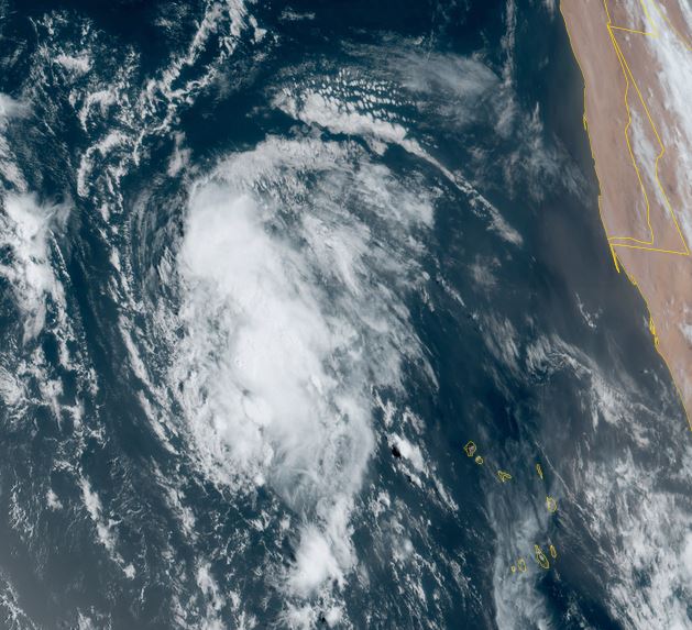
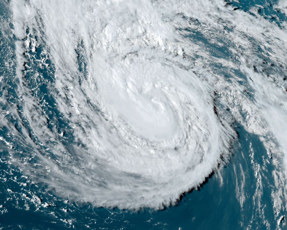
Saturday Morning Update
Margot shows slow strengthening
Satellite imagery shows a large burst of deep convection over Margot, but there is no organized banding at this time.
The Weather Situation
SUMMARY OF 500 AM AST...0900 UTC...INFORMATION
----------------------------------------------
LOCATION...19.9N 36.9W
ABOUT 890 MI...1430 KM WNW OF THE CABO VERDE ISLANDS
MAXIMUM SUSTAINED WINDS...45 MPH...75 KM/H
PRESENT MOVEMENT...WNW OR 295 DEGREES AT 13 MPH...20 KM/H
MINIMUM CENTRAL PRESSURE...1004 MB...29.65 INCHES
Tropicast: Visible satellite
 Tropical Weather Forecast:
Margot is expected to move into the central north Atlantic and strengthen. It is not expected to impact land at this time.
Re: Margot
Posted: Tue Sep 12, 2023 4:28 pm
by Tropical Inspector
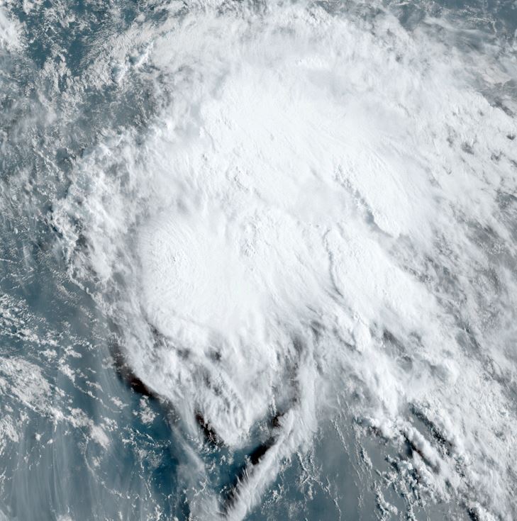
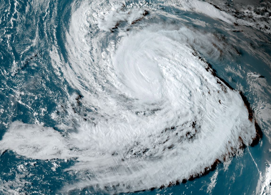
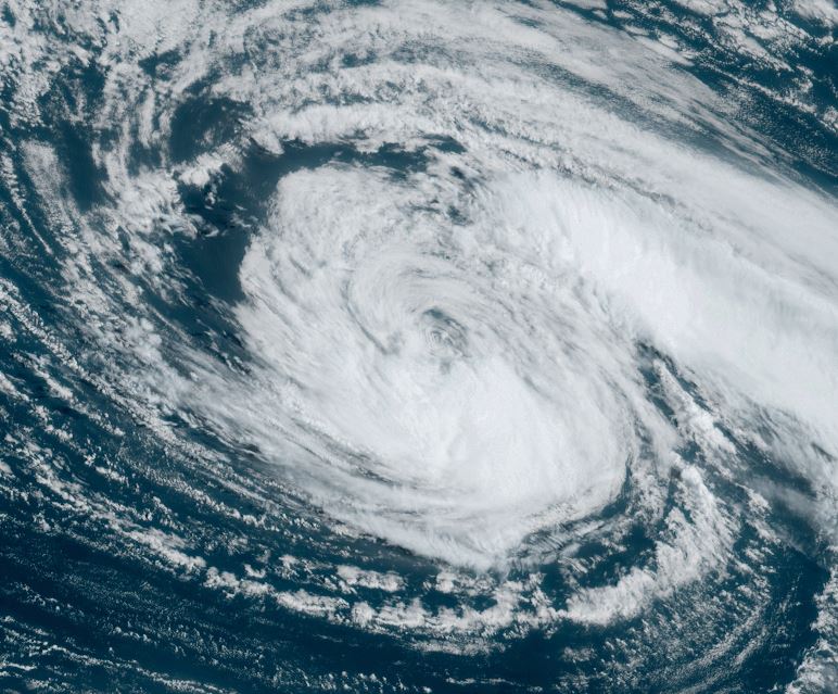
Tuesday Evening Update
Margot remains nearly steady
Satellite imagery did show and eye briefly today as Margot's top windspeed was estimated at 85 mph during the day.
The Weather Situation
SUMMARY OF 900 PM GMT...2100 UTC...INFORMATION
----------------------------------------------
LOCATION...31.7N 39.6W
ABOUT 835 MI...1345 KM WSW OF THE AZORES
MAXIMUM SUSTAINED WINDS...80 MPH...130 KM/H
PRESENT MOVEMENT...N OR 360 DEGREES AT 14 MPH...22 KM/H
MINIMUM CENTRAL PRESSURE...977 MB...28.85 INCHES
Tropicast: Visible satellite Sunday
 Tropicast: Visible satellite Monday
 Tropicast: Visible satellite Tuesday
 Tropical Weather Forecast:
Margot is forecast to continue northward into the open north Atlantic during the next several days with little change in intensity.
Re: Margot
Posted: Wed Sep 13, 2023 8:17 pm
by Tropical Inspector
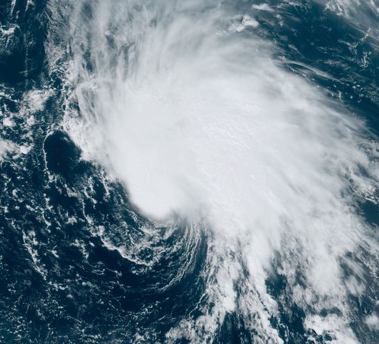
Wednesday Night Update
Margot a touch stronger
Satellite imagery tonight shows that cloud tops near the circulation center have warmed. In addition, the eye structure has weakened. IMO Margot is not as strong as advertised. Possibly 70-75 mph.
The Weather Situation
SUMMARY OF 900 PM GMT...2100 UTC...INFORMATION
----------------------------------------------
LOCATION...34.7N 40.6W
ABOUT 790 MI...1270 KM WSW OF THE AZORES
MAXIMUM SUSTAINED WINDS...90 MPH...150 KM/H
PRESENT MOVEMENT...N OR 360 DEGREES AT 7 MPH...11 KM/H
MINIMUM CENTRAL PRESSURE...971 MB...28.68 INCHES
Tropicast: Visible satellite Wednesday afternoon
 Tropical Weather Forecast:
The latest forecast models show Margot slowing down and should not move very much.
Re: Margot
Posted: Thu Sep 14, 2023 12:00 pm
by Tropical Inspector
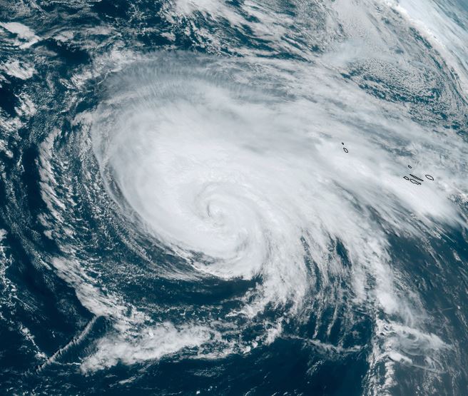
Thursday Afternoon Update
Margot expanding
The wind field of Margot is expanding which is to be expected as it moves toward higher latitudes. Cloud tops are warming so IMO the windspeed is likely a bit lower than the official estimate.
The Weather Situation
SUMMARY OF 300 PM GMT...1500 UTC...INFORMATION
----------------------------------------------
LOCATION...36.5N 39.8W
ABOUT 710 MI...1145 KM W OF THE AZORES
MAXIMUM SUSTAINED WINDS...80 MPH...130 KM/H
PRESENT MOVEMENT...NNE OR 30 DEGREES AT 6 MPH...9 KM/H
MINIMUM CENTRAL PRESSURE...978 MB...28.88 INCHES
Tropicast: Visible satellite
 Tropical Weather Forecast:
The latest forecast models show Margot slowing down and should not move very much. It eventually become extratropical by early to mid next week.
Re: Margot
Posted: Fri Sep 15, 2023 2:42 pm
by Tropical Inspector
Friday Afternoon Update
Margot weakening
Margot has some convection remaining around the circulation center, but it shows a trend toward weakening. Showers will reach the Azores with rainbands to the northeast of Margot.
The Weather Situation
SUMMARY OF 300 PM GMT...1500 UTC...INFORMATION
----------------------------------------------
LOCATION...36.3N 38.2W
ABOUT 625 MI...1010 KM W OF THE AZORES
MAXIMUM SUSTAINED WINDS...65 MPH...100 KM/H
PRESENT MOVEMENT...SE OR 135 DEGREES AT 5 MPH...7 KM/H
MINIMUM CENTRAL PRESSURE...990 MB...29.24 INCHES
Tropicast: Visible satellite
 Tropical Weather Forecast:
Margot will move in a clockwise turn during the next several days as it moves around a mid level high pressure area. Slow weakening should continue.
Re: Margot
Posted: Sat Sep 16, 2023 8:21 am
by Tropical Inspector
Saturday Morning Update
Margot changing little
Margot will change little over the next few days as it continues to slowly weaken. Some deep convection remain south of the low center.
The Weather Situation
SUMMARY OF 900 AM GMT...0900 UTC...INFORMATION
----------------------------------------------
LOCATION...35.0N 38.3W
ABOUT 660 MI...1060 KM WSW OF THE AZORES
MAXIMUM SUSTAINED WINDS...60 MPH...95 KM/H
PRESENT MOVEMENT...SW OR 220 DEGREES AT 7 MPH...11 KM/H
MINIMUM CENTRAL PRESSURE...990 MB...29.24 INCHES
Tropicast: Visible satellite
 Tropical Weather Forecast:
Margot will move in a clockwise turn during the next several days as it moves around a mid level high pressure area. Slow weakening should continue.
Re: Margot
Posted: Sun Sep 17, 2023 12:42 pm
by Tropical Inspector
Margot is extratropical as it has lost all convection.
Tropicast: Visible satellite