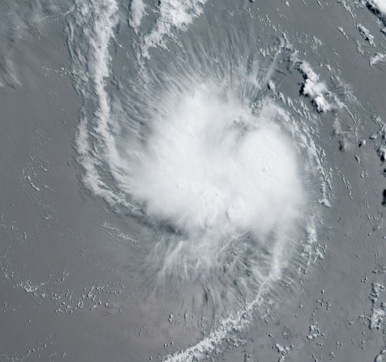
Cindy

Tropical cyclone archives of the 2023 atlantic hurricane season
Post Reply
User avatar
Tropical Inspector
Site Admin
Site Admin
Posts: 3581
Joined: Tue Feb 20, 2007 2:28 pm
Antispam: no
Location: Under a palm tree
Contact:

Cindy

Post by Tropical Inspector »

Thursday Morning Update

TD 4 forms
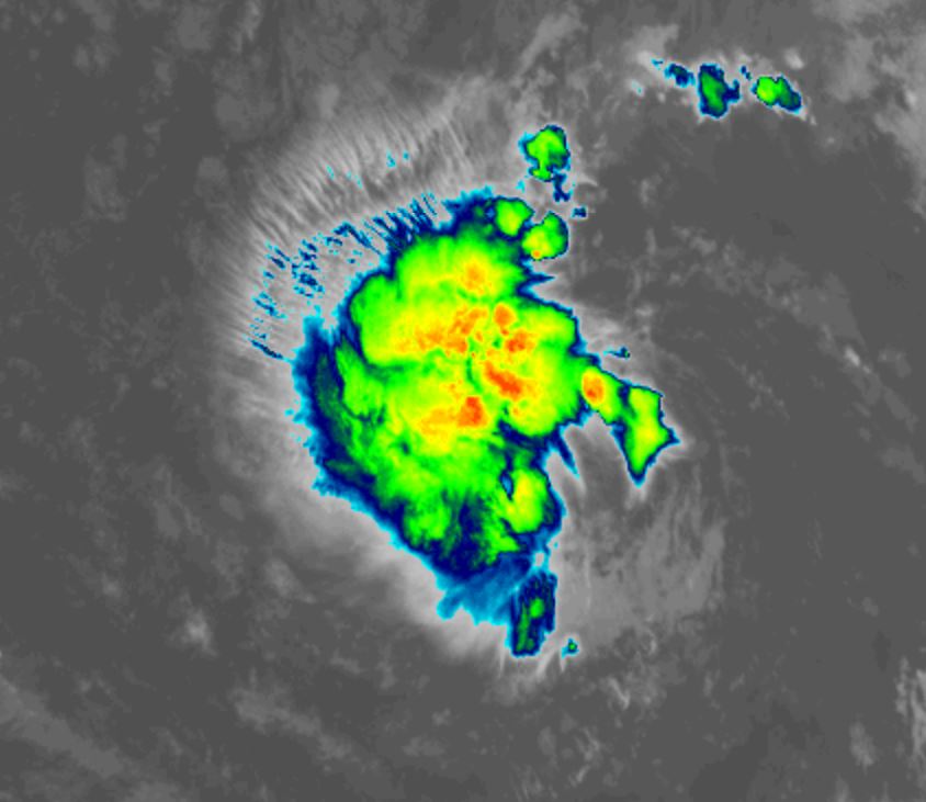
Satellite imagery shows an organized area of convection east of Bret in the south central North Atlantic. TD 4 will likely become the next tropical storm later today.


The Weather Situation
SUMMARY OF 500 AM AST...0900 UTC...INFORMATION
----------------------------------------------
LOCATION...10.9N 41.1W
ABOUT 1395 MI...2240 KM E OF THE LESSER ANTILLES
MAXIMUM SUSTAINED WINDS...35 MPH...55 KM/H
PRESENT MOVEMENT...W OR 280 DEGREES AT 12 MPH...19 KM/H
MINIMUM CENTRAL PRESSURE...1007 MB...29.74 INCHES

Tropicast: IR satellite
Image

Tropical Weather Forecast:
TD4 is expected to strengthen marginally and gradually be pulled NW to recurve before reaching the Leewards. It will then continue NW around a large subtropical high. Windshear will increase as it approaches the Islands and likely weaken the tropical cyclone. Interests in the Leewards should follow the progress of TD4.
Rich Johnson
Twitter: https://twitter.com/richjohnsonwx
Certified Broadcast Meteorologist - Hurricane Expert
User avatar
Tropical Inspector
Site Admin
Site Admin
Posts: 3581
Joined: Tue Feb 20, 2007 2:28 pm
Antispam: no
Location: Under a palm tree
Contact:

Re: Tropical Depression 4

Post by Tropical Inspector »

Thursday Evening Update

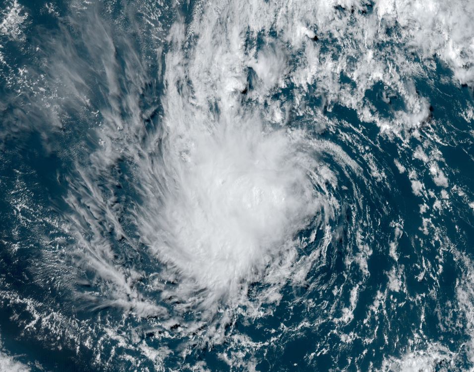
TD 4 fighting shear
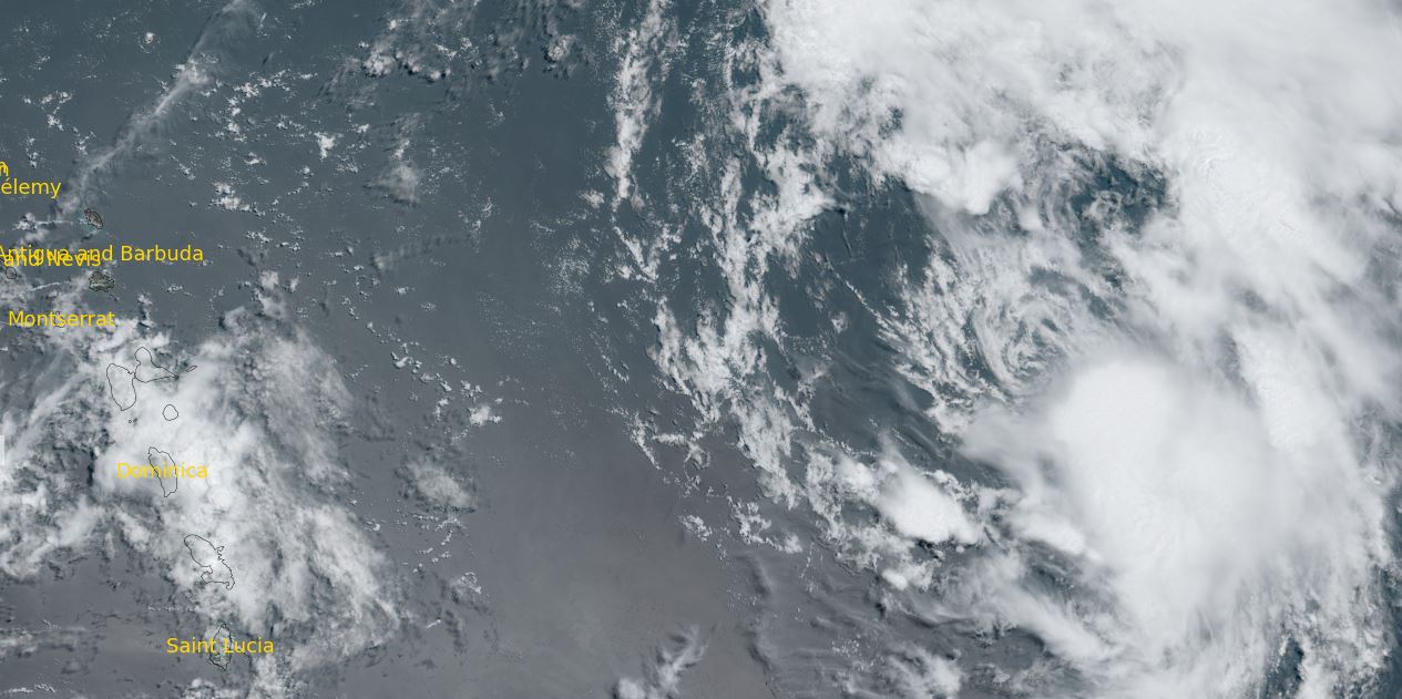
Satellite imagery shows shear from the east causing the deep convection to be displace to the west of the circulation center


The Weather Situation
SUMMARY OF 500 PM AST...2100 UTC...INFORMATION
----------------------------------------------
LOCATION...11.5N 44.0W
ABOUT 1190 MI...1920 KM E OF THE LESSER ANTILLES
MAXIMUM SUSTAINED WINDS...35 MPH...55 KM/H
PRESENT MOVEMENT...WNW OR 285 DEGREES AT 14 MPH...22 KM/H
MINIMUM CENTRAL PRESSURE...1007 MB...29.74 INCHES

Tropicast: Visible satellite
Image

Tropical Weather Forecast:
TD4 is expected to strengthen marginally and gradually be pulled NW to recurve before reaching the Leewards. It will then continue NW around a large subtropical high. Windshear will increase as it approaches the Islands and likely weaken the tropical cyclone. Interests in the Leewards should follow the progress of TD4.
Rich Johnson
Twitter: https://twitter.com/richjohnsonwx
Certified Broadcast Meteorologist - Hurricane Expert
User avatar
Tropical Inspector
Site Admin
Site Admin
Posts: 3581
Joined: Tue Feb 20, 2007 2:28 pm
Antispam: no
Location: Under a palm tree
Contact:

Re: Cindy

Post by Tropical Inspector »

Friday Morning Update

Cindy classified
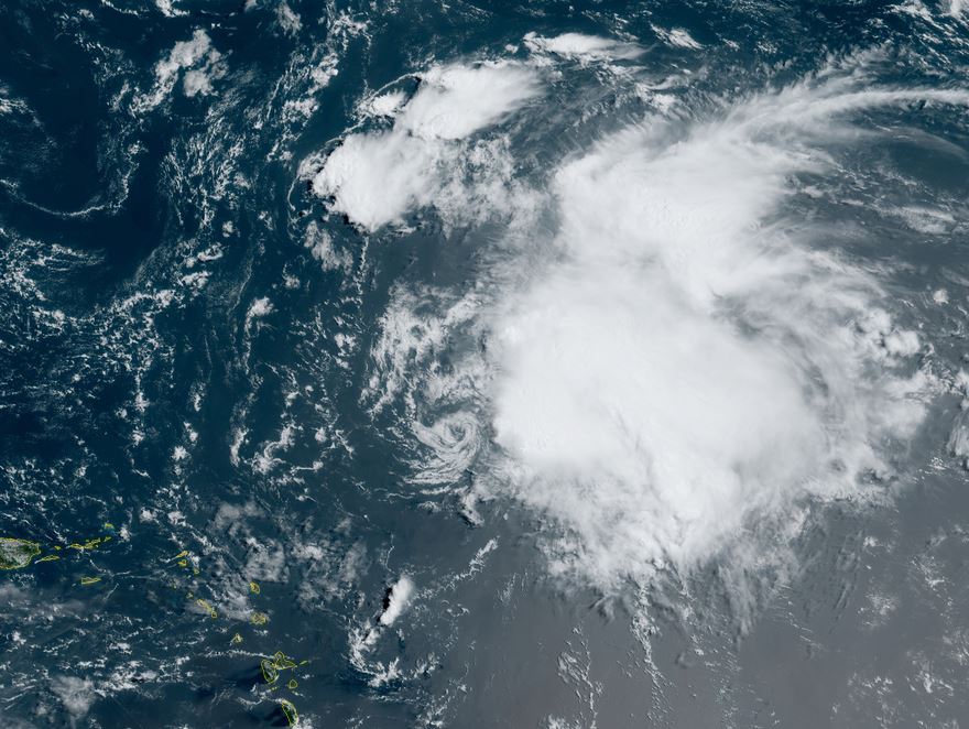
Cindy has a fairly symmetrical shape on satellite imagery but is fighting wind shear. Deep convection is mostly placed to the east of the circulation center.

The Weather Situation
SUMMARY OF 500 AM AST...0900 UTC...INFORMATION
----------------------------------------------
LOCATION...12.1N 46.9W
ABOUT 990 MI...1595 KM E OF THE LESSER ANTILLES
MAXIMUM SUSTAINED WINDS...45 MPH...75 KM/H
PRESENT MOVEMENT...WNW OR 285 DEGREES AT 15 MPH...24 KM/H
MINIMUM CENTRAL PRESSURE...1005 MB...29.68 INCHES

Tropicast: Visible satellite
Image

Tropical Weather Forecast:
Cindy is expected to strengthen marginally and gradually be pulled NW to recurve before reaching the Leewards. It will then continue NW around a large subtropical high. Windshear will increase as it approaches the Islands and likely weaken the tropical cyclone. Interests in the Leewards should follow the progress of Cindy.
Rich Johnson
Twitter: https://twitter.com/richjohnsonwx
Certified Broadcast Meteorologist - Hurricane Expert
User avatar
Tropical Inspector
Site Admin
Site Admin
Posts: 3581
Joined: Tue Feb 20, 2007 2:28 pm
Antispam: no
Location: Under a palm tree
Contact:

Re: Cindy

Post by Tropical Inspector »

Saturday Midday Update

Cindy being sheared
Satellite imagery shows the exposed low level center of Cindy. Deep convection remains mostly north and east of the center. In my opinion, Cindy's top sustained winds are likely more in line with 45 - 50 mph with gusts to 60 mph.

The Weather Situation
SUMMARY OF 1100 AM AST...1500 UTC...INFORMATION
-----------------------------------------------
LOCATION...16.4N 53.3W
ABOUT 535 MI...860 KM E OF THE LESSER ANTILLES
MAXIMUM SUSTAINED WINDS...60 MPH...95 KM/H
PRESENT MOVEMENT...NW OR 310 DEGREES AT 20 MPH...31 KM/H
MINIMUM CENTRAL PRESSURE...1001 MB...29.56 INCHES

Tropicast: Visible satellite
Image

Tropical Weather Forecast:
Cindy is now on a weakening trend and will be gradually be pulled NW to recurve before reaching the Leewards. It will then continue NW around a large subtropical high. Interests in the Leewards should follow the progress of Cindy.
Rich Johnson
Twitter: https://twitter.com/richjohnsonwx
Certified Broadcast Meteorologist - Hurricane Expert
User avatar
Tropical Inspector
Site Admin
Site Admin
Posts: 3581
Joined: Tue Feb 20, 2007 2:28 pm
Antispam: no
Location: Under a palm tree
Contact:

Re: Cindy

Post by Tropical Inspector »

Sunday Morning Update

Low level center is exposed
The low level center of Cindy is clearly visible west of the cloud mass. Deep convection looks impressive to the east, but the system will continue to weaken as the low continues to be sheared.

The Weather Situation
SUMMARY OF 500 AM AST...0900 UTC...INFORMATION
----------------------------------------------
LOCATION...20.3N 57.2W
ABOUT 430 MI...695 KM NE OF THE LESSER ANTILLES
MAXIMUM SUSTAINED WINDS...50 MPH...85 KM/H
PRESENT MOVEMENT...NW OR 320 DEGREES AT 21 MPH...33 KM/H
MINIMUM CENTRAL PRESSURE...1007 MB...29.74 INCHES

Tropicast: Visible satellite
Image

Tropical Weather Forecast:
Cindy will continue to weaken as the low level circulation has moved east of the convection. It will likely be downgraded to a tropical depression by Monday.
Rich Johnson
Twitter: https://twitter.com/richjohnsonwx
Certified Broadcast Meteorologist - Hurricane Expert
Post Reply

Return to “2023 Atlantic Hurricane Archives”

Who is online

Users browsing this forum: No registered users and 35 guests