Page 1 of 1
Gaston
Posted: Tue Sep 20, 2022 4:33 pm
by Tropical Inspector
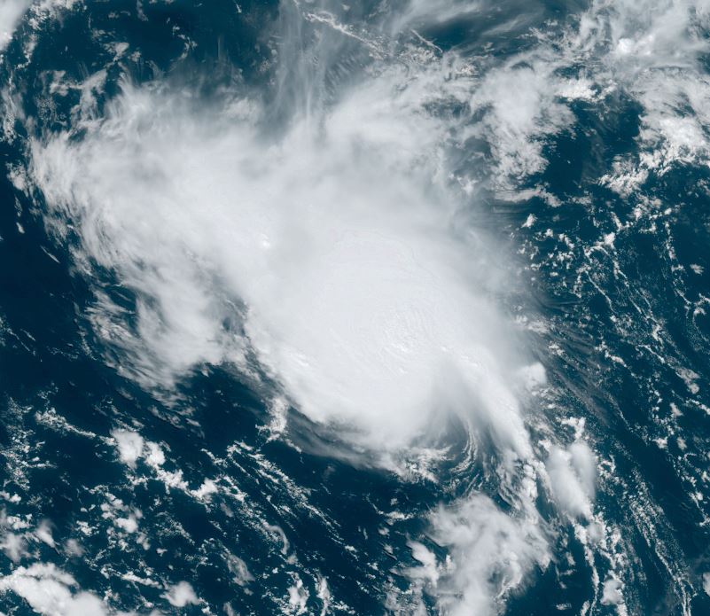
Tuesday Evening Update
Gaston is over the open waters
Slight southerly shear is affecting Gaston. Despite this deep convection is building north and near the center.
The Weather Situation
SUMMARY OF 900 PM GMT...2100 UTC...INFORMATION
----------------------------------------------
LOCATION...34.7N 44.4W
ABOUT 990 MI...1595 KM W OF THE AZORES
MAXIMUM SUSTAINED WINDS...40 MPH...65 KM/H
PRESENT MOVEMENT...NNE OR 20 DEGREES AT 17 MPH...28 KM/H
MINIMUM CENTRAL PRESSURE...1009 MB...29.80 INCHES
Tropicast: Visible Satellite
 Tropical Weather Forecast:
Gaston will move northeast with marginal strengthening and be near the western Azores by later this week.
Re: Gaston
Posted: Thu Sep 22, 2022 5:56 pm
by Tropical Inspector
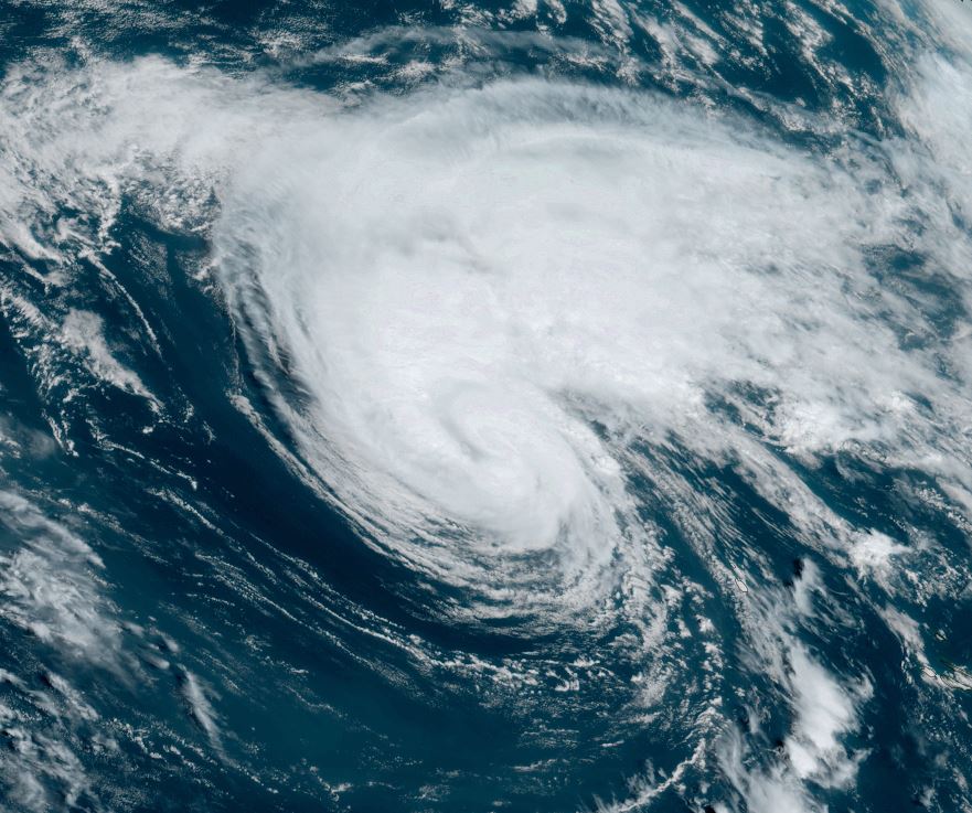
Thursday Evening Update
Gaston approaching the western Azores
Gaston is battling some dry air and shear on its southern flank, but still remains at 65 mph. Deep convection is holding on to the north of the circulation. Gusts to tropical storm strength have been seen in the western Azores.
The Weather Situation
SUMMARY OF 900 PM GMT...2100 UTC...INFORMATION
----------------------------------------------
LOCATION...41.1N 32.0W
ABOUT 245 MI...395 KM NW OF FAIAL ISLAND IN THE CENTRAL AZORES
MAXIMUM SUSTAINED WINDS...65 MPH...100 KM/H
PRESENT MOVEMENT...ENE OR 70 DEGREES AT 17 MPH...28 KM/H
MINIMUM CENTRAL PRESSURE...999 MB...29.50 INCHES
Tropicast: Visible Satellite
 Tropical Weather Forecast:
Gaston will be in the vicinity of the Azores for the next few days as steering currents remain weak.
Re: Gaston
Posted: Fri Sep 23, 2022 4:52 pm
by Tropical Inspector
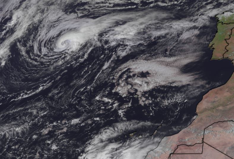
Friday Evening Update
Heavy showers over the Azores
Gaston will soon become extratropical. Rain bands are bringing locally heavy showers to the western and central Azores. Wind gusts to tropical storm strength can be expected into Saturday morning.
The Weather Situation
SUMMARY OF 900 PM GMT...2100 UTC...INFORMATION
----------------------------------------------
LOCATION...39.6N 28.7W
ABOUT 70 MI...110 KM N OF FAIAL ISLAND IN THE CENTRAL AZORES
MAXIMUM SUSTAINED WINDS...60 MPH...95 KM/H
PRESENT MOVEMENT...S OR 180 DEGREES AT 9 MPH...15 KM/H
MINIMUM CENTRAL PRESSURE...995 MB...29.39 INCHES
Tropicast: Visible Satellite
 Tropical Weather Forecast:
Gaston will become extratropical and move to the west away from the Azores.
Re: Gaston
Posted: Sat Sep 24, 2022 10:25 am
by Tropical Inspector
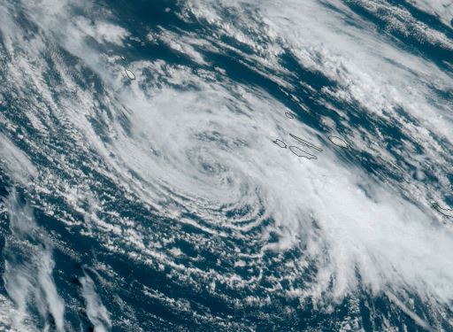
Saturday Midday Update
Heavy showers over the Azores
Gaston has lost its convection and only a few showers remain near the Azores.
The Weather Situation
SUMMARY OF 300 PM GMT...1500 UTC...INFORMATION
----------------------------------------------
LOCATION...38.0N 30.8W
ABOUT 120 MI...195 KM WSW OF FAIAL ISLAND IN THE CENTRAL AZORES
MAXIMUM SUSTAINED WINDS...45 MPH...75 KM/H
PRESENT MOVEMENT...WSW OR 245 DEGREES AT 9 MPH...15 KM/H
MINIMUM CENTRAL PRESSURE...1001 MB...29.56 INCHES
Tropicast: Visible Satellite
 Tropical Weather Forecast:
Gaston is moving away from the Azores as an extratropical cyclone.