Page 1 of 1
Fiona
Posted: Sun Sep 18, 2022 2:40 pm
by Tropical Inspector
Sunday Late Afternoon Update
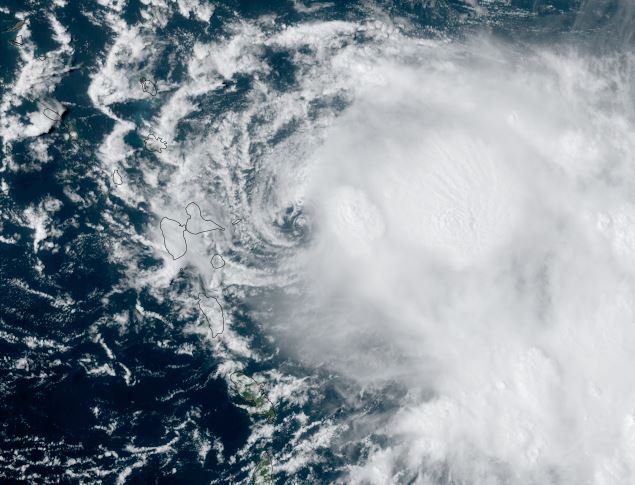
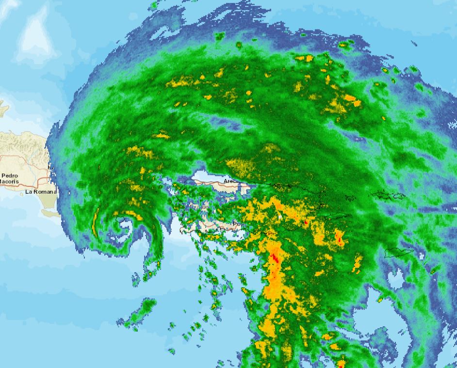
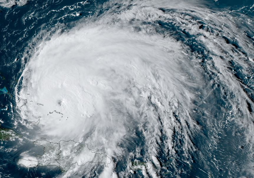
Fiona bringing heavy rainfall to Puerto Rico
Satellite imagery shows that the strongest part of the eyewall is over the Mona Passage west of Puerto Rico. Despite this, very heavy rainfall continues to affect most of Puerto Rico with a strong, moist flow flowing northward from the Caribbean Sea. Flash flooding and mudslides will continue to be a concern.
The Weather Situation
SUMMARY OF 200 PM AST...1800 UTC...INFORMATION
----------------------------------------------
LOCATION...17.8N 66.9W
ABOUT 25 MI...40 KM SW OF PONCE PUERTO RICO
MAXIMUM SUSTAINED WINDS...85 MPH...140 KM/H
PRESENT MOVEMENT...WNW OR 285 DEGREES AT 8 MPH...13 KM/H
MINIMUM CENTRAL PRESSURE...986 MB...29.12 INCHES
Tropicast: Visible Satellite Friday Afternoon
 Tropicast: Visible Satellite Saturday Afternoon
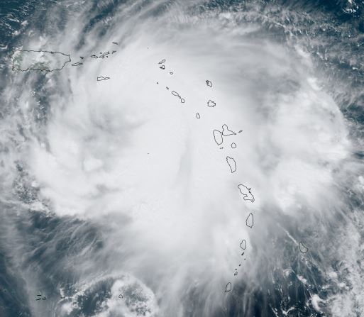 Tropicast: Visible Satellite Sunday Afternoon
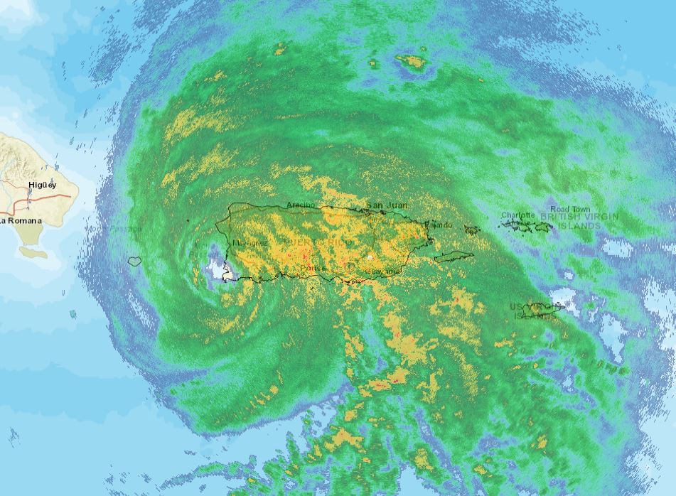
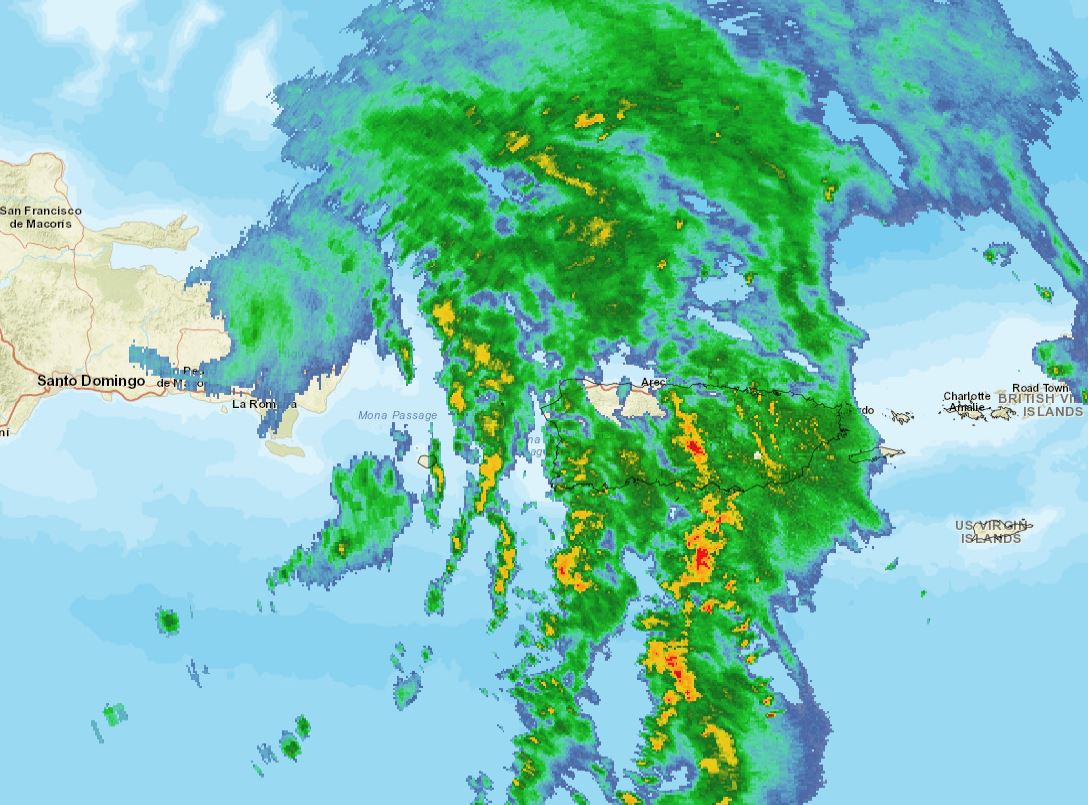
 Tropicast: Sunday Afternoon San Juan Radar
 Tropical Weather Forecast:
Fiona will move northward soon taking it closer to the Turks and Caicos / SE Bahamas by late Sunday night. It will continue to strengthen and possibly affect Bermuda later this week.
Re: Fiona
Posted: Sun Sep 18, 2022 7:43 pm
by Tropical Inspector
Sunday Night Update
The Weather Situation
SUMMARY OF 800 PM AST...0000 UTC...INFORMATION
----------------------------------------------
LOCATION...18.1N 67.8W
ABOUT 45 MI...70 KM W OF MAYAGUEZ PUERTO RICO
ABOUT 50 MI...85 KM SE OF PUNTA CANA DOMINICAN REPUBLIC
MAXIMUM SUSTAINED WINDS...85 MPH...140 KM/H
PRESENT MOVEMENT...NW OR 305 DEGREES AT 9 MPH...15 KM/H
MINIMUM CENTRAL PRESSURE...984 MB...29.06 INCHES
Tropicast: Sunday Night San Juan Radar 8:30 pm AST
Re: Fiona
Posted: Mon Sep 19, 2022 11:52 am
by Tropical Inspector
Monday Midday Update
The Weather Situation
SUMMARY OF 1100 AM AST...1500 UTC...INFORMATION
-----------------------------------------------
LOCATION...19.1N 69.2W
ABOUT 10 MI...15 KM SE OF SAMANA DOMINICAN REPUBLIC
ABOUT 205 MI...330 KM SE OF GRAND TURK ISLAND
MAXIMUM SUSTAINED WINDS...85 MPH...140 KM/H
PRESENT MOVEMENT...NW OR 310 DEGREES AT 8 MPH...13 KM/H
MINIMUM CENTRAL PRESSURE...980 MB...28.94 INCHES
Tropicast: Monday Morning San Juan Radar 9:00 am AST
Re: Fiona
Posted: Mon Sep 19, 2022 8:55 pm
by Tropical Inspector
Monday Night Update
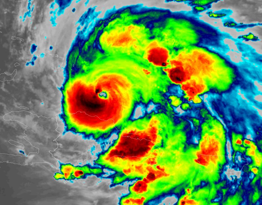
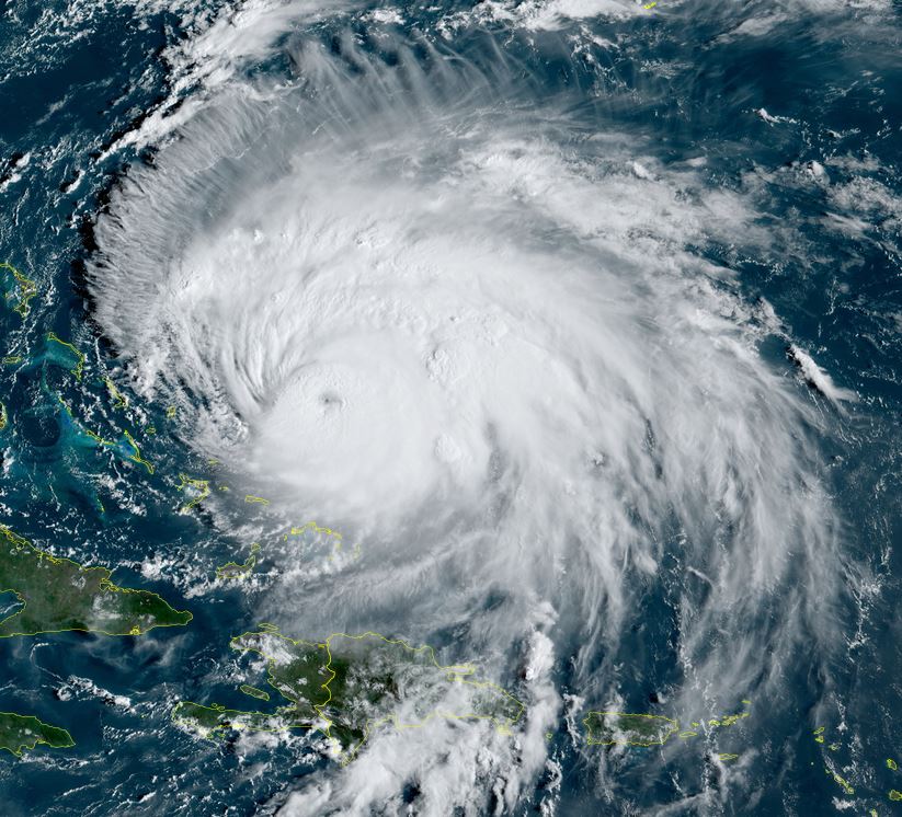
Fiona intensifying
Satellite imagery shows a thicker eyewall and deeper convection with cloud top cooling.
The Weather Situation
SUMMARY OF 800 PM AST...0000 UTC...INFORMATION
----------------------------------------------
LOCATION...20.2N 70.1W
ABOUT 130 MI...205 KM SE OF GRAND TURK ISLAND
MAXIMUM SUSTAINED WINDS...105 MPH...165 KM/H
PRESENT MOVEMENT...NW OR 325 DEGREES AT 10 MPH...17 KM/H
MINIMUM CENTRAL PRESSURE...974 MB...28.76 INCHES
Tropicast: IR Satellite
 Tropical Weather Forecast:
Fiona is tracking northwest and will pass just east of the Turks and Caicos Tuesday. It will become a major hurricane and pass near the vicinity of Bermuda Thursday evening.
Re: Fiona
Posted: Tue Sep 20, 2022 12:07 pm
by Tropical Inspector
Tuesday Afternoon Update
Fiona north of the Turks and Caicos
Fiona will continue to pull away from the Turks and Caicos today.
The Weather Situation
SUMMARY OF 1100 AM EDT...1500 UTC...INFORMATION
-----------------------------------------------
LOCATION...22.0N 71.4W
ABOUT 40 MI...65 KM NNW OF GRAND TURK ISLAND
MAXIMUM SUSTAINED WINDS...115 MPH...185 KM/H
PRESENT MOVEMENT...NNW OR 330 DEGREES AT 9 MPH...15 KM/H
MINIMUM CENTRAL PRESSURE...961 MB...28.38 INCHES
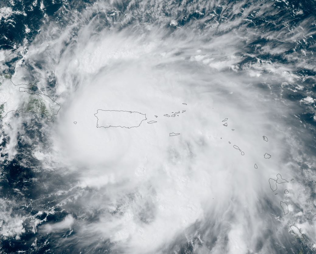
Tropicast: Visible Satellite
 Tropical Weather Forecast:
Fiona is tracking north northwest and will pass west of Bermuda Thursday evening.
Re: Fiona
Posted: Tue Sep 20, 2022 4:43 pm
by Tropical Inspector
Tuesday Evening Update
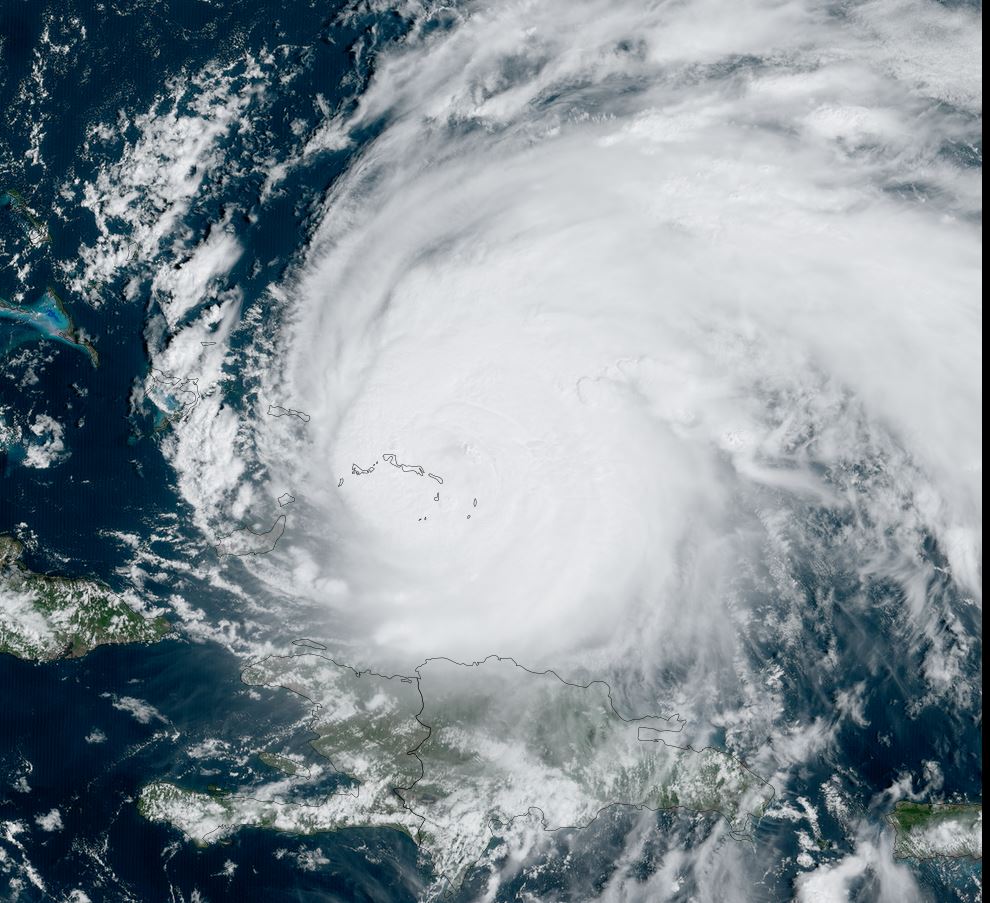
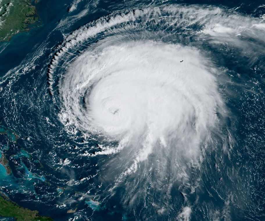
Fiona still a cat 3
Heavy rainfall and strong winds are still affecting the Turks and Caicos but should quiet down soon as Fiona pulls northward. Satellite imagery shows excellent outflow on the eastern half of the circulation but restricted to the west.
The Weather Situation
SUMMARY OF 500 PM EDT...2100 UTC...INFORMATION
----------------------------------------------
LOCATION...22.6N 71.8W
ABOUT 50 MI...80 KM N OF NORTH CAICOS ISLAND
ABOUT 795 MI...1280 KM SW OF BERMUDA
MAXIMUM SUSTAINED WINDS...115 MPH...185 KM/H
PRESENT MOVEMENT...NNW OR 330 DEGREES AT 8 MPH...13 KM/H
MINIMUM CENTRAL PRESSURE...957 MB...28.26 INCHES
Tropicast: Visible Satellite
 Tropical Weather Forecast:
Fiona will continue northward toward and be west of Bermuda Thursday night. It will be in the vicinity of eastern Nova Scotia / western Newfoundland by this weekend.
Re: Fiona
Posted: Thu Sep 22, 2022 11:57 am
by Tropical Inspector
Thursday Afternoon / Evening Update
Fiona moving west of Bermuda tonight
Fiona is maintaining its strength with the deepest convection on the west side of the eyewall. Bermuda can expect high surf especially on the south and western facing beaches. Heavy rainfall in outer rainbands and winds gusting to hurricane strength.
The Weather Situation
SUMMARY OF 500 PM AST...2100 UTC...INFORMATION
----------------------------------------------
LOCATION...30.4N 69.5W
ABOUT 305 MI...495 KM WSW OF BERMUDA
ABOUT 1030 MI...1660 KM SSW OF HALIFAX NOVA SCOTIA
MAXIMUM SUSTAINED WINDS...130 MPH...215 KM/H
PRESENT MOVEMENT...NNE OR 25 DEGREES AT 20 MPH...31 KM/H
MINIMUM CENTRAL PRESSURE...936 MB...27.64 INCHES
Tropicast: Visible Satellite Wednesday
 Tropicast: Visible Satellite Thursday
 Tropical Weather Forecast:
Fiona will pass west of Bermuda Thursday night into Friday morning. It will be in the vicinity of eastern Nova Scotia / western Newfoundland by late Friday night as a strong extratropical cyclone.
Re: Fiona
Posted: Fri Sep 23, 2022 5:06 pm
by Tropical Inspector
Friday Evening Update
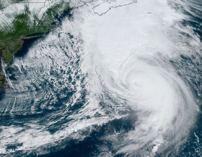
Fiona heading to eastern Nova Scotia
Hurricane force winds, heavy rainfall and high surf can be expected over Nova Scotia as Fiona makes landfall later tonight.
The Weather Situation
SUMMARY OF 500 PM AST...2100 UTC...INFORMATION
----------------------------------------------
LOCATION...39.6N 61.0W
ABOUT 370 MI...595 KM SSE OF HALIFAX NOVA SCOTIA
MAXIMUM SUSTAINED WINDS...125 MPH...205 KM/H
PRESENT MOVEMENT...NNE OR 30 DEGREES AT 40 MPH...65 KM/H
MINIMUM CENTRAL PRESSURE...940 MB...27.76 INCHES
Tropicast: Visible Satellite
 Tropical Weather Forecast:
Fiona will move over eastern Nova Scotia tonight into Saturday morning as a strong extratropical cyclone.
Re: Fiona
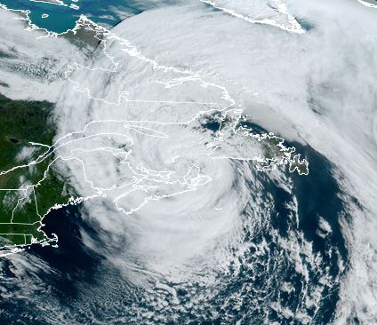
Posted: Sat Sep 24, 2022 10:33 am
by Tropical Inspector
Saturday Midday Update
Fiona over eastern Canada
Hurricane force wind gusts and heavy rainfall will continue today over eastern Canada.
The Weather Situation
SUMMARY OF 1100 AM AST...1500 UTC...INFORMATION
-----------------------------------------------
LOCATION...47.9N 61.3W
ABOUT 100 MI...160 KM WNW OF PORT AUX BASQUES NEWFOUNDLAND
MAXIMUM SUSTAINED WINDS...80 MPH...130 KM/H
PRESENT MOVEMENT...N OR 355 DEGREES AT 25 MPH...41 KM/H
MINIMUM CENTRAL PRESSURE...945 MB...27.91 INCHES
Tropicast: Visible Satellite
 Tropical Weather Forecast:
Fiona is an extratropical cyclone over eastern Canada.