Page 1 of 1
Rose
Posted: Sun Sep 19, 2021 8:00 am
by Tropical Inspector
Sunday Midday Update
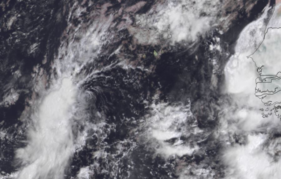
TD 17 forms
The Weather Situation
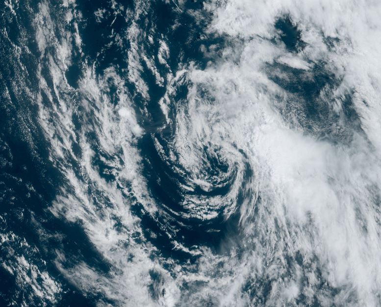
Tropical depression 17 has convection on the west side of its circulation.
Current Tropical Weather
SUMMARY OF 200 PM CVT...1500 UTC...INFORMATION
----------------------------------------------
LOCATION...13.2N 28.8W
ABOUT 315 MI...505 KM WSW OF THE SOUTHERNMOST CABO VERDE ISLANDS
MAXIMUM SUSTAINED WINDS...35 MPH...55 KM/H
PRESENT MOVEMENT...NNW OR 330 DEGREES AT 14 MPH...22 KM/H
MINIMUM CENTRAL PRESSURE...1007 MB...29.74 INCHES
Tropical Weather Forecast:
TD 17 is expected to move into the open Atlantic and not affect land
Tropicast: Visible Satellite
Re: Rose
Posted: Sun Sep 19, 2021 5:46 pm
by Tropical Inspector
Sunday Evening Update
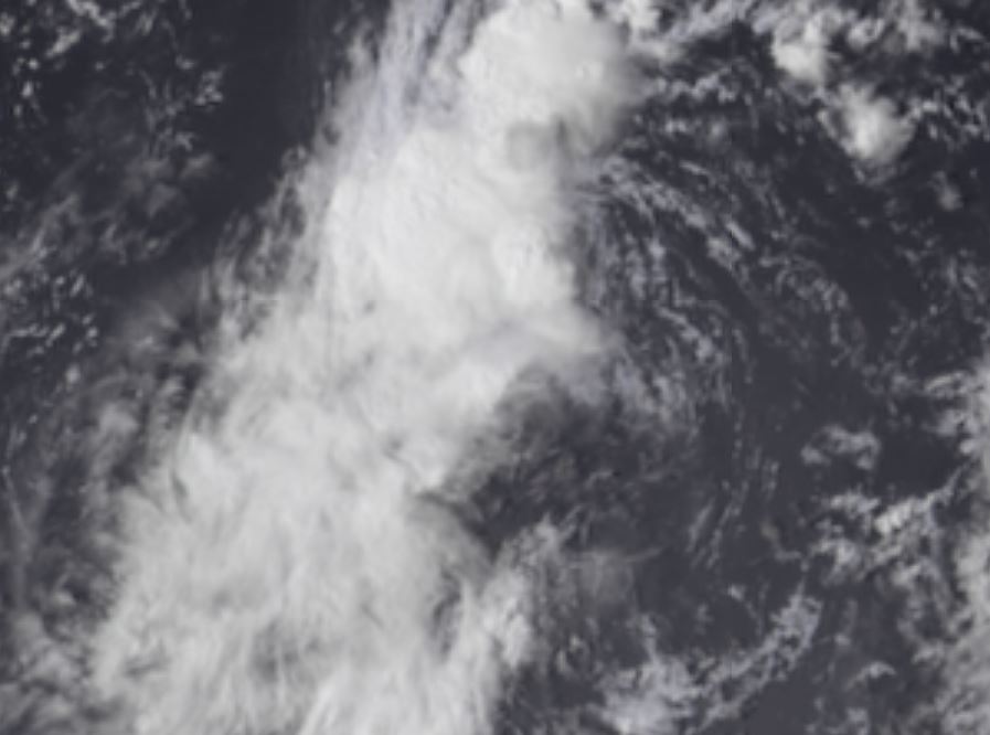
Rose named
The Weather Situation
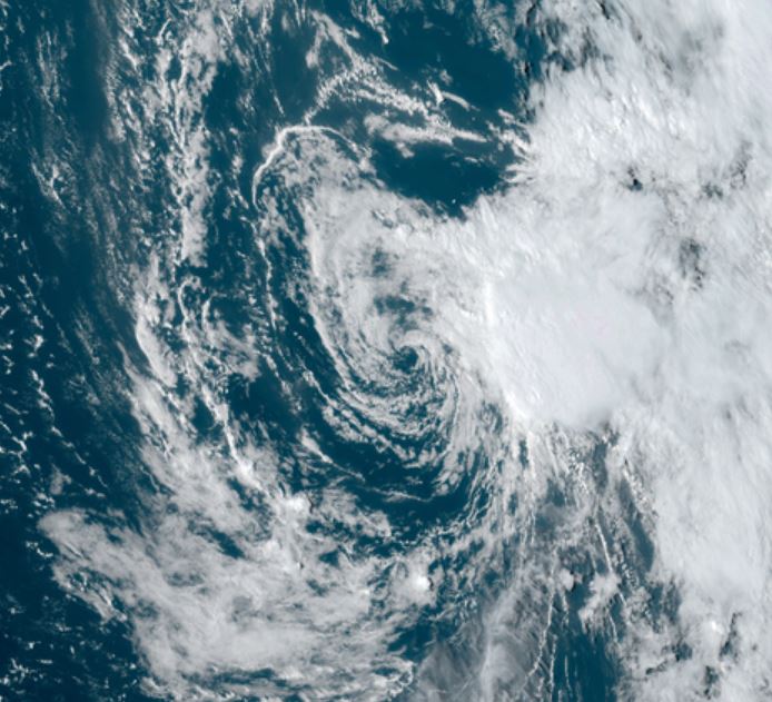
The low level circulation of Rose has now moved under deep convection as wind shear has weakened some.
Current Tropical Weather
SUMMARY OF 800 PM CVT...2100 UTC...INFORMATION
----------------------------------------------
LOCATION...14.3N 29.9W
ABOUT 370 MI...595 KM W OF THE SOUTHERNMOST CABO VERDE ISLANDS
MAXIMUM SUSTAINED WINDS...40 MPH...65 KM/H
PRESENT MOVEMENT...NNW OR 330 DEGREES AT 16 MPH...26 KM/H
MINIMUM CENTRAL PRESSURE...1005 MB...29.68 INCHES
Tropical Weather Forecast:
Tropical Storm Rose is expected to move into the open Atlantic and not affect land
Tropicast: Visible Satellite
Re: Rose
Posted: Mon Sep 20, 2021 6:17 am
by Tropical Inspector
Monday Morning Update
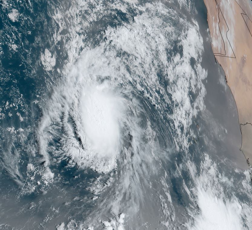
Rose stronger
The Weather Situation
Wind shear has lessened and Rose appears stronger on satellite imagery. IMO, Rose is considerably stronger then the 40 mph official strength. I wouldn't be surprised of 55-60 mph. I would also say the pressure is considerably lower, more like 997 mb.
Official NHC Data
SUMMARY OF 500 AM AST...0900 UTC...INFORMATION
----------------------------------------------
LOCATION...15.9N 32.6W
ABOUT 550 MI...885 KM W OF THE SOUTHERNMOST CABO VERDE ISLANDS
MAXIMUM SUSTAINED WINDS...40 MPH...65 KM/H
PRESENT MOVEMENT...NW OR 315 DEGREES AT 15 MPH...24 KM/H
MINIMUM CENTRAL PRESSURE...1005 MB...29.68 INCHES
Tropical Weather Forecast:
Tropical Storm Rose is expected to move into the open Atlantic and not affect land.
Tropicast: Visible Satellite
Re: Rose
Posted: Tue Sep 21, 2021 8:12 am
by Tropical Inspector
Tuesday Morning Update
Rose weaker
The Weather Situation
IMO, I am not buying the 45 mph wind speed from NHC. Clearly the tropical cyclone looks weaker than yesterday despite the low and mid level circulation not perfectly aligned. I am estimating 35-40 mph with Rose as shear has increased again. I will give NHC credit for putting Rose up to 50 mph last evening. They just seem a little slow with the intensity increases / decreases.
Official NHC Data
SUMMARY OF 500 AM AST...0900 UTC...INFORMATION
----------------------------------------------
LOCATION...21.0N 36.4W
ABOUT 880 MI...1420 KM WNW OF THE CABO VERDE ISLANDS
MAXIMUM SUSTAINED WINDS...45 MPH...75 KM/H
PRESENT MOVEMENT...NW OR 325 DEGREES AT 20 MPH...31 KM/H
MINIMUM CENTRAL PRESSURE...1006 MB...29.71 INCHES
Tropical Weather Forecast:
Tropical Storm Rose is expected to move into the open Atlantic and not affect land.
Tropicast: Visible Satellite
Re: Rose
Posted: Tue Sep 21, 2021 8:50 pm
by Tropical Inspector
Tuesday Evening Update
Rose changes little
The Weather Situation
Even thought the center of circulation is void of convection, deep convection exists well east. It is plausible that 40 mph sustained winds would be found in this area.
Official NHC Data
SUMMARY OF 500 PM AST...2100 UTC...INFORMATION
----------------------------------------------
LOCATION...22.5N 37.7W
ABOUT 1000 MI...1605 KM WNW OF THE CABO VERDE ISLANDS
MAXIMUM SUSTAINED WINDS...40 MPH...65 KM/H
PRESENT MOVEMENT...NW OR 320 DEGREES AT 10 MPH...17 KM/H
MINIMUM CENTRAL PRESSURE...1008 MB...29.77 INCHES
Tropical Weather Forecast:
Tropical Storm Rose is expected to move into the open Atlantic and not affect land.
Tropicast: Visible Satellite
Re: Rose
Posted: Wed Sep 22, 2021 4:57 pm
by Tropical Inspector
Wednesday Evening Update
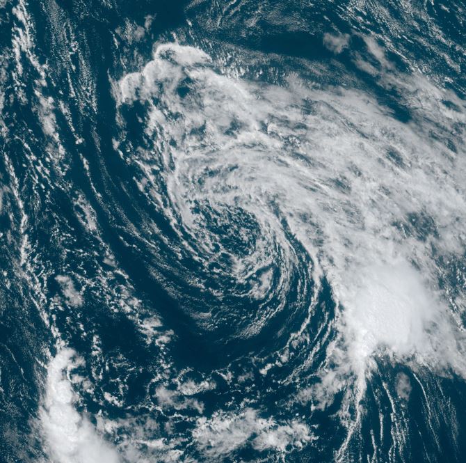
Rose winding down
The Weather Situation
Rose has a large open circulation center with some convection hanging on well to the southeast of the low.
Official NHC Data
SUMMARY OF 500 PM AST...2100 UTC...INFORMATION
----------------------------------------------
LOCATION...24.2N 40.2W
ABOUT 1190 MI...1920 KM WNW OF THE CABO VERDE ISLANDS
MAXIMUM SUSTAINED WINDS...35 MPH...55 KM/H
PRESENT MOVEMENT...WNW OR 300 DEGREES AT 10 MPH...17 KM/H
MINIMUM CENTRAL PRESSURE...1010 MB...29.83 INCHES
Tropical Weather Forecast:
Rose will drift north / northeast and become extratropical over the next few days..
Tropicast: Visible Satellite