Page 1 of 1
Nicholas
Posted: Sun Sep 12, 2021 1:38 pm
by Tropical Inspector
Sunday Afternoon Update
Nicholas named
The Weather Situation
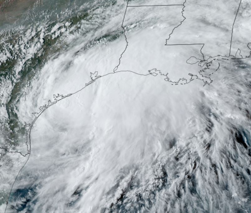
Satellite imagery shows a large, but still fairly disorganized area of convection over the western Gulf of Mexico. Organization and some strengthening is expected before landfall during the next 36-48 hours.
Current Tropical Weather
SUMMARY OF 100 PM CDT...1800 UTC...INFORMATION
----------------------------------------------
LOCATION...21.7N 95.5W
ABOUT 180 MI...285 KM NNE OF VERACRUZ MEXICO
ABOUT 310 MI...500 KM SSE OF MOUTH OF THE RIO GRANDE
MAXIMUM SUSTAINED WINDS...40 MPH...65 KM/H
PRESENT MOVEMENT...NNW OR 330 DEGREES AT 15 MPH...24 KM/H
MINIMUM CENTRAL PRESSURE...1008 MB...29.77 INCH
Tropical Weather Forecast:
Will move north northwest to the southern Texas coast by Monday, then move inland as a tropical storm early Tuesday on the central Texas coast.
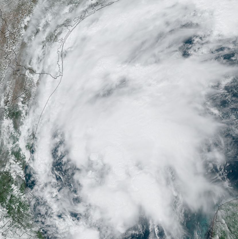
Tropicast: Visible Satellite
Re: Nicholas
Posted: Mon Sep 13, 2021 9:39 am
by Tropical Inspector
Monday Morning Update
Nicholas just offshore of the south Texas coast
The Weather Situation
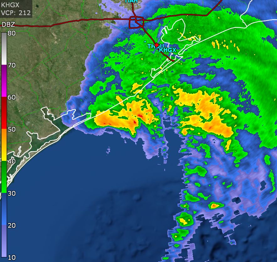
Nicholas is still rather disorganized and does not have a good radar appearance.
Current Tropical Weather
SUMMARY OF 1000 AM CDT...1500 UTC...INFORMATION
-----------------------------------------------
LOCATION...26.4N 96.8W
ABOUT 45 MI...70 KM NE OF MOUTH OF THE RIO GRANDE
ABOUT 140 MI...225 KM S OF PORT OCONNOR TEXAS
MAXIMUM SUSTAINED WINDS...60 MPH...95 KM/H
PRESENT MOVEMENT...N OR 5 DEGREES AT 12 MPH...19 KM/H
MINIMUM CENTRAL PRESSURE...1002 MB...29.59 INCHES
Tropical Weather Forecast:
Nicholas will move inland on the central Texas coast this evening and slowly move northeast during the next 24-48 hours. Flooding is the major threat from this system.
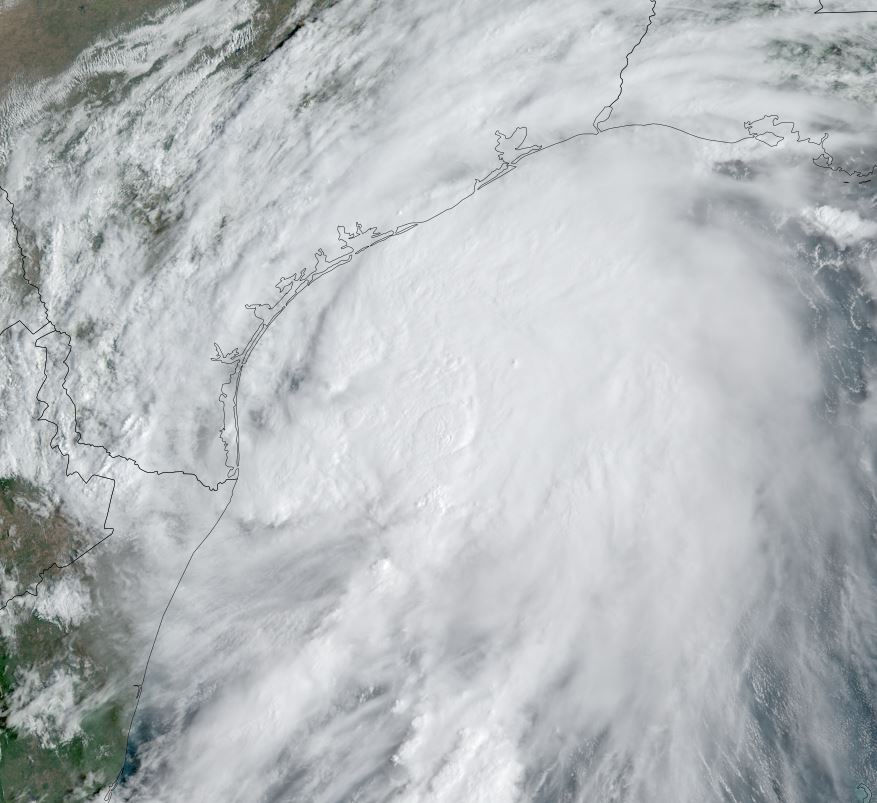
Tropicast: Visible Satellite
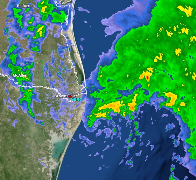
 Tropicast: Radar Satellite
Re: Nicholas
Posted: Mon Sep 13, 2021 6:41 pm
by Tropical Inspector
Monday Evening Update
Nicholas hours away from landfall
The Weather Situation
Nicholas has a large circulation but still does not present a good radar image. Very heavy rainfall can be expected over the upper Texas coast and inland into tomorrow.
Current Tropical Weather
SUMMARY OF 400 PM CDT...2100 UTC...INFORMATION
----------------------------------------------
LOCATION...27.4N 96.4W
ABOUT 70 MI...110 KM S OF PORT OCONNOR TEXAS
ABOUT 85 MI...140 KM SSW OF MATAGORDA TEXAS
MAXIMUM SUSTAINED WINDS...65 MPH...100 KM/H
PRESENT MOVEMENT...NNE OR 15 DEGREES AT 12 MPH...19 KM/H
MINIMUM CENTRAL PRESSURE...1000 MB...29.53 INCHES
Tropical Weather Forecast:
Nicholas will move inland later this evening on the central Texas coast and slowly move northeast during the next 24-48 hours. Flooding is the major threat from this system.
Tropicast: Visible Satellite
Re: Nicholas
Posted: Mon Sep 13, 2021 9:22 pm
by Tropical Inspector
Tropicast: Radar Monday Evening
Re: Nicholas
Posted: Tue Sep 14, 2021 10:14 am
by Tropical Inspector
Tuesday Midday Update
Nicholas producing heavy rainfall
The Weather Situation
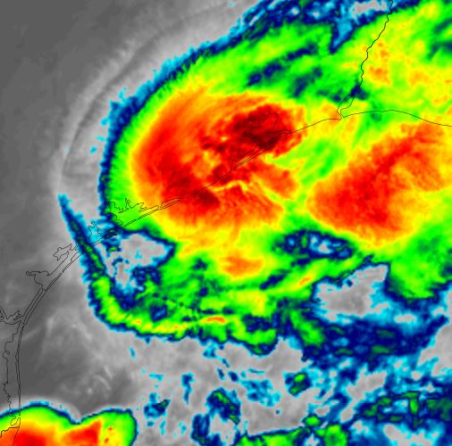
Nicholas was upgraded to hurricane strength briefly for one advisory in the middle of the night. IMO, despite having a 90 mph gust off of Matagorda Island, this was not a hurricane. Sustained winds of 75 mph could have easily produced winds of near 100 mph or more.
Current Tropical Weather
SUMMARY OF 1000 AM CDT...1500 UTC...INFORMATION
-----------------------------------------------
LOCATION...29.6N 95.3W
ABOUT 10 MI...15 KM SE OF HOUSTON TEXAS
ABOUT 85 MI...140 KM WSW OF PORT ARTHUR TEXAS
MAXIMUM SUSTAINED WINDS...45 MPH...75 KM/H
PRESENT MOVEMENT...NE OR 40 DEGREES AT 6 MPH...9 KM/H
MINIMUM CENTRAL PRESSURE...1002 MB...29.59 INCHE
Tropical Weather Forecast:
Nicholas will will continue to weaken as it moves ENE toward Louisiana
Tropicast: IR Satellite 1 AM CDT
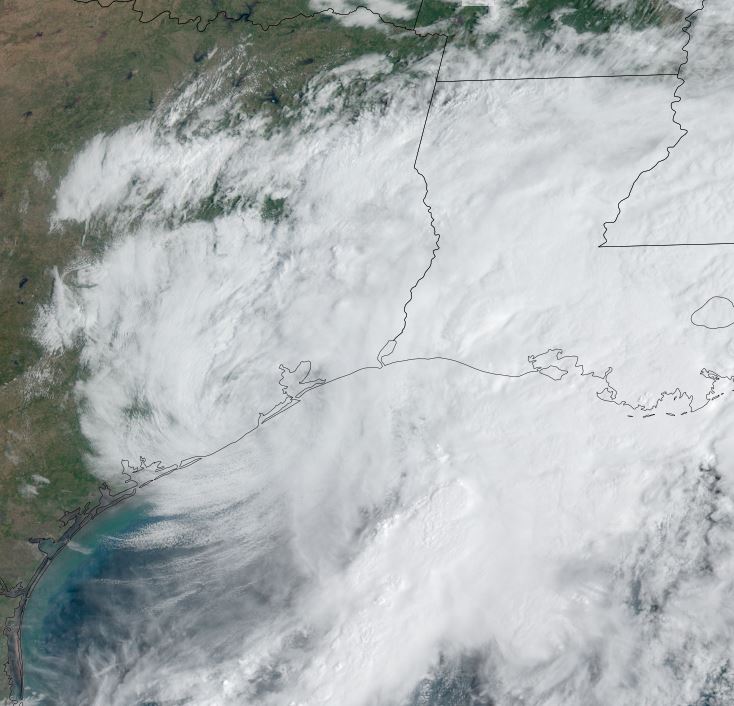
 Tropicast: Visible Satellite 10 AM CDT
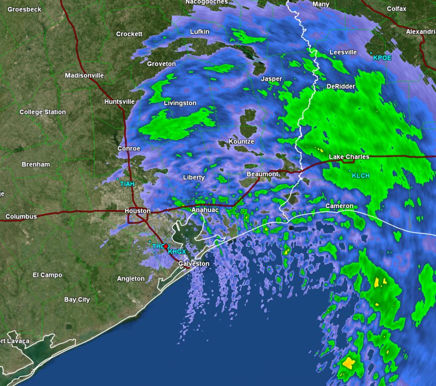
 Tropicast: Radar