Page 1 of 1
Eta
Posted: Sat Oct 31, 2020 6:46 pm
by Tropical Inspector
Saturday Night Update
Next...
The Weather Situation
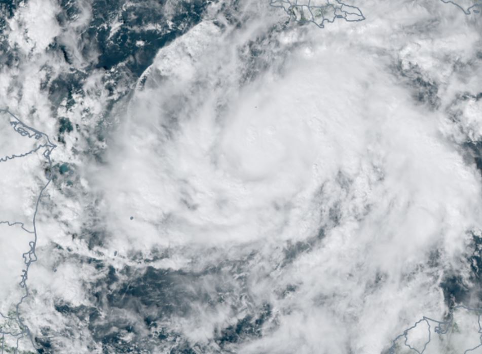
TD 29 has formed. Satellite imagery looks somewhat impressive with the outflow aloft. There still is little organized deep convection near the center.
For more frequent updates: Twitter:
https://twitter.com/richjohnsonwx
Current tropical weather
As of 5:00 PM EDT TD 29 was centered at 15.0 N / 73.2 W or about 665 miles east of Cabo Gracias a Dios, Nicaragua. It was moving west at 15 mph. Officially top sustained winds are estimated at 35 mph. Pressure was estimated at 1006 hPa (mb).
Tropical Weather Forecast:
TD 29 (Eta) will strengthen and move west toward the coast of Nicaragua by later Monday. It is likely to become a hurricane before landfall.
Tropicast: Visible Satellite
Re: Eta
Posted: Sun Nov 01, 2020 2:05 pm
by Tropical Inspector
Sunday Afternoon Update
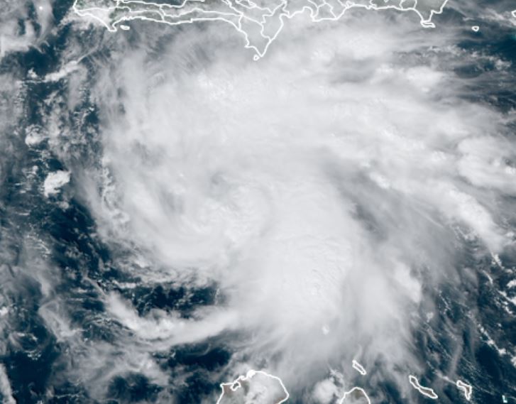
Eta steadily strengthening
The Weather Situation
Tropical Storm Eta is organizing with banding becoming more structured. Deep convection has also expanded near the center of circulation.
For more frequent updates: Twitter:
https://twitter.com/richjohnsonwx
Current tropical weather
As of 1:00 PM EST Tropical Storm Eta was centered at 14.9 N / 78.1 W or about 345 miles east of Cabo Gracias a Dios, Nicaragua. It was moving west at 15 mph. Officially top sustained winds are estimated at 50 mph. Pressure was estimated at 1000 hPa (mb).
Tropical Weather Forecast:
Eta is expected to become a hurricane before making landfall on the coast of Nicaragua Tuesday morning. Flash flooding is a grave concern with the slow motion of Eta.
Tropicast: Visible Satellite
Re: Eta
Posted: Mon Nov 02, 2020 2:19 pm
by Tropical Inspector
Monday Afternoon Update
Eta cat 3 now
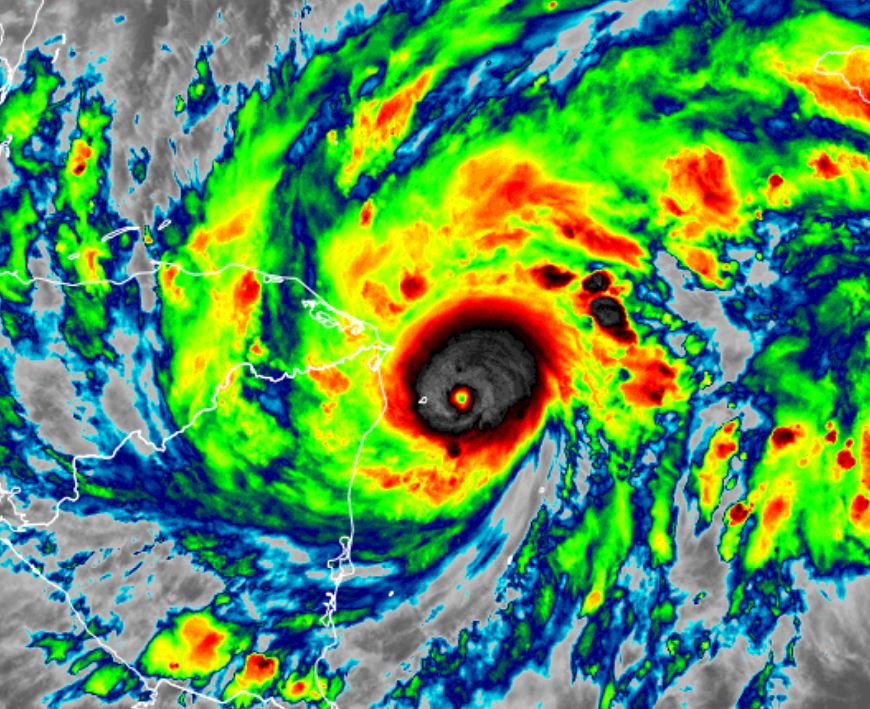
The Weather Situation
Eta has rapidly strengthened into a category 3 hurricane. It poses a massive flood and wind damage threat to Nicaragua into Honduras.
For more frequent updates: Twitter:
https://twitter.com/richjohnsonwx
Current tropical weather
As of 1:00 PM EST Hurricane Eta was centered at 14.7 N / 82.0 W or about 85 miles east of Cabo Gracias a Dios, Nicaragua. It was moving west at 9 mph. Officially top sustained winds are estimated at 120 mph. Pressure was estimated at 957 hPa (mb).
Tropical Weather Forecast:
Eta will be making landfall on the northeast coast of Nicaragua Tuesday morning. Expect disastrous flooding / mudslides / wind damage.
Tropicast: Visible Satellite
 Tropicast: IR Satellite
Re: Eta
Posted: Mon Nov 02, 2020 5:42 pm
by Tropical Inspector
Monday Evening Update
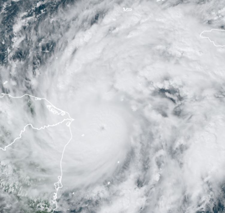
Eta cat 4
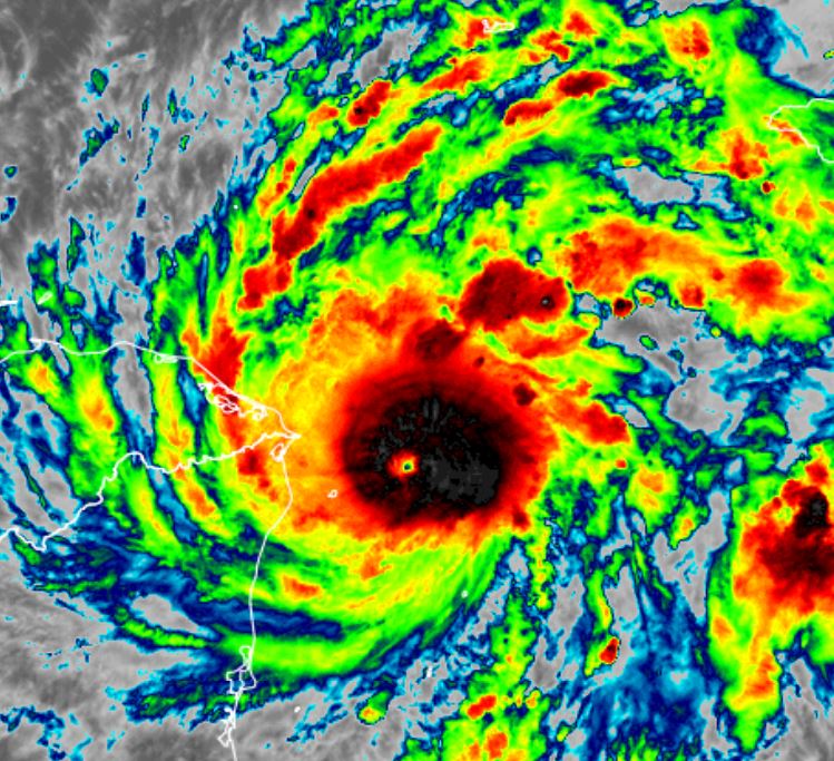
The Weather Situation
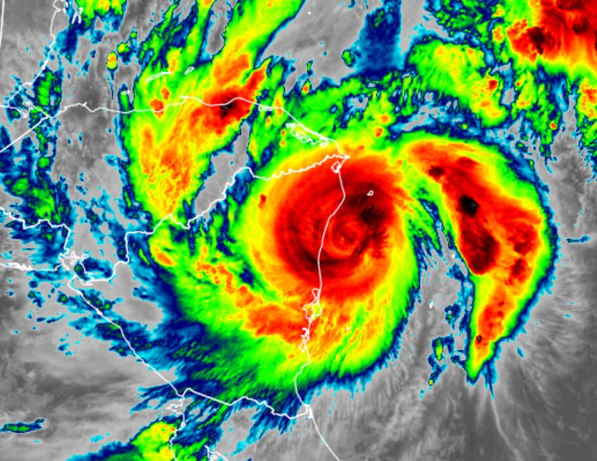
Hurricane Eta is now a category 4 of 130 mph estimated sustained winds as of Monday evening. The core is small but catastrophic wind damage and surge will occur over northeastern Nicaragua near and north of landfall. The eastern Caribbean coast of Honduras will also see these effects. Flash flooding from massive rainfall will cause mudslides over over the next several days from the very slow motion as it weakens.
For more frequent updates: Twitter:
https://twitter.com/richjohnsonwx
Current tropical weather
As of 4:00 PM EST Hurricane Eta was centered at 14.5 N / 82.3 W or about 70 miles ESE of Cabo Gracias a Dios, Nicaragua. It was moving WSW at 9 mph. Officially top sustained winds are estimated at 130 mph. Pressure was estimated at 948 hPa (mb).
Tropical Weather Forecast:
Eta will be making landfall on the northeast coast of Nicaragua Tuesday morning. Expect disastrous flooding / mudslides / wind damage.
Tropicast: Visible Satellite
 Tropicast: IR Satellite
Re: Eta
Posted: Tue Nov 03, 2020 9:25 am
by Tropical Inspector
Tuesday Morning Update
Eta cat 4
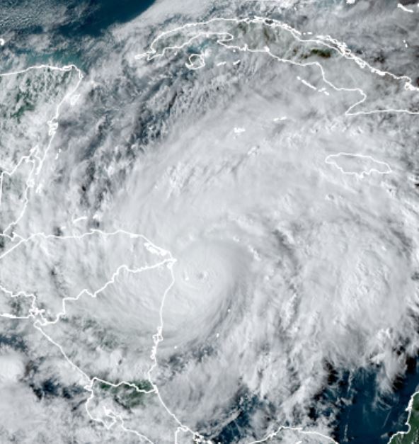
The Weather Situation
Hurricane Eta is about to make landfall it has weakened slightly as it is now interacting with land. It has affected the northeast and east central coast of Nicaragua with the worst effects. Satellite imagery no longer shows the eye as clouds have filled in. This is typical of a landfalling tropical cyclone. Pressure had dropped to 923 mb overnight.
For more frequent updates: Twitter:
https://twitter.com/richjohnsonwx
Current tropical weather
As of 7:00 AM EST Hurricane Eta was centered at 13.7 N / 83.1 W or about 30 miles SE of Puerto Cabezas, Nicaragua. It was moving WSW at 4 mph. Officially top sustained winds are estimated at 145 mph. Pressure was estimated at 936 hPa (mb).
Tropical Weather Forecast:
Eta will be making landfall soon on the northeast coast of Nicaragua Tuesday morning. Expect disastrous flooding / mudslides / wind damage. forecast models restrengthen it in the northwestern Caribbean in several days. It is likely to stay around for at least another week.
Tropicast: Visible Satellite
 Tropicast: IR Satellite
Re: Eta
Posted: Thu Nov 05, 2020 1:03 pm
by Tropical Inspector
Thursday Afternoon Update
Eta not discernable
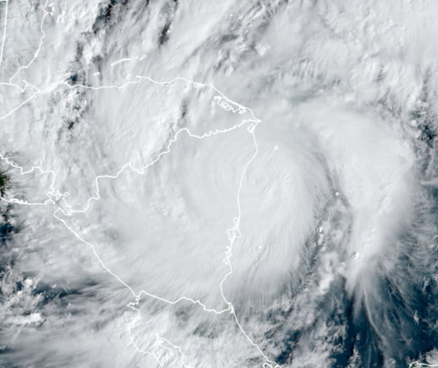
The Weather Situation
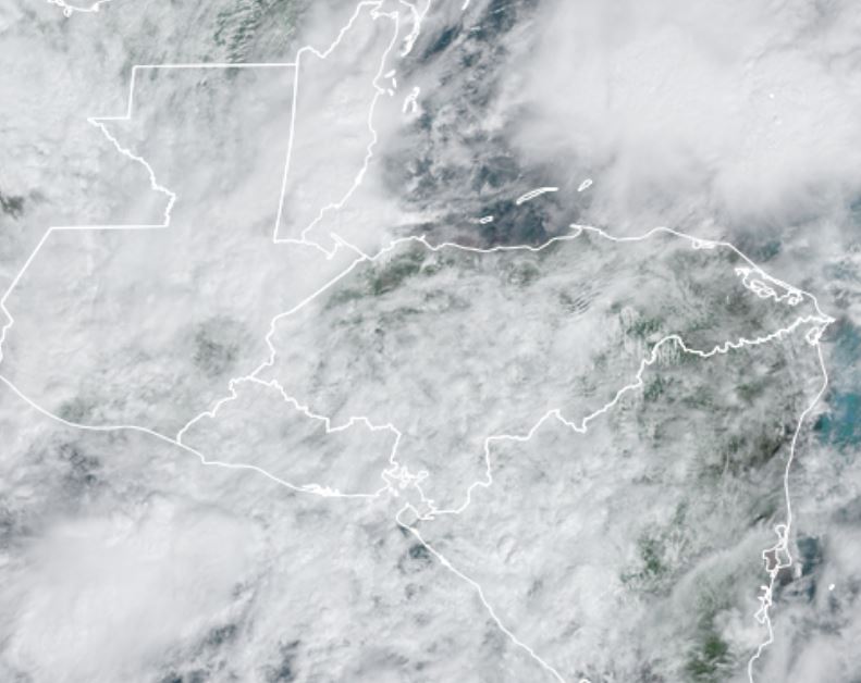
Widespread clouds / rainfall remain over Central America today. The center of Eta IMO is no longer discernable. Any new tropical cyclone should be given a new name.
For more frequent updates: Twitter:
https://twitter.com/richjohnsonwx
Current tropical weather
As of 9:00 AM EST Tropical Depression Eta was centered at 15.1 N / 87.8 W or about 80 miles south of Cieba, Honduras. It was moving NW at 9 mph. Officially top sustained winds are estimated at 30 mph. Pressure was estimated at 1005 hPa (mb).
Tropical Weather Forecast:
Eta, or whatever system reforms / form in the northwestern Caribbean it expected to move north into the Gulf next week.
Tropicast: Visible Satellite Wednesday
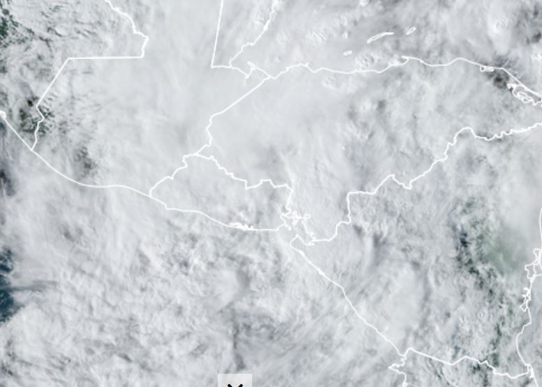 Tropicast: Visible Satellite Thursday
Re: Eta
Posted: Fri Nov 06, 2020 8:07 am
by Tropical Inspector
Friday Morning Update
Eta moving into western Caribbean
The Weather Situation
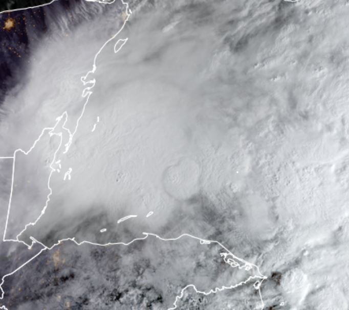
A large disorganized mass of showers and storms exists over the western Caribbean. Gradual organization is likely today.
For more frequent updates: Twitter:
https://twitter.com/richjohnsonwx
Current tropical weather
As of 6:00 AM CST Tropical Depression Eta was centered at 17.5 N / 87.8 W or about 65 miles east of Belize City, Belize. It was moving north at 7 mph. Officially top sustained winds are estimated at 35 mph. Pressure was estimated at 1004 hPa (mb).
Tropical Weather Forecast:
Eta is expected to move over central Cuba then be in the vicinity of south Florida late Sunday night into early Monday morning. It will drift northwest over the eastern Gulf of Mexico. Dry air and shear, especially late in the period will inhibit development.
Tropicast: Visible Satellite Thursday
Re: Eta
Posted: Sat Nov 07, 2020 9:06 pm
by Tropical Inspector
Saturday Evening Update
Eta heading into Cuba
The Weather Situation
Eta finally organized this morning and was upgraded to tropical storm strength. It is bringing heavy rainfall to central Cuba and will spread across rain weary south florida soon.
For more frequent updates: Twitter:
https://twitter.com/richjohnsonwx
Current tropical weather
As of 7:00 PM EST Tropical Storm Eta was centered at 20.4 N / 80.2 W or about 375 miles south of Miami, FL. It was moving northeast at 14 mph. Officially top sustained winds are estimated at 65 mph. Pressure was estimated at 991 hPa (mb).
Tropical Weather Forecast:
Eta will soon move over Central Cuba. It will slow down in the vicinity of south Florida near the Keys and dump heavy rainfall. The models have been shifting as a track toward southwest Florida is indicated. The models either weaken it west of Tampa or some now take it back south toward the Yucatan.
Tropicast: IR
Re: Eta
Posted: Sun Nov 08, 2020 11:27 am
by Tropical Inspector
Sunday Midday Update
Eta into the Florida Straits
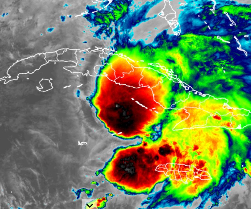
The Weather Situation
Eta has crossed central Cuba and is entering the Florida Straits. Deep convection extends into the western Bahamas and this moisture will move over south Florida bringing a threat for flooding rainfall. Also, the Florida Keys may see hurricane force conditions as additional strengthening is likely.
For more frequent updates: Twitter:
https://twitter.com/richjohnsonwx
Current tropical weather
As of 11:00 AM EST Tropical Storm Eta was centered at 22.5 N / 79.2 W or about 235 miles SSE of Miami, FL. It was moving north at 14 mph. Officially top sustained winds are estimated at 65 mph. Pressure was estimated at 993 hPa (mb).
Tropical Weather Forecast:
The track and intensity over the next several days is problematic. A combination of dry air, shear, warm water and weak steering currents aloft all pose a challenge. Right now it appears that Eta will strengthen as it moves toward the Keys with weaker wind shear during the next few days. It will likely drift west into the SE Gulf of Mexico. Models diverge after this. The most likely scenario takes it northeast toward the west coast of Florida. Wind shear and dry air will need to be watched as it will factor into the strength and ultimate track.
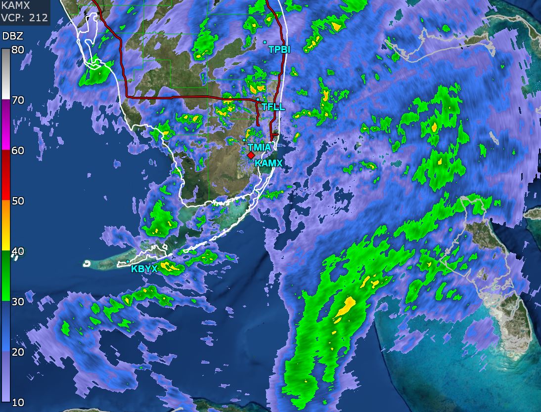
Tropicast: Miami Radar
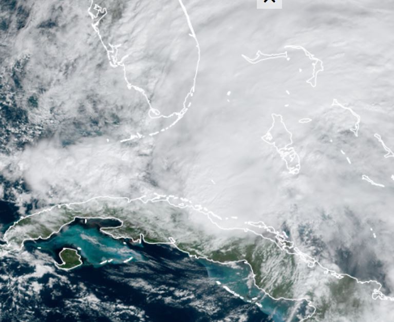
 Tropicast: Visible Satellite
Re: Eta
Posted: Sun Nov 08, 2020 10:38 pm
by Tropical Inspector
Sunday Night Update
Eta over the Keys
The Weather Situation
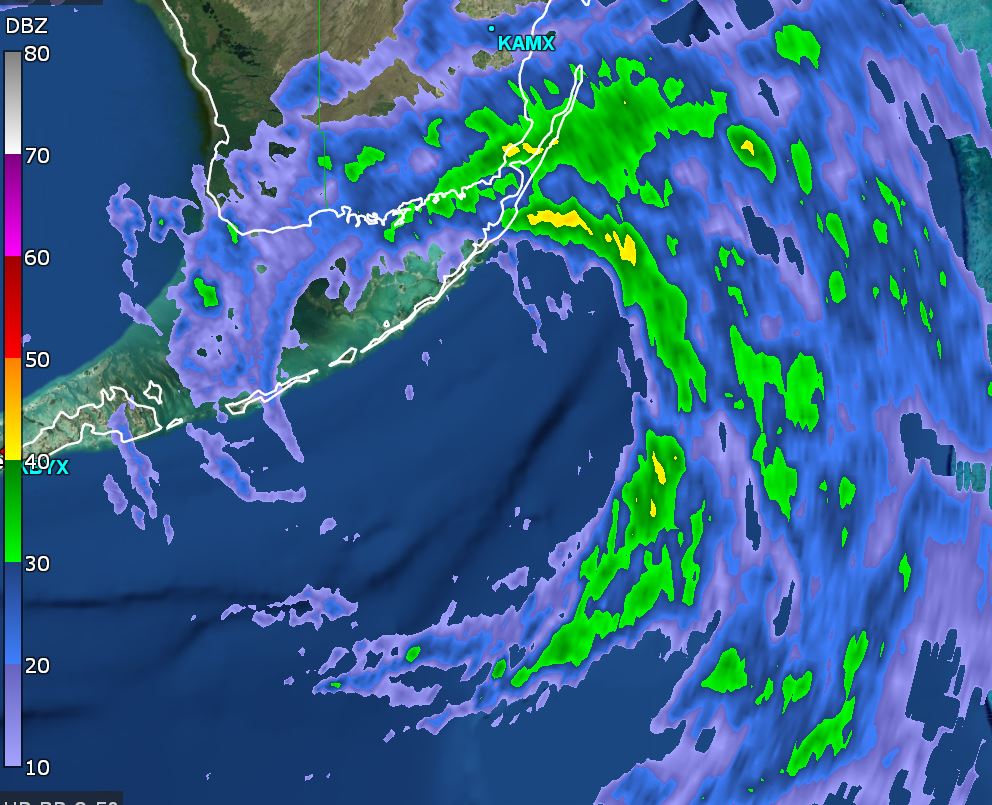
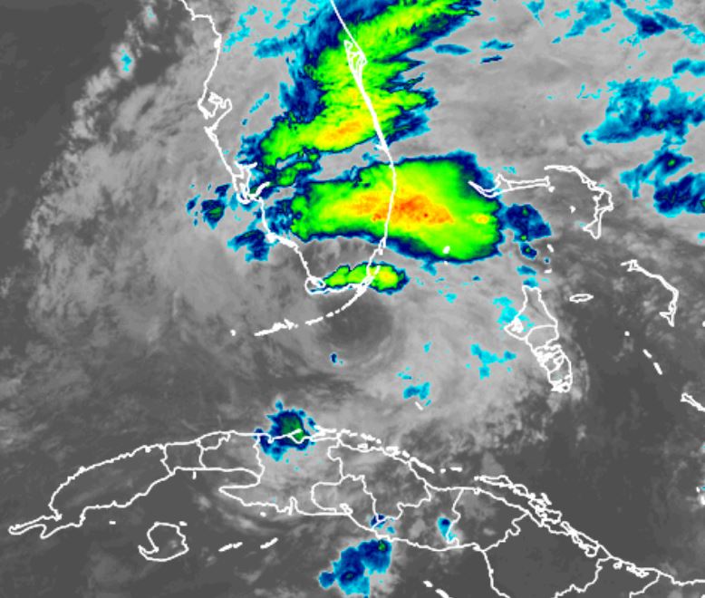
The center of Eta is showing up nicely over the Keys. The heaviest rains are falling to the northeast of the center over the SE coast of Florida
For more frequent updates: Twitter:
https://twitter.com/richjohnsonwx
Current tropical weather
As of 10:00 PM EST Tropical Storm Eta was centered at 24.6 N / 80.5 W or about 80 miles east of Key West, FL. It was moving northwest at 14 mph. Officially top sustained winds are estimated at 65 mph. Pressure was estimated at 993 hPa (mb).
Tropical Weather Forecast:
Eta is expected to drift southwest around an upper air low then turn back to the north in a few days. Weaker wind shear should allow for some strengthening. Later this week a large upper trough will move Eta to the north or northeast. It will likely weaken and lose tropical characteristics.
Tropicast: key West Radar
 Tropicast: Visible Satellite
Re: Eta
Posted: Mon Nov 09, 2020 5:25 pm
by Tropical Inspector
Monday Evening Update
Eta in southeast Gulf
The Weather Situation
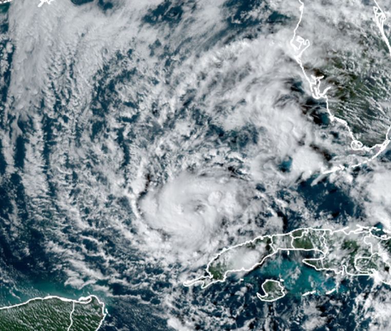
Dry air has greatly hampered the development of Eta. It has weakened some today. Deep convection surrounds the center of circulation.
For more frequent updates: Twitter:
https://twitter.com/richjohnsonwx
Current tropical weather
As of 4:00 PM EST Tropical Storm Eta was centered at 23.7 N / 84.8 W or about 140 miles WSW of the Dry Tortugas, FL. It was moving southwest at 16 mph. Officially top sustained winds are estimated at 50 mph. Pressure was estimated at 995 hPa (mb).
Tropical Weather Forecast:
Eta will drift a little more southwest and stall. It will then move north and weaken as it gradually loses tropical characteristics.
Tropicast: Visible Satellite
Re: Eta
Posted: Tue Nov 10, 2020 9:55 am
by Tropical Inspector
Tuesday Late Morning Update
Eta near western Cuba
The Weather Situation
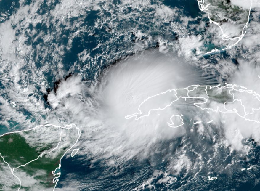
Eta has stalled which has allowed wind shear to relax. Deep convection is building so some strengthening has occurred.
For more frequent updates: Twitter:
https://twitter.com/richjohnsonwx
Current tropical weather
As of 9:00 AM CST Tropical Storm Eta was centered at 22.7 N / 85.3 W or about 60 miles NW of the western tip of Cuba. It was stationary. Officially top sustained winds are estimated at 60 mph. Pressure was estimated at 992 hPa (mb).
Tropical Weather Forecast:
Eta will then move north and weaken as it gradually loses tropical characteristics.
Tropicast: Visible Satellite
Re: Eta
Posted: Tue Nov 10, 2020 7:26 pm
by Tropical Inspector
Tuesday Evening Update
Eta moving toward western Florida
The Weather Situation
Eta has started moving again... back to the north. Very heavy rainfall could cause localized flooding on the west coast of Florida as it drifts toward the area over the next few days.
For more frequent updates: Twitter:
https://twitter.com/richjohnsonwx
Current tropical weather
As of 6:00 PM CST Tropical Storm Eta was centered at 23.5 N / 84.7 W or about 110 miles north of the western tip of Cuba. It was moving north at 7 mph. Officially top sustained winds are estimated at 60 mph. Pressure was estimated at 989 hPa (mb).
Tropical Weather Forecast:
Forecast models are moving east again. It is forecast to be just west of Tampa by later Wednesday and weaken north of there by Thursday.
Tropicast: IR Satellite
Re: Eta
Posted: Wed Nov 11, 2020 12:17 pm
by Tropical Inspector
Wednesday Midday Update
Eta a hurricane?
The Weather Situation
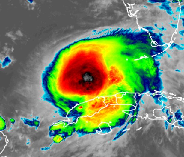
NHC upgraded Eta to hurricane strength late this morning. IMO this is not the right call. A flight level wind of 85 knots was found but these winds are not mixing to the surface. The SFMR and buoy data have not shown winds higher than 55-60 knots.(see data below). IMO surface sustained winds are 55 mph with gusts to 65 mph. Very heavy rainfall is working it's way up the west coast of Florida. Amounts great than 5" are possible. Water rise of 2-4 ft is possible.
For more frequent updates: Twitter:
https://twitter.com/richjohnsonwx
Current tropical weather
As of 10:00 AM EST Tropical Storm Eta was centered at 26.2 N / 83.7 W or about 145 miles SSW of Tampa, FL. It was moving NNE at 10 mph. Officially top sustained winds are estimated at 75 mph. Pressure was estimated at 983 hPa (mb).
Tropical Weather Forecast:
Eta will make landfall north of Tampa by Thursday. It should gradually continue weakening.
Tropicast: Water Vapor Satellite
 Tropicast: Buoy data Satellite
 Tropicast: Visible Satellite

Re: Eta
Posted: Thu Nov 12, 2020 8:12 pm
by Tropical Inspector
Thursday Evening Update
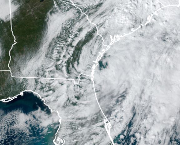
Eta east of Georgia, becoming extratropical
The Weather Situation
Eta made landfall near Cedar Key at 4 am. The main impact was heavy rainfall of 3 to 6" with locally higher amounts. Impressive totals fell over most of the peninsula. IMO, Eta was never a hurricane yesterday despite NHC classifying it. SFMR data matched what the buoys indicated.
For more frequent updates: Twitter:
https://twitter.com/richjohnsonwx
Current tropical weather
As of 4:00 PM EST Tropical Storm Eta was centered at 31.6 N / 80.6 W or about 90 miles SSW of Charleston, SC. It was moving NE at 18 mph. Officially top sustained winds are estimated at 40 mph. Pressure was estimated at 1004 hPa (mb).
Tropical Weather Forecast:
Eta will move east of Cape Hatteras tomorrow and become extratropical.
Tropicast: Visible Satellite Thursday Afternoon